Koxare and the Entrance to the Kourtaliotiko Gorge
The most complete guide to Crete: 221 places on the map, 23 routes and 49 articles — with photos, videos and the story behind every place. No sign-up, no trackers.
Routes drawn along real roads
Weather at every stop
Full-text search
“Near me” by geolocation
Create your own printable itinerary
Satellite, terrain, dark mode
Works offline
⌕
Searches 1.7 million characters of descriptions, not just names
—places
4regions
—routes
—with video
Search results
—
Interactive map
Find what is near you
Filters narrow the map and the list at once. Zoom out and pins group together.
Region
Category
Фильтры карты
Landmarks
Featured places
RegionCategory
Routes
Ready-made day trips
Individual places
Articles about landmarks
Koxare at the Kourtaliotiko gorge
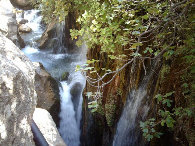
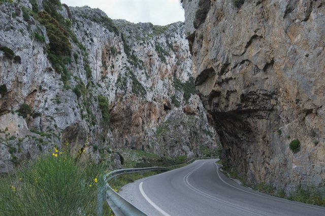
Koxare (Κοξαρέ) stands at the northern entrance to the Kourtaliotiko gorge, about 22 kilometres south of Rethymno, at an altitude of roughly 270 metres. It lies just off the Rethymno–Spili road, at the turning for Plakias, on the edge of a fertile and well-watered little plain given over to olives and to the grazing of sheep and goats. The village, with a little over two hundred inhabitants, occupies raised ground above the road to Preveli and for that reason controlled for centuries the important route through the district of Agios Vasilios. Today one of the most impressive stretches of southern Crete begins here: the descent into the gorge and to the river Kourtaliotis.
The area has long been inhabited. Greek local chronicles point to traces of Middle Minoan settlement – in 1989 British archaeologists excavated a Minoan peak sanctuary at 735 metres on Mount Kouroupas, above the village – derive the name from a Byzantine founder called Koxaris, and mention the ruins of a Venetian country house in the village. The parish church is dedicated to the Dormition of the Virgin, and a small folklore museum was opened in 2007. Within the bounds of the community are several caves – Fakoula, Achnotrypa and Belegrine – and the little river of Koxare flows through the fields before squeezing into the gorge.
The church of St George
The little church of St George stands near the road at Fatreliana – its founder is named as one Theodoros Sagkamas – and is closely bound up with the history of Koxare. Its wall paintings are the chief artistic sight of the village. The most remarkable is the representation of the Holy Trinity: the Holy Spirit appears as a dove issuing from the mouth of God the Father. For the Byzantine and post-Byzantine iconography of Crete such a treatment is unusual; the church is therefore of interest not only as a place of worship but as a rare monument of a local tradition of painting.
Koxare in the history of Crete
Its commanding position made Koxare a key point on the way to the south coast. At various periods the village found itself caught between the lines – between the Ottoman authorities and Cretan insurgents, and later in the struggle against the German occupying forces. In Ottoman times, according to local tradition, about half the inhabitants were Muslim.
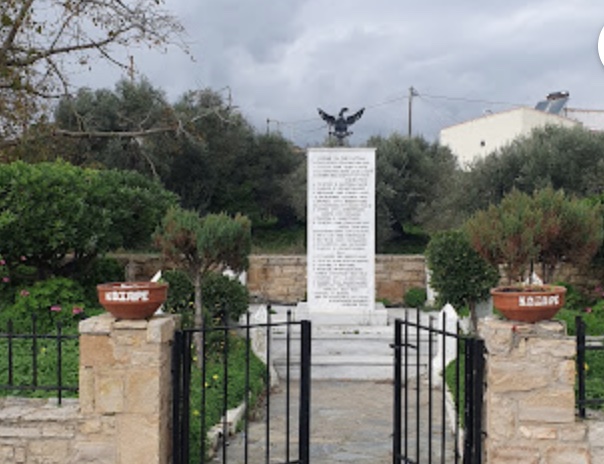
In the Second World War Koxare became a centre of resistance at an early stage; because of its strong left-wing peasant movement it had borne the nickname “Little Moscow” since the inter-war years, and fighters of the ELAS partisan army were active in the district, where the Germans were anxious to hold the approaches to the south coast. The first clashes came as early as the autumn of 1941, and in 1942 the villagers resisted the requisitioning of their grain; arrests and executions followed. On 29 August 1944 a punitive operation struck the village: the houses were looted, blown up and burnt, and the inhabitants fell victim to the reprisals. The old, the women and the children had earlier found refuge in Preveli Monastery. After the withdrawal the villagers rebuilt their village stone by stone; the church was restored in 1955. The memory of these events has a secure place in the history of the Cretan resistance and is marked every year at the end of August with a commemoration.
The Ottoman koules and the history of war
At the entrance to the gorge, on a height of some 350 metres south of the village and about 150 metres above the surrounding ground, the remains of the Ottoman fort known as the Koules have survived. Koxare had already been drawn into the struggle for the liberation of Crete in 1821; the fort itself was built in the year of the rising of 1866, or very soon afterwards, and is said to have had room for a garrison of several hundred men. Thirty years later, in 1896, insurgents partly destroyed it. The complex, measuring about 44 by 30 metres, was grouped around a large inner courtyard: on the west lay two rooms, one behind the other and linked by arches, beneath high barrel vaults, on the east a lower vaulted building; the entrance was by a ramp from the south. The masonry of pale local stone, bound with hard mortar and rendered inside and out, is 1.20 metres thick, and a rainwater cistern with waterproof plaster can still be made out. Both the western and the eastern ranges have since fallen in. The ruins are a reminder that the way to Preveli was not only a trading route and shepherds’ path but a strategic passage between the Messara and Sfakia.