The most complete guide to Crete: 221 places on the map, 23 routes and 49 articles — with photos, videos and the story behind every place. Everything is open and free: no sign-up, no paid sections and no advertising, open or hidden. You can install the guide on your smartphone as an app.
Routes drawn along real roads
Weather at every stop
Full-text search
“Near me” by geolocation
Create your own printable itinerary
Satellite, terrain, dark mode
Works offline
⌕
Searches 1.7 million characters of descriptions, not just names
—places
4regions
—routes
—with video
Search results
—
Interactive map
Find what is near you
Filters narrow the map and the list at once. Zoom out and pins group together.
Region
Category
Фильтры карты
Landmarks
Featured places
RegionCategory
Routes
Ready-made day trips
Individual places
Articles about landmarks
Plakias – beach and resort on the south coast
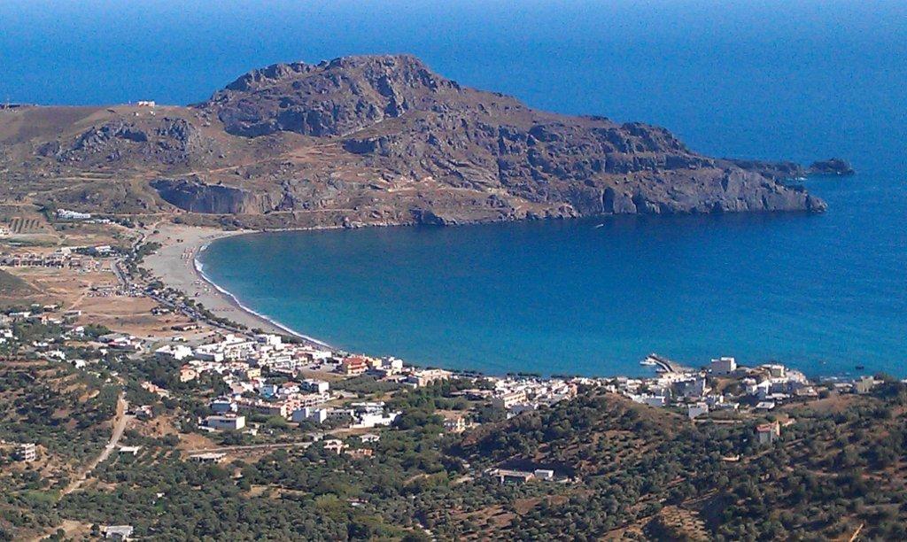
Plakias (Πλακιάς) has grown up on a fertile plain on the south coast, some 35 kilometres south of Rethymno by road, at the point where the Kotsifos – a river that runs all year – reaches the sea. Olive groves fill the valley behind, and the bare bulk of Mount Kouroupa closes it to the east. Local people have always called this strip of coast “Gialia”, the land by the shore. As late as the middle of the 20th century there was nothing here but a tiny fishing hamlet: Plakias first appears in the official record in the census of 1961, as the permanent home of six fishermen. Tourism began in the 1960s, when travellers found the bay for themselves. Today the resort has hotels, a small marina, diving centres and all the usual services, and receives visitors for most of the year, yet its plan is still dictated by shore, river and mountains.
The bay and the beach
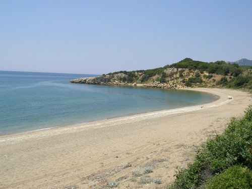
The main beach sweeps in a broad arc for about 1.3 kilometres between Cape Stavros and Cape Kako Mouri, also known as Psarellas. Fine grey sand and a gently shelving seabed make for easy bathing, and tamarisks give some natural shade; the beach is also recorded as a nesting place of sea turtles. The Kotsifos enters the sea at the western end, and the water there is noticeably cooler for it. The sands lie open to the winds: when the north wind drops through the gorges, windsurfers and other water-sports enthusiasts come into their own, while swimmers tend to move to the sheltered western part. The road along the front is level and pleasant to walk or cycle.
In the western part of the bay are the little harbour, the landing stages and a few short stretches of shore, linked by a promenade of tavernas and cafés. Because the water of the bay is shallow, larger vessels could never come alongside here, and the harbour remains a place of fishing boats and excursion craft. It is from here that the boats leave for the neighbouring coves and for Preveli.
Gonates tou Digeni – the “Knees of Digenis”
At the eastern end of the bay, in the pale limestone cliffs of Kako Mouri, are two caves and hollows joined by a narrow passage and known as Gonates tou Digeni (Γονατές του Διγενή) – the “Knees of Digenis”. According to Cretan legend Digenis Akritas knelt here to drink from the spring of Papachroni; popular memory explains the hollows in the rock by the weight of his body. The sheer wall, called Paligremnos, is the face of a geological fault: an extraordinarily smooth sheet of limestone rising more than 80 metres, and now one of the best-known crags in Greece, with some thirty bolted routes that follow both its cracks and its blank slabs. Its small caves gave the inhabitants shelter from air raids during the German occupation. Fishermen have their own lore about the place: on nights of the full moon between September and January the light thrown back from the cliff on to the water is said to draw squid in to the edge of the beach. Close by, a path sets off round the cape to the so-called tunnels of Plakias, galleries driven through the rock for an abandoned mining venture. A German entrepreneur laid a narrow-gauge Decauville railway here to bring lignite from a mine about 2.5 kilometres away to a loading point where ships could lie in deep water; the coal proved too poor to pay, and the enterprise was given up in 1930. The last kilometre of the trackbed, with its two tunnels, can still be walked from Paligremnos. A torch is needed, and care at the second tunnel, which ends abruptly above a deep chamber.
Ancient Lamon and Phoinix of the Lappaians
The coast at Plakias was inhabited long before the resort. Archaeologists and historians associate the district with Lamon or with Phoinix of the Lappaians – harbour towns of southern Crete known from ancient written sources; Phoinix, as the name says, was the port of the inland city of Lappa, which stood at present-day Argyroupoli and, according to Strabo, controlled this harbour on the opposite coast. Exactly where the ancient settlement lay is disputed among scholars. What is certain is that Roman finds are scattered over the whole plain, that Minoan traces are occasionally reported as well, and that by the church of the Zoodochos Pigi, the “Life-giving Spring”, there is an extensive necropolis of about five hectares with numerous graves, many of them missing their cover slab. In the wider surroundings of Plakias, moreover, field survey has brought to light stone tools reaching back into the Palaeolithic. In 2008 a Greek–American team led by Thomas Strasser of Providence College and Eleni Panagopoulou of the Greek Ephorate of Palaeoanthropology and Speleology, working under the American School of Classical Studies at Athens, identified 29 sites by caves and rock shelters between Plakias and the Preveli Gorge and collected some 2,000 artefacts, mostly of local quartz. Some are small Mesolithic tools – scrapers, notched and toothed pieces – while others are hand axes and cleavers of Lower Palaeolithic type, found in raised marine terraces whose geology points to an age of at least 130,000 years. Since Crete has been an island throughout that time, their makers must have arrived by sea, which makes these among the earliest indications of seafaring in the Mediterranean. The valley of the Kotsifos, then, was part of a lasting network of settlements and sea routes.
Plakias in the 20th century
Before the rise of tourism Plakias remained a modest fishing settlement of the people of Sellia and Myrthios; for administrative purposes it still belongs to the local community of Myrthios, within the municipality of Agios Vasilios. In the 1960s the bay became known among travellers and among those looking for a quiet, simple life in the south of Crete – the hippies of those years, who camped along the shore of Gialia, helped to make the name of the place. Roads, hotels, tavernas and the harbour installations followed. The village has grown fast, but its setting is still governed by the meeting of sea, river, mountains and two gorges – that of the Kourtaliotis and that of the Kotsifos.
Routes from Plakias
From Plakias one can drive on to Finikas, Myrthios, Sellia and Rodakino, and up into the Kotsifou Gorge, which cuts through the hills north of the village to the west of Mount Kouroupa and is known to botanists for the number of Cretan endemic plants growing on its walls. These roads link the beach with the hill villages and show how closely the coast is bound up with the hinterland of the former province of Agios Vasilios. A pleasant short walk leads about a kilometre and a half upstream along the Kotsifos to an old watermill; those who carry on reach Myrthios by old footpaths, and its terraces give the finest view over the whole bay.