The most complete guide to Crete: 221 places on the map, 23 routes and 49 articles — with photos, videos and the story behind every place. No sign-up, no trackers.
Routes drawn along real roads
Weather at every stop
Full-text search
“Near me” by geolocation
Create your own printable itinerary
Satellite, terrain, dark mode
Works offline
⌕
Searches 1.7 million characters of descriptions, not just names
—places
4regions
—routes
—with video
Search results
—
Interactive map
Find what is near you
Filters narrow the map and the list at once. Zoom out and pins group together.
Region
Category
Фильтры карты
Landmarks
Featured places
RegionCategory
Routes
Ready-made day trips
Individual places
Articles about landmarks
Myli and the Mylianos gorge
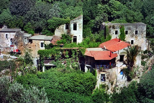
Myli is a small historic settlement in the green Mylianos gorge, about eight kilometres south of Rethymno, between Xiro Chorio to the north and Chromonastiri to the south. Its name means simply “mills”, and with good reason: from Venetian times, and probably from the Middle Ages, the people here built one watermill after another along the stream. Strictly speaking the gorge is less a ravine than a deeply cut, luxuriantly overgrown valley that begins on the northern slopes of Mount Vrysinas and gathers their run-off. The Venetians called it Valle Cammilari; under the Ottomans the place was known as Deirmenlik, which means nothing more than “place of mills”, and Turkish families settled in Kato Myli in that period. The community was never large and dwindled steadily through the 20th century – 99 inhabitants were counted in 1940, 52 in 1961, 36 in 1971 – and the census of 2021 recorded just 14.
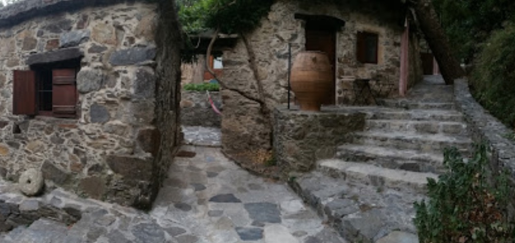
The stream, the orchards, the stone houses and the old waterworks still form a single ensemble of nature and history. In the valley lie the ruins of Pano Myli (Upper Myli) and Kato Myli (Lower Myli), together with small bridges, masonry channels and the mill buildings themselves; a few of the old mills have been restored and are lived in again. Walking between them, it takes little effort to picture the daily round of a community made up almost entirely of millers, who ground the cereals of the whole district. In 1995 the two abandoned quarters were listed as protected traditional settlements.
The abandoned village and the path
The path follows the stream through Kato and Pano Myli; the two quarters are about twenty minutes’ walk apart. Along the way there are stone houses, vaulted passages, little bridges, water runnels and the remains of numerous mills with their shafts and grinding gear. The trail laid out by the municipality starts not far from the present-day settlement of Myli, which lies about a kilometre and a half down the road from Chromonastiri; at an easy pace it takes a good hour and a half. Anyone who walks the whole gorge between Chromonastiri and Xiro Chorio covers some two and a half kilometres and just under 200 metres of height difference, and should allow two to two and a half hours. The route is waymarked and counts as easy – it is rated at the very bottom of the scale of difficulty used for Cretan gorges – and no vehicle can get into the gorge. There is a car park at the northern end, and the gorge can be walked in either direction; the local bus from Rethymno towards Chromonastiri, a ride of about twenty minutes, serves the southern trailhead. Spring and early summer, when the valley is at its greenest and the air still cool, are the best seasons, although the tall plane trees keep the path in shade even in the heat of August.
One of the old houses now serves as a small kafenio and taverna, at the southern end of the walk, and there is a simple café at the northern trailhead; one mill has been put back in working order to show how the machinery operated. Stout footwear is advisable, and sandals are best left behind: the surface is uneven, after heavy rain sections of the path are repeatedly damaged or impassable for a time, and the stream has to be crossed several times on stepping stones.
The green gorge preserves not only the traces of a craft but a varied natural world. Plane trees, olives, fruit trees and other moisture-loving plants line the water, and among them grow rare species of the Cretan flora; the old terraces were planted with orchards and vegetable gardens. The stream forms small waterfalls and pools – some of them deep enough for a dip – and sustains islands of damp habitat such as one hardly expects so close to the coast. The valley is often compared to a botanical garden. Along the path stand the chapels of St Anthony (Agios Antonios), St John (Agios Ioannis), the Five Virgins (Agies Pente Parthenes) and St Paraskevi (Agia Paraskevi).