Matala – port of Phaistos and beach of the flower children
The most complete guide to Crete: 221 places on the map, 23 routes and 49 articles — with photos, videos and the story behind every place. Everything is open and free: no sign-up, no paid sections and no advertising, open or hidden. You can install the guide on your smartphone as an app.
Routes drawn along real roads
Weather at every stop
Full-text search
“Near me” by geolocation
Create your own printable itinerary
Satellite, terrain, dark mode
Works offline
⌕
Searches 1.7 million characters of descriptions, not just names
—places
4regions
—routes
—with video
Search results
—
Interactive map
Find what is near you
Filters narrow the map and the list at once. Zoom out and pins group together.
Region
Category
Фильтры карты
Landmarks
Featured places
RegionCategory
Routes
Ready-made day trips
Individual places
Articles about landmarks
Matala: beach, caves and the memory of the hippies
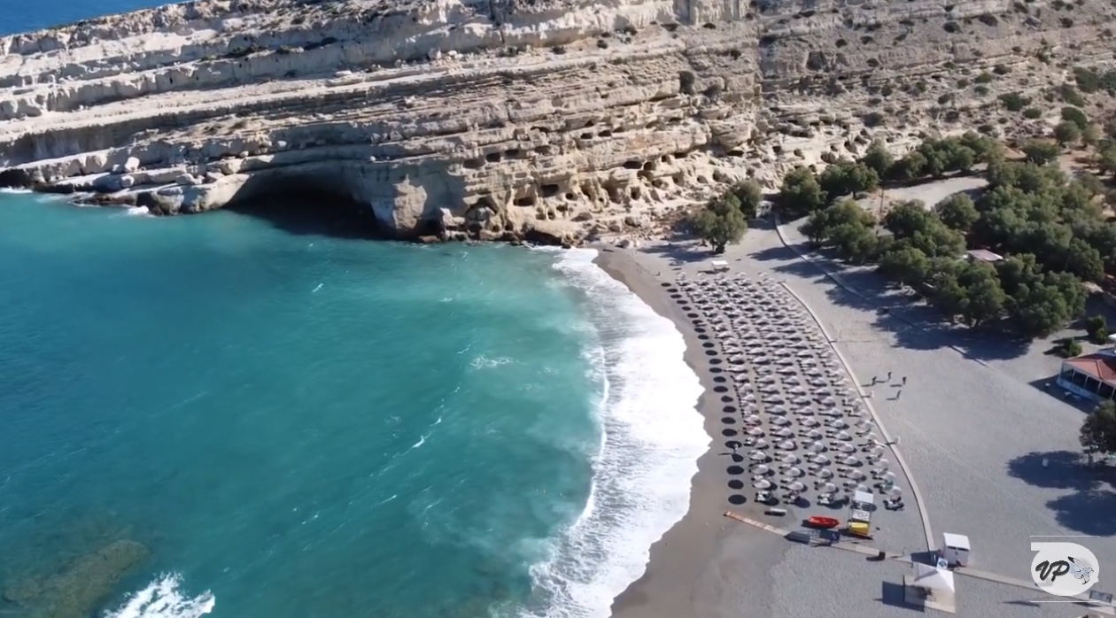
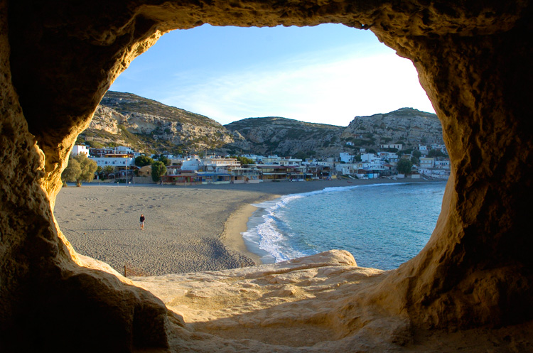
Matala (Μάταλα) lies some 70 kilometres south-west of Heraklion, at the point where a narrow valley running down from the Messara Plain reaches the Libyan Sea, a little to the north of Cape Lithino. Administratively it belongs to the village of Pitsidia and, with it, to the municipality of Phaistos. Two pale bars of soft calcareous sandstone push out into the water like the wings of a stage and enclose a bay open to the west, where in the evening the sun sinks straight into the sea. Today the village is a lively seaside resort with a sandy beach, tavernas, cafés, small hotels and boat trips; but its history goes back far beyond tourism. In the cliffs above the bay dozens of chambers hollowed out by human hands have survived, and the bay itself was the way to the sea – first for Phaistos, later for Gortyn.
The beach and the resort today
The beach of Matala, about 300 metres long, lies sheltered between the high rock walls. Sand and fine shingle have a reddish shimmer in places, which comes from the minerals in the rock; the bottom shelves gradually close to the shore. Bathing nevertheless depends on wind and swell: when the westerly freshens, strong waves roll into the bay. The climate is that of the hot, dry south coast – the mean temperature over the year is about 19 degrees, and less than 500 millimetres of rain fall, almost all of it in winter. At the edge of the beach tamarisks give shade; behind them begins the tangle of lanes with the little market.
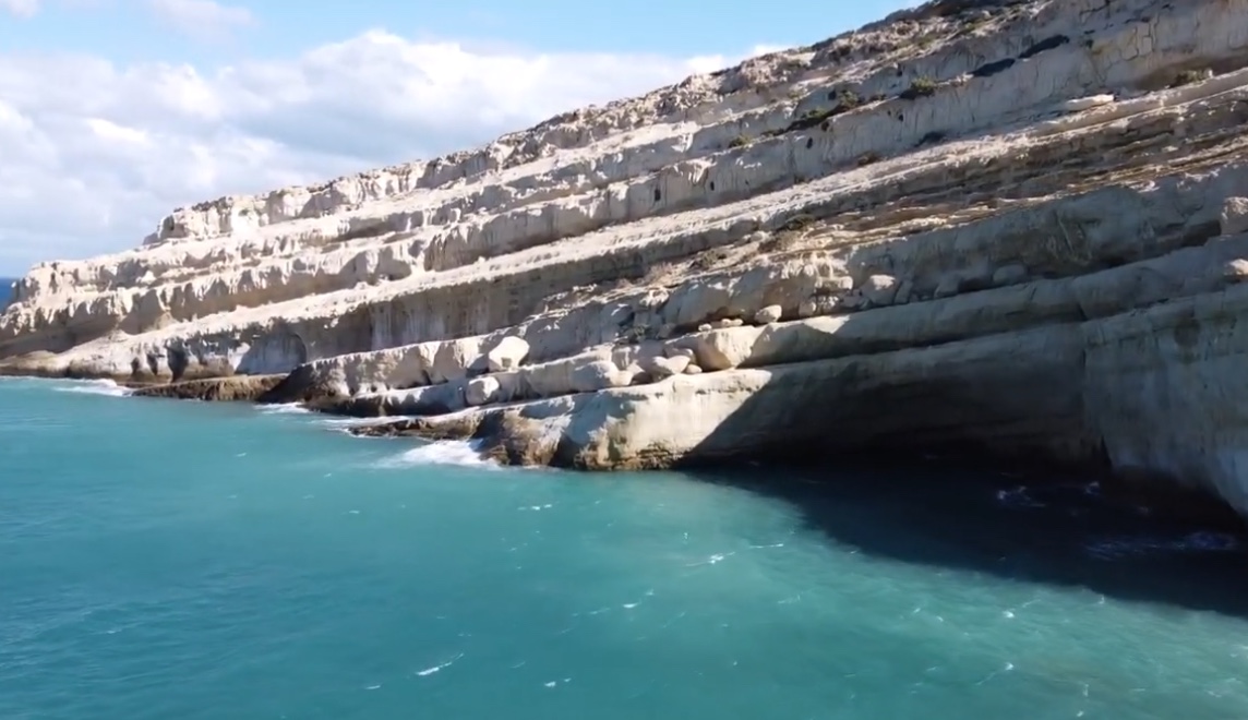
Anyone who would like to see the coast from the water can join a boat trip: it passes the caves along the shore and grottoes that lie below sea level, and shows the cliff face in its full height. On foot, the southern ridge is crossed in just under half an hour to the bay of Kokkini Ammos (Κόκκινη Άμμος), the “Red Beach” – a stony, shadeless path for which stout shoes and drinking water are needed. North of Matala stretches the long sandy beach of Kommos.
The ancient port of Phaistos and Gortyn
In Minoan times Matala was a harbour of Phaistos, whose palace stands only a few kilometres inland; its ancient name was Matalon. When Gortyn outstripped its old rival in the Hellenistic period, the bay fell to it as well – according to Polybius the Gortynians occupied the harbour around 220 BC, some decades before they destroyed Phaistos itself. In Roman times, when Gortyn was capital of the province of Creta et Cyrenae, Matala served alongside Lebena (Lendas) and Lasaia as one of its outlets to the Libyan Sea. Traces of this harbour activity survive under water and along the shoreline: basins and cuttings worked into the rock, which can be made out from the shore when the sea is calm. Neighbouring Kommos, only a few kilometres to the north, was the larger trading port of Phaistos and of Agia Triada. The bay thus belonged to a far-flung network of anchorages that linked the Messara with the Aegean and with North Africa.
The caves in the cliffs
The chambers lie in several storeys one above another in the northern wall of the bay, whose tilted beds of rock lead like ramps from one row to the next. Some rooms are well lit by daylight, others open only towards the sea; access to certain sections is arduous and calls for care, for the rock has been trodden smooth and is nowhere made safe. The archaeological evidence suggests that many of the rooms were laid out as burial places, whereas later visitors saw in them natural refuges and dwellings – fishermen, shepherds and, last of all, the travellers of the post-war years.
Today the area is fenced and under the supervision of the Archaeological Service; it is open only by day, at times for a small entrance fee. Sleeping in the caves has long been forbidden. The visit is at its best in the late afternoon, when the light turns the stone the colour of honey and the view from the upper rows takes in the whole bay.
Matala and the international hippie movement
In the 1960s and 1970s Matala became an emblem of the international counter-culture. Around 1965 the first beatniks settled in the caves, and from 1967 hippies followed from Europe and the United States. They lived with paraffin lamp and cooking pot, ate fish and the farmers’ vegetables, helped now and then in the fields, and sought a simple life, freedom and closeness to nature. A big picture story in Life magazine, published on 19 July 1968 under the title “Crete: A Stop in the New Odyssey”, made the bay known across the world. Joni Mitchell, Bob Dylan, Janis Joplin and Cat Stevens are named among the visitors. Joni Mitchell came in the spring of 1970, stayed for several weeks, and later worked her impressions into the song “Carey” on the album “Blue”, released in 1971, in which the Mermaid Café of the landlord Stelios Xagorarakis also makes its appearance.
Not everyone was pleased by these goings-on. During the military dictatorship in Greece the Metropolitan of Gortyn spoke out against the cave-dwellers in an encyclical and demanded their removal, local newspapers ran campaigns, and in May 1970 the police cleared the caves; there were arrests and seventeen convictions, mostly for possession of hashish. Greek accounts also suspect American pressure behind this, because among the hippies were young men who had evaded military service in Vietnam. The expulsion did not last: some groups returned or moved on to other beaches of the south coast; but towards the end of the 1970s the occupation of the caves came to an end.