Rodakino – where the first banner of the 1821 rising was raised
The most complete guide to Crete: 221 places on the map, 23 routes and 49 articles — with photos, videos and the story behind every place. No sign-up, no trackers.
Routes drawn along real roads
Weather at every stop
Full-text search
“Near me” by geolocation
Create your own printable itinerary
Satellite, terrain, dark mode
Works offline
⌕
Searches 1.7 million characters of descriptions, not just names
—places
4regions
—routes
—with video
Search results
—
Interactive map
Find what is near you
Filters narrow the map and the list at once. Zoom out and pins group together.
Region
Category
Фильтры карты
Landmarks
Featured places
RegionCategory
Routes
Ready-made day trips
Individual places
Articles about landmarks
Rodakino – a village that remembers the start of the rising
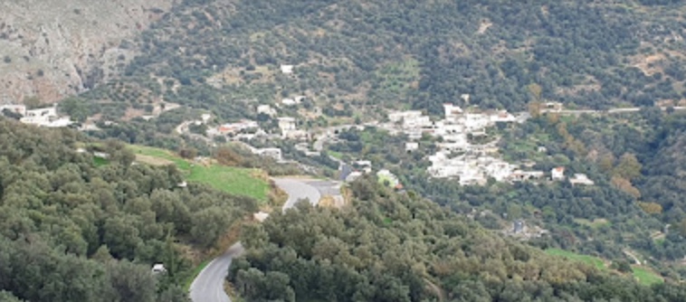
Rodakino lies a good 40 kilometres south-west of Rethymno, where the municipality of Agios Vasilios meets Sfakia. It is divided into Ano Rodakino and Kato Rodakino, which are about a kilometre apart. The upper village sits on the hillside at around 220 metres, the lower one, some hundred metres further down, extends towards the tracks that lead to the sea. Between the two a stream bed cuts a ravine into the mountain: the Rodakino Gorge, which forms below Mount Kryoneritis, runs for a little over three kilometres, narrows in places to a metre and a half and is dry for most of the year – a descent for roped canyoning parties only. This arrangement binds mountain pastures, arable land and coast into a single historical territory.
For Cretans Rodakino is bound up with the beginning of the rising of 1821. At the chapel of St George on the height of Kourkoulos, Melchisedek Tsouderos, abbot of Preveli Monastery, celebrated the liturgy, blessed the weapons and raised the banner of the struggle. From here the band marched to the Panagia Thymiani in Sfakia, where the representatives of the provinces were preparing the common outbreak of the revolt in Crete.
The Kotsifou Gorge and the chapel of St Nicholas
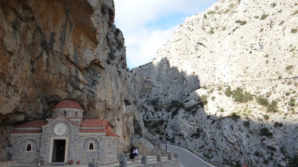
From Rodakino an excursion can be made to the Kotsifou Gorge, which begins at Kanevos and opens out in the direction of Myrthios. At its head the gorge is a cleft only about ten metres across; over its 1,800 metres it widens to some 600, between almost vertical walls that rise to a similar height. In a recess beneath the overhanging rock stands a tiny chapel of St Nicholas; the route links stony slopes, the green stretches of the gorge – where the stream, dry higher up in summer, runs all year below its springs – and places that speak of the life of the shepherds.
The origin of the name and the history of the settlement
Local tradition places the present Rodakino in about the 17th century – around 1600, as they say in the village – and connects it with the return of one family after the destruction of the older settlements, whose names live on as field names: Kourkoulos, Palio Chorio, Panagia and Ai-Lias. Another reading derives the name from the stream or ravine of Rikinthos, which divides the two villages. There are homelier explanations as well: a peach tree – ροδάκινο means peach – is said to have stood here in the barren landscape, or the inhabitants were ruddy-cheeked from the sun. The name itself, however, is older than the present village; a treaty of 1299 between Venice and the Kallergis clan is said already to mention men with the surname Rodakino. None of these versions has been proved, but all of them preserve the memory of difficult terrain and of the movements of people in the south of Crete.
Kourkoulos and the first banner of the rising
On 24 May 1821 Abbot Melchisedek Tsouderos of Preveli Monastery celebrated the Divine Liturgy on the height of Kourkoulos, at the chapel of St George, before a band of men from the province of Agios Vasilios. After the service he blessed the weapons and, in place of a national flag, raised the antimension, the consecrated altar cloth. Then the band set out for the Panagia Thymiani in Sfakia, where the general outbreak of the rising in Crete was being prepared – the banner of Rodakino thus preceded the organised start of the revolt by some days.
Melchisedek Tsouderos and the band from Preveli
Melchisedek Tsouderos, in the world Michail Tsouderos, was abbot of Preveli and an initiate of the Filiki Eteria. He supplied the insurgents with arms, maintained the link between the monastery and Sfakia and fought alongside his brothers Georgios and Ioannis. In June 1821 the band from Preveli was in action at Agios Ioannis Kamenos; Melchisedek himself fell in 1823, and his name became part of the historical memory of southern Rethymno. His monastery kept up the tradition: it was again a centre of organisation in the risings of 1866 and 1878.
The churches and paths of Rodakino
In Ano Rodakino stand the two-aisled church of the Dormition of the Virgin, the church of the Transfiguration of Christ, likewise two-aisled, and the church of St Panteleimon. The paths from the village lead to the Kotsifou Gorge, to the chapel of St Nicholas and to the coast; they join the ecclesiastical memory of the place to the old routes of shepherds and seafarers. Walkers on the E4 pass a further chapel, of the Holy Spirit, beside a spring of cold water on the way up to Kryoneritis, whose summit at 1,310 metres looks out over both the Sea of Crete and the Libyan Sea.
The Kotsifou Gorge and the coast
From Rodakino one reaches the Kotsifou Gorge, which links the hill villages with Myrthios and the sea. In the niche in the rock stands the chapel of St Nicholas, patron of travellers and seafarers. The route crosses stony slopes and pastures and passes through the green stretches of the gorge, and shows how closely Rodakino is tied by nature and history to the south coast.
Below the two villages three bays open out which are among the quieter beaches of the south coast: Korakas, Polyrizos and the long beach named after the chapel of St Marina. Fine grey sand and shingle, clear water and a few tavernas make them a good end to a day that began with history up on Kourkoulos. Korakas, about two kilometres below the village by a surfaced road, takes its name – “the crow” – from a hollowed rock at its eastern end that is thought to resemble the bird’s beak. Polyrizos, a short way west along the shore road, is sandy, shallow and calm, and suits families with small children; it lies among olive groves under the hill of Kastelos. Beyond that hill is Peristeres, a quiet bay of pebbles and rock with a few carob trees for shade, named after the wild pigeons that nest in the sea caves at its eastern end, where the swimming and snorkelling among the rock arches are particularly good.