Gergeri, Venerato and Agia Varvara – the middle of Crete
The most complete guide to Crete: 221 places on the map, 23 routes and 49 articles — with photos, videos and the story behind every place. Everything is open and free: no sign-up, no paid sections and no advertising, open or hidden. You can install the guide on your smartphone as an app.
Routes drawn along real roads
Weather at every stop
Full-text search
“Near me” by geolocation
Create your own printable itinerary
Satellite, terrain, dark mode
Works offline
⌕
Searches 1.7 million characters of descriptions, not just names
—places
4regions
—routes
—with video
Search results
—
Interactive map
Find what is near you
Filters narrow the map and the list at once. Zoom out and pins group together.
Region
Category
Фильтры карты
Landmarks
Featured places
RegionCategory
Routes
Ready-made day trips
Individual places
Articles about landmarks
The middle of Crete at the foot of Psiloritis
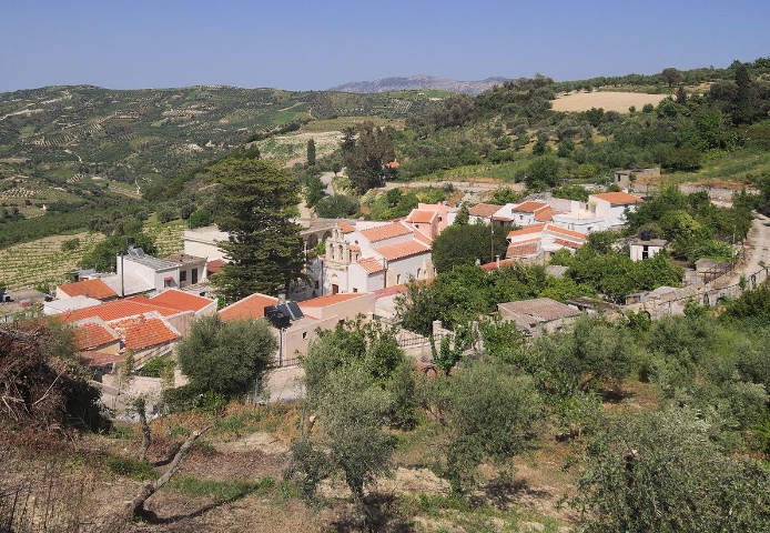
Right in the geographical middle of Crete, at the eastern foot of the “high mountain” – for that is all the name Psiloritis means – lie three attractive villages: Venerato, Agia Varvara and Gergeri. The old road from Heraklion to the Messara Plain strings them together like beads, and anyone who follows it climbs by degrees out of the vineyards of the north, from about 300 metres at Venerato to 580 at Agia Varvara, to the watershed of the island, before the view opens to the south.
Three villages and their traditions
These old settlements are rich in historic monuments, and at the same time Gergeri, Venerato and Agia Varvara keep up the living customs of their people. The video above shows the carnival at Gergeri, held on Clean Monday, the first day of Lent; the three villages are described in turn below.
Agia Varvara and Rizinia
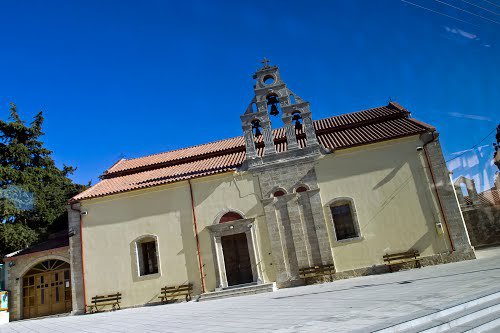
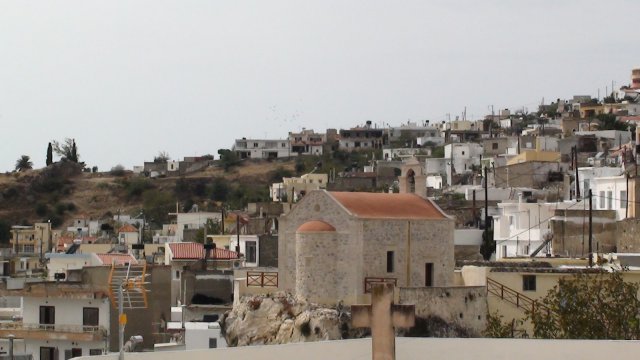
Beyond Venerato the road leads to Agia Varvara, some 30 kilometres from Heraklion and 580 metres above the sea – a long village, a kilometre and a half from the first house to the last. It owes its name to the church of St Barbara, of the 13th century, which stands in the middle of the village. At the entrance to the place the church of the Prophet Elijah (Ekklisia tou Profiti Ilia) rises on the crown of a massive boulder. Popular belief has it that this very spot is the middle, the “navel”, of Crete: two priests, the legend goes, set out from Sitia and from Chania to divide the island; when they met here, exhausted, one of them flung his hat to the ground and cried that this was the centre of Crete – and the hat turned into the rock. The boulder was once twice the size, part of it having broken away about a hundred years ago; the present chapel was renewed in 1933, and its feast is kept on 20 July.
Agia Varvara is first mentioned in 1577, in the description of Crete by Francesco Barozzi. In August 1823 an Ottoman and Egyptian army of 12,000 men under Hussein Bey camped here and drove back the Cretan insurgents who had gathered at Gergeri; in 1866 Ottoman troops destroyed the village, and in the Second World War a German unit was stationed here for a year and a half with a large military hospital, said to have been the biggest in the Balkans. Today the village, which has about two thousand inhabitants, is known for its vegetables, above all its cabbages, and for olives and wine. The patronal festival (panigyri) in honour of St Barbara takes place on 4 December with dancing, songs and hospitality, and on the last weekend of May the village holds its cherry festival.
To the right of the village, in the direction of Prinias, lie the ruins of the ancient city of Rizinia. From the table mountain, at about 690 metres, the eye ranges over the site of the town and the green hills round about as far as the north coast. The settlement arose at the end of the Minoan period and flourished in the Geometric and Archaic ages; by the 2nd century BC at the latest it had been given up. Besides the town itself, archaeologists have uncovered a cemetery, at Siderospilia across the road, with some 680 burials running from the 13th century to about 600 BC, among them the ritual burials of horses and dogs; on the plateau stand the remains of two temples of the 7th and 6th centuries BC, and at its western end a small Hellenistic fort with corner towers. Temple A, of about 625 BC, is the earliest Greek temple known to have been decorated with sculpture: its lintel carried two seated goddesses facing one another above a band of panthers. The famous frieze of horsemen and those enthroned goddesses, major works of early Greek sculpture, are on show in the Archaeological Museum of Heraklion.
Gergeri – water and old mills
Gergeri, about 40 kilometres south-west of Heraklion on the slopes of Psiloritis, at a little over 500 metres and hemmed in by steep crags, has not changed its name since early times. “Gergeri” is said to mean “murmur of water” – the word is held to be pre-Greek – and the village does indeed owe its name to its many underground springs. Their water was already used by the people of the ancient city of Gortyn, whose ruins lie not far away in the Messara: stretches survive of the Roman aqueduct that tapped the spring of Fountana. From the 15th century, and above all in the 17th and 18th, numerous watermills were built in the valley to grind grain; some are still used by the villagers. The place is first recorded in 1583, as “Giergeri”, in the census of Kastrofylakas, which gives it 500 inhabitants. With over a thousand today, spread over several quarters, Gergeri is one of the largest villages in the municipality of Gortyna, and it lives chiefly by stock-rearing and farming.
The churches of Gergeri
Gergeri has many churches. The most important is the church of the Transfiguration of the Saviour (Ekklisia Metamorfosis tou Sotira), a building of Early Christian origin raised on the site of an ancient Greek temple, whose marble blocks were used in its construction. The village chronicle records that in 1827 the priest Georgios Kyriakidis and twelve other Christians were executed here by the Turks. Gergeri had its part in the risings of that century: it was here that Emmanouil Tombazis assembled 3,000 Cretans in 1823, and the village was the birthplace of Frangias Mastrachas, the “golden eagle of Rouvas”, a captain of the revolt of 1866.
The churches of St George, St Stylianos and the Prophet Elijah
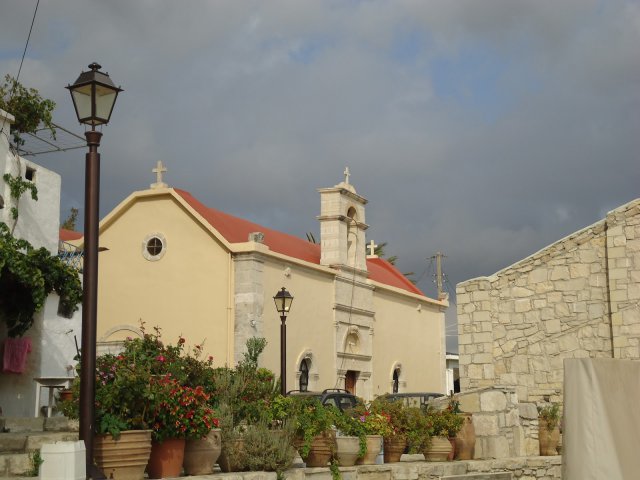
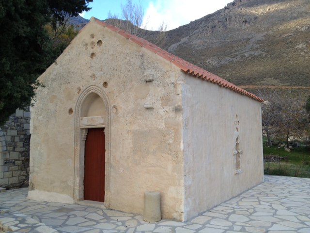
The churches of St George and St Stylianos (Ekklisia tou Agiou Georgiou, Ekklisia tou Agiou Stylianou) are also worth seeing. St George is the patron saint of the village; his parish church was rebuilt around 1900 over an older building and keeps its feast on 3 November, the day on which the barrels of new wine are broached. The church of St Stylianos, on the edge of the village, dates only from about 1970 and celebrates on 26 November. Especially picturesque is the church of the Prophet Elijah (Ekklisia tou Profiti Ilia), built in about 1905 on the tip of a rock and looking far out over the Messara; its feast falls on 20 July.
Panagia Kera and the memory of the war
The church of the Panagia Kera (Ekklisia tis Panagias Keras), a single-aisled, barrel-vaulted building in the western, newer cemetery of Gergeri, was built in 1443 – by three monks, according to tradition. Its wall paintings of the 15th century can hardly be made out today, blackened as they are by smoke. The memory of the village’s darkest hour is linked with this church: here, on 14 August 1944, the German occupiers murdered twenty-five inhabitants of Gergeri and of the neighbouring village of Nivritos.
The Natural History Museum of Gergeri
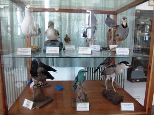
The museum of the natural history of the region, unusual in its subject, repays a visit. It grew out of an environmental project at the local secondary school: three teachers and the school’s seventy-six pupils assembled the collection, which is shown in a geology room – rocks of the district, the materials won from them and data on the local climate – and a room for flora and fauna. The same building houses a small museum of folk art.
The oak forest of Rouvas
The museum is devoted above all to the plants and animals of a unique tract of woodland, the oak forest of Rouvas (Prinodasos tou Rouva), which is protected as part of the European network of Natura 2000 sites. The tree in question is the “prinos”, the kermes oak (Quercus coccifera), an evergreen that elsewhere mostly occurs only as scrub: stands centuries old, grown into stately trees, have survived nowhere on Crete but here, at the foot of Psiloritis, on a small upland plain reached by some 16 kilometres of rural road from Gergeri. Among the oaks grow Cretan maples, which turn gold and red in autumn, and, on the northern side, the endemic Cretan zelkova (Zelkova abelicea), the “abelitsia”. Every year in May the shepherds meet in Rouvas for the traditional sheep-shearing, the “kouros”, celebrated with song and dance; the little chapel of St John in the middle of the forest – he is the shepherds’ patron – is their festival ground, and wooden tables and benches under the trees serve picnickers the rest of the year.
Venerato and its Venetian name
The attractive village of Venerato lies three kilometres from Dafnes and about 20 kilometres from Heraklion, at around 300 metres. It is lost in the green of countless olive groves and vineyards, and vines and olives remain its livelihood. It was founded by wealthy Venetian merchants and nobles as a summer retreat; the place first appears in a document in 1369, in the archive of the Duke of Crete. The gentry built country seats here that were at once dwelling and defensive tower – the ruinous Venetian mansion known as the Serai, in the south-eastern part of the village, is a survivor – and are said to have thought so highly of the spot that it was called “Venice, but for an onion skin”.
Panagia Paliani and the origin of the name
The name Venerato means “venerated”. What was venerated was presumably the convent of the Panagia Paliani, which according to tradition was founded in the 4th century on a hill near the village, some 700 metres to the east above the river Apollonas, and which still draws pilgrims with its holy myrtle, honoured on 24 September. Venerato is, incidentally, held to be the only settlement in all Crete to have kept its Venetian name unchanged.
The Venerato gorge and the river Apollonas
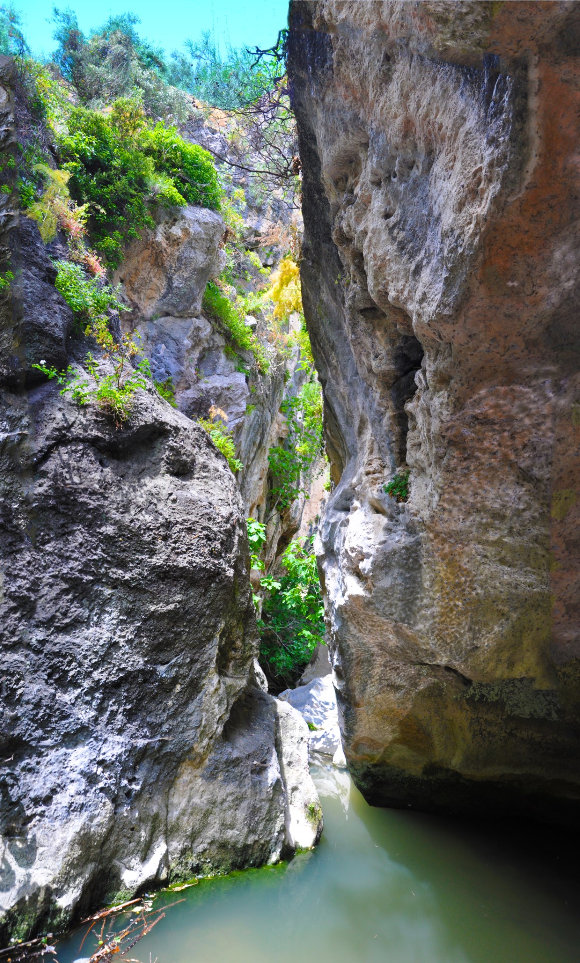
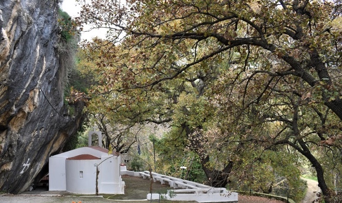
Right beside the village lies the gorge of the same name. Short as it is – about 500 metres – it is striking in its beauty. Through it flows the Apollonas, which rises near Agia Varvara and runs on to join the Giofyros. The river, which carries water all year round, is the lifeline of the district – orange, lemon and mandarin orchards thrive on its valley floor – and bears in its name the memory of the ancient city of Apollonia. Fitted neatly into the cliffs, at the mouth of the gorge, is the little church of St Fanourios: a single-aisled, barrel-vaulted building beneath a rock overhang, put up around 1600 and named as a monastery in documents of 1610 and 1640. In 1931, as an inscription over the door attests, it was restored by a family from Venerato. On 27 August, the saint’s day, the faithful bring the traditional “fanouropites”. The ravine is said to have served as a refuge both under the Turks and during the German occupation.
The way through the gorge
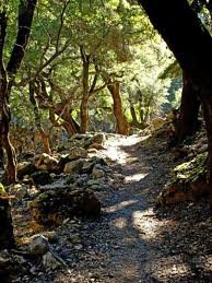
The route through the gorge has some remarkable scenery, above all the narrow passage of Kouroupi with its cascades and impressive rock formations: here the walls, some 25 metres high, close in to about 60 centimetres, and the stream drops over a seven-metre step into a deep pool. Ivy and plane trees overgrow the banks, and at the spot called “Gra Spiliara” wild pigeons nest. The walk calls for care and preparation: there are places where one must wade or scramble over rock, and in the narrow section a helmet is part of the kit.