Samaria Gorge – the long descent from Omalos to the Libyan Sea
The most complete guide to Crete: 221 places on the map, 23 routes and 49 articles — with photos, videos and the story behind every place. No sign-up, no trackers.
Routes drawn along real roads
Weather at every stop
Full-text search
“Near me” by geolocation
Create your own printable itinerary
Satellite, terrain, dark mode
Works offline
⌕
Searches 1.7 million characters of descriptions, not just names
—places
4regions
—routes
—with video
Search results
—
Interactive map
Find what is near you
Filters narrow the map and the list at once. Zoom out and pins group together.
Region
Category
Фильтры карты
Landmarks
Featured places
RegionCategory
Routes
Ready-made day trips
Individual places
Articles about landmarks
Samaria Gorge – the national park of the White Mountains
The Samaria Gorge (Φαράγγι της Σαμαριάς) opens on the southern edge of the Omalos plateau, in the White Mountains above Chania. It is the heart of the White Mountains – Samaria National Park, founded in 1962 to protect a singular landscape, its endemic flora and the Cretan wild goat, the kri-kri; the few families still living in the gorge were moved out in the same year. From Xyloskalo to Agia Roumeli on the shore of the Libyan Sea the gorge runs for about 16 kilometres. The official trail inside the park measures roughly 13 kilometres, and a further three or so follow a track down to the coast. The figure of 18 kilometres that is often quoted is not the length of the ravine but the distance from the settlement of Omalos to the sea.
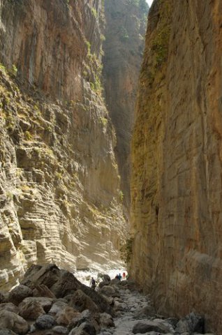
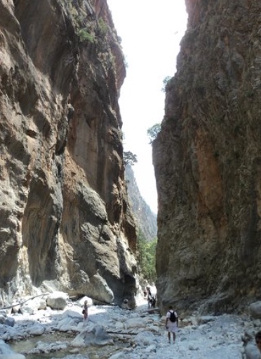
Samaria is one of the largest and most imposing gorges in Crete, cut by a torrent between the main massif of the White Mountains and Mount Volakias. The path loses some 1,200 metres in height along the way, and in places the walls rise sheer for several hundred metres, while the floor varies from about 150 metres across to a mere three or four. Forests of pine – the Calabrian pine grows here naturally – and cypress clothe the slopes, with plane trees along the water and the endemic ambelitsia, the Cretan zelkova; there are springs throughout, aromatic and medicinal herbs on the screes, and a rich bird life. Kri-kri may be seen here, and overhead griffon vultures, bearded vultures, golden eagles and other birds of prey. Cretan cypress has been prized since antiquity, and tradition has it that timber from these mountains was shipped as far as Egypt. Samaria is at once a nature reserve and a place with a history, where for centuries the people and the insurgents of the White Mountains found refuge: women and children fled here after the failure of Daskalogiannis’s revolt in 1770, and in 1867 Ottoman troops who tried to force the gorge burned Agia Roumeli at its mouth. The last such episode came in May 1941, when King George II and the prime minister, Emmanouil Tsouderos, fleeing the German advance, came down through the gorge to the south coast.
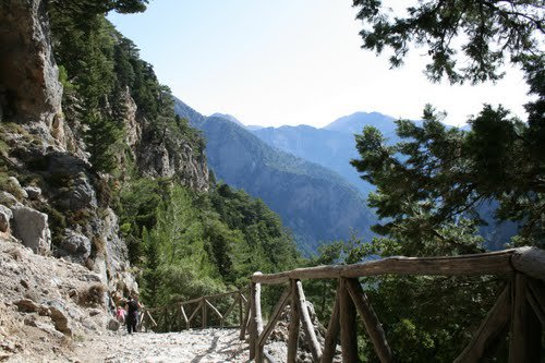
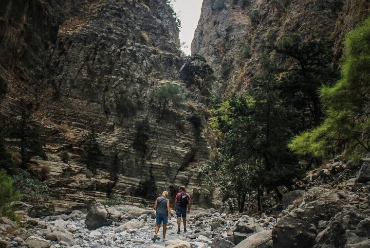
Xyloskalo lies at about 1,250 metres and forms the northern entrance to the park. From here a made path descends steeply in tight zigzags: the name Xyloskalo, “wooden staircase”, is usually connected with a timber stairway the local people used before the present path was laid out. The first kilometres run through pine forest. After about 1.7 kilometres the path reaches the first rest area, Neroutsiko, and a little over a kilometre further on the spring of Riza Sykias; by then the worst of the descent is over. Below that the trail crosses the bed of the Tarraios and passes drinking-water springs again and again. The descent calls for proper footwear – walking shoes or boots with a good tread rather than sandals – and time in hand: the stones, polished by generations of walkers, can be slippery, and in the mountains the weather turns quickly. An early start pays, since the upper section is then still in shade.
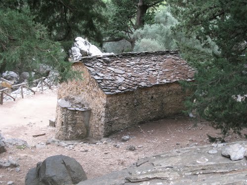
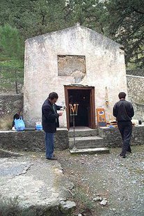
Further down, in a small clearing among old pines and cypresses, stands the church of St Nicholas, a little under four kilometres from the entrance. It is thought to occupy the site of an ancient shrine, variously assigned to Apollo or to Artemis and dated to the 6th century BC; the neighbourhood is also linked with the ancient town of Kaino, which legend made the birthplace of the Cretan goddess Britomartis. The small churches and chapels along the way are a reminder that the gorge was not merely a passage through the mountains but a place where shepherds and the people of the surrounding villages lived all year round.
The old village of Samaria lies roughly halfway, at about 300 metres above sea level and a little over seven kilometres from Xyloskalo. Before the national park was created a few families lived here from stock-rearing and woodcutting; once the area had been placed under protection in 1962, the inhabitants were resettled. The abandoned stone houses now serve the park wardens, and the spot, with its spring and its shade, is the principal halt of the walk – a good place to eat, refill bottles and rest before the second half. Two churches survive, that of St Nicholas and that of Osia Maria, St Mary of Egypt, which stands a little apart from the houses on the far side of the stream bed. It was the latter that gave its name to the village and to the gorge itself. The church buildings preserve traces of the Byzantine and post-Byzantine tradition; the most valuable liturgical objects have been removed for safekeeping.
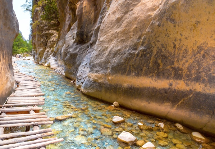
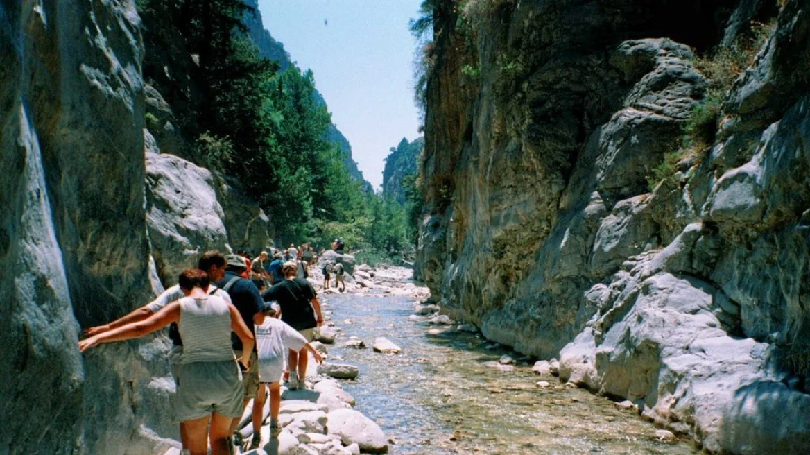
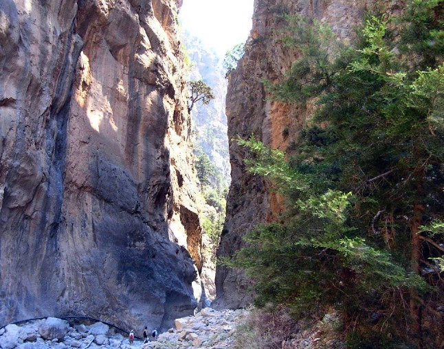
Beyond Samaria the path passes the spring known as Nero tis Perdikas, “the partridge’s water”, and the rest area of Christos with its small chapel, and then comes to the narrowest point of the gorge, the Sideroportes or “Iron Gates”, often simply called Portes. The name derives from the walls that almost meet and from the dark colour of the limestone, which from a distance recalls rusted metal. Here the stream bed narrows to three or four metres, while the rock on either side towers for some 300 metres. The passage is made over footbridges and stepping stones; it is also where almost every walker stops to look straight up.
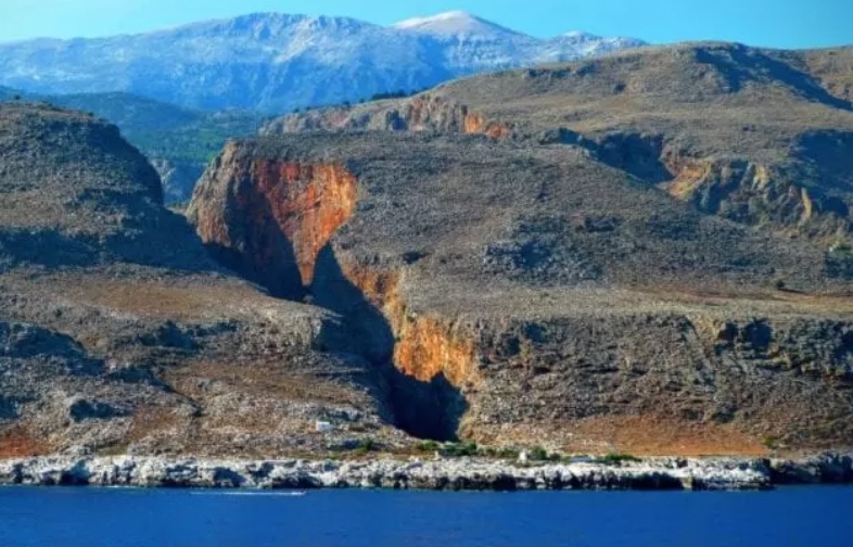
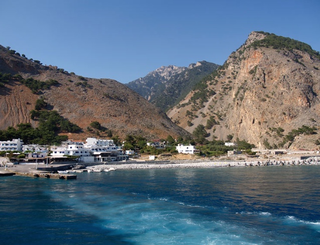
Past the Iron Gates the gorge gradually widens. The path leads by old olive trees, oaks, cypresses and planes and then reaches the lower part of the national park; the landscape grows drier and brighter, and the heat, held between pale rock walls, is at its fiercest here in the early afternoon. At Agia Roumeli the mountain route ends on the Libyan Sea, on a long beach of dark pebbles where most walkers finish the day with a swim. The village is a tiny place – the community numbered 78 residents at the 2021 census – of two parallel streets along the water, lined with tavernas and rooms. No motor road links it with the north, which is why the return is normally made by ferry – to Chora Sfakion, or westwards to Sougia and Paleochora.
Agia Roumeli stands on the site of ancient Tarra, a city that struck its own coins: issues of the 3rd and 2nd centuries BC show the head of a Cretan wild goat, an arrow and a bee. Tarra shared a monetary union with Elyros, Hyrtakina and Lissos, flourished in the Graeco-Roman period and was later known for its glass workshops; Pausanias and Stephanus of Byzantium mention it, and the grammarian Lucillus of Tarra, a commentator on the Argonautica of Apollonius of Rhodes, was born here. Archaeological and written evidence connects the city with the cult of Apollo Tarraios, parts of whose temple have been found, and with the sea routes of southern Crete. The first modern traveller to identify and examine the site was the Englishman Robert Pashley in the 1830s; a stele from Tarra carved with a double axe is displayed in the Archaeological Museum of Chania. In the surrounding area the church of the Panagia, remains of ancient buildings and the ruin of an Ottoman watch-fort, on the hill west of the village, have survived. On the beach, some way east of the village, stands the chapel of St Paul, which local tradition associates with the Apostle’s voyage along the Cretan coast.
The full traverse from Xyloskalo to Agia Roumeli usually takes five to eight hours, depending on pace, heat and the state of the path; six hours with pauses is a fair average for a walker in reasonable condition. The effort is easily underestimated, for the route is downhill almost all the way and it is the knees and thighs, not the lungs, that suffer. Inside the park there are rest areas at intervals of one to two kilometres, piped drinking-water springs along almost the whole route – a single bottle to refill is enough – and lavatories at regular stages. Entry is permitted only in the fixed season – as a rule from May until the second half of October – and during opening hours; before setting out, check the official notices on weather, rockfall, water level and temporary closures.
The route lies within the national park, and for that reason it is forbidden to leave the marked path, to light fires or to leave litter behind. Spending the night and bathing in the pools are likewise not allowed. Kri-kri and other animals are protected – the wild goat also under the Bern Convention – and must not be fed, however tame the animals around the old village may seem.
The core zone of the park covers about 48,500 stremmata – almost 4,850 hectares. Protected here are forests of cypress and pine, plane trees, oaks, endemic plants and the Cretan mountain goat, the kri-kri, which outside the White Mountains survives only on a few offshore islets such as Thodorou, opposite Agia Marina. Vultures and other rare birds of prey nest in the gorge as well, and on the coast nearby, at Fournoti beach, a plant micro-reserve of about 6.5 hectares shelters the vulnerable shrub Hypericum aciferum. The Council of Europe counts the gorge among the protected natural monuments of the continent. The interplay of geology, water and vegetation makes Samaria not merely a walking route but a natural monument in a class of its own.