The most complete guide to Crete: 221 places on the map, 23 routes and 49 articles — with photos, videos and the story behind every place. No sign-up, no trackers.
Routes drawn along real roads
Weather at every stop
Full-text search
“Near me” by geolocation
Create your own printable itinerary
Satellite, terrain, dark mode
Works offline
⌕
Searches 1.7 million characters of descriptions, not just names
—places
4regions
—routes
—with video
Search results
—
Interactive map
Find what is near you
Filters narrow the map and the list at once. Zoom out and pins group together.
Region
Category
Фильтры карты
Landmarks
Featured places
RegionCategory
Routes
Ready-made day trips
Individual places
Articles about landmarks
Fournes in the Keritis Valley
Fournes (Φουρνές) lies some fifteen kilometres south of Chania, about a hundred metres above sea level, in the valley of the river Keritis, among orange groves, olive plantations and plane trees. The river itself is one of the largest in Crete: it rises in the White Mountains above Zourva and Meskla, runs north for more than 25 kilometres through the plain of Alikianos and reaches the sea at Platanias, a village that takes its name from the plane trees along the riverbed; it is generally identified with the Iardanos of Homer, beside whose streams, the Odyssey says, the Kydonians lived. The land around the village has long been given over to citrus, and Fournes is counted among the largest of the so-called orange villages of the Chania hinterland; there are tens of thousands of orange trees, and in late spring or early summer the village holds a festival for anthonero, the flower water distilled from orange blossom. Tradition derives the name from old ovens built into the earth, Greek “fournoi”, which stood in the Fteredi fields beside a stream and were used for baking bread and clay bricks. From Fournes the road runs through Episkopi, Myloniana, Potistiria, Lygides and Perivolia to Chania and on to Mournies, while the main road south climbs towards Omalos.
The history of the place goes back at least to Venetian times: the census of 1583 records “Furnea” with 419 inhabitants. In 1834 only 36 families lived here, thirty Christian and six Muslim; by 1881 there were 284 Christians, and today the village has around 900 residents. Among the older churches is Agia Sofia, dating from about 1510, and the principal church of the Saviour, which goes back to a building of 1580 and was rebuilt in 1939; this two-aisled church of the Transfiguration of the Saviour and St Panteleimon is unusual for its three domes, and its feast is kept on 26 July. The memory of the German occupation weighs heavily. On 1 August 1941, in the reprisals that followed the Battle of Crete, men from Fournes, Alikianos, Skines, Meskla, Vatolakkos, Koufos, Prases and other villages of the valley were shot on the bank of the Keritis at Alikianos, near the old arched bridge; 118 died that day, eighty of them from Fournes. In February 1944 about 180 people were arrested here and some of them deported to Germany.
Fournes and Mournies: a necessary clarification
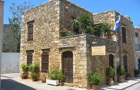
Fournes is often confused with Mournies, the ancestral home of the Venizelos family. The museum house of Eleftherios Venizelos stands in Mournies, on the outskirts of Chania, about four kilometres south of the town; Fournes itself is a different village, a further ten kilometres or so up the valley of the Keritis and today part of the municipality of Platanias, whereas Mournies belongs to the municipality of Chania and gave its name to the former municipal unit of Eleftherios Venizelos.
Mournies really is bound up with the Venizelos family: there stands the house in which the future statesman was born on 11 August 1864, the home of his father Kyriakos, and there too are old ecclesiastical monuments, among them the Patriarchal Monastery of Chrysopigi, founded in the late 16th century, whose monks were massacred by the Turks in 1821 and which was restored in 1848. The village flourished in the early 17th century, when wealthy nobles built country houses here, the best known being the Villa Koukounara. The name of the place comes from the mulberry trees, “mournies”, that once grew here. Fournes, by contrast, matters chiefly as the rural centre of the valley, from which one travels easily to Chania, to the gorges and to the villages of the western hinterland. There is, admittedly, a link with Venizelos here too: the village remembers its headman Georgios Frangonikolakis, who sheltered the politician in his house.
The church on the hill and the tradition of Nikephoros Phokas
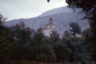
On the hill above the village stands a small church which local tradition dates to the year 999 and associates with the age of the Byzantine emperor Nikephoros Phokas. According to this tradition it was built after Crete had been freed from Arab rule in 961, the year in which Phokas recovered the island for Byzantium. The historical connection with the Great Lavra is explained by the fact that Nikephoros Phokas promoted the foundation of Megisti Lavra on Athos only two years later, in 963, and the same emperor is remembered in the district as the patron of the old Monastery of St Eleftherios at Mournies; the particular attachment of this church, however, is to be understood as local church tradition rather than as a documented fact.
From the hill the view opens over the whole valley, from the foothills of the White Mountains down to the plain of Alikianos. Nearby lie old monastic estates and small chapels; their siting shows how Byzantine and later settlements bound the places of prayer to roads, springs and arable land, each church standing where a path crossed a stream or a terrace of olives began.
The Monastery of St Eleftherios
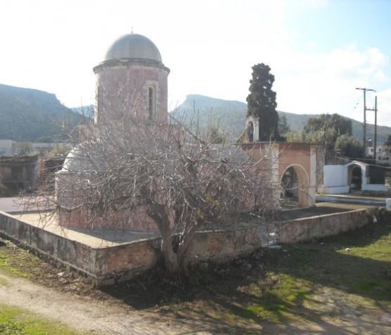
East of the village lies the Monastery of St Eleftherios (Moni Agiou Eleftheriou), assigned to the 16th and 17th centuries. Its architecture grew by stages: an early chapel – its forward part is held to be a great deal older, perhaps of the 10th century – was enlarged, and the main church received its characteristic triconch plan with a dome, in which echoes of Venetian mannerism combine with the building tradition of Athos. The church is a single-naved building with three apses forming a Latin cross and a large dome, now painted blue, without side chapels. Under Ottoman rule the monastery served as a refuge for monks; in 1681 it became a metochi, a dependent estate, of the Monastery of Chrysopigi, and it was in that period that it chiefly prospered. To it belonged extensive olive plantations and an oil mill which, according to its inscription, was built in 1678 and renewed in 1850; its millstones and screw presses from the late 19th century survive remarkably complete. The place entered political history on 2 November 1905, when the agreement that ended the Therisso revolt was signed here. That rising, begun on 23 March 1905 under Eleftherios Venizelos, Konstantinos Foumis and Konstantinos Manos, demanded union with Greece and an end to the autocratic rule of Prince George, the High Commissioner; its settlement, negotiated with the Great Powers, brought an amnesty and the surrender of some 700 to 800 rifles, and within a year the prince had left the island, replaced by Alexandros Zaimis. The complex has been a listed monument since 1982, but the cells, storerooms and oil mill have fallen into decay and await restoration.
The name Eleftherios is connected with the Greek word for “free” (Ἐλευθέριος). In Orthodox tradition it denotes the holy bishop Eleftherios, a martyr of the age of Hadrian who, according to his Life, was born in Rome, became bishop in Illyricum and was put to death together with his mother Anthia, the widow of a consul; his memory is kept on 15 December. The monastery is the one attached to Mournies; the district has no other foundation of that name.
The valley and its footpaths
Above Fournes begin the paths to the gorges and the wooded slopes; here the road forks towards Meskla, four kilometres to the south at 200 metres, where the springs of the Keritis rise, and towards Lakki, the gateway to the Omalos plateau. A second, gentler walk leads north-east along the river to Alikianos. The paths are suited to unhurried walking, but after rain the stream beds and stony stretches become slippery. In the village itself one can stop at a kafenion or taverna and sample local cheese, produce made from citrus fruit and dishes of the Cretan kitchen. The valley is at its loveliest in late winter and spring, when the oranges ripen and, shortly afterwards, the blossom fills the air.