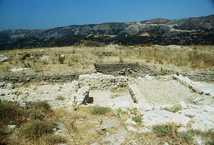
Ancient Sybrita at Agia Fotini: the Lost City of the Amari Valley
The most complete guide to Crete: 221 places on the map, 23 routes and 49 articles — with photos, videos and the story behind every place. Everything is open and free: no sign-up, no paid sections and no advertising, open or hidden. You can install the guide on your smartphone as an app.
Routes drawn along real roads
Weather at every stop
Full-text search
“Near me” by geolocation
Create your own printable itinerary
Satellite, terrain, dark mode
Works offline
⌕
Searches 1.7 million characters of descriptions, not just names
—places
4regions
—routes
—with video
Search results
—
Interactive map
Find what is near you
Filters narrow the map and the list at once. Zoom out and pins group together.
Region
Category
Фильтры карты
Landmarks
Featured places
RegionCategory
Routes
Ready-made day trips
Individual places
Articles about landmarks
Agia Fotini and ancient Sybrita
Only a kilometre beyond Apostoli lies Agia Fotini (Αγία Φωτεινή), the present administrative centre of the Amari valley. The settlement is young: it came into being only in the 1950s, on part of the ground that in antiquity belonged to the city of Sybrita. From the rise there is a wide view over the valley, some 25 kilometres long and lying at 400 to 500 metres, which is framed on the east by the slopes of Psiloritis (2,456 metres) and on the west by the Kedros massif (1,777 metres) – one of the most fertile and tranquil landscapes of central Crete, and the natural passage between the north coast at Rethymno and the Messara Plain.
Sybrita – a city of the Amari valley
Ancient Sybrita – also recorded as Sybritos, Soubrita, Sibyrtos or Sivrytos – occupied the hilly ground between the present villages of Agia Fotini, Thronos, Klisidi, Genna and Apostoli. Its acropolis lay on the summit of Throniani Kefala immediately above Thronos, a naturally strong position that offered security and at the same time commanded the northern approach to the valley. The city was fortified and supplied by a great aqueduct that brought water from a distance. Its territory extended over the whole Amari valley and part of the valley of Agios Vasilios; ancient reckoning placed it eight Roman miles from Eleutherna. The ancient harbour of Soulia, thought to have lain in the area of modern Agia Galini, linked Sybrita with the Libyan Sea.
Coins and political independence
Sybrita struck its own silver money – the most visible sign of the independence of a Cretan polis. The issues, the finest of which belong to the 4th century BC, show Dionysus with the attributes of the vine, Hermes and Zeus; the types are almost always connected with the worship of Dionysus or Hermes, and in these images the cults and economic ties of the city are reflected. The legend reads “Sybrition” (ΣΥΒΡΙΤΙΩΝ, “of the Sybritians”) and marks the coin as the issue of a particular body of citizens. Among collectors and numismatists the staters of Sybrita are held to be especially finely cut works of Cretan die-engraving; the city has long been famous for its numerous and beautiful silver pieces.
From the Late Bronze Age to the Roman Empire
Archaeological research shows that the Sybrita area was already inhabited in Late Minoan times. Around the 12th century BC, in the dark age that followed the destruction of the Minoan world, inhabitants of the valley withdrew to the protective hilltop; the place name is associated with the “su-ki-ri-ta” of the Linear B tablets. A Greek–Italian mission – the Rethymno antiquities service together with the Italian National Research Council (CNR) in Rome – has been investigating the summit since the 1980s in three areas: the north plateau, the south plateau and the centre. More than forty pits came to light, filled with pottery, animal bones and food remains, which bear witness to communal feasting from the 12th to the 9th century BC, along with hearths, ovens and remains of a fortification. A clay krater of the Early Protogeometric period (c. 975–950 BC), found in 2002, carries a depiction of an armed dance; it is regarded as the oldest image of its kind in Greek vase painting.
Later the city expanded in Hellenistic and Roman times, when in the excavators’ judgement it reached the height of its prosperity. The excavations have uncovered sections of the acropolis and residential quarters, houses with mosaic floors, clay vessels, terracotta figurines, metal implements and jewellery, and also the tomb structures of a necropolis on lower ground south-west of Thronos. To these may be added the traces of the long-distance aqueduct, a hypocaust that points to a bath, and fragments of a bronze statue of the 1st century AD. The finds prove that urban life went on for centuries without a break; they are kept in the Archaeological Museum of Rethymno. In 2016 the archaeological zone of Sybrita was redefined and enlarged in order to protect the monuments from the Late Minoan to the Roman period.
Sybrita in early Byzantine times
In the early Byzantine centuries Sybrita did not forfeit its importance. The city became the seat of a bishopric, and its bishop appears among the roughly 520 bishops and delegates at the Fourth Ecumenical Council at Chalcedon in 451, which the emperor Marcian convened and which defined the doctrine of the two natures of Christ. The large basilica over whose remains the church of the Panagia at Thronos now stands – a three-aisled building with a narthex – is regarded as the cathedral of this community. From the middle of the 2nd century AD, however, prosperity had gradually declined; the decay and destruction of the city centre are connected with the crises of late antiquity and with the raids of the Arabs, in the wake of which the population withdrew to better-protected settlements and the urban focus shifted. Towards the end of the 8th century the traces of city life peter out. The name, though, remained alive into Venetian times and persists in the title of the Orthodox metropolis responsible for the district, which is still called “Lampi, Syvritos and Sfakia”; in the Roman Catholic Church, too, Subrita lives on as a titular see.
Touring the Amari valley
Agia Fotini makes a good base for drives through the Amari. From here the roads lead to Thronos, Kalogeros, Monastiraki – site of a Minoan palace – Vizari, Fourfouras, the largest village of the valley, Kouroutes, Nithavris and Apodoulou, and to other villages besides. They wind along the flanks of Psiloritis, through oak groves, olive plantations and stands of cypress, and past the plane trees that line the mountain streams; near Genna, less than a kilometre from Thronos, an ancient olive with a trunk more than ten metres round has been declared a natural monument. The district has abundant rain, and its very name is derived from amara, an ancient Greek word for a water channel. A route of this kind combines the archaeology of Sybrita with living villages and the natural scenery of central Crete.