Aptera, city of the Sirens: a route through the Chania hinterland
The most complete guide to Crete: 221 places on the map, 23 routes and 49 articles — with photos, videos and the story behind every place. Everything is open and free: no sign-up, no paid sections and no advertising, open or hidden. You can install the guide on your smartphone as an app.
Routes drawn along real roads
Weather at every stop
Full-text search
“Near me” by geolocation
Create your own printable itinerary
Satellite, terrain, dark mode
Works offline
⌕
Searches 1.7 million characters of descriptions, not just names
—places
4regions
—routes
—with video
Search results
—
Interactive map
Find what is near you
Filters narrow the map and the list at once. Zoom out and pins group together.
Region
Category
Фильтры карты
Landmarks
Featured places
RegionCategory
Routes
Ready-made day trips
Individual places
Articles about landmarks
This route is an introduction to the upland Crete that lies behind Chania: handsome mountain country, archaeological and historical monuments, and the vivid traditions of the people who live among them. It sets out through the citrus groves at the gates of the town, climbs into the foothills of the White Mountains, where a good deal of modern Greek history was decided, and ends on the rock plateau of Aptera, from which the eye takes in the whole of Souda Bay. Most of the roads are narrow and winding, so the distances on the map are a poor guide to the time required; allow a full day, or split the route in two.
From Chania to Aptera
Setting out
We leave Chania heading south, towards Perivolia, a village that today belongs, like Varypetro and Therisso further on, to the same municipal unit of the town. A plain opens ahead, drowned in the green of citrus and olive trees; in spring the scent of orange blossom hangs heavily over the road.
The water park
About seven kilometres south of Perivolia the village of Varypetro lies in very attractive hill country. Here is the Limnoupolis water park, a sprawling complex built into the slope, with a large number of slides, pools and water games – in the summer months a favourite outing for families from Chania and for holidaymakers with children.
The Monastery of St Kyriaki and the Cave of the Seven Youths
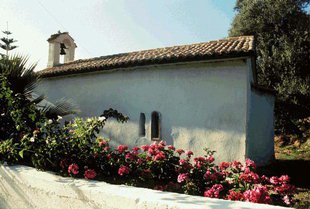
The monastery lies about twelve kilometres south-west of Chania, below the height known as Kastellos, and is reached by an asphalt road. It is surrounded by woodland, by a small ravine with a stream, and by a whole series of cave chapels to which paved paths lead. The monastery church, a single-nave building, is dedicated to the Transfiguration of the Saviour (feast on 6 August) and also keeps the day of St Kyriaki on 7 July. It stands in the middle of a rectangular 16th-century enclosure, hemmed in by the cells and the domestic buildings. Since 1637 Agia Kyriaki has been a metochi, a dependency, of the Chrysopigi convent near Chania. By 1992 it was a ruin; between 1993 and 1996 the sisters of Chrysopigi rebuilt the decayed buildings from the ground up, and they now also run a Centre for Orthodoxy and Ecology here, which offers programmes of environmental education.
Around the monastery are the cave chapels of St Anthony (feast on 17 January), of the Holy Seven Youths (4 August), of St Silouan the Athonite (24 September) and of the New Martyrs of Crete (23 June). Worth seeing, too, is the restored 16th-century olive mill, which now serves the nuns as their refectory. In Ottoman times the remote monastery gave shelter to the insurgents of the district. On 14 May 1866 the first great pan-Cretan assembly met here: the delegates of the provinces drew up a petition to the Sultan and to the Great Powers, and at a later assembly of the same kind the wish for the union of Crete with Greece was openly declared – the prelude to the great revolt of 1866 to 1869.
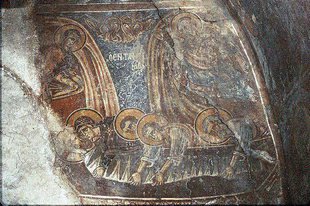
A few steps from the monastery is the Cave of the Seven Youths (Agii Epta Pedes), dedicated to the Seven Sleepers of Ephesus. It is known for the archaeological remains of an early church and for the impressive restoration work of recent decades. A small bridge leads on from here to a chapel and to a second cave with a spring of the purest water. The place is famous for its beauty and draws many pilgrims on the feast day, 4 August. The wider surroundings are also rich in caves and chapels; among them are the renewed chapel of Agios Antonios and an olive press in the cave called Alitrivadio. The grove and ravine around the monastery are now a protected landscape.
The Therisso Gorge
From Varypetro return to Perivolia and continue through the deeply cut Therisso Gorge (Therisiano Farangi). It is six kilometres long, climbs some 400 metres from mouth to head, and now officially bears the name of Eleftherios Venizelos. Unlike most Cretan gorges it can be driven through in comfort: the narrow road follows the stream bed under plane trees, between rock walls to which cypresses and holm oaks cling. The stream itself carries water only until spring. Shortly before the gorge ends there is a large cave, eight metres high, twelve metres wide and twenty metres deep. It has yielded numerous finds, from the Neolithic to the Minoan period. Like most caves in Crete it served the Cretans as a refuge under Ottoman rule. The gorge is also pleasant to walk and, as far as difficulty goes, makes almost no demands – it is rated among the very easiest on the island – but allow about two hours on foot and keep an ear open for traffic.
Therisso – the village of Eleftherios Venizelos
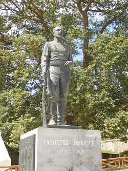
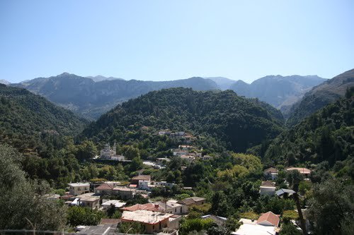
At the head of the gorge you reach Therisso, 16 kilometres south of Chania and about 580 metres above the sea, a farming village of little more than a hundred people. It is bound up as closely as any place could be with Eleftherios Venizelos, the most important Greek statesman of the 20th century: his mother, Styliani Ploumidaki, came from Therisso, and it was here that he set up his headquarters. He was born, however, at Mournies, which we visit later on this route. The country round about is covered in lush, wild vegetation.
Therisso is a historic place. Several important engagements in the struggle for liberation from Ottoman rule were fought here; the village was destroyed in 1821 and 1822, and burnt in September 1866 by the troops of Mustafa Pasha. The gorge made it a natural fortress, and that is why Venizelos – whom Prince George had dismissed from the government in March 1901 – chose it in March 1905 for a revolutionary assembly, with Konstantinos Foumis and Konstantinos Manos at his side. Some 1,500 armed Cretans gathered at first; within twenty days there were 7,000 sympathisers in the village, against the 1,100 gendarmes at the prince’s disposal. In the church of St George the assembly, called by the man who is a national hero of Greece and of Crete alike, proclaimed union with Greece and rose against the policy of Prince George. When the insurgents came to terms in November they handed in 700 to 800 rifles, and the prince found himself obliged to lay down his office the following year – a step that led in the end to the union of Crete with Greece.
The family house that served Venizelos as headquarters survives; it now holds a historical museum with documents and photographs from those months. A second small museum, the Museum of National Resistance, commemorates the years 1941 to 1945. The churches of St George and of the Panagia complete the short list of sights. The cafés and tavernas of the village are good places to rest and to try the local cooking; the cheeses are renowned, and so is the lamb and kid from the mountain pastures.
The life of Eleftherios Venizelos
Even the early years of Eleftherios Venizelos were lived in the shadow of the struggle for the union of Crete with Greece. His family had only loose ties to the old Cretan clans: it came originally from Mystras in the Peloponnese, where it bore the name Cravvatas, and had to flee to Crete after the rising there. His father, the merchant Kyriakos Venizelos, became a well-known figure in the Cretan insurrections against the Ottomans. Eleftherios was born at Mournies on 23 August 1864; when the Cretan revolt of 1866 to 1869 broke out the family went into exile, first on Kythira and then on the island of Syros, and came home only with the amnesty of 1872. He finished his schooling at Ermoupolis on Syros in 1880, went on to read law at the University of Athens, took his degree in 1886/87 and returned to Crete, where he worked as a lawyer, as a journalist and soon as a politician. First elected on 2 April 1889, he sat as a deputy for the Cretan Liberals and was among the leaders of the rising of 1896/97, which brought the island its autonomy.
Venizelos had a decisive hand in drafting the constitution of autonomous Crete. He took the justice portfolio, which he held from 17 April 1899 until his dismissal on 18 March 1901, helped to build up the gendarmerie and reorganised the courts. Despite the friction with Prince George and the Therisso revolt that grew out of it, he strengthened his position; in 1908 the Cretans, under his leadership, declared their union with Greece. In 1910 he went to Athens, founded the Liberal Party and, on 6 October of that year, became prime minister – the first of eight terms that together came to more than twelve years. From then on his work shaped the country’s domestic and foreign policy, above all in the Balkan Wars of 1912/13, which roughly doubled the territory of the Greek state and on 1 December 1913 also brought the formal union of Crete with the motherland.
His periods in office were marked by reforms intended to modernise the country: a land reform, support for agriculture and the expansion of education. The quarrel with King Constantine over entry into the First World War split the country deeply – in August 1916 Venizelos set up a rival provisional government at Thessaloniki, and Greece joined the Allies only after the king’s departure in 1917 – and his later years, too, were overshadowed by domestic conflict; after the failed coup of March 1935 he was condemned to death in his absence. Nonetheless Venizelos left an unmistakable mark on Greek history and went on representing his country’s interests on the international stage to the last, signing the treaties of Sèvres in 1920 and Lausanne in 1923 and, in his government of 1928 to 1932, reconciling Greece with Turkey. He died in Paris on 18 March 1936. His homeland honoured him with a grave on the hill of Profitis Ilias above Chania, from which one looks out over the town and the sea.
From Therisso up into the White Mountains
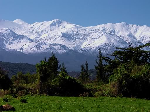
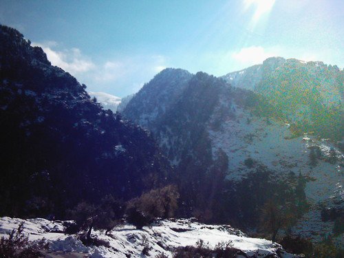
Above Therisso rise some twenty summits that carry snow well into spring – the Madares, as the Cretans call the bare high zone of the White Mountains (Lefka Ori). Those who love mountain scenery can go up by two routes: by a track to the summit of Xerokefala (1,237 metres) or by a mountain path to the far higher Kaloros (1,926 metres). The second needs a whole day and experience of pathless terrain.
Zourva
From Therisso one can also reach the mountain village of Zourva, after five kilometres of a steep, twisting road of hairpin bends. It sits at 572 metres above the valley of the Keritis, with a pine wood above the houses and a few traditional guesthouses. At the entrance to the village is a viewpoint called Paradisos – Paradise. From each of these three points there is a rare and arresting prospect, in which the white of the snow is set against the deep green of the olive and citrus groves in the valley and, to the north, the sea. It is not easily forgotten. From Zourva footpaths lead to the spring of Tromarissa and down into the Meskla gorge.
Meskla
From Zourva we turn north and come down to Meskla. The village lies 200 metres above the sea, some 20 kilometres from Chania at the foot of the White Mountains, where the River Keritis rises. It had more than 600 inhabitants in 1900 and has fewer than 300 today. It stands on the site of an ancient city which, ever since the English traveller Robert Pashley, has been identified with Rizinia; the French scholar Paul Faure thought instead of Keraia. Not far from the village, at the spot called Poule, stretches of Cyclopean walls with towers still stand, the oldest of undressed blocks, the later ones of the 4th century BC.
Twice Meskla was almost wholly destroyed: around 1570 by the Venetians, after the failure of the revolt of Georgios Kantanoleos, who is said to have had the seat of his rival government here, and in 1866 by the Turks. The name of the village is traced to the scrub that afterwards overgrew the ruins. In the Second World War Meskla again paid dearly for its resistance: 48 of its inhabitants were executed by the German occupiers.
The Church of Christ the Saviour
And yet, in spite of all the devastation, the Byzantine church of Christ the Saviour (Sotiras Christos) has survived. A small single-nave building, it is dedicated to the Transfiguration and in its present form dates from the beginning of the 14th century. It contains frescoes with scenes from the New Testament, painted in 1303 by the celebrated Theodoros Daniil and his nephew Michail Veneris; the date is preserved in an inscription above the door. The paintings in the narthex were added later, in the 15th century. The two belong to the handful of painters of Venetian Crete who are known by name, and their workshop was active in several village churches of western Crete.
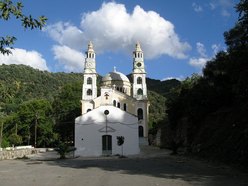
At the far end of the village, about 600 metres from the Saviour, stands a second Byzantine place of worship, the church of the Mother of God (Dormition of the Panagia), of curious architecture: an old part is preserved in its original form – a plain vaulted single-cell chapel whose walls are now whitewashed – while the other was added in modern times, in 1972, and carries two very tall bell towers. Until then the old chapel was the main church of the village. It is said to have been built with material from a Graeco-Roman temple, possibly dedicated to Aphrodite; remains of a mosaic floor can still be seen.
Fournes
In the picturesque valley of the Keritis, planted without a gap with citrus trees – more than 120,000 are counted – lies the village of Fournes, four kilometres below Meskla. Many of the oranges sold in the markets of Chania come from here. Beyond Fournes we drive towards Chania, through the hamlet of Episkopi (4 kilometres); two kilometres further on we turn right at a crossroads and return to Perivolia by way of the hamlets of Myloniana, Potistiria and Lygides. From there the route continues to Mournies.
Mournies
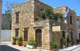
This place too, whose name comes from the mulberry trees (mournies), is linked with Eleftherios Venizelos. On the central square stands the family’s stone house, a typical two-storey Cretan dwelling of its time, where Kyriakos and Styliani Venizelos lived after their marriage and where he was born in 1864 and spent the first two years of his life, before the family went into exile in 1866; after their return in 1872 he spent his boyhood summers here, until the family moved to Chalepa in 1880. Badly dilapidated, the house was restored in 1955 by the architect Paul Kakouris at the instigation of the statesman’s son Sofoklis. Today it is a museum, run since 2018 by the National Research Foundation “Eleftherios K. Venizelos”, and can be visited; the ground floor covers his childhood and youth up to 1910 and the history of the village, the upper floor his later career, and the exhibits include his cradle as well as photographs from his private and political life. Mournies has a good deal else that deserves attention – among other things a three-storey Venetian country house in which Ottoman and Greek dignitaries were guests. A dark memory clings to the year 1833: thousands of Cretans gathered here then to protest against the taxes of the Egyptian administration; the demonstration was put down, and dozens of its spokesmen were hanged.
On the hill above the village you will find, besides a splendid all-round view, a little church which according to local tradition was built in the year 999 and commemorates the victory over the Saracens of the Byzantine general and later emperor Nikephoros Phokas, who won Crete back for the empire in 961. Tradition connects the chapel with the Great Lavra, the monastery on Mount Athos that Phokas patronised, and holds it to have been that monastery’s property.
A kilometre east of the village lies another monastery, Agios Eleftherios, of the 17th century and of notable architecture: the church is a plain triconch with a dome, and the olive mill, dated 1678, has largely kept its old fittings. Originally independent, the monastery was placed under Chrysopigi in 1681 – the same convent that owns Agia Kyriaki at Varypetro; it has been a listed monument since 1982 but stands abandoned. Those who like to walk can climb into the gorge above the village and enjoy the fine views.
The villages of Keramia
From Mournies it is worth turning south to visit the district known as the villages of Keramia (Choria ton Keramion), on the northern, limestone flank of the White Mountains. These villages lie scattered on the slopes of the mountains Orino, Mavri and Psara and combine the untouched wildness of the snow-covered summits with the lush green around the settlements; the road up from Chania is one long panorama. The district, like the river of the same name, owes its name to the colour of its soil, a clay suited to the making of ceramics, which allowed the potter’s craft to flourish in these villages. Its oil and wine are well thought of locally.
The villages are Panagia, Achlades, Loulos and Gerolakkos, where you should see the fine Byzantine church of St John; then comes Platyvola with the Platyvola cave, one of the more important in Crete, which has yielded finds from the Neolithic and the Early Minoan period. The last village is Drakona, just under 25 kilometres from Chania. Its few dozen inhabitants live from olives, livestock and bee-keeping – the thyme and heather honey of Drakona is widely prized. Legend has it that the name comes from an exceptionally hard boulder opposite the village square, the “dragon’s stone”, which a giant is said to have hurled here in a contest. The church of St George was, according to its inscription, renewed in 1833 and has a gilded, carved iconostasis.
By the same road we return to Mournies and follow the national road in the direction of Heraklion; before long the road to Nerokourou branches off. The place is known not only for its rich archaeological evidence of the Minoan palatial period – a Minoan country house was excavated here – but also for the idiosyncratic architecture of its old dwellings.
Aptera – the city of the Sirens
A landscape of fairy-tale beauty and myths of great expressive force: the ruin field of Aptera is well preserved, and the view from the fortress of Paleokastro beckons like the voice of a Siren.
The ancient city lay about 15 kilometres east of Chania on a limestone plateau, roughly a kilometre inland from the southern shore of Souda Bay, which falls away steeply to the water on the north and opens to the White Mountains on the south. At the height of its power its territory ran from the borders of Kydonia, the ancient Chania, to Lappa in the south and Cape Drapano in the east. Hardly anywhere in western Crete brings history, legend and prospect together as forcefully as this.
The myth of the Sirens
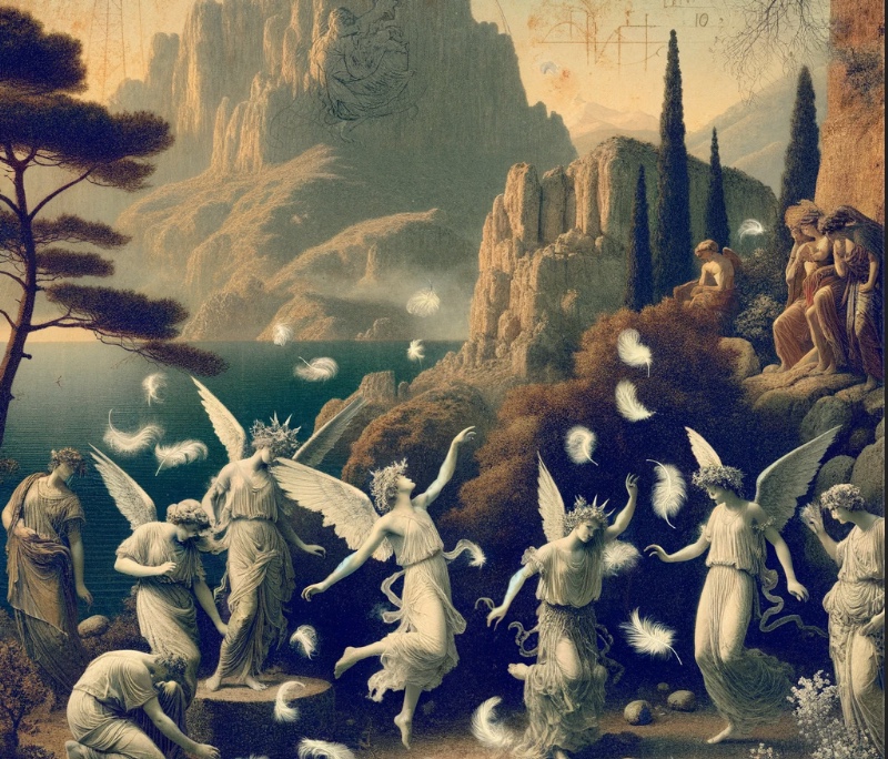
According to the myth, which the late-antique lexicographer Stephanus of Byzantium records, the Sirens lost their feathers in a musical contest with the Muses and fell naked to earth. The place where they came down has been called Aptera, “the wingless one”, ever since. How the Sirens – usually described as daughters of the river god Achelous by one of the Muses – came by their wings in the first place is a matter on which the versions of the myth differ widely. In one they were the companions of Persephone. After her abduction they wandered about and came to the land of Apollo, where Demeter turned them into winged creatures – as a punishment, Hyginus says, for not having come to Persephone’s aid. In another, told by Ovid, the gods changed them into birds for the very purpose of searching for the stolen girl. Others again relate that Aphrodite made them half birds because they refused marriage, or that they wept for the rape of Persephone, fled to the rock of Apollo and there took on the shape of birds.
On the advice of Hera they challenged the Muses to a singing contest; Pausanias saw at Coroneia in Boeotia a statue of Hera carrying the Sirens in her hand, which alluded to the story. The Muses won, plucked out the Sirens’ feathers and wove them into wreaths, which they wore from then on as ornaments on their heads. The Sirens, for their part, took their revenge henceforth on seafarers. They are portrayed as maidens of marvellous beauty and bewitching voice; with the sound of their songs they lull those who sail past to sleep, and then tear them apart and devour them.
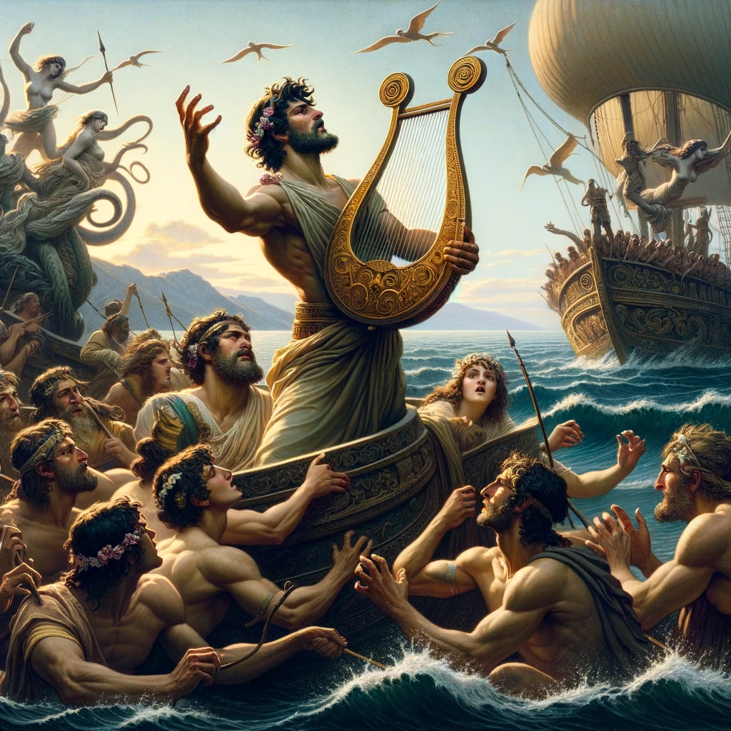
The Argonauts escaped destruction only because Orpheus, who sailed with them, drowned out the Sirens’ singing with his own song and the music of his lyre. In the telling of Apollonius of Rhodes one of the crew, Butes, heard them all the same and leapt overboard, to be rescued by Aphrodite.
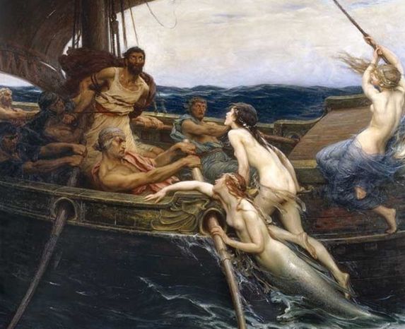
In Homer’s “Odyssey” – Book 12, where there are only two of them and neither is named – they try to seduce Odysseus and his companions with their song. They promise knowledge of all things and in truth lead men to their death. Odysseus, forewarned by Circe, has his men’s ears stopped with beeswax and himself lashed to the mast – so that he can hear the songs without yielding to the temptation. Later writers add that the Sirens, fated to die once a mortal had heard them and passed unharmed, then drowned themselves.
The islands of Souda Bay – from the Sirens to NATO
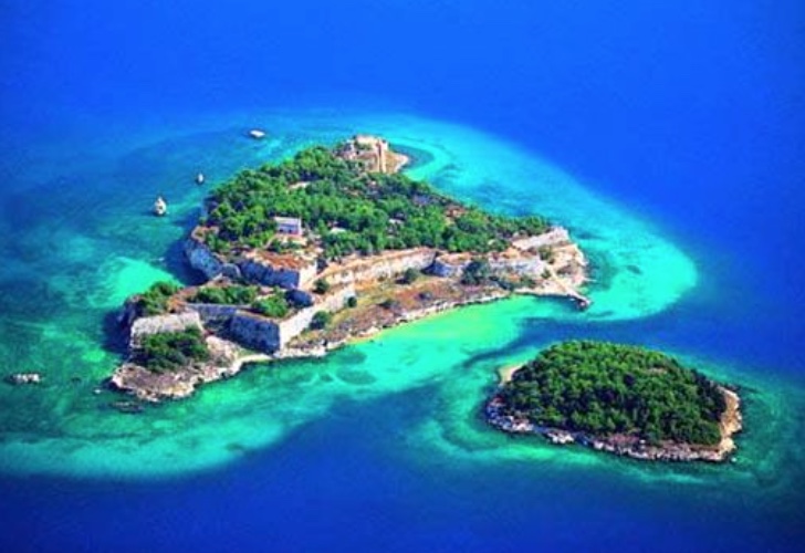
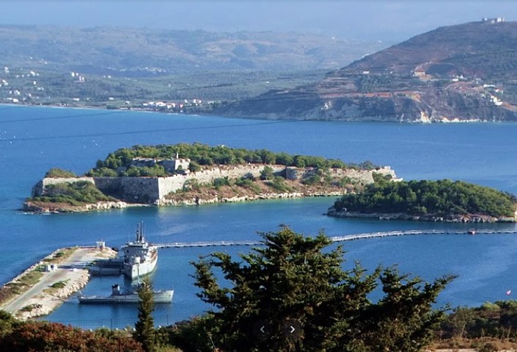
Souda Bay is one of the safest natural harbours in the Mediterranean. At its entrance, opposite Aptera, lie two islets which in antiquity were called Leukai, “the white ones”; the larger is Souda, the smaller Leon, which medieval Venetian charts mark as Rabbit Island. Legend has it that Zeus assigned these islets to the Sirens as their permanent home; in another version, the one Stephanus gives, they threw themselves into the sea in shame at their defeat, turned white and were themselves changed into the islands. Minoa was the ancient name of one of the two harbours of Aptera; it is sought at present-day Marathi on the north shore of the bay.
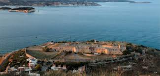
On the larger island, Souda, the Venetians heeded the call of the Sirens in 1573 and built a fortress to command the mouth of the bay against the Ottomans – in the long run to no avail. After the Venetians the Turks held the island, and they too had to give it up. The last to prove unable to resist the spell of the bay are the navies of our own day: on its shores lie a large Greek naval base and one of the most important bases of the United States and NATO in the Mediterranean, at which aircraft carriers regularly call. The island itself has no permanent inhabitants.
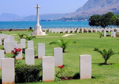
At the inner end of the bay, right at the water’s edge, lies the Allied war cemetery, designed by the architect Louis de Soissons and tended by the Commonwealth War Graves Commission. More than 1,500 Commonwealth dead of the Second World War rest here, most of them casualties of the Battle of Crete in May 1941; 776 of them could not be identified. There are also 19 graves of the First World War. Among the named headstones are those of the archaeologist John Pendlebury, shot in May 1941, and of the New Zealander Dudley Perkins, killed with the Cretan resistance in February 1944. Rising impressively above the rows of white headstones is the tall Cross of Sacrifice with its bronze sword.
The fortress of Souda in detail
Work on the Venetian fortress began in 1573. The Venetians had recognised the strategic position of island and bay for the operations of their fleet: whoever held the islet controlled the entrance. The designer and director of works was the military engineer Latino Orsini, and within a year the first guns were already mounted on the island. The complex comprised barracks, powder magazines, dwellings, cisterns, churches and a small harbour of its own; an outwork on the neighbouring islet gave it additional protection.
In 1646, when the Turks attacked, the fortress was still unfinished and its weak points were exposed. The Turks destroyed magazines and barracks, but the defenders under the command of Gerolamo Donà showed unbending courage and held out.
Although Crete fell to the Turks in 1669, the fortress remained in Venetian hands for another half-century. It was regarded as the unofficial capital of the “Kingdom of Crete” and was a refuge for Cretan insurgents. In 1715, after a siege of 72 days, it surrendered on 27 September – not from military weakness, but because no more support came from Venice. With that, Venetian rule in Crete came finally to an end.
Under the Ottomans the fortress served as a naval station and supply post. It was evacuated by the Turks in 1898; in the period of the Cretan State it attracted the attention of the Great Powers. In February 1913 the last Turkish flag in Crete was hauled down here, and since the union of the island with Greece in the same year the Greek flag has flown over the fortress.
The fortress has preserved unique elements of architecture and fortification, among them its bastions and the church built in 1585, where Augustinian friars conducted the services. As the island lies within a restricted military zone, it is accessible only to a limited extent and on particular dates; from the plateau of Aptera, however, the whole of it can be surveyed, and binoculars are worth bringing.
The archaeological site of Aptera
More probable than that the city is named after the Sirens is that it takes its name from the goddess Artemis Aptera, the “wingless” Artemis, whose image appears on the city’s coins found in the excavations. The place name itself is of great age: it already occurs on Linear B tablets from Knossos (14th–13th century BC) in the form a-pa-ta-wa, though the Bronze Age settlement seems to have lain about a kilometre and a half away, at modern Stylos. Anyone standing on the site of ancient Aptera, 200 metres above the sea, enjoys the magnificent view over Souda Bay – and may notice that the outline of the city recalls a bird in flight.
The city on the plateau was founded in the Geometric period. It reached its greatest prosperity in Hellenistic times, when it struck its own coins, dominated the seaborne trade of western Crete through two harbours – Minoa and Kissamos – and concluded treaties with distant powers such as Pergamon; its archers were sought after as mercenaries. It was not always at peace with its neighbours: in the 3rd century BC it fought Kydonia, and in the Lyttian War of 220 BC it sided with Knossos until the Polyrrhenians forced it to change camp. The severe earthquake of AD 365 began the decline, and another in the 7th century, together with the raids of the Arabs, sealed it. The year 823, when the Arabs conquered Crete, is taken as the end of the city.
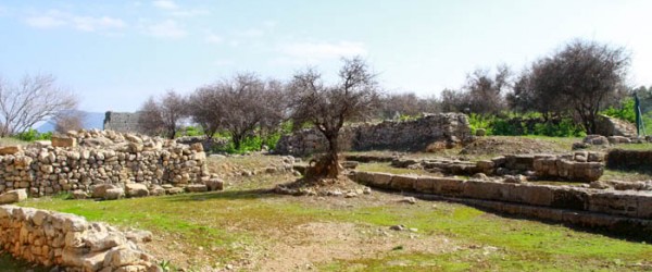
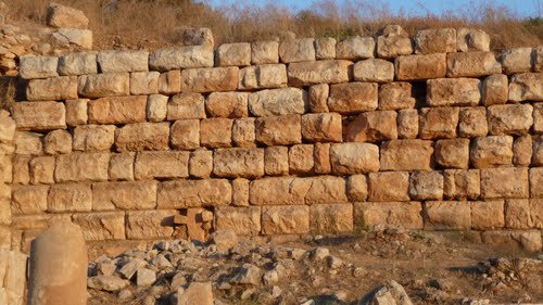
At ancient Aptera you will see magnificent stretches of the city wall of the 4th and 3rd centuries BC. The circuit was 3,480 metres long and, masterfully fitted to the terrain, followed the edge of the plateau; on the west the carefully jointed courses of ashlar still stand several metres high. Outside the main gate lie the cemeteries, with a heroon and two monumental tombs.
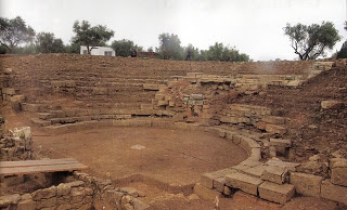
Also to be seen are a small two-roomed temple of the Classical period, of the 5th century BC, dedicated to Demeter and her daughter Persephone, an administrative building with an apse, enormous water reservoirs, Roman baths, a Roman peristyle house and the remains of the ancient theatre. The theatre lies in a natural hollow near the south-east gate and faces south to the White Mountains. It was first built in the first half of the 3rd century BC of the local fossil-bearing limestone and remodelled under the Romans in the later 1st century AD; its cavea measured 54.68 metres across, with at least 26 rows of seats divided into four wedges by five stairways. A lime kiln set up in the middle of it in the 20th century burnt most of the seats to quicklime, which is why much of the auditorium shows only its rubble core. Excavated in 2008–09, the theatre has been restored in recent years and was reopened in 2015; it holds about 350 spectators. In the middle of the excavated area stands the former monastery of St John the Theologian, a metochi of the monastery of St John on Patmos, in existence by the 12th century and inhabited until 1964, in whose courtyard the tour begins. The first excavations were carried out by French archaeologists in the years 1862 to 1864; systematic research has been under way since the 1980s. There is little shade on the plateau, so come early or late in the day.
The cisterns of the Roman period
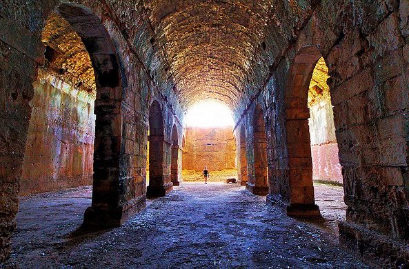
The most impressive of the surviving ancient structures are the cisterns of the Roman period. The largest in effect is a three-aisled vaulted hall carried on rows of massive piers, 17 by 25 metres inside, into whose half-light one can step; it held some 2,900 cubic metres of water. A second, laid out in the shape of an L, lies a few paces away: its arms are 55.80 and 34.20 metres long, and its capacity, about 3,050 cubic metres, was slightly greater still. Both are built of Roman concrete lined with waterproof mortar and braced outside by buttresses against the pressure of the water. Both collected rainwater for the city’s baths, which lie lower down the slope to the north, and their dimensions seem calculated as much to inspire awe as to be useful.
The fortress of Paleokastro
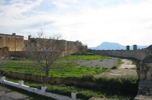
On the north-eastern edge of ancient Aptera rises a fortress with watchtowers, built by the Turks after the revolt of 1866. It is called Paleokastro or simply the Koules of Aptera; building began in December 1867, under the supervision of Hüseyin Avni Pasha, and took about a year. It was one of a whole network of more than twenty such strongholds with which the Ottoman administration sought to bring the rebellious island under control. Ashlar blocks from the ancient city were among the building materials used.
The fortress is almost square in plan. It is armed with two massive towers on the south and south-west sides, with a large bastion on the north-east and with two semicircular towers on the remaining sides; the wings enclose a rectangular courtyard, and loopholes for rifles open in the walls. From here the garrison watched the road from Apokoronas to Chania and the harbour of Souda, working in concert with Itzedin below. Later the building served the children of the neighbouring village of Megala Chorafia as a school. It is excellently preserved and restored, and the view from it is magnificent (see the video).
The fortress of Itzedin
Below the Koules, halfway down the slope towards the sea, lies the second Ottoman fortress of this coast.
Down to the south, to the village
Kalami
We drive down to Kalami, which lies on a hillside directly at the entrance to Souda Bay. In its numerous cafés one can rest and sample the dishes of Cretan cooking. The principal sight of Kalami is the guard fortress of Itzedin, built in the years 1866 to 1872 on the orders of the Turkish pasha Reuf and named after Izzeddin, the first-born son of Sultan Abdülaziz; the name itself means “glory of the faith”. It stands on the site of a Turkish tower of 1646 and was the most important defensive work of the harbour.
In more recent times, down to its closure in 1971, the fortress served as a prison for especially dangerous criminals and for those condemned to death. Eleftherios Venizelos, too, spent some days here: in 1903, during his conflict with Prince George, he was locked up for about two weeks. Later political prisoners were held in the fortress – under the dictatorship of General Pangalos his opponents, after his fall in 1926 the general himself for two years, from 1948 Communists and finally opponents of the Colonels’ junta. The inmates organised themselves, pressed for better conditions and smuggled in books.
Itzedin is one of the most significant monuments of Ottoman rule in Crete and a characteristic example of 19th-century military architecture; it has been a protected monument since 1986. Several feature films have been shot within its walls, among them “Days of ’36” by Theo Angelopoulos and “Stone Years” by Pantelis Voulgaris.