The most complete guide to Crete: 221 places on the map, 23 routes and 49 articles — with photos, videos and the story behind every place. No sign-up, no trackers.
Routes drawn along real roads
Weather at every stop
Full-text search
“Near me” by geolocation
Create your own printable itinerary
Satellite, terrain, dark mode
Works offline
⌕
Searches 1.7 million characters of descriptions, not just names
—places
4regions
—routes
—with video
Search results
—
Interactive map
Find what is near you
Filters narrow the map and the list at once. Zoom out and pins group together.
Region
Category
Фильтры карты
Landmarks
Featured places
RegionCategory
Routes
Ready-made day trips
Individual places
Articles about landmarks
The route to Lissos runs right across the west of Crete, from the north coast to the south. From Chania and Voukolies the road climbs towards the foothills of the White Mountains, crosses the historic district of Selino and finally drops to Sougia, some 70 kilometres south of Chania, from where a footpath leads over to the ancient port of Lissos. In a single day you pass olive groves and vineyards, mountain villages and painted Byzantine churches, places that commemorate the Second World War and an excavation site directly on the Libyan Sea. Anyone who can manage it, though, should allow two days and spend the night in Paleochora or Sougia – the road is all bends, and almost every village is worth a stop.
From Chania to ancient Lissos
The start of the route
From Chania you follow the coast road west, towards Tavronitis. After a few villages you turn south, to Voukolies and on to Palea Roumata and Kakopetros – all of them, like Tavronitis itself, communities of the municipal unit of Voukolies, which stretches from the north coast to the foothills of the White Mountains. The route keeps to minor roads through hill country; how long it takes depends on the stops you make and on the state of the road, and it is easy to underestimate the journey by looking at the kilometres alone.
Voukolies
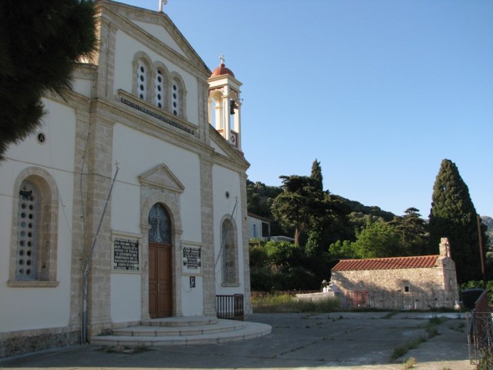
Voukolies (Βουκολιές) is a green village on the river Tavronitis, lying at about 200 metres and surrounded by olive groves and vineyards; with a little under a thousand inhabitants it is the largest place on this side of the hills. Every Saturday morning it holds its people’s market, the Laiki Agora, a tradition that survived even the Ottoman period; widely known, too, is the great Good Friday market, whose roots likewise go back to Turkish times. In the village stands the Byzantine church of Agios Konstantinos, dated to somewhere between the 13th and the 15th century, and about 600 metres away are the remains of an Ottoman tower built in 1866. Voukolies was an important focus of the Cretan risings: in February 1897 the Turkish fortification here was fought over, and the capture of the tower by the insurgents and the expeditionary corps landed from Greece went down in history as one of the episodes in Crete’s struggle for union with Greece.
Palea Roumata
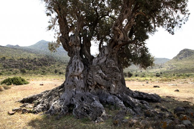
The road climbs towards Kakopetros. Before the village it is worth making a detour of about seven kilometres to Palea Roumata (Παλαιά Ρούματα), a scattered settlement of seventeen small hamlets spread over the slopes around the main one, Archontika. Here stands an ancient olive tree with a huge hollow trunk. Local tradition gives it an age of about three thousand years; it is protected as a natural monument. Whatever its true age, the sheer dimensions of the tree bear witness to its exceptional age and to its importance in this landscape. Walkers will also find near Palea Roumata the shady Vavouledo gorge, lined with plane trees and chestnuts, with a Byzantine double chapel at its entrance.
Kakopetros
Kakopetros (Κακόπετρος) lies in a fertile valley known for its olive oil and its wine. The name – “bad Petros” – is said to go back to a feared man of the Turkish period; in Venetian records the area is still called Potamia. On a rise are the remains of the Byzantine fortification of Kastro Malarifa. Small castles of this kind watched over the mountain passes and gave the population a refuge during raids. Because of what it suffered under the German occupation – it was burnt in the reprisals of 1941, like Floria and Kandanos further along the road – Kakopetros is counted among the martyr villages of Greece; a monument on the village square recalls this. From here the road continues over the watershed to Floria.
Floria
In Floria (Φλώρια), already listed in the Venetian censuses of the 16th century, the churches of the Holy Fathers (Agii Pateres) and of Agios Georgios survive from the 15th century. The frescoes of the church of St George are attributed to the painter Georgios Provatopoulos, who worked in the late tradition of Cretan painting, the school from which, a little later, the great icon painters of the island emerged. On the square stands the memorial to the villagers who lost their lives during the German occupation: here, on the road south, local people confronted the advancing German troops in May 1941, three days after the airborne invasion of Crete had begun, and the village was among those destroyed in retaliation.
Kandanos
Kandanos (Κάνδανος), also spelt Kantanos, is the historic heart of Selino and today the seat of the municipality of Kantanos–Selino, a small town of some 600 people with a health centre, a bank and a handful of cafés. The place is linked with the ancient city of Kantanos, which is mentioned in the written sources of antiquity and flourished in Hellenistic and Roman times – the Peutinger Table, the Roman road map, gives sixteen miles from Cantanum to Lissus; in the Early Christian period it was a bishop’s seat, and traces of basilicas of the 5th and 6th centuries have been identified in the surrounding area. From Roman times comes a praetorium, an administrative building whose ruins give an idea of the scale of a provincial centre. The Venetian administration, too, made Kandanos the ecclesiastical centre, which is why an unusual number of churches have survived round about.
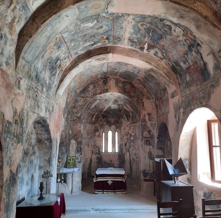
Dozens of Byzantine churches are counted here. Particularly well known is the church of the Archangel Michael at Kavalariana, with frescoes of the 14th century from the circle of the painter Ioannis Pagomenos, who decorated many churches in Selino at that time. Kandanos is also one of the symbols of resistance to the German occupation. From 23 to 25 May 1941 people of the district, armed with whatever they had and helped by the gendarmes of Selino, held up the German advance on Paleochora at the gorge of Kandanos; 25 soldiers fell. On 3 June, three days after the fighting on Crete had ended, German troops acting on the reprisal orders of General Kurt Student razed the place to the ground in retaliation and killed inhabitants – some 180 victims are named. Rebuilding was forbidden on pain of death. The boards the occupiers put up after the destruction survive as physical evidence of the policy of collective punishment; one of them reads: “Here stood Kandanos. It was destroyed in atonement for the murder of 25 German soldiers.” Present-day Kandanos was rebuilt after the war; in the 1960s German volunteers worked on the town’s waterworks as a gesture of reconciliation, and on 31 October 2024 the German Federal President came to the memorial in person.
Plemeniana
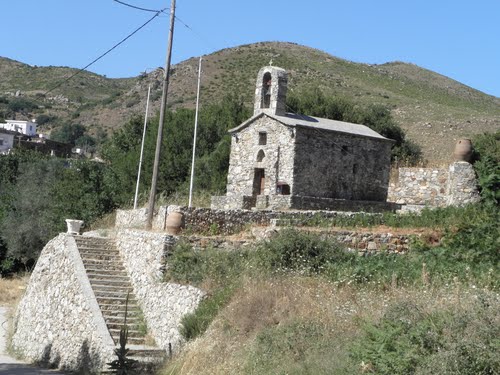
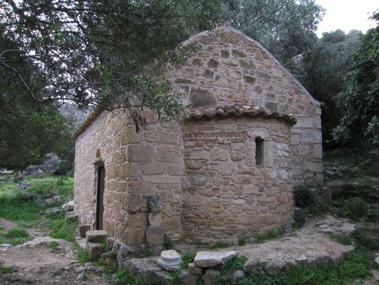
At Plemeniana (Πλεμενιανά) the church of Agios Georgios deserves a visit, one of the many Byzantine churches in the valley of Selino; its donor inscription gives the year 1409. The neighbouring church of the Saviour (Sotiras Christos) preserves building elements from an Early Christian basilica. The little churches form a whole network of monuments here, tied to the rural settlements, the monasteries and the old paths. For the most part they are plain, single-aisled buildings with a barrel vault, unremarkable from outside and painted throughout within; the key is often kept by a neighbour or at the village kafenio, so it pays to ask.
Kakodiki
Kakodiki (Κακοδίκι) is surrounded by chestnut groves and by numerous underground springs, whose water has long been held to have healing properties. Byzantine chapels lie scattered round about; the best known is the church of the Panagia, with frescoes dated 1420, and the churches of the Archangel Michael and of Agios Isidoros belong to the same period. Two kilometres away are the archaeological remains of ancient Kantanos. The road then runs down by way of Vlithias and Kalamos to the sea, at Paleochora.
Paleochora
Paleochora (Παλαιόχωρα) lies on a small peninsula, barely 400 metres wide and 700 metres long, between two bays. Clear water, the long sandy beach of Pachia Ammos on the west side and the pebble beach on the east, together with good facilities, have made the little town of some 2,000 people a popular resort, but there is more to its history than bathing. The historical museum tells the story of Selino’s past, and paths to the gorge of Anidri and to Gianiskari beach lead to springs, caves and quiet stretches of coast. Ferries link the town with Sougia, Agia Roumeli, Loutro and Chora Sfakion along the roadless south coast, and with the island of Gavdos.
The principal historic sight is the fortress of Selino at the tip of the peninsula, which the Venetians built in 1282 under the Duke of Crete Marino Gradenigo and which gave its name – Castel Selino – to the whole province. The ground it stands on is older still, for Paleochora occupies the site of the ancient town of Kalamydi. The castle was destroyed and rebuilt several times: in 1332 it was taken by rebels under Vardas Kallergis, and two years later the Venetians restored it. In 1539 the Ottoman admiral Hayreddin Barbarossa attacked the place; in 1595 the castle was renewed once more, in 1653 it fell to the Ottomans, who later altered it in their turn. What survives is mainly low stretches of wall – and a wide view over both bays. The place had been entirely abandoned by 1834; the present town came into being only in the second half of the 19th century, when resettlement began in 1866, and its old core has houses of various periods.
Azogires
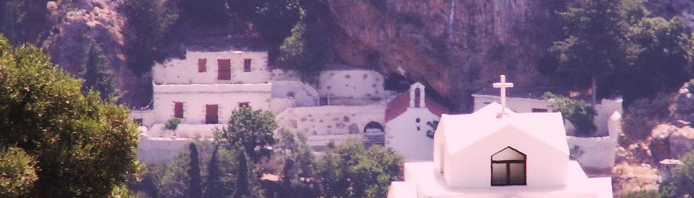
Beyond Paleochora the route turns inland again, to the village of Azogires (Αζωγυρές), which lies at about 360 metres in a lush green stream valley and owes its name to a shrub common there. Here are the caves of Soures and Charakas, known since antiquity; according to local stories, people of rank were buried in them. In Christian times the caves became places of solitary prayer. From the 13th century there were hermitages here in which, according to monastic tradition, ninety-nine monks lived who had come from Egypt, Cyprus and Attaleia – the “99 Holy Fathers”, whose memory the Church keeps on 7 October. Traces of their cells survive among the rocks. Below the little monastery stands a plane tree which, unlike others of its kind, keeps its leaves in winter; the villagers see in this a miracle of the Fathers, who used to sit in its shade. The village also has a small museum of the district.
The road goes on through Strati, along the Vlithias valley, and reaches Temenia.
Temenia
Temenia (Τεμένια) is known for its mineral springs, whose water is drunk all over Crete. On Kastri hill above the village, between Temenia and Papadiana, lie the remains of the ancient city of Hyrtakina: stretches of Cyclopean wall of massive, barely dressed blocks, a double line on the north and west sides running for about half a mile, recall its defensible position, and its gateways were flanked by inner walls to hem in an attacker. Ptolemy and Stephanus of Byzantium both mention the town. Like its neighbours it belonged to the league of the mountain cities, with which it shared a coinage – wild goat and bee, dolphin and eight-rayed star. Excavations in 1939 concentrated on a sanctuary of Pan on the acropolis, where a headless marble statue of the goat-legged god, of Roman date, was found. At the foot of the hill, deep in greenery, stands the church of Christ the Saviour (Sotiras Christos), the older part of which goes back to the 13th century, while the extension was added in the 14th; the frescoes date from the 16th and 17th centuries.
Rodovani
Rodovani (Ροδοβάνι) is famous for its honey. Not far from the village, on Kefala hill, lie the ruins of Elyros, the most important city of south-western Crete in Classical, Hellenistic and Roman times, with a developed economy and a coinage of its own – the coins show wild goat and bee. Its walls are reckoned to have had a circuit of some three kilometres, and it was held to be the birthplace of Thaletas, the poet and musician credited with inventing the Cretic rhythm. Elyros worshipped Apollo and the two heroes Phylakides and Philandros; according to Pausanias the citizens dedicated at the sanctuary of Delphi a bronze goat suckling the two boys. In the 3rd century BC it was at war with Kydonia, and in 183 BC it was among the Cretan communities that concluded an alliance with King Eumenes II of Pergamon. In Byzantine times Elyros was a bishop’s seat – a basilica of the 6th century remains – before the raids of the Saracens put an end to it. The site, rediscovered by the English traveller Robert Pashley in the 19th century, has never been systematically excavated: you see walls, column fragments and pieces of entablature among the terraces, while the fine Roman statue known as the Philosopher of Elyros is in the Archaeological Museum of Chania. In the church of the Panagia frescoes survive; it was built with donations from the Kantanoleon family. Georgios Kantanoleon led a rising against the Venetians which tradition places in 1570, and the frescoes record the faces of the donors.
Sougia
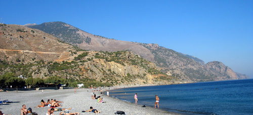
From Rodovani the route joins the Chania–Sougia road and drops to the sheltered bay of Sougia (Σούγια). A pebble beach two kilometres long, pine-clad slopes and a handful of tavernas, small hotels and rooms make the village – fewer than a hundred people live here all year – a pleasant base for the night before the walk to Lissos. The present village is young – as late as the early 19th century it did not exist – yet it stands on the ground of ancient Syia, the second port of Elyros. Its prosperity in the Early Byzantine period is attested by three basilicas with excellent floor mosaics of the 6th century; over one of them rises the village church of Agios Panteleimon, and the mosaic found there is now shown in the Archaeological Museum of Chania. In summer the coastal ferry calls here on its way between Paleochora and Agia Roumeli.
Ancient Lissos
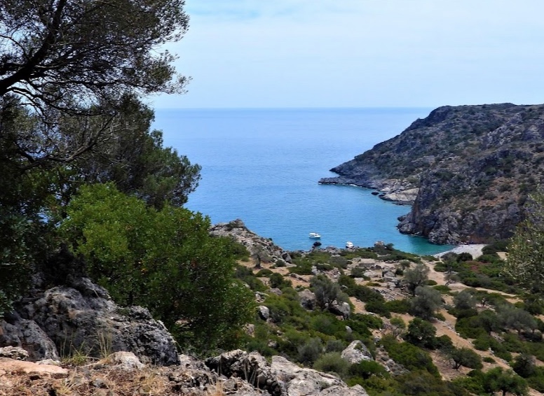
Lissos (Λισός) is an ancient port and cult site on the bay of Agios Kirikos, about three kilometres west of Sougia, set in a small hollow of the hills that opens to the sea like a theatre. Founded in the Classical period, the city served Elyros as a port and in Hellenistic times belonged to the league of the mountain cities, the Koinon of the Oreioi, which united Lissos, Syia, Poikilassos, Tarra, Hyrtakina and Elyros and had one of its centres at Lissos; in the 3rd century BC the league was allied with King Magas of Cyrene. Ptolemy lists the town, and the ancient sailing manual known as the Stadiasmus places it between Syia and Kalamydi. Lissos had a trading and a fishing fleet and struck its own coins, inscribed with the name of the Lissians, bearing symbols of the sea such as the dolphin – others show a flying dove, an eight-rayed star or the caps of the Dioscuri – and images from the circle of the goddess Diktynna, the Cretan Artemis.
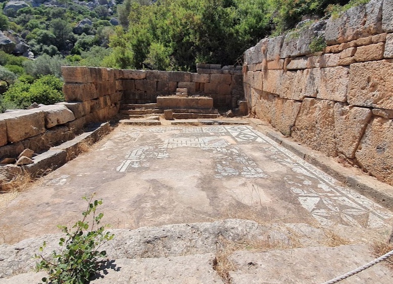
The most important monument was the sanctuary of Asklepios, where the sick from all over Crete sought a cure – not least on account of the water that issues from the rock beside the temple. Ancient healing included temple sleep, incubation: the patient spent the night in the sanctuary and awaited the god’s instruction in a dream. The Asklepieion was discovered in 1957 when, so the story goes, a shepherd came upon the first statues; the excavations of 1957 and 1958 were directed by Nikolaos Platon. They brought to light the small Doric temple with its mosaic floor of animals and geometric patterns, votive offerings and about twenty marble sculptures, among them figures of Asklepios, Hygieia and Pluto; they can be seen today in the Archaeological Museum of Chania, and no site on Crete other than Gortyn has yielded more statuary. There are also Roman baths, the line of an aqueduct, a theatre, the remains of a mole and, on the western slope, a necropolis of some fifty barrel-vaulted tomb chambers of Roman date, standing above the bay like a village of the dead. As recently as 2022 the Ephorate of Antiquities of Chania uncovered a further public building in the middle of the city: a small odeon or council house of the 1st century AD with a stage, two vaulted side rooms and fourteen rows of seats.
In Byzantine times Lissos became a bishop’s seat, and it is still listed as such by the 6th-century geographer Hierokles. Between the 7th and the 9th century the settlement was probably abandoned; tradition blames the raids of the Saracens. The earthquake of AD 365 had already altered the coastline: the former port installations have since lain a good way from the sea. Today Lissos is uninhabited; you reach it on foot from Sougia in about an hour and a half along the European long-distance path E4, or in some twenty minutes by boat.
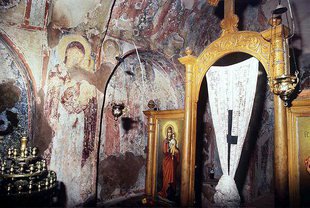
On the site stands the little church of Agios Kirikos, built on the remains of an Early Christian basilica, with ancient worked stones set into its walls and frescoes inside; beside it a mosaic floor survives. On 15 July, the saint’s feast day, people from Sougia and the villages of Selino come on foot and by boat to the patronal festival in the otherwise deserted bay. Nearer the sea stands a second chapel, dedicated to the Panagia and likewise raised over an Early Christian building; it is put together from ancient marble blocks, and the granite columns and marble fragments lying around it are thought to belong to another temple. After the visit you return to Sougia and drive home on the Chania–Sougia road; on the way it is worth stopping at Kampanos.
Practical notes
The walk from Sougia to Lissos takes about 90 minutes each way. It starts at the little port, climbs through a narrow, shady gorge and then crosses an open plateau before dropping steeply into the bay; water, a hat and shoes with a good grip are therefore essential. In summer it is best to set out early in the morning. At Lissos there is neither taverna nor shop, but there is the spring by the sanctuary and a quiet beach of coarse pebbles with a little shade from the trees. Ask about access to the excavation site and the condition of the path before setting out: after heavy rain there may be washouts, and in the hot season the path can be closed because of the risk of fire.