Agia Galini, the “Holy Calm” – through the Amari valley in the footsteps of Daedalus
The most complete guide to Crete: 221 places on the map, 23 routes and 49 articles — with photos, videos and the story behind every place. No sign-up, no trackers.
Routes drawn along real roads
Weather at every stop
Full-text search
“Near me” by geolocation
Create your own printable itinerary
Satellite, terrain, dark mode
Works offline
⌕
Searches 1.7 million characters of descriptions, not just names
—places
4regions
—routes
—with video
Search results
—
Interactive map
Find what is near you
Filters narrow the map and the list at once. Zoom out and pins group together.
Region
Category
Фильтры карты
Landmarks
Featured places
RegionCategory
Routes
Ready-made day trips
Individual places
Articles about landmarks
This route links the north coast with the south of the island. It begins in Rethymno, follows the Prassano Gorge into the green Amari valley between Psiloritis and Kedros, and ends at Agia Galini on the Libyan Sea – a place whose name means “Holy Calm” and which tradition connects with the flight of Daedalus and Icarus. Along the way come traditional villages, Byzantine churches with precious wall paintings, the ruins of the ancient city of Syvritos, the cave of St Anthony with its age-old sanctuary of Hermes, and the Monastery of the Archangels at Asomaton. The route closes with the cave of Daedalus and the sea grottoes near Agia Galini.
From Rethymno to the “Holy Calm”
Leaving Rethymno
We leave Rethymno on the national road (Εθνική Οδός), heading west. After three kilometres we pass under a bridge and follow the so-called Amariotiko road, the old district road into the Amari, southwards. At kilometre 6 we pass the church of St Eftychios (Εκκλησία του Αγίου Ευτυχίου), and two kilometres further on we stop at Prasses.
Prasses
Prasses (Πρασσές, also Prasies) lies on a valley slope among olive groves, some ten kilometres south-east of Rethymno and below the green flanks of Mount Vrysinas. Its traditional architecture and leafy surroundings make the village the natural starting point for the walk into the Prassano Gorge. The name is often derived from the Greek word for leek, or for the lush green of the district – an explanation that seems plausible enough in view of the luxuriant vegetation, even if it cannot be securely proved.
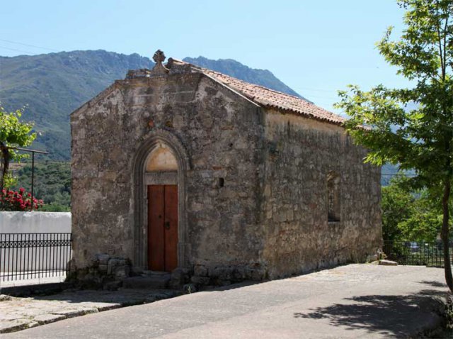
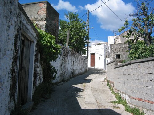
In the village cemetery stands an old church with wall paintings of the 14th century. In the village itself, houses with round Venetian arches predominate; a stroll through the lanes of Prasses gives a vivid picture of the architecture that took shape under Venetian rule – stone doorways, arched gateways and shady inner courtyards.
The Prassano Gorge
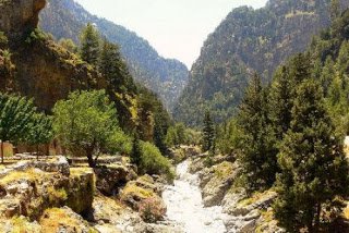
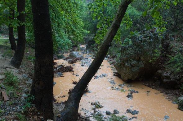
South of Prasses begins the Prassano Gorge, cut into the limestone by the river over thousands of years. It runs northwards for about six kilometres through the rocky hills of Gargana, and its stream reaches the sea at Platanias, the eastern suburb of Rethymno. The bed dries out in summer; the traverse is therefore usually planned for the period between mid-June and the end of October, and undertaken only in suitable weather, for at other times the river carries too much water – all the more so since the gorge also takes the overflow of the Potami reservoir. Allow about four hours for the walk, which descends only a hundred metres or so and is not difficult, though the going is over boulders and gravel; in part it follows the E4 long-distance path, and at the narrowest point the rock walls close in to about four metres. Stout shoes, light clothing and plenty of water are indispensable. The gorge is a protected natural area: plane trees and rare plants grow here, and it is home to birds, among them birds of prey – buzzards and a small population of Bonelli’s eagle – as well as reptiles and amphibians.
Among them dittany – Origanum dictamnus
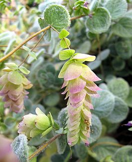
Among the treasures of the gorge is dittany, also called dittany of Crete or hop marjoram, in Greek diktamo or erontas. Virgil raised a monument to this plant in the “Aeneid” (XII, 411–424).
Venus, the poet relates, cannot bear to see her son Aeneas suffer undeservedly when an arrow has wounded him. On Cretan Ida she plucks dittany, a stalk with a purple flower and downy, curling leaves – a herb which the nimble mountain goats know and seek out when a feathered arrow is lodged in their flesh. Wrapped in a dark cloud, the goddess brings the herb and secretly steeps it in the water of a gleaming bowl, to which she lends healing power; she adds drops of ambrosia and fragrant panacea. The physician Iapyx, who suspects nothing of all this, bathes the wound with the water – and at once the pain leaves Aeneas’s body, the blood is staunched, the deep wound closes, the arrowhead comes away as if of its own accord, and the hero’s old strength returns.
Dittany of Crete (Origanum dictamnus) already counted as a medicinal plant in ancient literature; Hippocrates recommended it for stomach complaints and wounds, Aristotle, Theophrastus and Plutarch mention the story of the wounded goats, and to this day the Cretans make a tea from it for stomach troubles and colds. It is a low perennial, only 20 to 30 centimetres high, with rounded grey-green leaves covered in a velvety white down and, in summer and autumn, pale pink to purple flowers held among deep pink bracts. Because the plant grows on sheer rock faces, the gatherers – the erontades – used to risk their lives; a man who brought it to his sweetheart proved his courage by it, whence the popular name “erontas”, love. Today dittany, found wild nowhere but in Crete, is classed as rare and protected and may not be collected in the wild; the tea on sale comes from cultivation, most of it from Embaros and the neighbouring villages south of Heraklion.
Rare species of bat still live in the caves of the gorge. Only here is there an endemic species of grasshopper, which has been named after the gorge. On the coast, where the river runs into the sea, the sandy beaches between Perivolia and Skaleta are nesting grounds of the endangered loggerhead turtle (Caretta caretta), and in the coastal waters beyond lives the Mediterranean monk seal (Monachus monachus), which is on the Red List. Ornithologists have counted 129 species of bird in the woods of the gorge.
The cave of St Anthony
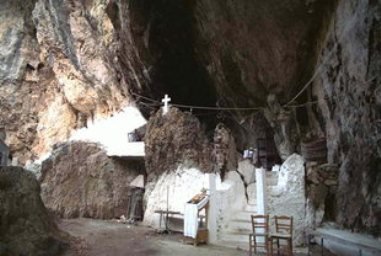
North of the village of Patsos, in the gorge of St Anthony, a cave lies beneath an overhanging rock, with a chapel of the 16th century fitted into it. In antiquity this was a sanctuary of Hermes Kranaios. Federico Halbherr dug here in 1885–86; further objects that turned up in 1894 were sold to Arthur Evans, and the Greek archaeological service excavated again in 1989. The archaeologists found material from the Late Minoan to the Roman period, including cult objects, vessels, human and animal figurines, a statuette of Pan and the remains of animal sacrifices; the finds are now in the Archaeological Museum of Heraklion and, Evans’s share, in the Ashmolean Museum in Oxford. An inscription of the 1st century AD attests the cult explicitly: a certain Stephanos dedicated a gift to Hermes Kranaios in fulfilment of a vow. To this day pilgrims tuck little slips of paper with their requests to the saint – Anthony is the saint of caves and the protector of children – into the crevices of the rock, and the water that drips from the roof is held to be holy: a fine example of how sacred places in Crete have stayed sacred down the ages.
Patsos itself lies at 450 to 490 metres at the northern foot of Mount Soros. In Venetian documents the village appears as “Pazzo”; in 1583 it had 110 inhabitants. The gorge of St Anthony, two to three kilometres north of the village, is a Natura 2000 site with some 80 plant and 24 animal species, endemics among them. A footpath about five kilometres long, laid out by the forestry service, leads over wooden bridges and steps through the shady, well-watered valley – a welcome refreshment in summer. A second, smaller cave, Fournare, lies about 300 metres south of the chapel.
Apostoli
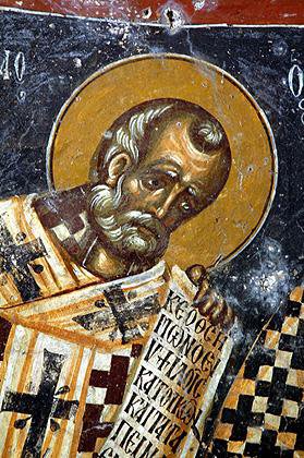
According to legend the Ten Saints, Christian witnesses to the faith, hid in the woods of this district from Roman persecution. They were seized, taken to Gortyn and there suffered martyrdom in the year 249. In their honour the church of the Holy Apostles (Εκκλησία των Αγίων Αποστόλων) was built, and the village that grew up around it was given the name Apostoli. In time the old church fell into ruin; in 1888 the new building that stands today was put up in its place, and the tall bell tower was completed in 1905. In the same village stands a far older church, that of St Nicholas (Αγίου Νικολάου), with wall paintings of the 14th century of high artistic quality.
The ancient city of Syvritos
Only a kilometre from Apostoli lies the village of Agia Fotini, named after St Photini. It is a larger place that serves as a centre for the surrounding district, and it commands a splendid view over the whole Amari valley.
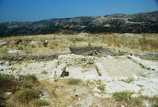
The chief sight of the district is ancient Syvritos, whose remains lie on the hill of Kefala above the village of Thronos, at the northern end of the Amari valley. The city existed from Late Minoan times into the Roman and Early Byzantine periods; it flourished in the Classical age, and in Hellenistic times covered some fifty hectares. It was an important city-state and one of the first cities in Crete to strike its own coins: on one side they showed Zeus, Hermes or Dionysos – the last with his wine cup and thyrsos – and on the other the name of the city, ΣΥΒΡΙΤΙΩΝ. For about a thousand years Syvritos was a thriving community, in Roman and Early Byzantine times too, when it was the seat of a bishop; the see is attested by 451. Decline and destruction came with the Arab conquest of the island in the 9th century.
The excavations, on which Greek and Italian archaeologists have been working for decades – a joint mission of the Greek antiquities service and the Consiglio Nazionale delle Ricerche in Rome – have brought to light a wealth of precious evidence for the high culture of the islanders: remains of cyclopean city walls and of later Hellenistic fortifications in regular ashlar, whole residential quarters with splendid mosaics, pottery painted with scenes of everyday life, mythical heroes and religious ceremonies, statuettes, tableware of many kinds and jewellery. More than forty ritual pits of the 12th to 9th centuries BC, filled with pottery, animal bones and the remains of meals, show how the place lived through the Dark Age, and a clay krater found in 2002 bears the oldest known picture of an armed dance in Greek vase painting. A path leads up from the village of Thronos to the site, from which there is a wide view over the valley.
From Agia Fotini a detour to the south-east is worth making, to the villages of Thronos, Kalogeros, Monastiraki, Vizari, Fourfouras, Kouroutes, Nithavris, Apodoulou and Amari. They lie on the slopes of Psiloritis, which are covered with oak woods, olive groves and centuries-old cypresses, while the banks of the mountain streams disappear beneath plane trees.
Thronos
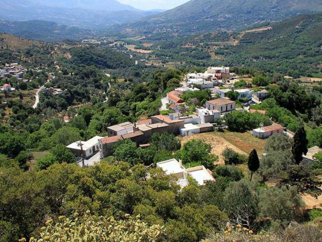
From this village, 540 metres up at the western foot of Psiloritis, an overwhelming view opens over the whole Amari valley and to the peaks of Psiloritis. It took its name – Thronos, the throne – from the bishopric of ancient Syvritos, which existed here in Early Byzantine times: the bishop had his seat, his cathedra, in this place, and remains of that residence survive to this day. The village is mentioned in writing in 1577 by Francesco Barozzi, among others, and later in the Ottoman tax registers. It is a small place now, with only a few dozen permanent inhabitants; on the height of Kastellos, some 800 metres to the east, are the remains of a Byzantine fortification of about the 13th century.
The monument to see here is the church of the Panagia Throniani (Ναός της Παναγίας Θρονιανής), dedicated to the Dormition of the Virgin, with unique frescoes of the 14th and 15th centuries, remains of mosaic and, over the entrance, the arms of the Kallergis family, famous in Crete. The present Byzantine church was built in the 14th century over an Early Christian basilica, part of whose mosaic floor can be seen in the yard in front of the church; that in turn is said to have stood on the site of an ancient temple of Zeus. Hardly any other place conveys so forcefully the sense of an unbroken continuity of ages and faiths on this extraordinary island. Today Thronos also offers a few simple family-run guesthouses and tavernas – a good place for a rest with a view.
The road continues eastwards. After a kilometre you reach the hamlet of Klisidi, with a healing spring called “Tis Petras to Nero”, the water from the rock, and after another kilometre you drive into Kalogeros.
Kalogeros
This pretty village, set among greenery, is famous for two old Byzantine churches. The first is the church of St John the Theologian (Εκκλησία του Αγίου Ιωάννου του Θεολόγου), of the 14th century, whose entire interior is covered with impressive paintings; the mastery of the unknown painter is astonishing.
At the far end of the village, on the road to the monastery of Asomaton, the church of St Paraskevi (της Αγίας Παρασκευής), built between the 13th and 15th centuries, rises in a grove of cypresses. It is a classic Byzantine cross-in-square church, but it holds a most unusual scheme of painting. Let into the north wall is a burial chamber which ends in an apse and is entirely covered with frescoes. Among them an image of Christ stands out, blessing two people with raised hands; the inscription reads, in substance: “Blessing on the servant of God Georgios Chortatzis and his wife.” Georgios Chortatzis was a celebrated poet of the 16th century from Rethymno, author of the tragedy “Erofili” and of other works that rank as masterpieces of the Cretan literature of the Renaissance and of modern Greek poetry as a whole. The villagers are proud that it should be in their church that the great poet lies – a tradition which scholarship, it must be said, does not confirm in every particular. Two kilometres from Kalogeros lies the monastery of Asomaton.
Asomaton Monastery
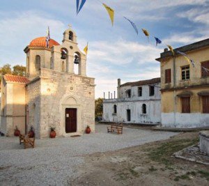
The beginnings of Asomaton Monastery (Μονή Ασωμάτων), 35 kilometres south-east of Rethymno, go back according to local tradition to the second Byzantine period; the dates given range from the 9th or 10th century to the 13th, when a document speaks of a “monastery of the Archangel Michael”. Six graves and bronze crosses of the 10th century have been found beneath the church floor. The first church was a cross-in-square building which, tradition says, was destroyed by Arab conquerors and rebuilt as a single-aisled domed church. Under the Venetians the house was linked with the noble family of Varouchas. In 1646 the Turks laid the monastery waste; in 1682 it was renewed by the hieromonk Makarios of Margarites. An eminent abbot of the 18th century was the learned Methodios Syligardos, an outstanding authority on Byzantine church music and later Bishop of Lampi – the see was for a time housed in the monastery – whom the Ottomans executed on 9 July 1793.
In 1810 the monastery was damaged by a severe earthquake, and in 1821 it was bombarded by the Turks because it was regarded as a spiritual centre of the rising against Ottoman rule; in those years its abbot, Gerasimos, was killed. In 1833, under the Egyptian administration of the island, it was restored thanks to the efforts of the then abbot, Iosif, who moreover founded a Greek school in the neighbouring village of Monastiraki, the best-known place of learning in the province at that time; the monastery paid for it out of its own means and also supported schooling in Rethymno. During the revolt of 1866–1869 it again served as a centre of the insurgents. The iconostasis was carved about 1846 by Georgios Litinas, a self-taught sculptor from nearby Platania; it was later gilded. In 1925 Abbot Agathangelos Lagovartos had the church rebuilt from the foundations of the old Byzantine structure, as the domed cruciform church that stands today.
In 1929 the monastery made over 471 hectares of land to the state for the founding of an agricultural school. The institution survives in altered form to this day as the agricultural research and training centre of Asomaton. After almost a century without a monastic community the Church of Crete has brought the monastery back to life: since April 2024 a community of nuns has been living here, and in July 2025 the first abbess, Chrysostomi, was solemnly installed.
The monastery church is dedicated to the Archangels and possesses valuable icons of the 17th and 18th centuries, among them the famous icon of the Holy Trinity (Αγίας Τριάδας) of 1619 and representations of the Archangels of 1755; some of its sacred vessels are kept in the Historical Museum of Crete in Heraklion. At the entrance to the monastery stands a handsomely designed fountain whose water is held to have healing powers. The setting is superb: the monastery lies in the middle of the vale of Asomaton, between Kedros and the Ida range, surrounded by vineyards, olive groves, plane trees, oaks and many kinds of fruit tree.
Monastiraki
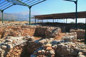
This village, two kilometres from Asomaton Monastery, is known as the place where the monastery school was founded in 1833. Because the school building looked like a monastery, the village came to be called Monastiraki, the “little monastery”. Besides the school, the Byzantine church of the Archangel Michael deserves a visit: its frescoes of the Dormition of the Virgin and the woodcarving of its iconostasis are dated to 1513 and 1528. In the parish church of the Transfiguration of the Saviour (Μεταμόρφωση του Σωτήρος) hangs a bell that was cast in 1585. Many of the houses in Monastiraki go back to Venetian times, and east of the village, on the hill known as Kokkinos Charakas, you can visit the remains of a Minoan settlement whose important complex of storerooms and workshops belongs to the Old Palace period, roughly 2000–1700 BC. German archaeologists made a first, limited dig here in 1942, during the occupation; systematic work was resumed in 1980 by the University of Crete under Athanasia Kanta, while Yannis Tzedakis and Louis Godart explored the southern side. They uncovered rows of magazines with large storage jars, shrines, living quarters, a hall with a central column, a system of pipes and basins for collecting rainwater, and archive rooms containing hundreds of clay sealings, which tie the place closely to Phaistos and suggest that it administered the Amari valley on the palace’s behalf. An earthquake and the fire that followed destroyed the complex at the end of the Old Palace period; unlike Phaistos and Knossos it was never rebuilt, which is why its plan has survived so undisturbed.
From Monastiraki we drive one kilometre straight on to the east and then continue south-east to reach Vizari, which lies at about 360 metres above sea level.
Vizari
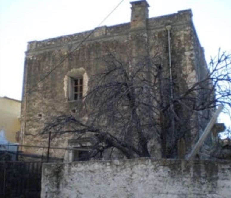
Under Venetian rule Vizari was a prosperous village, and one of the oldest in Amari. From that period a half-ruined mansion (Μέγαρο) of the noble Sarnachi family survives at the entrance to the village; on its façade you can make out the fragments of a sundial with Roman numerals. West of the village archaeologists uncovered an Early Christian basilica of the 7th century, part of a larger Roman and early Byzantine settlement at the spot called Ellinika. Excavated in 1956 by Konstantinos Kalokyris, it is a three-aisled building some 34 metres long and 17 metres wide, floored with clay tiles; it is thought to have served as the cathedral of the bishopric of Syvritos, and it was destroyed during the Arab conquest of the 820s. Locals call the ruin Rimokklisa, the “deserted church”. The prosperity of Vizari lasted into modern times: in 1929 the village still supported five doctors and three pharmacies. Near Vizari, reached from the north-western exit of the village, an artificial reservoir has been created, which today also serves water birds as a resting place. Fourfouras lies very close by; an old stone mill stands beside the road that leads there.
Fourfouras
The village was founded by people from neighbouring Vizari on a rocky ridge at the foot of Psiloritis, 460 metres above sea level. It may owe its name to this awkward, defensible position, for popular etymology hears a “fortress” in it; another tradition derives it from the surname of the first settler, a hunter. It first appears in the Venetian census of 1583, which counted 225 inhabitants; with just over 500 today it is the largest village in the municipality of Amari. The villagers took part in every rising against the Turks, particularly those of 1821 and 1866. Fourfouras is now a favourite starting point for the ascent of Psiloritis from the south – the European long-distance path E4 passes through it and offers the easiest approach to the mountain from this side – and above the village stretches the oak woodland of Pardi. Three old Byzantine churches survive in the village and its fields.
The church of the Panagia Kardiotissa (της Παναγίας της Καρδιώτισσας), in the fields known as Livada, has frescoes of the 14th and 15th centuries; according to tradition a Catholic convent stood beside it in Byzantine and Venetian times, and the remains of cells can still be seen. Its feast is kept in the courtyard on 8 September. Next to it stands the church of St Paraskevi (της Αγίας Παρασκευής), built in 1515 under the Venetians.
Finally, in the fields of Mourtzes south-east of the village stands the well-known church of St George, a single-aisled, barrel-vaulted chapel raised on the ruins of an older one, with frescoes from the years 1411 and 1620.
A winding road now takes us up the flank of Psiloritis to the village of Kouroutes.
Kouroutes
At 510 metres on the south-western slopes of Psiloritis lies the village of Kouroutes, divided into an upper and a lower quarter (Pano and Kato Chorio). The division is said to date from Ottoman times, when Muslim families lived in the upper village and Christians in the lower; Arabic-script inscriptions can still be seen on some of the older houses. It is a very ancient settlement: in the fields of Amygdales whole quarters of dwellings, workshops, potters’ kilns and tombs of Late Minoan and Roman date were found; archaeologists from the Heraklion museum recorded them at the beginning of the 20th century, but no systematic excavation followed. As everywhere in the mountain villages, the population has fallen sharply – from 303 inhabitants in 1940 to only about eighty today, most of whom live from farming and stock-raising. The name itself is rooted in the mythology of the ancient Greeks.
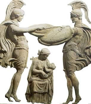
When Rhea, the mother of Zeus, hid her newborn son from his father Cronus, who devoured his children, and handed Cronus a stone wrapped in swaddling clothes in his place, the Curetes, the mythical guardians of the child, performed an armed dance and beat their weapons against their shields so that Cronus should not hear the infant crying. For that reason ancient writers also speak of the slopes of Psiloritis as the land of the Curetes, and the villagers like to claim descent from these demigods.
In the present village you can visit the church of the Annunciation (Εκκλησία του Ευαγγελισμού), for a long time the principal church of the inhabitants, as well as the church of St John (Εκκλησία του Αγίου Ιωάννη) and the church of St Anthony (Εκκλησία του Αγίου Αντωνίου), the cemetery chapel that stands between the two quarters. The main church today is the church of the Ascension (Εκκλησία της Αναλήψεως) in the lower village; next to it stands the modern parish centre of the community of Kouroutes.
Higher up the slope of Psiloritis, in the oak wood of Pardi, stands the lovely stone chapel of St Titus (Ξωκλήσι του Αγίου Τίτου), built on the site of an ancient sanctuary. It is worth being here on 25 August, when the feast of St Titus, the first bishop of Crete, is kept with great ceremony – with a large fair and a procession beneath the spreading, centuries-old oaks.
Closer still to the summit is a mountain refuge for climbers, who set out from here for the top of Psiloritis on the route familiar to walkers as No. 4. The hut, Toumbotos Prinos, stands at 1,600 metres on the western shoulder of the massif; it was built in 1984, sleeps thirty and is run by the Mountaineering Club of Rethymno. A dirt road of about twelve kilometres climbs to it from Kouroutes, while walkers on the E4 need some four hours from Fourfouras and a further three from the hut to the peak. On the summit, at 2,456 metres, stands the stone chapel of the Holy Cross (Ξωκλήσι του Τιμίου Σταυρού); in clear weather the view from up there takes in the whole island. The last and particularly interesting stop on our detour is Apodoulou.
Apodoulou, the “village of Cinderella”
One of the sights is the large mansion of Kalitsa Psaraki, to which an entirely true story is attached. Kalitsa, the daughter of the village headman, was carried off as a girl of about eleven during a Turkish raid in 1821, taken to Egypt and sold in the slave market of Alexandria. A wealthy Scot, the traveller and pioneer Egyptologist Robert Hay, fell in love with her, bought her freedom, had her educated and married her in 1828; the wedding took place in Malta in May of that year. Hay, born at Duns Castle in Berwickshire in 1799, had first seen Alexandria as a young naval officer and spent the years 1824–1828 and 1829–1834 recording the monuments and inscriptions of Egypt with a team of artists; his drawings are now in the British Library and his collection of antiquities went to the British Museum. Later Kalitsa returned to her homeland with her husband: in the 1840s she found her father and mother again, and the couple had an imposing house built in Apodoulou. They lived there from time to time and did a great deal of good for Kalitsa’s fellow villagers. Even after her husband’s death in 1863 she kept coming back to her village with her children. That is the story of the Cretan Cinderella.
The village is very picturesque, rich in underground springs and old trees, and protected as a traditional settlement. Its name, Apodoulon, probably means “the freedman”. Land so blessed was naturally inhabited from the earliest times. Archaeologists have uncovered a Minoan tholos tomb here: a large chamber with a corbelled vault, approached by a passage (dromos) and containing four sarcophagi, which are now in the Archaeological Museum of Rethymno. The tomb, of Late Minoan date, lies about 400 metres north of the main site, a large building of evidently religious purpose, a sanctuary or ceremonial mansion on a height some 450 metres above sea level with a view down to the Libyan Sea. Spyridon Marinatos began digging there in 1934. The place was occupied from the Late Neolithic to the Late Minoan period, and the building itself was chiefly in use in the Middle Minoan III phase. The complex at Apodoulou counts among the most important Minoan sites of central Crete. The finds bear precious witness to the sophistication of its inhabitants: a small axe of pure gold, richly decorated libation vessels, a basin inscribed in Linear A and much else. The settlement flourished undisturbed until Venetian times, when it was destroyed. In late summer the local cultural association holds a wine festival.
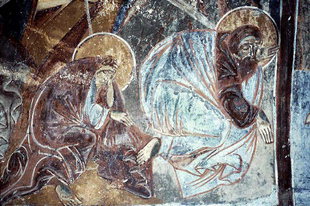
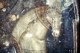
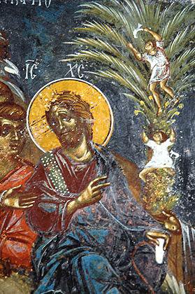
You should also see the Byzantine church of St George the Sword-bearer (Άγιος Γεώργιος ο Ξιφηφόρος), about a kilometre from the village; estimates of when it was built and painted range from the 13th to the 15th century. Shown here are some of the splendid frescoes of the church of St George, which are usually assigned to the 15th century.
From Apodoulou we return to the junction and take the road to Amari.
Amari
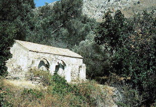
Amari, in full Nefs Amari, lies at an altitude of about 460 metres at the foot of Mount Samitos, the 1,013-metre ridge that closes the valley on the west, some forty kilometres south-east of Rethymno. The prefix Nefs dates from Ottoman times and denoted the chief place of a district – Amari was the administrative centre of the province of the same name, to which it still gives its name. Its own name is variously traced to a Byzantine settler family or to a Venetian lord called Amari. The inhabitants live from agriculture, above all from growing and curing a particular kind of olive, the “throumbes”, which ripen on the tree and become wrinkled and sweet; the fertile soil of the district also suits cherries, peaches, plums and apricots. On a hill by the village are the remains of a Byzantine fortress, and a conspicuous tower rises in the middle of the settlement. Just outside the village stands the half-ruined church of St Anne, in fact a double church of two single-aisled buildings, the southern one now roofless, with surviving wall paintings of the 13th century – among them the Melismos, the breaking of the eucharistic bread, in the apse. A founder’s inscription dates them to 1225, which places them among the oldest dated frescoes in Crete.
Meronas
Find on the map
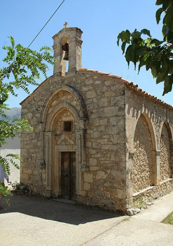
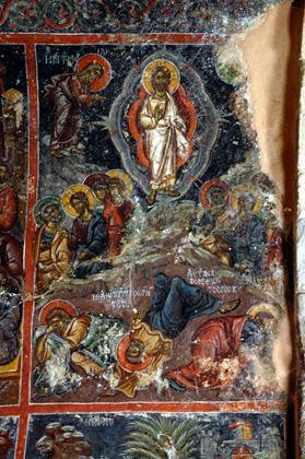
The next village, Meronas (Μέρωνας), lies at about 620 metres on the south-eastern slope of a ridge, some 35 kilometres from Rethymno, and looks out across the whole Amari valley to Psiloritis. It is an old place: it is first mentioned in a notarial deed of 1301, and the Florentine traveller Cristoforo Buondelmonti, who passed this way in 1415, praised its charming, elevated position among countless walnut and other fruit trees. Meronas is celebrated for its Byzantine church of the Panagia (Ekklisia tis Panagias), with accomplished wall paintings of the 14th century. It is a domed, three-aisled basilica: the nave belongs to the second half of the 14th century, the north aisle is dedicated to St George and the south aisle, added around the 16th century, to the Apostles Peter and Paul. The nave is painted with scenes from the life of Christ – Nativity, Baptism, Transfiguration, Crucifixion – and of the Virgin, in a style that points to painters trained in Constantinople. Above the entrance is displayed the coat of arms of the Kallergis family, one of the most distinguished noble houses of Crete, which left its mark here as founder of the building; the same arms recur among the frescoes inside, and the fine portable icon of the Virgin Hodegetria kept in the church is thought to have been their gift. In the surrounding countryside there is also a painted church of St George, and in the fields of Sochora sherds of Graeco-Roman date have been picked up. After the Ottoman conquest, as a document of 1648 records, the revenues of the village were assigned as a pious endowment to the Sultan Ibrahim Mosque in Rethymno.
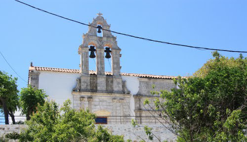
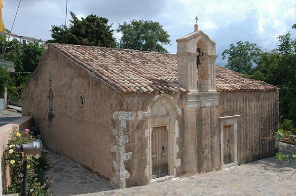
The church of the Dormition of the Virgin (Kimisis tis Theotokou) with its particularly handsome bell tower.
All the villages you pass through on the way on to Agia Galini reward you with magnificent views of the bay of the Libyan Sea and of the massive mountains that frame it. In the village of Agia Paraskevi it is worth stopping at the Byzantine church of the 16th century, which shelters a tomb decorated with frescoes.
Agia Galini and the cave of Daedalus
The name Agia Galini means something like “holy stillness” or “holy calm”. A local legend relates that the Byzantine empress Eudokia – the learned Athenian Athenais, wife of Theodosius II (408–450) – was caught in a storm on her voyage into exile, around the year 441, and made a vow to the Virgin. Saved in the quiet bay, she is said to have founded a church of the “Panagia Galini” here; tradition identifies it with the old church of the Panagia in the cemetery, overlooking the beach. Others derive the name from “aei galini”, the “ever calm” anchorage in the lee of Cape Lithino, and others again recall that the local people used to say “Ai-Galinis” – an echo of the monastery of Christ Galinios, which is mentioned by Joseph Bryennios in 1394 and by Buondelmonti in 1415. The legend explains the name; the history of the place that archaeology can grasp, however, reaches back to the ancient port of Soulia.
Find on the map
Antiquity
It is assumed that as early as Minoan times the trading port of the powerful city of Syvritos in the Amari valley lay here – the city whose remains are found near present-day Thronos, in the foothills of Psiloritis. The port is recorded as Soulia or Soulena, and an ancient coastal pilot, the “Stadiasmus”, lists it as a harbour with good drinking water. The river that reaches the sea here is said to have been called Electra in antiquity. The principal deity was Artemis; two columns of Egyptian marble survive from her temple, and its foundations are thought to lie beneath the present church of the Panagia in the cemetery. The ruins of Soulia can be seen on the hill south-east of the modern village, but in Agia Galini itself two tombs of late Roman date came to light not long ago. Pirate raids put an end to the ancient settlement and its successors – tradition speaks of a sack by Arab corsairs as early as AD 640 – so that, apart from some use as a landing place under the Venetians, the bay remained almost uninhabited for centuries.
The Roman ship
In 1937 the wreck of a Roman ship of the 3rd century AD was discovered in the bay. The objects recovered included statues of Aphrodite, Eros and Demeter, 260 copper or bronze coins, which were identified by the archaeologist Nikolaos Platon and had been struck under the emperors Gordian, Philip and Decius among others, as well as statuettes, lamps and all kinds of metal implements. Some of the finds are displayed in the local museum.
The sea caves
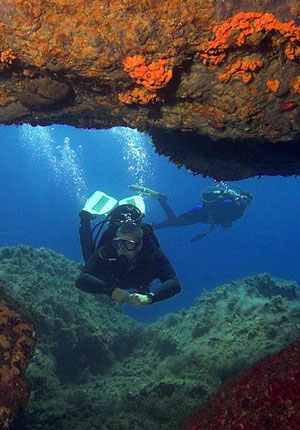
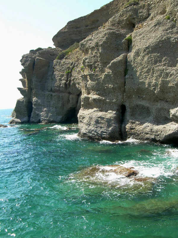
Then there are the famous grottoes in the coastal cliffs, mostly along the rugged shore west of the harbour, which can be entered only from the sea by boat. To them the coast of Agia Galini owes its nickname, the “little Capri of Crete”; one of the caves, in which rock doves nest, is indeed called the “Blue Grotto” after the Italian model. The light thrown back by the water plays in trembling reflections over walls and roofs and gives the caves an unreal enchantment that draws thousands of visitors year after year. The excursion boats that leave from the harbour combine the caves with the beaches of Agios Georgios and Agios Pavlos further west, and some go out to the two uninhabited Paximadia islets, twelve kilometres offshore.
The cave of Daedalus
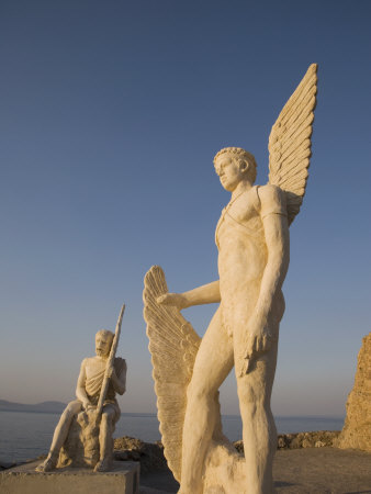
North-west of Agia Galini lies the cave of Daedalus, which local tradition links with Daedalus and Icarus. Here, it is said, the master builder made the wings of wax and feathers with which to escape the power of King Minos; the villagers also speak of the “hideout of Daedalus”, and regard the cave as his workshop. Today a dedicated visitors’ path leads to it, and on the tall rock above the harbour two modern statues of father and son commemorate the first flight in human history, which the story has them begin from this very crag.
The principal church
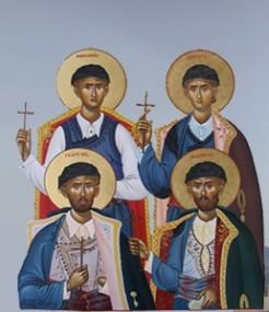
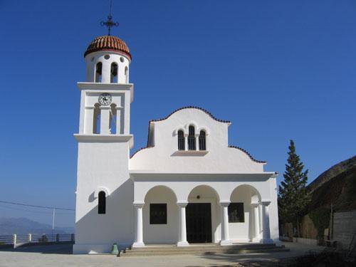
Two churches dominate the look of the village: the church of the Dormition of the Virgin, built as a basilica, and the church of the Four Martyrs (Agii Tesseris Martyres), on which building began at the start of the 20th century. It is dedicated to Georgios, Angelis, Manouil and Nikolaos, four men from the nearby mountain village of Melambes who were beheaded in Rethymno on 28 October 1824 for their faith.
The present day
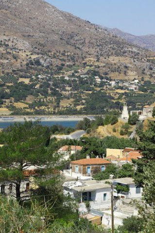
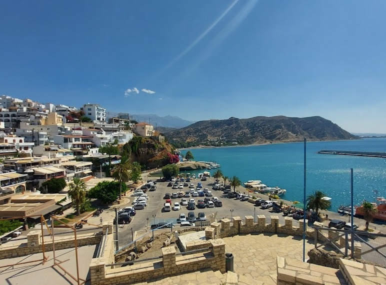
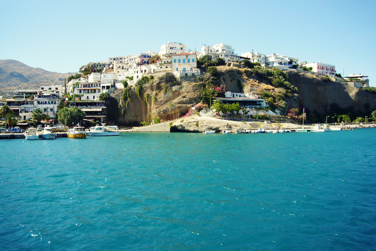
Modern Agia Galini rises like an amphitheatre above the valley of the Amarianos, also called the Platys, a river that rises near Thronos, carries water all year round and flows out into the sheltered bay of the Gulf of Messara on the Libyan Sea. Narrow paved lanes, and houses into whose walls stones from ancient buildings have been set, preserve the face of the old port. Yet the settlement is young: only in February 1885 did the first ten families from Melambes settle permanently on the bay; twenty more soon followed, some of them from neighbouring Sachtouria, and before the year was out a good thirty warehouses and shops were standing. The harbour had already served in the risings of 1821 and 1866 for landing supplies for the fighters, and tunnels cut into the rock behind the beach recall the Second World War. In 1916 the entrepreneur Matthaios Mamalakis even opened a hot bath here, in which heated sea water was administered for curative purposes – at that time the only establishment of its kind in Crete.
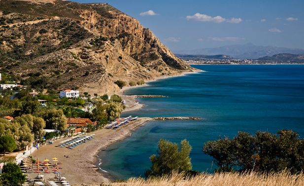
Today Agia Galini, about 55 kilometres from Rethymno and just under 70 from Heraklion, is a resort of some 650 permanent residents with a central pebble beach, a gently shelving sea bed and small neighbouring coves that are reached by boat. In the harbour the fishermen’s caiques still lie alongside the excursion boats, and on summer evenings there are theatre performances, concerts of Cretan music and the popular fish suppers of the local fishermen’s association. Conditions along the coast vary: some coves lie sheltered from the swell, others are fully exposed to the wind. Before an outing it is therefore advisable to check the weather and to ask whether the boats are putting out at all.
Agia Fotini beach (Paralia tis Agias Fotinis)
A small bay with fine shingle on the shore, crystal-clear water and a gently shelving sea bed – a quiet spot where the sea glows in every shade from turquoise to deep blue.
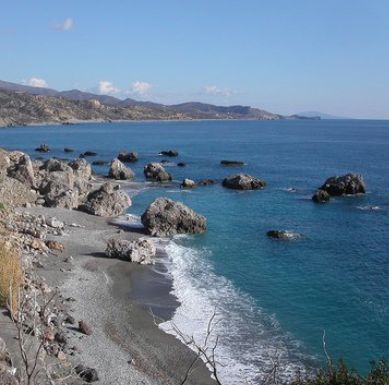
A tiny cove of fine shingle, enclosed by rocks on every side; close inshore three large boulders rise out of the water. A beautiful, almost secretive place.
Agios Pavlos beach (Paralia tou Agiou Pavlou)
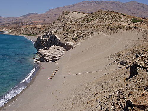
The beach of St Paul is a sandy shore hemmed in by rocks, at the tip of Cape Melissa. It lies open to the wind – the westerlies are frequent and can be strong – which heaps the sand into dunes; behind the long western strand, almost a kilometre of soft sand, they tower 25 to 30 metres high. This gives the place its own austere mood. The dunes are a ten-minute walk from the hamlet of Agios Pavlos, or can be reached from the plateau above by a steep slide down the sand; there are few facilities.
Around Agia Galini
Setting out from Agia Galini
From Agia Galini excursion boats run not only to the nearby beaches just mentioned but also to Preveli and Chora Sfakion. Only about 20 kilometres away, moreover, lie the ruins of two famous cities of ancient Crete: the Minoan palace of Phaistos, and Gortyn, later the capital of the Roman province.
You have come down over the slopes of Psiloritis to Agia Galini and carry a wealth of impressions with you. Even so, it is still possible to cross from here to the “Rusk Islands”, of which more in a moment. And anyone who longs to see Byzantine antiquities gathered in a single place will find them in the celebrated village of Spili; on the way there you should stop in Melambes, ten kilometres from Agia Galini.
The Rusk Islands (Paximadia)
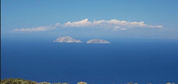
The boat also takes you to the two islets of Paximadia (Παξιμάδια) in the Gulf of Messara – the name means “rusks” and alludes to the hard, twice-baked barley bread of Crete. They are the summits of submarine mountains: one island rises 252 metres above the sea, the other 166 metres. The islets lie roughly twelve kilometres south of the harbour. The larger western island and the smaller eastern one are separated by a narrow strait, the “Bougazi”; seen from the Messara plain the two merge into a single recumbent shape, which is why local people also call them “Elefantaki”, the little elephant – a baby elephant lying down. From either summit a wide view opens up: on one side the bay and the coast of Crete, on the other the boundless Libyan Sea.
The uninhabited islands have small, isolated beaches with glass-clear water; fishermen take shelter in Varkaki bay in heavy seas, and Cape Sakoulevas surprises with coloured rock strata and numerous caves. In antiquity the islets belonged to Phaistos and were called “Dionysioi” after the god Dionysus or “Letoai” after the goddess Leto, who was worshipped at Phaistos. This fits a version of the old myth in which Leto is said to have given birth to her children Apollo and Artemis not on Delos but on these very islets. They figure prominently in Klaus Modick’s novel “Der kretische Gast”.
Melambes
Every schoolchild in Crete knows this village steeped in history. During the great rising of 1866 to 1869 against Ottoman rule a band of a thousand irregulars had its quarters in Melambes (Μέλαμπες), led by Kapetan Michalis Korakas, one of the leading figures of the independence movement. This force added many a glorious chapter to the history of the Cretan struggle for freedom. The village itself paid a high price: in 1866 sixty of its inhabitants fell in its defence before Melambes was burnt to the ground. People here relate with pride that no Turks ever settled permanently in the village, and recall that monks from Melambes were among those who died at Arkadi Monastery in 1866. The tradition of resistance continued: men of the village fought in the First Balkan War of 1912, and more than a hundred joined the Cretan resistance during the Second World War.
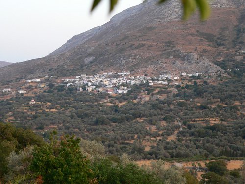
The present village lies at 570 metres, in a saddle between Mount Kedros (1,777 metres) and Mount Vouvala (947 metres), 42 kilometres south of Rethymno, with wide views – Psiloritis to the north, the Gulf of Messara to the south. It grew up in Venetian times out of several scattered hamlets and is first recorded by Francesco Barozzi in 1577; the census of 1583 counted 338 inhabitants, that of 1881 just over a thousand, and fewer than five hundred live here now. From the Venetian period date the churches of Agia Paraskevi and Agios Georgios with their two layers of painting. The villagers are proud that the Four Holy Martyrs came from their village: married men who outwardly passed as Muslims but had secretly remained Christians, took part in the rising of 1821 and after their arrest refused to renounce the faith. “As Christians we were born, as Christians we shall die,” they are said to have answered the pasha. They were beheaded at the Great Gate, the Guora Porta of Rethymno, and their relics are kept in the church dedicated to them in that city; Melambes built its own church of the Four Martyrs in 1952. Every year on 28 October the people of Melambes hold a great panigiri by the church in Agia Galini in honour of their four fellow villagers – with liturgy, fair, songs, dances and hospitality for all present. Anyone who is there gains a vivid impression of the manners and customs of the district.
Akoumia
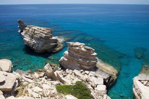
A village deep in greenery, at 525 metres on the slope of Siderotas (also Asiderotas, about 1,200 metres), facing which Mount Kedros rises majestically. Some 450 people live here. Its history reaches far back. Tradition holds that the Byzantine general and later emperor Nikephoros Phokas wrested the island from the Arabs in 961 and that this settlement was founded on his orders – its name is traced to the Byzantine family of Koumis, which settled here at that time. The church of the Transfiguration of the Saviour (Metamorfosis tou Sotira) is supposed to have been built in the same period; its frescoes are excellently preserved and according to local tradition belong to the 10th or 11th century, although the founders’ inscription gives the year 1389 and praises the building as the joint work of the village community. From the Turkish period there remains a curious two-storey defensive tower whose large loopholes look like windows. The village square is shaded by an ancient plane tree, and about 13 kilometres further down lie the two beaches of Triopetra, named after the three rocks that stand in the sea there.
Spili
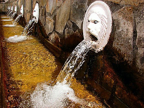
At last we have arrived in Spili (Σπήλι), an old place famous for its churches, at an altitude of about 430 metres at the foot of Mount Vorizis, an outlier of the Kedros massif, some 30 kilometres south of Rethymno on the main road to Agia Galini. It is the seat of the municipality of Agios Vasileios and its market town, with around 630 inhabitants. It enjoyed its heyday under the Venetians; from that time date the houses in the characteristic style, the narrow paved lanes and numerous handsomely framed fountains. The name probably goes back to the caves (spilia) in the surrounding cliffs. In the main square stands the impressive Venetian fountain with 25 spouts, 19 of them fashioned as lions’ heads. The iron-bearing spring water pours from the mouths all year round at a constant temperature of about 13 degrees, and tavernas and coffee houses are lined up in the shade of the plane trees round about. Botanists come in spring for the upland of Gious Kambos, a plateau of some 2.5 square kilometres at about 750 metres north-west of Kedros, where the red Tulipa doerfleri, one of the few tulips native to Crete, flowers among the cornfields.
In the village itself – Spili and its fields are reckoned to hold a good twenty churches and chapels – the following deserve a visit: the two-aisled church of St Charalambos and St Theodore (Agiou Charalambou ke Agiou Theodorou) in the Byzantine style, whose older part preserves frescoes of the 14th to 15th century; at the entrance to the village near the school the medieval Byzantine church of St George (Agiou Georgiou); the Byzantine church of St Anthony (Agiou Antoniou) of the 14th century; and finally the churches of the Panagia and of the Transfiguration of the Saviour (Panagias ke Metamorfosis tou Sotira), likewise of the 14th century, in each of whose wall paintings a subject from the afterlife survives that is rare in fresco.
The three-aisled church of the Apostles Peter and Paul (Naos ton Apostolon Petrou ke Pavlou) serves as the cathedral of the metropolis – the Holy Metropolis of Lampi, Syvritos and Sfakia – which has had its seat in Spili since 1936; the bishop’s palace stands in the village. Building began in 1959 and the first liturgy was celebrated in 1962; the church is also dedicated to St Nikon and St Isidore. On the Episkopi hill above the village a monastery of the New Martyrs Raphael, Nicholas and Irene has been established in recent times, and since 2012 an ecclesiastical museum has displayed liturgical vessels and archive material. Those who stay longer can walk from Spili across to Gerakari on the European long-distance path E4, passing the edge of Gious Kambos on the way.