The Idaean Cave route: from Rethymno to the second cave of Zeus
The most complete guide to Crete: 221 places on the map, 23 routes and 49 articles — with photos, videos and the story behind every place. No sign-up, no trackers.
Routes drawn along real roads
Weather at every stop
Full-text search
“Near me” by geolocation
Create your own printable itinerary
Satellite, terrain, dark mode
Works offline
⌕
Searches 1.7 million characters of descriptions, not just names
—places
4regions
—routes
—with video
Search results
—
Interactive map
Find what is near you
Filters narrow the map and the list at once. Zoom out and pins group together.
Region
Category
Фильтры карты
Landmarks
Featured places
RegionCategory
Routes
Ready-made day trips
Individual places
Articles about landmarks
This route links the east coast of the Rethymno district with the mountain villages of the Mylopotamos country and the Nida plateau. Along the way lie the seaside resorts of Skaleta and Panormo, the early Christian basilica of Agia Sofia, the traditional villages of Perama, Garazo and Anogeia, ancient Axos, the monastery of Atali, the caves of Melidoni and Sfendoni and finally the Idaean Cave (Ideon Andron) – one of the most important sanctuaries of ancient Crete, which myth connects with the childhood of Zeus. At the end one returns to the sea, to the bay of Bali, which in antiquity was the harbour of Axos. In the space of a few hours the road climbs from the coast to more than 1,400 metres, crossing country that ranges from citrus orchards and olive groves to bare upland pastures under Psiloritis, at 2,456 metres the highest mountain in Crete.
From Rethymno to the cave of Zeus
Leaving Rethymno
From Rethymno the route runs east in the direction of Heraklion. At the resort of Skaleta the traveller finds a beach of sand and fine shingle; from there the road keeps to the coast as far as Panormo, a little over 20 kilometres east of the town and about five and a half kilometres short of Perama, where we shall turn inland.
Panormo (Panormos)
Just before Panormo the road crosses the river Geropotamos. At its mouth a small lagoon has formed, cut off from the sea by a sandbar. As the seabed shelves steeply here, the lagoon is the better place for a quiet swim, particularly with children. The coast west of Panormo as far as Cape Lianos Kavos belongs to the Natura 2000 network of protected areas. The present village stands on the site of ancient Panormos, the trading port of Eleutherna.
Excavations have brought to light remains of a settlement of the 4th and 3rd centuries BC, with evidence of a Ptolemaic presence, as well as a large early Christian basilica. In 1204 and 1205 the Genoese seafarer Enrico Pescatore briefly held sway over the island; on his orders a castle with two gates and seven towers was built on the rock above the harbour, the Castel Milopotamo, of which remains can still be seen. The Venetians took it from the Genoese in 1212. For a long time the place was therefore known simply as Kastelli. In 1647 the fortress fell to the Ottomans. According to local historical tradition the inhabitants abandoned Panormo in 1651 and fled to the mountains; the village was not permanently resettled until after 1881. It then developed into the district’s chief port for the export of olive oil and carobs – a restored carob mill, the Charoupomylos, now serves as a cultural centre and concert hall. In 1905, during the struggle for union with Greece, the village was shelled by a Russian warship. After the bombing of the Second World War the fishing village gradually turned into a holiday resort, a change hastened by the building of the national road and the completion of the harbour in 1980. Today Panormo offers sandy beaches, water sports, hotels, restaurants and tavernas, and has grown without losing its village character.
In the centre of the village, stone houses and quiet, traffic-free lanes have survived. The most important monument is the early Christian basilica of Agia Sofia, discovered in 1948 by the archaeologists Konstantinos Kalokyris and Nikolaos Platon. It lies a little over half a kilometre from the village, an easy walk. This was a three-aisled church with a timber roof, 54 metres long and 23 metres wide – by common consent the largest early Christian basilica in Crete. It dates from the 5th or 6th century. The finds show that it was an important centre of Christian life on the island. The basilica remained in use into the 7th century and was probably destroyed in the Arab raids. In the course of the year Panormo keeps three great church festivals: the Ascension, the feast of St John the Baptist on 24 June and St Nicholas’s day on 6 December. From here the route leaves the coast and turns inland to Perama.
Perama
Perama is a green place on the left bank of the Geropotamos, surrounded by gardens and vineyards, and as the chief town of Mylopotamos it is also the administrative and commercial centre of the district. In summer it holds the Perama carnival, with concerts and performances, and the grape festival, celebrated at the end of August with music, dancing and hospitality. The “Kouritia Odos” eco-museum introduces the ecological and agricultural heritage of the district and offers short themed walks: the “Olive Path” at Achlades, the sanctuary of Hermes and honey-making near Melidoni, a Minoan tomb and a cypress grove at Tsanakiana, and a Minoan palatial building and the “plane tree of Zeus” at Monastiraki. From Perama the route continues by way of Dafnedes and Mourtzana to Garazo and on to Anogeia.
Garazo
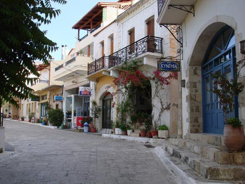
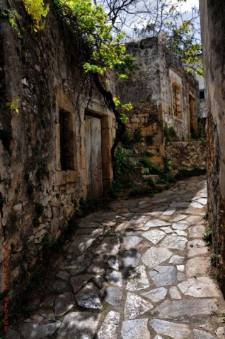
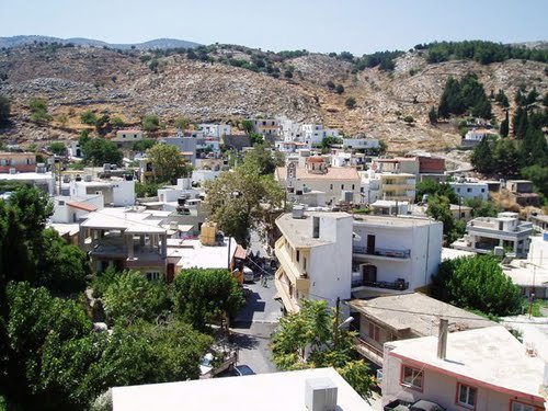
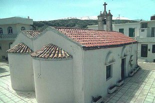
Garazo is a handsome traditional village of well-kept stone houses, courtyards full of flowers and narrow lanes. It gives a good idea of the self-reliant mountain villages of Crete, whose way of building obeyed one consideration above all others: protection against enemies. The houses crowd close together and the lanes twist and turn, so that an attacker would have found it hard to get his bearings. In the middle of the village, on the square, rises the imposing church of Agia Kyriaki (Ekklisia tis Agias Kyriakis).
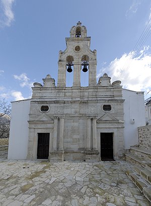
Also worth seeing in the same village is the fine two-aisled church of St Charalambos and the Dormition of the Virgin (Ekklisia tou Agiou Charalambou ke tis Kimiseos tis Theotokou), whose façade is a modified copy of that of Arkadi Monastery – the celebrated church front of 1587, with its paired Corinthian columns, that became a model for church builders across the Rethymno district. Close by is the Museum of Folk Sculpture, whose collections are highly instructive. Notable too is the aqueduct that the villagers built by their own efforts in 1915; its source is enclosed by a fountain in the traditional style. From there a Venetian paved path, a so-called kalderimi, leads for 1.5 kilometres to the oldest stone building in the village.
The path is lined on both sides with plane trees, walnuts and fruit trees, and a walk along this avenue is a pleasure, shaded even at midday. On the edge of the village stands the little church of St George (Naos tou Agiou Georgiou). The best time to come is mid-August, when Garazo hosts the great Pan-Cretan Citron Festival (Giorti tou Kitrou), with concerts, performances, a village fair and food and drink. The citron (kitro) has long been grown in the area and is made into liqueur and candied fruit; the festival has been held for more than three decades. The next village with notable sights is Axos.
The ancient city of Axos
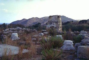
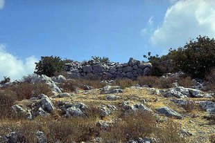
The village lies at about 500 metres in a fertile valley of Mylopotamos at the rocky northern foot of Psiloritis; the stream Oaxos flows through the valley. Abundant spring water and a mild climate have favoured agriculture in every age, and people settled in this beautiful spot very early. The proof is the ruins of the ancient city of Oaxos or Axos, of Classical date, which occupy a hill to the south of the present village, rising to some 600 metres; settlement, however, goes back to prehistoric times, with pottery from the very end of the Bronze Age and unbroken occupation from the Geometric period onwards.
The ancient city was laid out on several terraces, had a strongly fortified acropolis and possessed its own trading harbour on the site of present-day Bali. According to myth it was founded by Oaxos, a son of Apollo and of Akakallis, daughter of Minos, king of Knossos. Herodotus, in the 5th century BC, mentions a king Etearchos of Axos and tells the story of his daughter Phronime, mother of the Battos who later founded Cyrene in North Africa. Apollonius of Rhodes, in the Argonautica, makes this the place where the nymph Anchiale gave birth to the Idaean Dactyls.
The legend of Talos is also connected with the district. King Minos received from his mother Europa the gift of a mighty man of bronze – in the usual version it was Zeus who had given him to Europa – whom the smith-god Hephaestus had fashioned to guard the king’s realm: a mechanical sentry, so to speak. Talos had the task of making the circuit of the island three times a day; some versions of the myth even have him fly round it, and ancient Cretan coins do show him as a naked winged figure in the act of hurling a stone. If enemy ships approached, he flung boulders at them and sank them; anyone who nevertheless reached the shore after the wreck he destroyed with jets of fire from his mouth. When no danger threatened from outside, the bronze giant halted at various places on his rounds and taught the people the laws, which were engraved on bronze tablets that he always carried with him – an image that recalls the tablets of the law of Moses. This is the rationalised Talos of the dialogue Minos, attributed to Plato, where he tours the villages three times a year. It was his duty to see strictly that these laws were obeyed. He had one weak point, a single vein at the ankle covered only by thin skin, and the fullest account, that of Apollonius of Rhodes, tells how the sorceress Medea bewitched him into grazing it, so that his lifeblood drained away. Between his patrols the giant rested on a bed of hills that are called after him the Talean Mountains (Talaia Ori). They extend along the coast of the Sea of Crete between the districts of Rethymno and Heraklion and end at the bay of Bali.
From about the 3rd century BC until the reign of the emperor Caligula, ancient Axos struck its own coins with the heads of Apollo, Zeus or Artemis, and maintained far-reaching relations with other cities and islands of the Mediterranean. In Roman and Byzantine times too it remained a prosperous and important city; between 395 and 961 it was the seat of a bishop, and the Byzantine geographer Hierocles lists it among the twenty-two cities of Crete. Tradition records that there were once 46 Byzantine churches in Axos, of which only about ten survive today; many were decorated with frescoes and mosaics, some of the 14th century. Under the Venetians Axos declined: whereas the village still had 586 inhabitants in 1583, the Ottoman tax registers of 1691 record only about 250. According to local tradition, inhabitants moved up the slopes of Psiloritis and there founded a group of villages that were called Axika Anogia, the “upper villages of Axos”.
The excavations, begun by the Italian Archaeological School in 1899, have produced impressive evidence of the city’s architecture: the old acropolis, the andreion – the citizens’ assembly hall – temples of Aphrodite-Astarte, Apollo and Demeter, walls of Cyclopean blocks and the remains of houses. Inscriptions are cut into enormous stones, extracts from the laws of the city-state; one Archaic text, written boustrophedon with the lines running alternately left and right, sets out the terms of a contract with craftsmen. At the south-western foot of the acropolis tombs of three periods were uncovered – Archaic, Hellenistic and Roman. About 700 metres from the acropolis, on the hill of Chalepa, the so-called “Ellinospita” (houses of the Hellenes) are preserved, spacious vaulted burial chambers of Roman date; a path links them with the acropolis and makes a rewarding walk. South of the present village of Axos, walls eight metres high were discovered that probably belonged to an aqueduct. Among the finds are numerous clay statuettes of naked female deities from the sanctuary of Aphrodite, ascribed to the early, so-called labyrinthine period – older scholarship saw in them evidence of a matriarchal order in Early Minoan Crete – together with richly decorated bronze helmets, bronze vessels of the 7th century BC and many inscriptions. The finds are kept in museums in Crete, the bronze armour notably in the Archaeological Museum of Heraklion, and partly in private collections. The municipality and the antiquities service are currently working on a plan to make the acropolis more accessible.
Axos is famous above all for its many Byzantine churches and its monastery. Outstanding among them, for its remarkable architecture, is the cruciform church of Agia Sofia (Naos tis Agias Sofias).
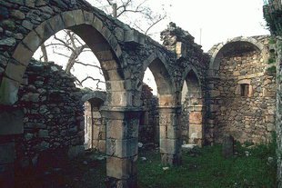
In the village there is also the church of St John (Naos tou Agiou Ioanni), with splendid frescoes, an iconostasis and panels of mosaic. Worth seeing too are the churches of the Holy Cross, St George and the Archangel Michael (Ekklisies tou Timiou Stavrou, tou Agiou Georgiou, tou Michail Archangelou) in the middle of the village, the three-aisled basilica of Agia Paraskevi (Ekklisia tis Agias Paraskevis) of the 12th century and the church of Christ the Lord (Ekklisia tou Afendi Christou). On the edge of the village lies the old church of the Panagia Kavousani, named after the nearby spring of Kavousi; it preserves astonishing frescoes. Beside it are the ruins of the church of SS Eleftherios and Modestos (Naos Agion Eleftheriou ke Modestou), of the second Byzantine period. In the centre of the village a finely worked medieval fountain still splashes and still gives water.
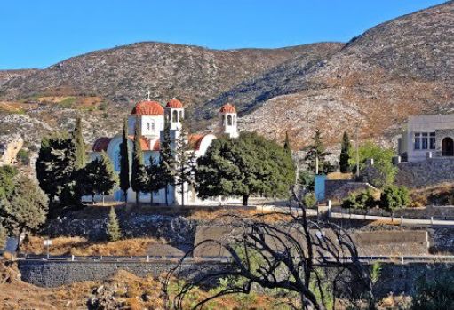
There are two monasteries in the neighbourhood of Axos. Near the locality of Agridia rises the stately monastery of Christ of Chalepa (Moni Christou Chalepas). It is uninhabited today; its main church was never even completed, because the monks left in the course of the wartime events of 1912. From the monastery grounds there is a very fine view all round.
Only four kilometres away, near Livadia, is the second monastery, Diskouri (Moni Diskouriou), built in the Venetian period as a defensible compound. Its name is said to derive from an ancient sanctuary of the Dioscuri, Castor and Polydeuces, over which it supposedly arose. It was altered several times in the 19th and 20th centuries and is of great architectural interest; the complex includes cells, the abbot’s quarters, a refectory, an olive press and storerooms. The single-aisled main church is dedicated to St George, who is held in particular reverence by the shepherds and stockbreeders of all the villages on the slopes of Psiloritis. The custom long persisted here that shepherds suspected of stealing livestock would swear an oath of purgation before the saint’s icon. Every year on 23 April a great festival, a panigiri, is held with a market: the shepherds of the surrounding villages bring lambs as an offering to St George, which are auctioned, and the proceeds go to the monastery. Singers and dancers perform. The monastery also owns the little chapel of the Holy Cross on the summit of Psiloritis (2,456 metres), the highest mountain in Crete. Another church, that of the Holy Apostles (Ekklisia ton Agion Apostolon), stands on a hilltop at the place called Meteoro.
Colourful festivals are held on 14 September in honour of the Holy Cross, on 21 May for the day of SS Constantine and Helen and on 15 August for the feast of the Dormition of the Virgin. Anyone lucky enough to be present at one of these panigiria gains a vivid impression of the manners and customs of the Cretan mountain people.
We now climb further up the northern slope of Psiloritis. The landscape changes: rocky mountains, little greenery, but in return wide views.
Anogeia
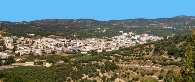
Anogeia is a cluster of quarters on the northern slope of Psiloritis at an altitude of some 740 metres, with a little over 2,200 inhabitants. Lowest of all is Perachori, with the church of the Virgin (Ekklisia tis Panagias), crystal-clear springs and centuries-old plane trees. Next comes Armi, and above it Metochi, with the church of St Demetrios (Ekklisia tou Agiou Dimitriou) and the open-air Nikos Xylouris Theatre, which seats 1,500 and is named after the famous singer and lyra player, a native of Anogeia (1936–1980), whose brother Psarantonis is no less celebrated. The theatre plays an important part in the cultural life of the whole of Crete: in the summer months it hosts several festivals, to which folk singers, dance groups and theatre companies come from all over the island. Especially popular is the contest of the makers of mantinades – those rhyming couplets that are improvised on the spot and turn to any subject. They are accompanied on the lyra, the Cretan bowed instrument that children in Anogeia learn to play from an early age.
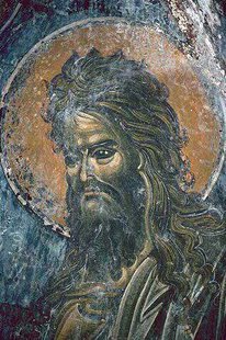
The villages of Anogeia are at least a thousand years old. Local legend ties the first settlement to an icon of St John the Baptist, found by a shepherd on Psiloritis, which kept returning of its own accord to the spot where the first church was then built. After the reconquest of the island by the Byzantine general and later emperor Nikephoros Phokas (961), tradition has it that they became fiefs of the Phokades, a few noble families from the circle of Phokas. Venetian chronicles also mention prosperous settlements under the common name of Anogia; by 1593 some 911 people lived here. In the Venetian period there were scarcely any popular risings here; under Ottoman rule, by contrast, it was precisely the inhabitants of these villages who instigated and sustained numerous revolts. In May 1822, under the leadership of Vasilios Sbokos, they won a notable victory over a Turkish detachment. To punish the unbending mountain people Serif Pasha sent his troops, who found the place empty – its men were away fighting in the Messara – and laid the villages waste and plundered them. Because of their active part in the revolt of 1866, the Ottomans again burnt the villages to the ground in November 1867. In the Second World War the inhabitants put up determined partisan resistance. In April 1944 fighters from Anogeia helped the British officers Patrick Leigh Fermor and William Stanley Moss to abduct the commander of the German troops in Crete, General Heinrich Kreipe, and to take him over the mountains to the south coast – a grave humiliation for the occupiers.
On 13 August 1944 the German command under General Friedrich-Wilhelm Müller issued the order “to raze Anogeia to the ground and to kill every male inhabitant found within a radius of one kilometre”. The text of the order can be read today on a plaque in the village square. Three battalions surrounded the village, and over some three weeks the troops destroyed it: about 120 people were killed, among them the old and infirm who had been unable to flee, and around 940 houses were dynamited or burnt down. As if by a miracle only the church of St John the Baptist was left standing, in which wall paintings of the 12th century have been preserved.
After the war the villages were rebuilt in the style of the time, which is why Anogeia, for all its age, looks like a modern town. In 1947 Anogeia was awarded the War Cross, one of Greece’s highest military decorations, for its special contribution to the fight against the German occupiers, and was officially declared a martyr village. In the history of the place it was the third complete destruction, after those of 1822 and 1867.
Fourni
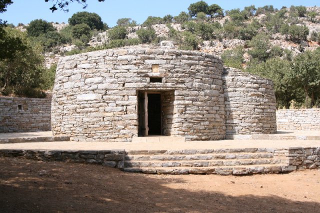
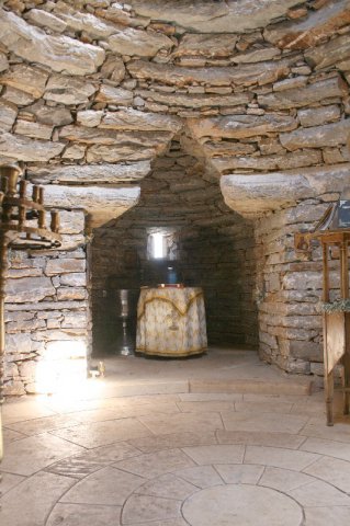
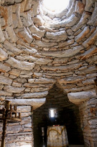
Twelve kilometres south of Anogeia, in the upland pasture known as Fourni and at an altitude of about 1,200 metres on the flank of Psiloritis, stands the little stone chapel of St Hyacinth (Ekklisaki tou Agiou Yakinthou). It was designed by the architect Stavros Vidalis in the form of a mitato, the round stone hut of the Cretan shepherds, so that it sits among these slopes as though it had always belonged to them. Hyacinth is the patron of pure feeling, of noble love and of the marriage bond – an Orthodox counterpart, as it were, to St Valentine. Church tradition makes him a native of Caesarea in Cappadocia and a chamberlain at the court of the Roman emperor Trajan. Because he held to his Christian faith and refused to eat meat that had been offered in sacrifice to the gods, he was thrown into prison, where he was given nothing else to eat and died of starvation; the version told at Anogeia places his death in AD 98, at the age of twenty, while other lives of the saint make him a boy of twelve who died in Rome about ten years later. Accounts of how long he fasted range from twenty days to forty.
At the request of the villagers, and with the blessing of the Metropolitan of Rethymno – the building of the chapel was also approved by the Ecumenical Patriarch Bartholomew – a popular festival, the “Yakinthia”, was instituted in the saint’s honour. The idea came from the songwriter Loudovikos ton Anogion, a son of the village, who in 1998 founded a non-profit association named after the saint together with his fellow villagers. The festival is conceived on a generous scale: folk-dance groups from all over Crete take part, and there are theatre performances, shadow-puppet shows with the figure of Karagiozis, contests in the singing of mantinades and a good deal more. The celebration falls on 3 July, the saint’s feast day in both the Orthodox and the Catholic calendar, and as at every panigiri a market goes with it. The events of the Yakinthia now stretch across the summer and are known well beyond Crete.
Zominthos
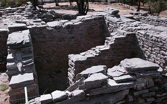
Among the most important sights near Anogeia is the Minoan settlement of Zominthos, some seven kilometres from the village at an altitude of 1,187 metres, beside the road that climbs to the Nida plateau. The archaeologist Yannis Sakellarakis came upon it in 1982, when he heard a shepherd use the name Zominthos. The first campaigns ran from 1983 to 1990; work resumed in 2004, for a few seasons in collaboration with Diamantis Panagiotopoulos, and since 2010 it has been directed by Efi Sapouna-Sakellaraki. It is not finished yet. Zominthos is so far the only known high-mountain settlement whose principal building recalls the palace of Knossos. This central building, commonly called the “palace”, is laid out on a strict north–south axis, covers some 1,500 square metres and had two, perhaps even three storeys; in places its walls still stand to a height of three metres. Around 80 rooms of various kinds have been identified, and the number goes on rising as the excavation proceeds: workshops, among them a potter’s workshop without parallel in Minoan Crete, storerooms, and the apartments of a master of the house who – if he was not King Minos himself – must have stood very close to him in rank.
Only a small part of the area – about five per cent – has been uncovered, yet the finds have surpassed all expectations. The wall paintings on plaster are astonishing, for the colours have survived as well as the drawing. Thanks to the hard building stone of Psiloritis, window and door openings are clearly preserved. The excavators recovered some 50 large storage jars (pithoi), numerous amphorae, tools of bronze and bone, jewellery, objects worked in rock crystal, clay vessels and a large horn. The site was already occupied around 1800 BC; the great building went up in the Neopalatial period, around 1600 BC, and was destroyed about 1400 BC, probably by an earthquake. Zominthos was evidently an economic and religious centre: from here the trade in farm and pastoral produce and in timber from Psiloritis was directed, and here lay an important staging post on the sacred way that linked Knossos with the Idaean Cave. The organisation and the high technical standard of so large a settlement, in the harsh conditions of the mountains, are remarkable. In 2025 Zominthos was inscribed on the UNESCO World Heritage List as one of the Minoan Palatial Centres.
The Idaean Cave
The cave of Zeus – Crete has two of them. Where the father of the gods actually came into the world is a question that probably only he could answer. The Cretans take the matter calmly: which of the two caves, the Dictaean or the Idaean, is held to be the true birthplace depends, not infrequently, on which is nearer to where one happens to be staying.
Find on the map
So where was Zeus born? In the Idaean Cave?
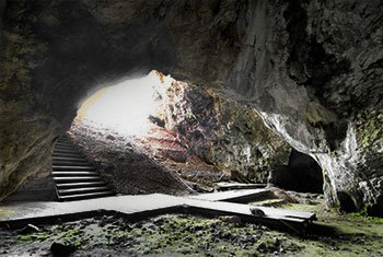
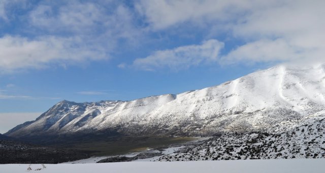
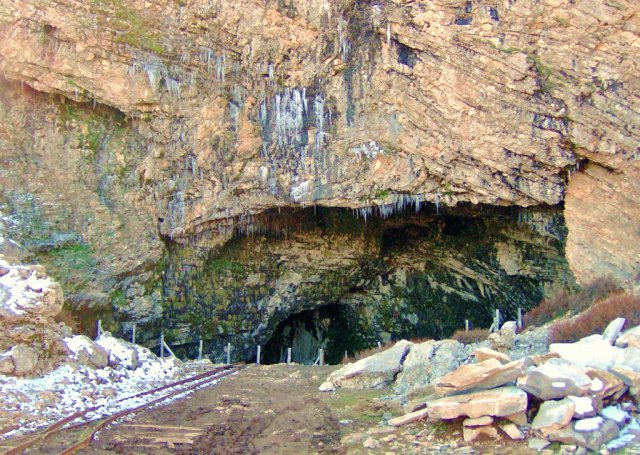
Two caves in Crete lay claim to the glory of having been the cradle of Zeus: the Dictaean Cave above the Lasithi plateau and the Idaean Cave. The latter opens not far from Anogeia, high in the massif of Psiloritis, the ancient Ida and the highest mountain on the island. A well-made road some twenty kilometres long leads from Anogeia through a bare mountain landscape dotted with shepherds’ huts (mitata) up to the broad Nida plateau; from its edge a short walk brings you to the cave. The entrance is tremendous, and near it stands a large rectangular altar hewn from the rock. The interior, by contrast, is plain: beyond the mouth the floor slopes down into a single great hall of about forty metres by fifty, with a few side recesses and, apart from a handful of stalactites near the entrance, no decoration to speak of. It is not nature but history that gives this place its significance.
As with all ancient myths, there are many versions. According to one of them Zeus was born in the Dictaean Cave and grew up in the Idaean. That is roughly how the mythographer Apollodorus tells it in his “Library” (I 1, 5–7).
When Kronos had taken his sister Rhea to wife, he swallowed every child she bore him, for Gaia and Uranus had prophesied that a son of his own would one day strip him of his power. First he swallowed Hestia, as soon as she was born, then Demeter and Hera, and after them Pluto and Poseidon. Enraged at this, Rhea went to Crete when she was pregnant with Zeus and gave birth to him in a cave on Mount Dikte. She handed the boy over to be reared by the Kouretes and by the nymphs Adrasteia and Ida, the daughters of Melisseus.
The nymphs fed the child on the milk of the goat Amaltheia. The Kouretes, meanwhile, stood guard in full armour before the cave and beat their spears against their shields, so that Kronos should not hear the infant crying. Rhea herself wrapped a stone in swaddling clothes and handed it to Kronos, who gulped it down as though it were the newborn child.
When Zeus was grown, he rose against his father, cast him from his throne and forced him to disgorge the brothers and sisters he had swallowed. Kronos was hurled down into Tartarus; Zeus divided the rule of the world with his brothers Poseidon and Hades and himself became the chief of the Olympian gods.
It was the Idaean Cave in particular that antiquity associated with the god’s childhood and with the armed dances of the Kouretes. It was also known by the name “Arkesion”, derived from “arkesis”, help – for people came here to beg the aid of Zeus. Tradition has it that King Minos climbed to the cave every nine years to receive new laws from his divine father, and the philosopher Pythagoras, too, is said to have taken part here in the secret rites in honour of Zeus and to have been initiated into them; the Cretan seer Epimenides is named among the initiates as well. The god was worshipped in the cave not only as a child but also as a youth and as a ruler in his maturity, and behind him stands an older deity of vegetation who died and was reborn with the seasons. The cult involved animal sacrifice, ecstatic dances and the sound of drums and rattles; a festival was held every year, and the mysteries were bound by strict secrecy, the initiates swearing an oath of silence.
For a long time afterwards Cretan priests performed a clamorous armed dance at the festivals of Gaia and of Idaean Zeus; warlike round dances of this kind were alive in Homeric times too. Anyone who looks closely at the dance traditions of the Cretan highlands today will again and again come across motifs that seem to reach back into remote antiquity and have survived in the everyday life of the mountain people.
Excavations and finds
The cave was discovered for scholarship by chance: in 1884 a shepherd’s dog is said to have drawn attention to ancient objects in the ground. The very next year, 1885, the Italian archaeologist Federico Halbherr dug here on behalf of the Philological Society of Heraklion under Iosif Chatzidakis – the same pair who in 1886 made the first excavation in the Dictaean Cave. Further investigations followed in 1917 under Stefanos Xanthoudidis and in 1956 under Spyridon Marinatos. Before the scholars arrived, however, local people had already pulled numerous objects out of the earth and sold them to dealers; some even found pieces of gold in the soil.
The most thorough excavation was led from 1982 by the Athenian archaeologist Yannis Sakellarakis, working with his wife Efi; he called the cave the “Bethlehem of antiquity”. At 1,538 metres conventional methods were hardly feasible: darkness, damp and, in winter, ice obliged the team to install generators, winches and even a small light railway, jokingly called the first railway in Crete. The winter of 1983–84 was so severe that the ice at the entrance had to be broken up. The finds prove that the cave was in use for thousands of years – on present knowledge from about the 4th millennium BC, through its great age as a sanctuary in the Geometric and Archaic periods, to the 1st century AD, and on a smaller scale later still, as the Roman lamps show.
Most famous of all are the bronze votive shields of the late 8th and 7th centuries BC, with scenes in repoussé and engraving – one shows Zeus surrounded by the Kouretes – and with them parts of bronze tripod cauldrons, bronze and silver vessels, figurines, pottery, precious ivories and ivory seals, gold jewellery with granulation and inlaid stones, miniature vases of gold, countless broken clay lamps and a goat’s knucklebone mounted in silver, which was probably used for divination. Pilgrims travelled for days to get here; rich and poor alike hung their gifts on the branches of the poplar before the entrance, a custom recorded by Theophrastus. The treasures of the cave are today one of the glories of the Archaeological Museum of Heraklion. Sakellarakis’s last great publication on the cave and its treasures was completed after his death in 2010 by his wife and collaborator, Efi Sapouna-Sakellaraki.
On the way back from the cave of Zeus
Zoniana and the spring of Amaltheia
Popular belief has it that the name of the village of Zoniana derives from that of Zeus. About a hundred metres from the cave rises a spring called the “Water of Amaltheia” (Νερό της Αμάλθειας) – a reminder of the goat which, according to the myth, suckled the young god with her milk.
Zoniana lies at an altitude of some 650 metres on the northern slopes of Psiloritis, only a few kilometres below Anogeia. Once a small municipality in its own right, it has belonged since the local-government reform of 2011 to the municipality of Mylopotamos and counts about 1,200 inhabitants. With its narrow lanes and old stone houses, the village still lives largely from stock-rearing; its dairies are known for graviera, anthotyro and the sourish xinomyzithra. It makes a good base for excursions to the high plateaux of Ida and to the observatory on Skinakas.
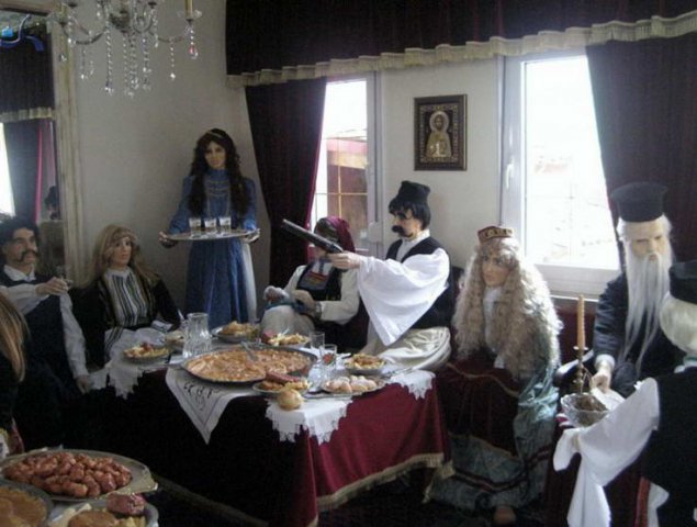
The best-known sight in Zoniana is the Potamianos family’s Wax Museum (Μουσείο Κέρινων Ομοιωμάτων) on the village square, the work of the sculptor Dionysis Potamianos and one of only two museums of its kind in Greece; the other is at Ioannina. Over about 1,000 square metres, something like a hundred life-size figures re-create scenes and personalities from Cretan history from antiquity to the present, arranged in thematic sections on myth, folk life, the uprisings and politics. Outstanding Cretans of more recent centuries are here as well: the poet Vitsentzos Kornaros; Domenikos Theotokopoulos, who won world fame as El Greco; Eleftherios Venizelos; and Nikos Kazantzakis, the island’s great writer, who was several times nominated for the Nobel Prize in Literature. The whole painful history of Crete is mirrored in these scenes, the Holocaust of Arkadi Monastery among them; a visit is instructive and vivid, and along the way one learns how wax figures are made. The museum is accessible to wheelchair users.
Atali Monastery
The monastery of St John the Baptist (Μονή Τιμίου Προδρόμου Ατάλης) lies at about kilometre 33 of the new national road from Rethymno to Heraklion and roughly a kilometre south of it, on the eastern slope of the hill of Agia Ypakoi, known locally as Apakoi, just west of Bali. The whole surrounding country is steeped in memories of monks and hermits and bears the character of a sacred landscape held in special veneration. On the neighbouring slopes and along the coast there were once hermitages and small monasteries. The hill opposite the monastery is called the “Hill of Pachomios”, after a monk of that name, and the hill above it the “Hill of Holy Obedience”. Mount Apakoi, one of the lowest summits of the Talean range, already carried a peak sanctuary in Minoan times; it was later succeeded by a shrine of the Panagia, a chapel of the Virgin Gorgoepikoos.
These traditions surely moved the monks to found their house in this impressive spot: with a boundless view over the Sea of Crete, and yet not easily made out from the water – no small advantage on a coast exposed to pirate raids. The architecture has peculiarities that follow from the sloping site and from the demands of an insecure age in which one had to fortify oneself. The complex forms a fortress-like rectangle on several levels. The katholikon does not stand in the centre, as is usual in monastic architecture, but apart and at a different height on the north-eastern side of the group of buildings, reached by a stair that could be shut off from the rest by a heavy door. It has two aisles, and its south front carries rich carved stonework.
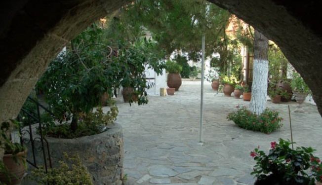
The main gate on the west, on the other hand, follows the traditional form of a monastery porch. It is vaulted and offers enough sheltered space for pilgrims and travellers to wait in the dry of a morning until the monastery opened. Immediately behind the gate, to the south, was the stable, in which stone mangers survive to this day. The other working buildings indispensable to monastic life – olive press, mill, potter’s workshop, bakehouse – are ranged along the passage, at a sensible distance from the abbot’s rooms, the cells and the refectory. Particularly impressive is the inner courtyard, which is completely separate from the service buildings. It forms a rectangle parallel to the long axis of the monastery; the doorways of the cells and the stone arches compose a handsome picture and bear witness to a complex built with great care.
The monastery already existed in Venetian times, but exactly when it was founded is unknown. Some fragments of fresco in the katholikon date from the 14th century; the first written record, however, is a notarial deed of 1628, according to which the monastery then had a brotherhood and its renewal was beginning. The buildings themselves also preserve important evidence of the state of the monastery around the middle of the 17th century. So well considered a plan is otherwise found in Crete only in the great monasteries, most of them of the same period. As for the name Bali, which the bay and the monastery now share, its first mention is in the account of the traveller Richard Pococke in 1739.
The earliest date in the monastery is on the main gate, with the inscription ΑΧΛΕ (1635): “The fear of the Lord is the beginning of wisdom. Remember, O Lord, thy servant Pachomios, hieromonk.” The opening words are those of the Psalmist: “The fear of the LORD is the beginning of wisdom” (Psalm 111:10, King James Version). The octagonal window also bears a date, ΑΧΛΗ (1638). By 1646, when the Turks overran the district, the building work was essentially complete: the little church of St John the Baptist had been enlarged, the cells for ten to twenty monks were finished and the communal rooms had been put up. Important evidence for the completion of this work is provided by the few surviving frescoes in the refectory, painted shortly after the beginning of the 17th century. Painted monastic refectories are a great rarity in Crete. Whether this was the first building phase or already a second, we do not know; some scholars even consider these frescoes contemporary with those of the church.
What immediate consequences the Turkish conquest had for the monastery is not recorded. Evidently, though, there was destruction in 1646–47 which was later made good, as an inscription of 1692 over the gate between the range of cells and the katholikon suggests. According to local tradition the monks at that time took a miracle-working icon of the Mother of God for safekeeping to a monastery on the island of Sifnos, where it remained through the years of the war.
Throughout the Cretan War, and after the final conquest of the island by the Ottomans, Cretan insurgents used the bay of Bali for their own purposes, and so the Baptist’s monastery was drawn into the maelstrom of the risings. The scanty reports down to the middle of the 18th century attest merely that it continued to exist. From 1761 the evidence becomes more frequent and reveals a livelier existence: the fountain inside the monastery was built, and icons, books and liturgical vessels were donated. The year 1761 appears on the icon “In Thee Rejoiceth” (Ἐπὶ σοὶ χαίρει), with the inscription: “Remember, O Lord, thy servant Gervasios, hieromonk. 1761. By the hand of Emmanouil.”
The icon of the Nativity of St John the Baptist bears the year 1763: “Remember, O Lord, thy servant Emmanouil. 1763. By the hand of Emmanouil.” The hieromonk Gervasios further presented the monastery in 1784 with a costly cross of blessing and in 1795 with a silver-bound Gospel book printed in Venice. On its back is the monastery’s own note of the donation: “Monastery of Atali in the island of Crete 1795.”
To the same period belongs the more distant fountain outside the walls, fed from the stone fountain on the peak of Apakoi, from which the monastery drew its water; its inscription reads: “Donor Michail. In the year 1791, on 10 July. Abbot Gedeon.” In 1791 the icon of St John the Baptist for the iconostasis was painted as well.
The monks took part in the rising of 1821, and it seems that the monastery was then set on fire, or at least that its church was damaged. Repairs followed the rising; the most important was the carved wooden iconostasis, which carries an inscription with the name of Abbot Meletios Karteris: “At the expense and under the supervision of the hieromonk Meletios 1837.” The next piece of evidence is an inscription of 1853 on a small icon of the Baptist.
During the great Cretan revolt (1866–1869) Turkish troops fell upon the monastery again and again. In 1866 they plundered it and desecrated the holy places; at the same time refugees found shelter here, and the sheltered bay served the insurgents as a key harbour for supplies. Later Abbot Gerasimos Pikrakis distinguished himself in the struggle against the Ottomans; his deeds passed into songs that the Cretans sang. In 1874 he succeeded Meletios Karteris as abbot, but for all his efforts he did not manage to put the monastery on a new footing. In 1881 only two monks and nine laymen were living there, the latter evidently tenants of the monastery lands. Its dissolution was decided in 1900 and carried out in 1935. After the German occupation the monastery stood empty – it was deserted by 1945 – and fell into complete ruin. In 1979 it was scheduled as a historic monument.
On 24 June 1983, the feast of the Nativity of St John the Baptist, the late Metropolitan Titos Silligardakis celebrated an episcopal liturgy in the monastery church and in the course of it installed Archimandrite Anthimos Syrianos as the new abbot – the future Metropolitan of Rethymno and Avlopotamos. With great devotion he set about rebuilding and reordering the monastery at once. The result of his labours is what pilgrims and visitors see and admire today. Since 24 June 1996 his successor, the devout, learned and energetic Parthenios Kalyvianakis, has carried on the work with the same zeal. Among the important works already completed is the chapel of St Theodosios the Cenobiarch, under whose protection the present community stands.
The Sfendoni Cave
The magnificent Sfendoni Cave lies about a kilometre from the village of Zoniana, on the southern slopes of the hill of Chalepa, 43 kilometres from Heraklion and 52 from Rethymno. Its entrance is about 630 metres above sea level. It owes its name, “Tou Sfendoni i Trypa”, Sfendonis’s Hole, to an insurgent from Sfakia who is said to have hidden here – and, in the darker version of the tale, to have killed a boy who stumbled on his hiding place. A legend also tells of a beautiful nymph who lived in the cave; a shepherd saw her often and fell in love with her, but she fled from him into the depths of the mountain. The mouth of the cave was originally only about a metre wide and has been enlarged for visitors; a paved path leads to it from the car park.
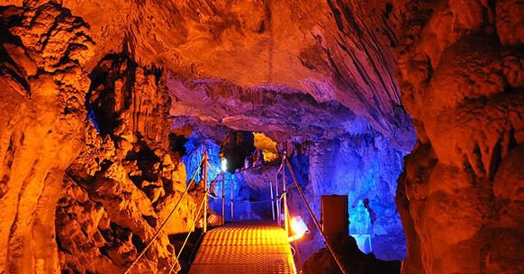
The age of the cave has not been precisely determined; estimates range from eight to fourteen million years. Its greatest length is 145 metres and its total area is put at 3,000 to 3,400 square metres, of which about two thirds can be visited along a walkway some 270 metres long. Excavation has shown that shepherds used the cave from the Neolithic to the present day – only occasionally, as the pottery shows, but over thousands of years. Near the innermost chamber the skeleton of a child was found, coated in calcite – evidently it had lost its way in the labyrinthine passages.
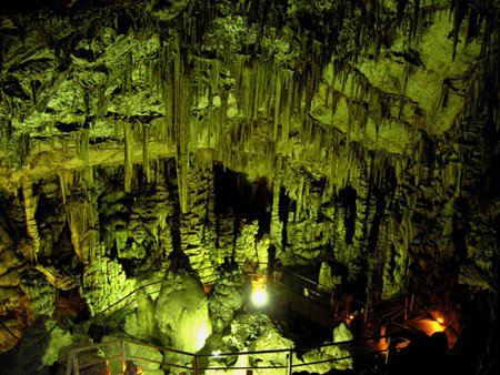
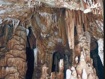
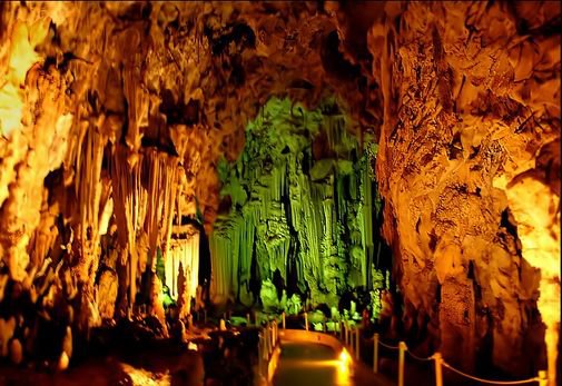
In natural decoration it is one of the richest caves in Crete. Fourteen chambers, divided by massive columns into labyrinthine compartments, bear poetic names: the Palace Hall, the Organ Hall, the Parthenon, the Hall of the Petrified Waves, the Panorama, the Mitropolis, the Hall of the Lost Boy and others. Stalactites and stalagmites in many colours, rimstone pools, crystals of calcium carbonate and the rare cave pearls – little balls of calcite that grow in concentric layers in shallow basins of water – create, in the skilfully placed light, the unreal sensation of travelling into another world. The cave is also a valuable habitat: four species of bat – their droppings have blackened parts of the roof – and dozens of invertebrates live here, among them colourless and blind species adapted to perpetual darkness; at least two are so far known only from Sfendoni.
The village of Melidoni and the Melidoni Cave
The village was once the family property of the Byzantine noble house of Melidonis. Over many generations members of this family did much good for the island, and the inhabitants kept the name out of gratitude. One example among many: by 1821, the year of the uprising, Georgios Melidonis, a scion of the family, had studied medicine in Europe; he was the first to bring vaccination against smallpox to the island, and taught people to vaccinate one another. Among the festivals of Melidoni one curious custom stands out, the “stealing of the bride” (κλοπή της νύφης), enacted every year on Clean Monday, the beginning of the Orthodox Lent before Easter. Visitors need not be alarmed – no stranger is carried off.
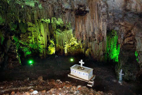
The Melidoni Cave (Σπήλαιο Μελιδονίου) lies about 1.8 kilometres north-west of the village at an altitude of some 220 metres, at the western end of the Talean Mountains (Ταλαία Όρη), 26 kilometres east of Rethymno. According to legend its first occupant was the bronze giant Talos, the guardian of Crete, whom the sorceress Medea finally brought down. Archaeological investigation – the French scholar Paul Faure dug here systematically in 1954, and rescue excavations followed in 1987 when the cave was fitted out for visitors – has shown that it was already a place of worship in Minoan times, apparently of a female deity; a Middle Minoan bronze axe came to light in 1940. In antiquity it was sacred to Hermes Talaios and to Talaian Zeus, and it remained a sanctuary into the Roman period. The finds, which run from the Neolithic to Roman times, are in the museum at Rethymno. Some 2,000 inscriptions survive on the walls, from the 1st century BC to the present.
In more recent history the cave is associated with a harrowing event. During the struggle for independence women and children from the surrounding district took refuge here from the Turks, while their husbands, fathers and sons waged guerrilla war against the Ottomans in the mountains; some thirty armed men defended the entrance. Some 340 women and children were shut inside. Troops under Hussein Bey besieged the cave for weeks; the summons to surrender was rejected by those within. When an assault failed, the commander had the entrance blocked with hay, brushwood, tree trunks and cloths soaked in oil and set alight. All those inside suffocated in the smoke. The event is usually dated to January 1824; the siege had begun at the end of 1823. Their bones rest in the first great hall beyond the entrance, called the “Hall of Heroes” (Αίθουσα Ηρώων) – a vast space 55 metres long, 44 wide and up to 25 metres high, where a stone ossuary holds the remains. A chapel of the Annunciation of the Mother of God has also been built there, and an eternal flame recalls the victims, whom the village commemorates every year.
From Melidoni the road leads off to the right to the new national road from Rethymno to Heraklion. Beyond the village of Exandis you continue east for a short distance and then turn left, down to the seaside village of Bali.
Bali
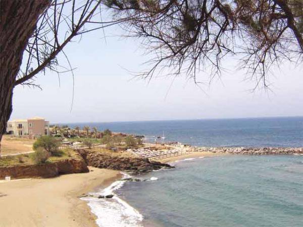
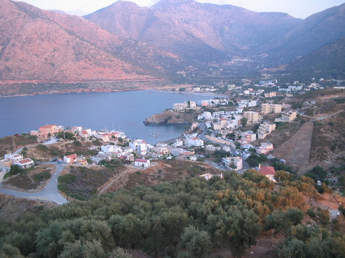
Bali is a quiet, picturesque resort at the head of the bay of the same name, 30 kilometres east of Rethymno and 43 west of Heraklion. Its name is usually derived from the Turkish word “bal”, honey – a reminder of the bee-keeping that once flourished here. The bay faces west and is well sheltered from the wind, so that the sea is almost always calm; the water is cooled by freshwater springs fed from the Psiloritis range. There is not one beach but a string of sandy coves – Livadi, the longest and busiest, then Varkotopos, Limani by the little harbour, and Karavostasis furthest out – all with sunbeds and parasols. The seabed shelves gently – an ideal place for families with children. Along the shore are numerous small tavernas and cafés where excellent Cretan dishes can be tried. Not far from the village lies Atali Monastery (Μονή Ατάλης). Somewhere in this bay the ancient town of Atali is thought to have stood, though it has not yet been found; Greek scholars look for the old harbour of Astali, the port of Axos, on the headland of Pyrovolopetra. During the revolt of 1866–1869 the sheltered bay was an important landing place for supplies to the insurgents.