The most complete guide to Crete: 221 places on the map, 23 routes and 49 articles — with photos, videos and the story behind every place. Everything is open and free: no sign-up, no paid sections and no advertising, open or hidden. You can install the guide on your smartphone as an app.
Routes drawn along real roads
Weather at every stop
Full-text search
“Near me” by geolocation
Create your own printable itinerary
Satellite, terrain, dark mode
Works offline
⌕
Searches 1.7 million characters of descriptions, not just names
—places
4regions
—routes
—with video
Search results
—
Interactive map
Find what is near you
Filters narrow the map and the list at once. Zoom out and pins group together.
Region
Category
Фильтры карты
Landmarks
Featured places
RegionCategory
Routes
Ready-made day trips
Individual places
Articles about landmarks
This route takes us from Rethymno due south to the shore of the Libyan Sea. On the way we see the magnificent landscape of Crete, meet villages with a character of their own, their people and their customs, and visit a string of sights – above all Preveli Monastery and the beach of the same name with its grove of Cretan date palms. In little more than 35 kilometres the scenery changes its face several times: from the wooded slopes of Mount Vrysinas, across the fertile uplands of the interior and through the narrow rock gorge of the Kourtaliotis, cut between the Kouroupa and Xiro mountains, to the bare brown coastal hills that drop steeply into the deep blue sea.
On the way from Rethymno to Preveli
The first kilometres: out of town and into the hills
We leave Rethymno at its southern edge by the road that leads to Agia Irini, Roussospiti, Chromonastiri and Myli. Within a few minutes the noise of the coastal town has dropped behind, and the road winds up the foothills of Vrysinas between olive groves and cypresses, gaining some 300 metres of height before the first villages. Anyone who wants to take these first stops without hurrying should allow half a day for them before going on south.
Agia Irini (St Irene)
The convent of Agia Irini probably grew up beside the cave dwellings of Byzantine hermits. It existed until the uprisings of the 19th century, was destroyed in 1866 and has been rebuilt since 1989; today it belongs to the Metropolis of Rethymno and Avlopotamos. The katholikon stands at the edge of a rocky spur; its unusual position, and the courtyard hewn from the rock with its cisterns, are part of the building history of the house.
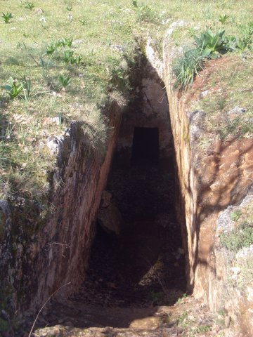
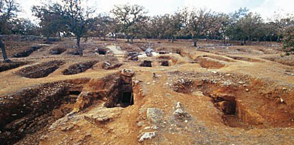
Armeni is a Late Minoan cemetery about nine kilometres south of Rethymno. Since 1969 more than two hundred chamber tombs cut into the rock have been investigated here – 232 at the latest count, besides a single corbelled tholos tomb that is older than the rest – most of them dating from between 1400 and 1200 BC. The family tombs, with their larnakes, weapons, jewellery and vessels, make it possible to study the funerary customs of Late Minoan society.
The miracle of the Cross of Preveli
According to the tradition of the monastery, German soldiers tried in 1941 to carry off from Preveli a fragment of the True Cross. The aircraft that was to take the relic to Germany could not leave the ground as long as it was on board; only after the holy object had been given back did the take-off succeed. The story lives on in the spiritual memory of Preveli and is closely bound up with the veneration of the monastery’s treasure.
Agia Irini is a small village on a hill that owes its name to the convent of the same dedication. Tradition has it that this was founded around 1362 and dedicated to St Irene; originally it was evidently a house for monks. In 1866 the Ottomans destroyed village and monastery, which then lay deserted for more than a century until, in 1989, Metropolitan Theodoros of Rethymno refounded it as a convent. Since then it has been inhabited and full of life again.
The convent is a place of great beauty; from its terraces there is a striking view over the whole of Rethymno and the Sea of Crete. The nuns practise traditional handicrafts – embroidery, weaving, icon painting – and a small exhibition of their work introduces the Cretan patterns and motifs of these crafts. Many of the pieces can be bought on the spot.
In 2011 the restoration of the three-aisled katholikon was completed. It is dedicated to the memory of the holy great martyrs Irene (central aisle), Euphemia (right-hand aisle) and Catherine (left-hand aisle). The iconostasis, the royal doors and the more recent proskynitarion of St Irene, of tulipwood, are the work of a craftsman from Chania who stands in a long tradition of woodcarving. The icons of the iconostasis and of the royal doors were painted by the sisters of the convent themselves. Besides the miracle-working icon of St Irene – a work of the hieromonk Nestor Vassalos, of 1930 – the church contains an old copy of the icon of the Panagia Eleousa (the Merciful) from Kykkos Monastery in Cyprus, which tradition traces back to the Evangelist Luke; it is a family heirloom of the late Metropolitan Theodoros. Here the faithful can also venerate relics of St Irene and St Euphemia and a fragment of the True Cross.
The katholikon does not lie, as is usual, in the middle of the monastic enclosure, but right at its edge, on the highest, south-eastern point of the holy rock, close to the precipice that opens on the east side. This suggests that Agia Irini was not originally planned as a monastery: the church was there first, and it was the church that drew the monks to this small hill. It was probably altered around 1755 and changed from a single-aisled into a three-aisled building. The three domes – one over each altar – point the same way, for they belong to the period of Ottoman rule. The pointed windows, on the other hand, point to the Venetian era, and chiefly to the years before 1600. A legend explains the alteration with the story of a monk who lived here and cured the daughter of the pasha of Rethymno; in gratitude he was given leave to rebuild the single-aisled church with three aisles – a permission that was by no means a matter of course under Ottoman rule.
This three-aisled church may well be a unique example of Cretan sacred architecture. A large part of it is hewn from the rock, and the rest is completed in masonry. Nor was the church alone made in this way: its courtyard, and two cisterns in which rainwater was collected, are cut out of the stone in the same space. In this way the slope of the ground was evened out and the level surfaces needed for the use of the church were obtained.
The solemn consecration of the katholikon after the completion of the restoration was performed on 20 August 2011 by His Beatitude Theodoros II, Pope and Patriarch of Alexandria and All Africa – a Cretan by birth and a spiritual son of the well-known Metropolitan Theodoros of Rethymno who had once refounded the convent. The patronal feast of St Irene is kept on 5 May.
Roussospiti
Up a gently rising, thickly wooded slope of Vrysinas we come after only two kilometres to the village of Roussospiti (Ρουσσοσπίτι), which lies at about 300 metres, nine kilometres south-east of Rethymno, and is notable for the Venetian architecture of its old houses. The name is explained either as the “red house” or, less soberly, as the house a Russian woman is supposed to have built here; a Venetian count of 1583 recorded 157 inhabitants, and there are a little over five hundred today. Among the houses a three-storeyed mansion with a vaulted carriage entrance stands out. The village is also known for its graceful Venetian fountain, a 17th-century work whose spout is a lion’s head, from which the inhabitants draw water to this day.
The mansion stands next to the Church of the Presentation of the Virgin (Naos ton Eisodion), a single-chambered building of the early 14th century in which masterly wall paintings by an unknown artist have survived, a Crucifixion among them. Also worth seeing is a Venetian chapel of the 17th century with Corinthian capitals, built of porous tufa. The village feast falls on 26 July, the day of St Paraskevi. From Roussospiti we recommend a detour of three kilometres eastwards to the village of Chromonastiri.
Chromonastiri
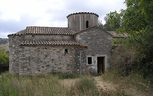
Chromonastiri (Χρωμοναστήρι), a well-preserved traditional village some eleven kilometres south-east of Rethymno at the foot of Vrysinas, at a height of 360 metres, is known for two outstanding churches and a Venetian country villa. Its name is generally thought to reflect the pairing of the village with the monastery of the Panagia Kera. The Church of St Eftychios (Naos tou Agiou Eftychiou) lies near the village, at the hamlet of Perdiki Metochi. It has fragmentary wall paintings of the 11th century in the so-called Macedonian style – the saints and Christ are given strikingly large eyes – and elaborate brickwork. It is a classic Byzantine cross-in-square church with a single nave and is considered one of the oldest surviving churches in the district.
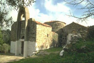
Two kilometres south-east of the village stands the Church of the Panagia Kera (Naos tis Panagias tis Keras), an 11th-century foundation. It too is famous for its accomplished frescoes of the 11th century, the most impressive of which shows the Mother of God herself. The architecture is unusual as well: the church is three-aisled and barrel-vaulted, with a side aisle built on at right angles to the main body.
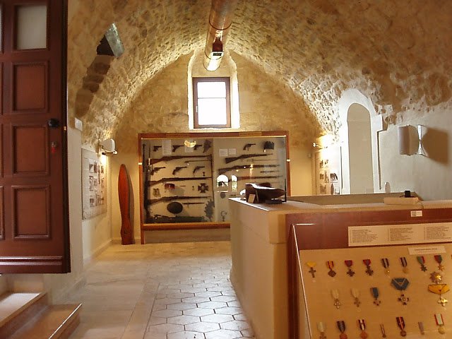
In the same district lies the Venetian country villa of the Clodio family, restored some years ago. It was built in 1610 as the summer seat of a noble Venetian-Cretan family who had grown rich as tax collectors. After the Ottoman conquest it became the residence of a Turkish aga and was known as the Konaki, and his descendants lived in it until the Ottomans left in 1898. The last owner, Alkiviadis Kotzampasis, gave it to the village in 1985; the army took it over in 1997 and rebuilt it by 2002. On the villa a Venetian coat of arms, the so-called Gate of the Nobles, medieval water channels, storerooms, presses for wine and oil and an Ottoman bath survive. Since 21 May 2010 it has housed the Military Museum of Crete, a branch of the War Museum in Athens. On show are Venetian dress and weapons, arms from the War of Independence of 1821 down to the Second World War, a separate section on the Battle of Crete, historic uniforms and, in the grounds, aircraft, tanks and artillery pieces.
We return to Roussospiti. Anyone in the mood for a walk through unspoilt woodland can reach Myli from Chromonastiri by a paved path in about two kilometres; the gorge begins just north of the village.
Myli (the mills)
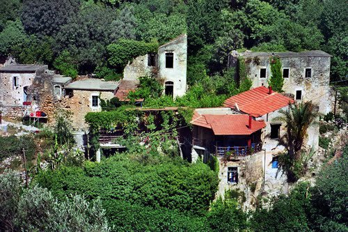
Myli is a tiny hamlet in dense woodland, in two clusters – Ano and Kato Myli, upper and lower – with watermills on a fast-flowing stream that gathers the water of the northern slopes of Vrysinas; it is to the mills that it owes its name. Some thirty are said to have worked in the valley at one time; the inhabitants were millers almost to a man, and ground the grain of the whole surrounding country. In time no more than about thirty people still lived in the few houses and ran the mills. The last inhabitants left the old village in 1972 for fear of rockfalls and moved to Nea Myli, built on higher ground to the west. Today one mill has been restored and shows the old technique, and in one of the houses a café looks after walkers.
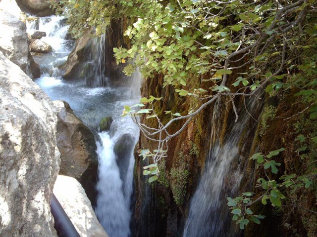
The springs of Agios Antonios and Pente Parthenes feed the stream all year round; they form small waterfalls and pools in the shade of mighty plane trees. In the rock walls of the gorge are several cave churches, among them those of St Anthony, St John, the Five Virgins – the cemetery church of the old village – St Paraskevi and St Nicholas. The gorge itself is about 2.5 kilometres long and falls 190 metres; the signposted path is among the easiest gorge walks on the island, and two and a half hours cover the whole of it at a leisurely pace. A short stroll through the thick wood on the paved path, and the sight of the fairy-tale cottages and mills of Myli, leave a lasting impression. Afterwards we return to Roussospiti, from where the road continues up the slopes of Vrysinas. With every bend a new landscape opens.
Armeni
The village of Armeni (Αρμένοι) owes its name, tradition says, to its first settlers, Armenians in the army of the Byzantine emperor Nikephoros Phokas, who freed Crete from the Arabs in 961. After the victory the emperor allowed an Armenian contingent to settle on this fertile ground. Apart from its fine landscape, the place has become famous for one of the most important archaeological discoveries of recent decades.
About a kilometre north of the village, on a low rocky hill covered with oaks and olives, tombs of the Minoan period were discovered. Each tomb consists of two parts: a sloping passage with steps and a roomy burial chamber, whose entrance was closed with stone slabs or rubble walling; some chambers have benches, a central pillar or niches. More than 220 tombs have already been uncovered, and the work continues. Most of the burials had not been robbed – only four tombs are known to have been plundered before the end of the Minoan age – so that a great number of valuable finds came to light, which testify to the high level of development the Minoans had reached. It is regarded as the most intact Minoan cemetery yet excavated.
Among them are painted clay larnakes with scenes of everyday life, religious symbols such as the horns of consecration, and hunting scenes with strange animals – on one, four hounds pursue two stags and a wild goat, the agrimi – together with numerous seals, vessels, weapons and pieces of jewellery of great skill: bronze daggers, swords and spearheads, gold beads, silver rings and an ivory comb that was probably imported from Egypt or Syria. These finds, some of them now displayed in the Archaeological Museum of Rethymno and others in Chania, have given scholars invaluable knowledge of the period from 1400 to 1200 BC. Which town the cemetery belonged to is still unknown – the village of Kastellos, where traces of occupation of the same date have been found, has been proposed; its size implies an important settlement, which may perhaps be connected with a copper deposit some four kilometres further south. The fenced cemetery is as a rule open during the day, and the principal tombs are lit; a walk among the open tomb entrances under old oaks is a curiously quiet experience. The steps of the dromoi are steep and uneven, so sound shoes are advisable. Twelve kilometres beyond Armeni, Koxare lies on our way.
Koxare
The village of Koxare (Κοξαρέ) lies at the northern entrance to the Kourtaliotiko Gorge and, because of its commanding strategic position, was more than once the scene of fighting against Ottomans and Germans. The wall paintings in the little church of St George (Eklisaki tou Agiou Georgiou) are worth seeing. On its walls is a representation unique in the whole of Greece: the Holy Spirit, in the form of a dove, proceeding from the mouth of God the Father. It draws connoisseurs of icon painting from all over the world.
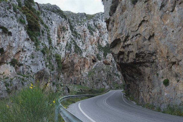
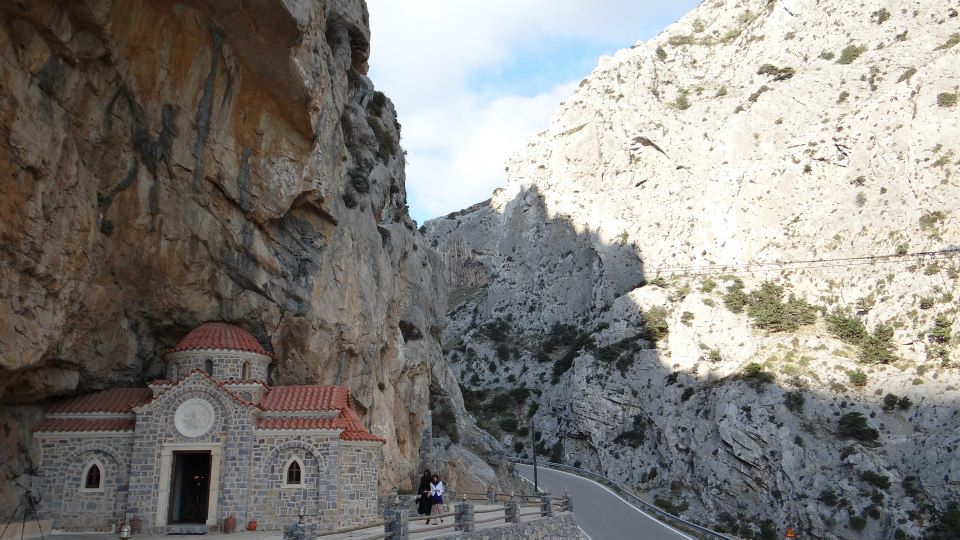
The Kourtaliotiko Gorge is about two and a half kilometres long, and its rock walls tower up to 600 metres. Its name is usually derived from the clapping, rattling noise (kourtala) that the wind makes in the clefts and high caves of the rock; it is heard best a few paces inside the northern entrance. Through the gorge flows the Kourtaliotis, one of the few rivers in Crete that carry water all year round, on its way south between the Kouroupa and Xiro mountains to the sea at Preveli. A stone stairway leads down from the road to the chapel of St Nicholas and to the springs of the river, near which the water drops in a fall some forty metres high; according to legend the saint made them gush from the rock with his staff. Rare birds of prey nest in the caves of the cliffs – the lammergeier, or bearded vulture, among them – which is why the gorge is protected as an important habitat, forming with Mount Kedros one of the country’s designated Important Bird Areas. The Cretan date palm (Phoenix theophrasti) grows wild along the stream.
Lovers of mountain scenery can walk through the gorge on the bank of the Kourtaliotis and will be richly rewarded. It should be borne in mind, however, that such an expedition can take six to eight hours there and back and is to be recommended only to walkers with stamina, and the path is not one for the days after heavy rain.
We, however, skirt the gorge by the road, which runs high above the river and offers fine views into the depths, and stop at the mouth of the gorge in the village of Asomatos, where the road to Plakias branches off to the west.
Asomatos
Asomatos (Ασώματος) lies where the Kourtaliotiko Gorge opens out, on the slopes of Mount Kouroupa, and is one of the five settlements that make up the municipal unit of Foinikas. It takes its name from a small Byzantine church of the Archangel Michael, captain of the “bodiless powers” (asomates dynameis) – the angelic host, which Orthodox tradition thinks of as pure spirit. The village first appears in the records in 1577, when Francesco Barozzi lists it as Assomato de Mega Potamo, “Asomatos of the Great River”, after the stream that runs down from the gorge to the sea at Preveli; a Venetian census of 1583 counted 89 inhabitants.
The villagers are proud that the celebrated Tsouderos family, which has given Crete a long line of distinguished figures, comes from Asomatos. Among them were Georgios Tsouderos, a military leader in the War of Independence of 1821, and Melchisedek Tsouderos, abbot of Preveli from 1803 and a member of the Philiki Etaireia, the secret “Society of Friends” that prepared the Greek rising. It was he who helped to set the revolt alight in Crete, and he paid for it with his life in battle in February 1823.
Do call at the unusual private Historical and Folklore Museum that the village priest, Michail Georgoulakis – Papa Michalis to everyone here – set up in his own house; it is also signposted as the Oriseum. He spent his whole life gathering the exhibits, which bear witness to every chapter of Cretan history and culture: weapons and documents, household goods and furniture, textiles and costumes, farm implements, church plate and other ecclesiastical relics, much of it from the last decades of Ottoman rule, together with old banknotes, books and faded photographs. It is the kind of collection in which nothing is behind glass that could be hung on a nail instead, and half an hour passes quickly. About two kilometres beyond Asomatos we turn left at a junction, and the road brings us to the monastic complex of Preveli.
Preveli Monastery
According to tradition the monastery was founded at the end of the 10th or the beginning of the 11th century by a priest-monk of the Prevelis family, and it remains one of the great religious centres of Crete, some 37 kilometres south of Rethymno and directly subject to the Ecumenical Patriarchate of Constantinople.
Foundation and first buildings
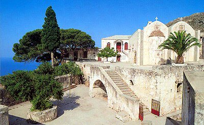
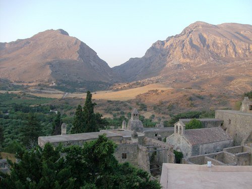
The Monastery of St John the Baptist at Preveli, which lies beyond the green Kourtaliotiko Gorge, greets its visitors with an austere mountain landscape that breaks off in sheer cliffs to the sea. Tradition places its foundation at the end of the 10th or the beginning of the 11th century and credits it to a priest-monk of the Prevelis family; another story has a feudal lord named Prevelis turning a small chapel of St John into a monastery. The early centuries are scarcely documented: the oldest surviving inscription dates from the 17th century – a fountain in the rear monastery carries the year 1701 – though a bell dated 1594 points to a greater age. Preveli is an important religious centre, and it is bound up with the legend of the miraculous finding of an icon of the Mother of God, which came to be known by the epithet Antifonitria, “she who answers”.
The Lower Monastery
Kato Moni
Ioannou Prodromou Preveli – the Lower Monastery of St John the Baptist at Preveli. Beyond the green Kourtaliotiko Gorge the landscape changes abruptly. Ahead lie harsh, low, bare hills that drop in vertical cliffs straight into the sea. Two colours rule the scene: the brown of the hills and the blue of the water. On the way to the monastery we cross a stone arched bridge over the Megalos Potamos, built in 1850 by the monks themselves, who in the same years, between 1850 and 1852, also bridged the neighbouring Bourtzoukos stream. The monastery was founded by a priest-monk named Prevelis, of the well-known Rethymno family of that name, at the end of the 10th or the beginning of the 11th century. In 1646, in the first years of the Ottoman conquest of the island, the Turks razed it almost to its foundations; descendants of the same family rebuilt it in 1678. It was laid waste again during the rising of 1770, and was shaken by an earthquake in 1810. In the 18th century a new group of buildings arose three kilometres from the old monastery and was given the name Piso Monastiri tou Ioannou Theologou, the Rear Monastery of St John the Evangelist. The Lower Monastery is no longer inhabited, and its roofless cells and storerooms stand open to the sky, but it merits a stop for the 19th-century frescoes by the noted icon painter Merkourios, which survive on the walls of the monastery church.
The Upper Monastery
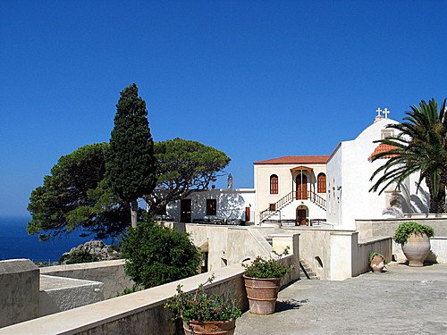
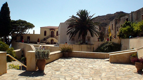
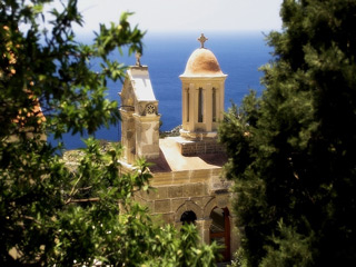
The Upper or Rear Monastery (Piso Moni Preveli), still a working community of monks, draws pilgrims in great numbers. It stands 170 metres above sea level on the rocky coast, on the cliffs of Mount Mesokorfi, and the view across the boundless blue of the Libyan Sea has something close to enchantment about it. The monastery covers a good deal of ground, its ranges laid out on three sides of a court in the shape of the Greek letter Π with the church in the middle: the cells of the monks and abbots, storerooms, refectories, bakeries, guest quarters for pilgrims and the monastery church with its tall belfry – all of it rewarding and instructive to look round. The katholikon was built in 1836, under Abbot Nilos Moschovitis, who had begun the work of renewal after the disasters of 1823; with its characteristic triangular bell gable, it is divided into two aisles and has two altars. The left is dedicated to the Annunciation of the Mother of God, the right to St John the Theologian. Inside, the eye is caught by a richly carved wooden iconostasis and by paintings made around 1841 by Merkourios, a painter from Santorini. The monastery museum is known for its fine collection of portable icons, the oldest going back to the 16th century and the best of them 19th-century work by well-known icon painters of the day such as Michail Prevelis, Merkourios and Vivilakis. The principal feast of the monastery, in honour of St John the Evangelist, is kept on 8 May.
Preveli also played an outstanding part in the Cretans’ struggle for freedom. Abbot Melchisedek Tsouderos, a member of the Philiki Etaireia, was among those who prepared the ground for the rising in Crete in 1821 and fell in battle on 5 February 1823; in reprisal the monastery was sacked. In the revolt of 1866 it served as a refuge for the insurgents – fourteen of its monks are said to have taken up arms themselves – and for this the Ottomans set it on fire the following year. Rebuilding did not begin until 1897.
The Second World War
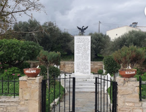
In May 1941, when German paratroops took Crete in a surprise assault, soldiers of the British Commonwealth who had been cut off on the island – British, Australians and New Zealanders – found sanctuary in the monastery. Under Abbot Agathangelos Lagouvardos the monks hid the men by day and led them down to the shore by night, where submarines took them off to safety in Egypt; several thousand found shelter here in all. In the courtyard, to the right of the Holy Gate, stands a fountain put up by Australians in 1991 in gratitude to the monastery. One of the men it sheltered, the Australian corporal Geoff Edwards, later gave the name Prevelly to a settlement on the coast of Western Australia. For the help it had given, the monastery was occupied and ransacked by the Germans on 25 August 1941, and the monks were taken to a camp near Chania. After the war it was restored, and it is inhabited to this day. To every Cretan it stands for love of liberty, courage and heroism; a memorial with the bronze figures of a monk and a soldier, beside the road above the monastery, recalls those months.
The museum
The museum preserves rare documents and manuscripts, among them a bull on parchment of 1798 – it was Patriarch Gregory V who, in 1789, had placed the monastery directly under the patriarchal throne – and monastic registers of the 19th century, together with liturgical vestments and church plate. But it also holds one of the great relics of Christendom: a fragment of the wood of the Cross of Christ, which tradition says came from Constantinople. Its precious reliquary, a cross known as the Timios Stavros, is made of an exceedingly rare wood and adorned with gold and precious stones. A miracle story is attached to it. It belongs to 1941, when the Germans occupied the monastery, confiscated the cross on 13 September 1941 and meant to carry it off to Germany. For one reason and another the aircraft could not get off the airfield. Only when the relic had been handed back did the machine take off; in some versions the cross was first given to the police in Chania and returned from there to the monastery. An older legend tells much the same of the year 1823: pirates are said to have acquired the cross then, but off Lemnos their ship lay as if spellbound for three days, though the wind was fair, until they gave the relic back to the monks. It remains in the monastery to this day.
The beach and lake of Preveli
A place where one can swim in the sea and in fresh water within a few strokes of each other – and one of the most singular beaches in Crete.
Finikas beach, or the lake of Preveli
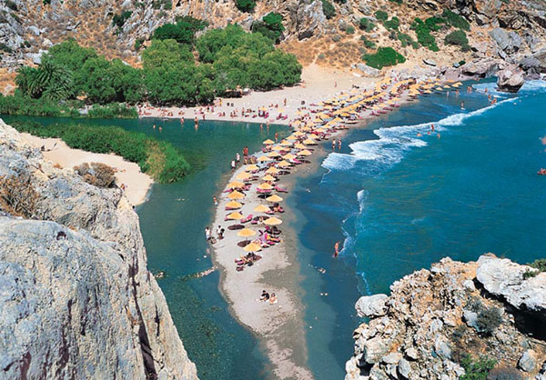
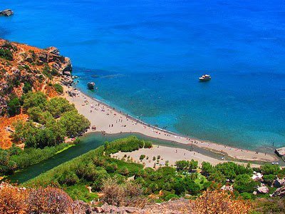
Roughly halfway between Kato Moni Preveli and Piso Moni Preveli – between the two monasteries, that is, about a kilometre and a half beyond the lower one – a steep path turns off to the left and drops to the shore, to the beach of Limni Preveli. From the car park above the sheer cliffs the descent takes fifteen to twenty minutes; the climb back in the midday heat is a good deal harder, and stout shoes and plenty of water are advisable. Go early or late in the day if you can. The path leads to an enchanting spot: the river, here called the Megalos Potamos and in its upper course the Kourtaliotis, forms with its fresh water a small lake, more of a pond, only ten metres short of its mouth, ringed by pale sea sand; the sea bed just offshore is stony, the water very clear and noticeably cool. Upstream the water runs on between rock walls far inland, so that one can wade for some distance along the cold, clear river in the shade of palms, willows, oleanders, carobs and reeds. At the mouth itself are several “baths”, as local people call them: small hollows floored with pebbles and little stones.
The banks and the river bed are lined by a large grove of Cretan date palms, Phoenix theophrasti, a species formally described only in 1967 by the Swiss botanist Werner Greuter and named after Theophrastus, the ancient naturalist who had written of the palms of Crete. It grows to as much as 15 metres, usually on several slender trunks, with grey-green fronds two to three metres long; its small yellowish-brown dates are thin-fleshed and fibrous and hardly worth eating. The palm occurs naturally only in a few places in Crete and nearby islands and on the south-western coast of Turkey, and the grove at Preveli, covering some ten acres, is the second largest on the island after Vai. To the palms the place owes its other name, Finikas, and it used to be thought of as a Garden of Eden, a piece of African landscape on the coast of Crete. On 22 August 2010 a devastating wildfire destroyed the grove almost entirely. Yet the palms began to shoot again from their rootstocks after a short time, and today the grove has largely grown back – a striking example of the resilience of the species. For all that, Preveli beach is extremely popular. Besides the mountain path from the monastery it can be reached from the sea, by water taxi from neighbouring Plakias, from Agia Galini and from Sfakia – provided, of course, that the weather allows and the sea is calm. A shorter approach comes in from the west by a dirt track and the little beach of Drymiskiano Ammoudi; it saves effort but misses the view from the cliff top. Near the river mouth stand two pretty churches: St Savvas (Naos tou Agiou Savva), of the 19th century, and St Photini (Naos tis Agias Fotinis), of the 14th.
Sights around Preveli
Near Preveli
We go back to our junction on the Asomatos road, turn right this time, and come down to Plakias.
Plakias beach
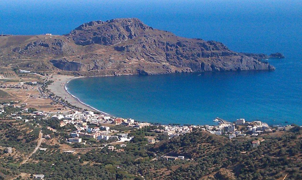
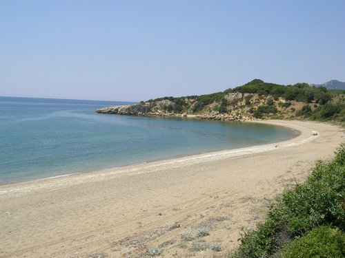
Some twenty-five years ago there was only a small village here; today Plakias (Πλακιάς) is a fully fledged resort with everything a holiday requires – hotels, restaurants and bars. Its beginnings were humbler still: a jetty and a few houses put up in the late 19th century by fishermen from Sellia, and as late as the census of 1961 it was recorded as the permanent home of just six fishermen. The name is connected with the Greek for “flat” and with the plakes, the flat stones of the shore; the place stands on the level fan of debris washed out of the Kotsifou Gorge directly to the north. In the summer season it hums with life. It owes this to its great horseshoe of a beach, known as Gialia, which runs for 1.3 kilometres eastwards towards Cape Mouri: fine golden sand, shaded here and there by tamarisks, and a sea bed that shelves very gently, which makes it particularly good for families with children. High, bare mountains frame the bay and give it an unusually dramatic backdrop.
Everything is laid on for water sports. Part of the beach lies in a steady sea breeze and is therefore a paradise for surfers. At the eastern end, where the vertical cliffs of Paligremnos rise to a great height and attract rock climbers, there are two caves in the rock which local people call Gonates tou Digeni, the “Knees of Digenis”; a narrow passage joins them, and nearby are tunnels once cut to carry coal down to cargo ships. Legend has it that the fabled hero Digenis Akritas, the giant of the Byzantine heroic epics, knelt here to drink from a spring, and that the earth gave way beneath his weight. He is the “twice-born border lord” of a 12th-century verse romance, son of an Arab emir and a Byzantine noblewoman, and Cretan folklore has left traces of him elsewhere too – his footprint is shown on Psiloritis. The remains of an ancient town are also thought to lie near Plakias, which appears in the sources as Lamon or Phoinix Lampeon; Roman finds have turned up, and a large cemetery of some five acres was discovered beside the church of the Zoodochos Pigi.
We leave Plakias and drive back the way we came, but after a kilometre, at the village of Finika, turn off to the north-west to visit four places: Myrthios, Sellia, Rodakino and the Kotsifou Gorge (Farangi tou Kotsifou).
Myrthios
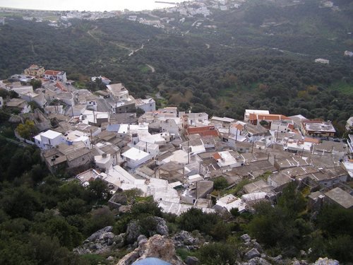
It is worth driving up to the village of Myrthios (Μύρθιος), which clings like an amphitheatre to the southern slope of Kouroupa: the whole of the Libyan Sea and the bay of Plakias then lie spread out below – a breathtaking sight, especially in the late afternoon, when the light softens. The village is an old one, its recorded history, like that of Sellia, reaching back to the Byzantine reconquest of the 10th century. In the narrow lanes between whitewashed houses, small tavernas with terraces invite one to linger. Here too is the church of the Transfiguration of the Saviour (Eklisia tis Metamorfosis tou Sotira), whose frescoes include a rare depiction of the torments of sinners in hell. Another church, St Charalambos (Eklisia tou Agiou Charalambou), is known for its carved iconostasis of the 19th century. From Myrthios it is eight kilometres to Sellia.
Sellia
The road to Sellia (Σελλιά) should be taken slowly, with stops. The sharp contrast between the stern aloofness of the White Mountains (Lefka Ori), some of whose summits carry snow even into summer, and the lush green of the olive groves in the valley leaves no one unmoved. The village itself lies on the southern side of Mount Xyli at a height of 280 metres, on a saddle between two ridges – sela, “saddle”, is the origin of its name – so that it looks down on the bay of Plakias on one side and the cove of Souda on the other, and on a clear day out to the island of Gavdos. It is said to have come into being around 1200, when scattered hamlets drew together for protection against corsairs; its main church, of the Dormition of the Virgin, was completed in 1886. They say there is no better place from which to watch the sunset, which lends a thousand shades to the Libyan Sea and to the bare, seemingly lifeless mountains round about. The landscape then recalls the paintings of van Gogh – and a glass of Cretan raki only heightens the effect. From Sellia the road runs west to the village of Rodakino.
Rodakino
Rodakino (Ροδάκινο), some 45 kilometres from Rethymno, is a village steeped in history and dear to every Cretan. Here, on 24 May 1821, in the church of St George on the height of Kourkoulis, the abbot of Preveli, Melchisedek Tsouderos, blessed the banner of the rising against Ottoman rule, which was thus raised in Crete for the first time; the day is still kept as a local anniversary. The village is in two parts, about a kilometre apart and separated by a ravine with the Rikintos stream: Ano Rodakino (Upper Rodakino) at around 220 metres and Kato Rodakino (Lower Rodakino) at around 120 metres. The name, which means “peach” – after a tree, it is said, that flourished here in spite of the dry ground – is documented as early as 1299, in a Venetian treaty. In the revolt of 1866 the bay of Korakas below was used more than once for landing munitions. Rodakino made history in the Second World War as well. The Germans burned the village on 20 August 1943; and on 14 May 1944 General Heinrich Kreipe, abducted near Heraklion on the night of 26–27 April by Cretan resistance fighters and the British officers Patrick Leigh Fermor and William Stanley Moss, was taken off from Peristeres beach, just west of Rodakino, by a Royal Navy motor launch and carried to Mersa Matruh in Egypt. From Rodakino, too, the wide views leave an unforgettable impression, and the nearby beaches of Korakas – fine grey pebbles and very clear water, two kilometres below the village – Polyrizos and Peristeres are an invitation to swim.
Anyone in the mood for a walk through the little Kotsifou Gorge, which begins at the village of Kanevos and opens towards the bay of Plakias, has the chance to see the tiny church of St Nicholas (Naos tou Agiou Nikolaou), built into a niche in the rock beneath an overhang in an exceedingly picturesque spot. The gorge is named after the blackbirds (kotsifi) that nest in its crags. The road, built between 1951 and 1953, follows the ravine, so that its steep walls can be experienced from the car as well.