Agios Nikolaos to Sitia: the coast road, Faneromeni Monastery and the east of Lasithi
The most complete guide to Crete: 221 places on the map, 23 routes and 49 articles — with photos, videos and the story behind every place. Everything is open and free: no sign-up, no paid sections and no advertising, open or hidden. You can install the guide on your smartphone as an app.
Routes drawn along real roads
Weather at every stop
Full-text search
“Near me” by geolocation
Create your own printable itinerary
Satellite, terrain, dark mode
Works offline
⌕
Searches 1.7 million characters of descriptions, not just names
—places
4regions
—routes
—with video
Search results
—
Interactive map
Find what is near you
Filters narrow the map and the list at once. Zoom out and pins group together.
Region
Category
Фильтры карты
Landmarks
Featured places
RegionCategory
Routes
Ready-made day trips
Individual places
Articles about landmarks
The road from Agios Nikolaos to Sitia follows the north-east coast of the regional unit of Lasithi, and in the space of a single day it links the still-inhabited monastery of Faneromeni, ancient settlements, a succession of seaside villages and the archaeological site of Gournia. It is at its most impressive in the morning, when the light alters the colours of rock and sea from one minute to the next and the mountains above Mirabello Bay are still wrapped in a thin haze.
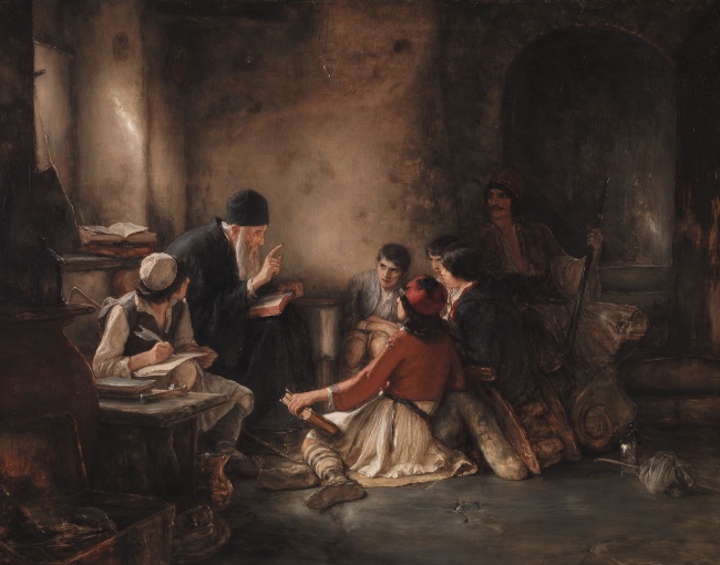
Faneromeni belongs to the Metropolis of Ierapytna and Sitia. Its principal church, the katholikon, is dedicated to the Dormition of the Mother of God and to the Life-giving Spring (Zoodochos Pigi), and during the centuries of Ottoman rule a clandestine school was kept here. Just as much a part of the monastery’s historical memory is the role it played as a place of refuge and as a prop of the Cretan uprisings.
Towards the north-eastern end of the route, off the bay of Sitia, lie the Dionysades (Διονυσάδες), four uninhabited islands that are awkward to reach: the two larger ones, Gianysada and Dragonada, and the rocky islets of Paximada and Paximadaki. Gianysada is the southernmost of the group and Paximada the northernmost. They lie some 16 kilometres north of Sitia and about 12.5 kilometres from the lighthouse on Cape Sidero, cover a little over five square kilometres between them and rise to 127 metres on Gianysada. Tradition derives their name from the god Dionysus, who is said to have been worshipped here – the name is an ancient one, and Diodorus Siculus has the god himself create the islands off Crete – and in antiquity they belonged to the city of Itanos. On Dragonada, the island with a small landing place, a scrap of beach and a chapel of St Anthony, traces of settlement and gravestones of the Early Christian period have been found; there is a cave on its eastern side, and columns of rock stand out of the sea off its western shore. The islands form part of the Natura 2000 network of protected areas, are designated a wildlife refuge and are listed by BirdLife International as an Important Bird Area.
Seabirds and migrants nest here, among them Eleonora’s falcon, in one of the significant colonies of the Mediterranean – around 600 breeding pairs – and Scopoli’s shearwater, alongside the smaller Yelkouan shearwater; lesser kestrels pass through on migration. The falcons are summer visitors only, leaving in autumn for their winter quarters in Madagascar. The Dionysades are the scene of one of the longest-running bird-monitoring programmes in Greece, begun by German scientists in 1963 and directed for decades by the ornithologist Dietrich Ristow. The islands can be reached only by boat from Sitia, and anyone who lands must observe the strict conservation rules, above all during the breeding season in late summer.
The route
The route starts in Agios Nikolaos and keeps to the Sitia road. Along the way there is a rocky coast broken by coves and beaches, the monastery of Panagia Faneromeni, ancient Gournia and the small villages of eastern Lasithi. An early start is best: the outlines of shore and mountain are then at their sharpest, and the heat of the day is still a long way off.
Leave town on the main Agios Nikolaos–Sitia road and, after about 17 kilometres, turn off at a junction signposted “Moni Faneromenis”. A narrow, twisting but surfaced road then climbs to the monastery, which stands at around 540 metres on a precipitous slope in the foothills of the Dikti Mountains – on the north face of Mount Stavros, between Gournia and Pachia Ammos and high above the Minoan town. The whole drive from Agios Nikolaos comes to some 24 kilometres.
The monastery of the Virgin Revealed (Faneromeni)
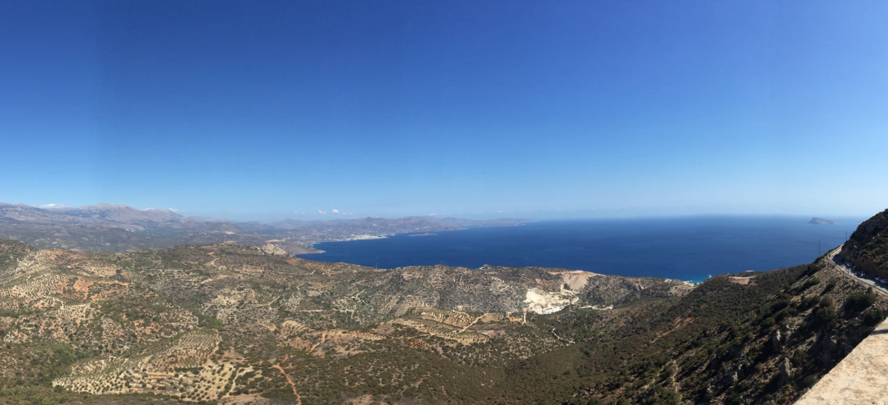
Faneromeni Monastery (Μονή Παναγίας Φανερωμένης) is inhabited to this day: a community of monks living under the coenobitic rule, also known locally as the Panagia of Gournia. It stands in a wild, rocky landscape riddled with caves and ranks among the most important places of pilgrimage in eastern Crete. From its terrace the eye takes in Mirabello Bay, the isthmus of Ierapetra and, in the distance, the town of Agios Nikolaos – a view that would justify the drive on its own.
When the monastery was founded is not known, and the buildings themselves give no answer. It probably goes back to the middle Byzantine period, that is, to the years between 961 and 1204; by the 13th century at the latest its existence is securely attested. Local tradition has it that Cretan leaders gathered here in 1282 to discuss the struggle against Venetian rule. The present complex grew up piecemeal, climbing the slope on half a dozen levels with the cave church on the fifth. Its fortress-like appearance and its principal buildings date largely from post-Byzantine times, chiefly the late 16th and the 17th century – a restoration is recorded in 1624 – and parts of it were altered again by heavy-handed work in the middle of the 20th century.
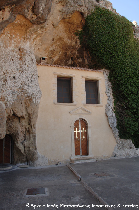
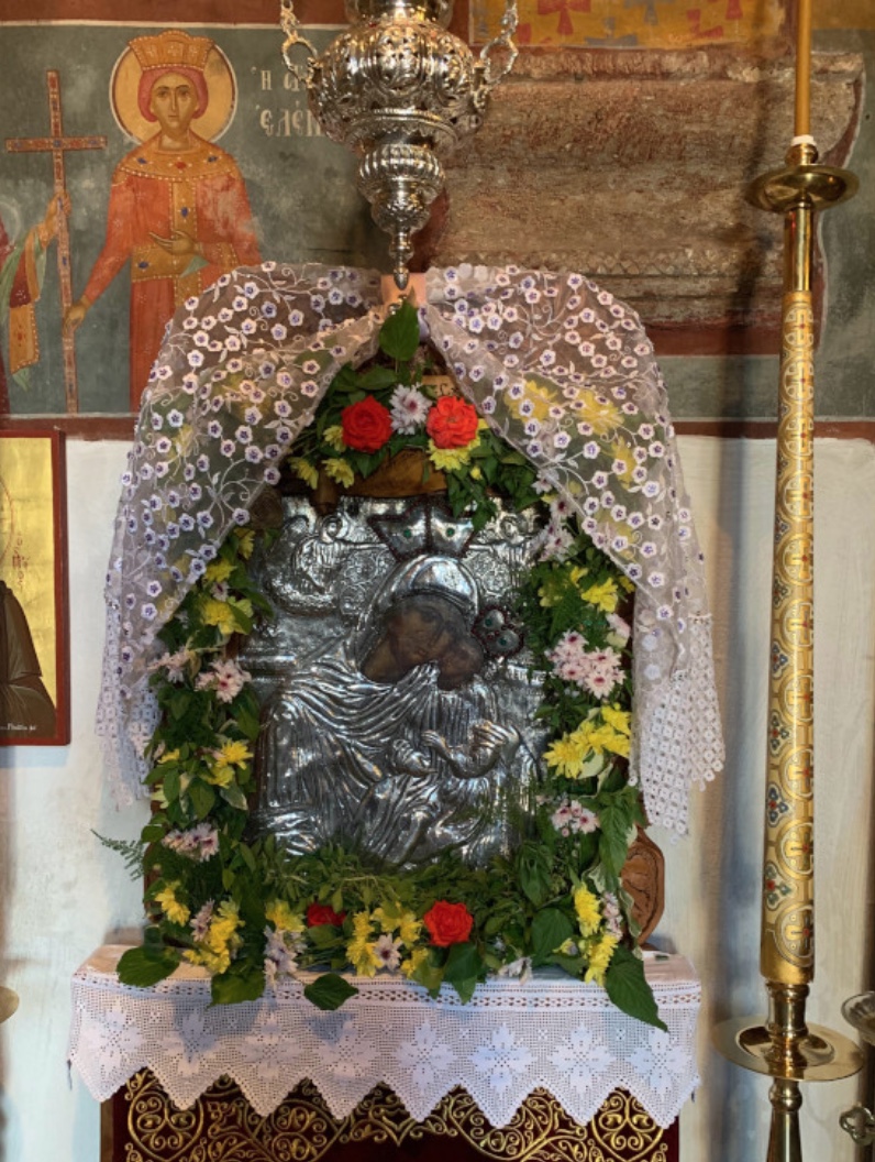
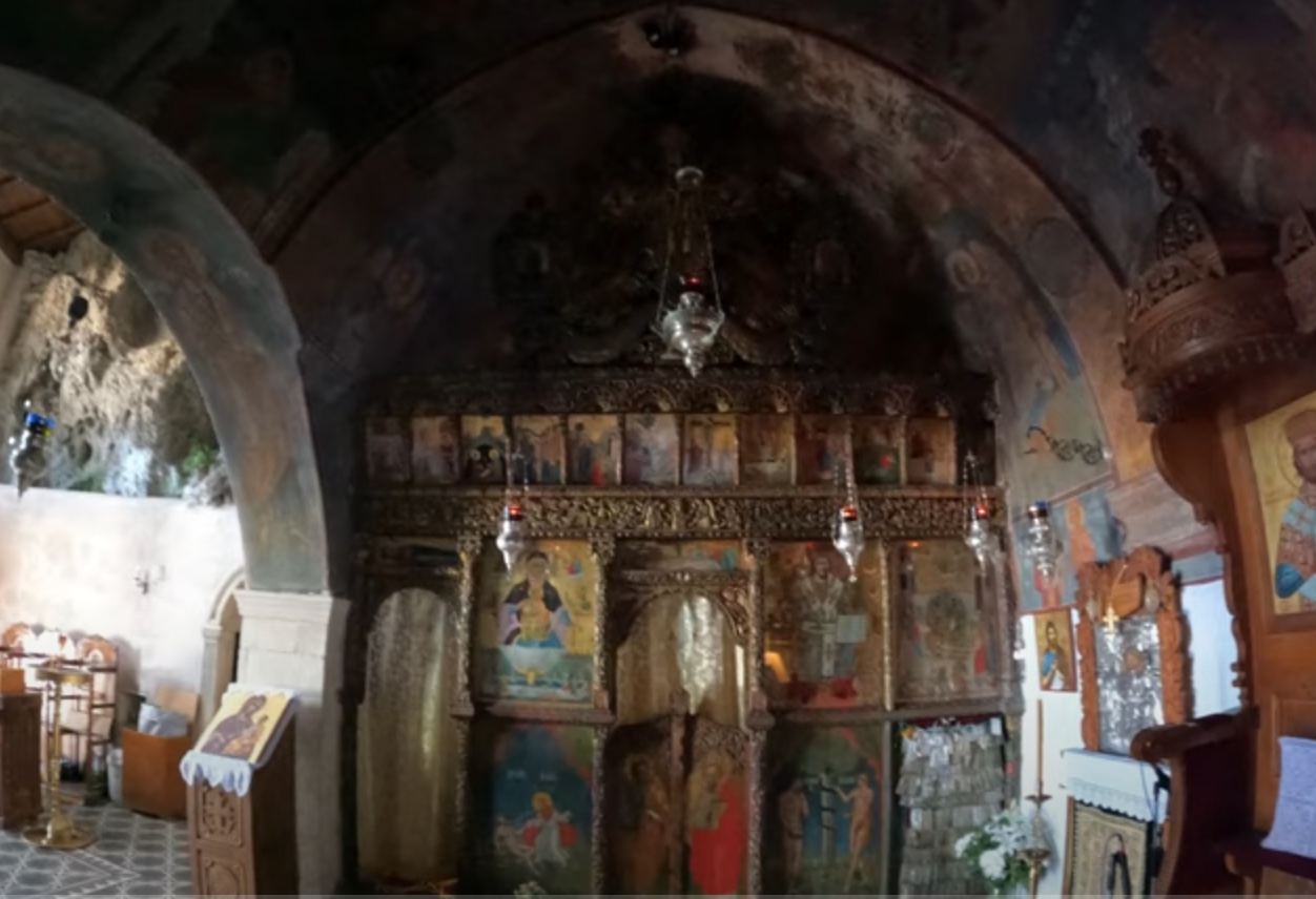
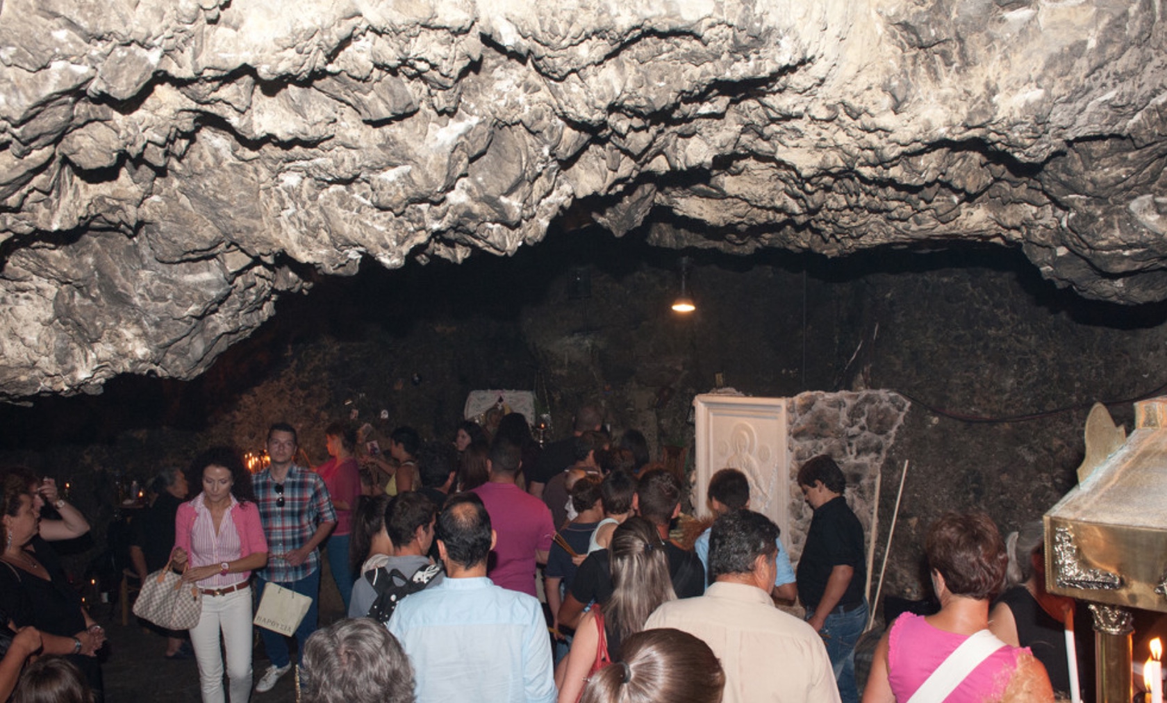
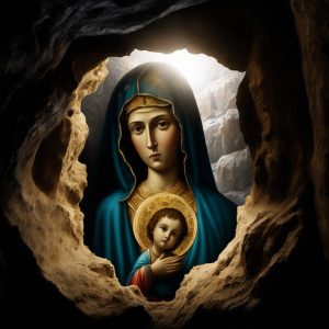
The katholikon is built into a natural cave beneath an overhanging cliff and is dedicated to the Dormition of the All-Holy Mother of God and to the Life-giving Spring. It is a two-aisled church of the late Venetian period, with a narthex, a nave under a pointed barrel vault and the agiasma, the place of the holy water; its wall paintings are blackened by fire, the result, it is thought, of a Turkish attack. Four ranges of buildings enclose a narrow courtyard; the rectangle measures roughly 49.5 by 24.5 metres. Outside the enclosing wall are farm buildings and a guest house. The cave and its spring were the kernel of the monastery and account for its name: Faneromeni means “she who has appeared” or “the revealed one”, for tradition says that the icon of the Mother of God showed itself to a shepherd on this very spot.
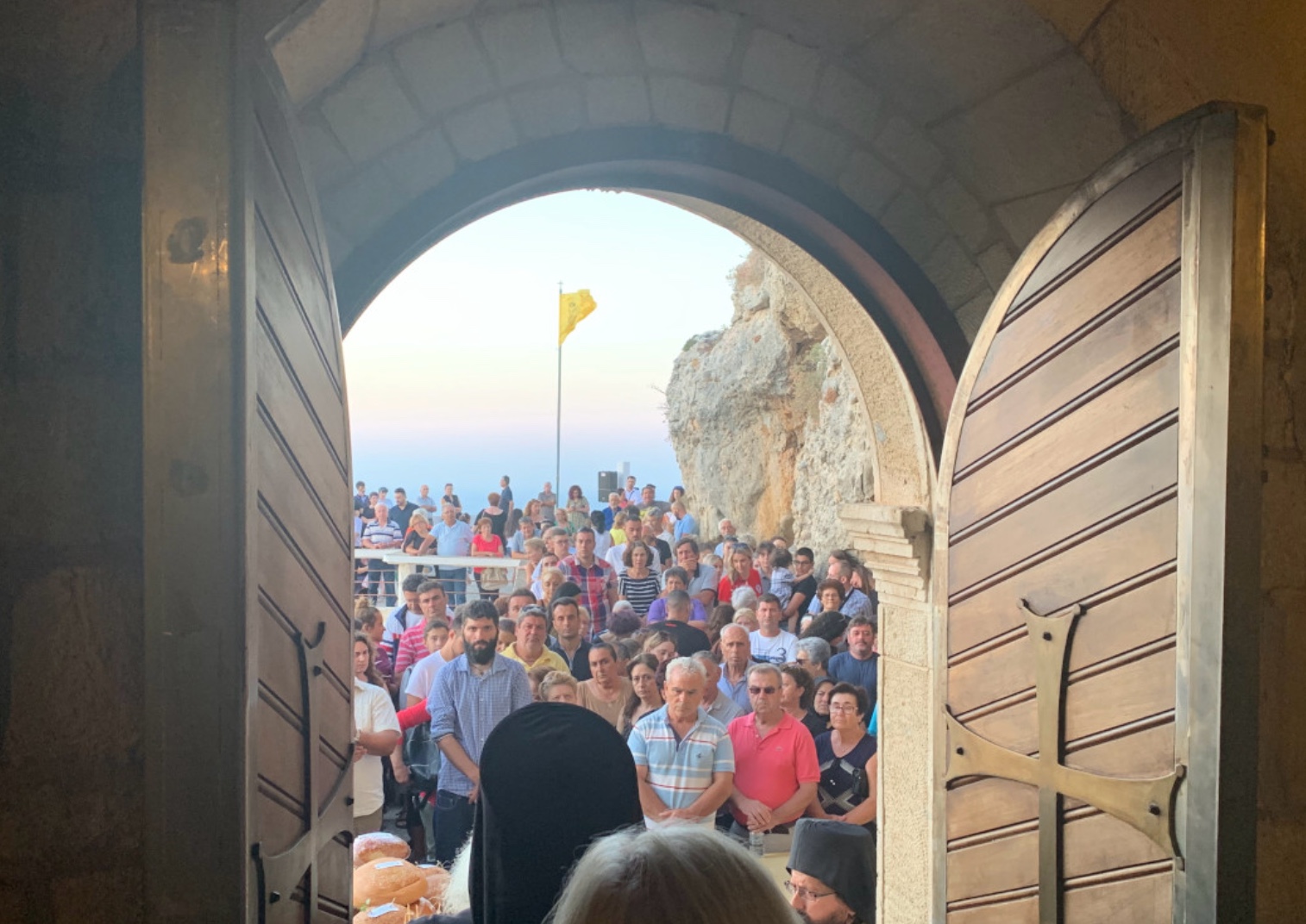
The feast of Panagia Faneromeni is kept on 15 August. On the eve and on the day of the Dormition itself pilgrims pour in from all over Crete, many of them on foot, to fulfil a vow and to thank the Mother of God for her help; some arrive much earlier and pass the whole fortnight of the preceding fast at the monastery. For that reason Faneromeni is counted among the greatest pilgrimage shrines of eastern Crete.
The history of the monastery in detail
Architectural and epigraphic evidence allows the monastery’s early history to be connected with the Byzantine era, while the surviving buildings were remodelled several times under the Venetians and the Ottomans. The katholikon is hewn into the rock; beside it is a second cave, reached by a flight of steps from the courtyard, where water seeps out of the limestone and is venerated by the faithful as a holy spring and taken away as holy water.
The legend tells of a shepherd whose bellwether ram went missing every day around noon. One day he followed the animal and saw it drinking from a trickle of water that ran out of a cave. As he drew near, he caught sight of an icon of the Mother of God inside. He took it back to his hut, but the next morning it had vanished and was found again in its place in the cave. Every further attempt to carry the icon elsewhere came to nothing.
So arose the belief that the icon wished to remain in the cave, and the shepherd duly built the first church on the spot. People still say that the icon now and then reveals itself to the faithful afresh, only to disappear again as mysteriously as it came – above all on 15 August and on other feasts of the Virgin. On the days of the Dormition and the other Marian festivals pilgrims come to the sanctuary to pray and to venerate it.
Because it was so hard to reach, the monastery was not only a house of prayer but a refuge as well, proof against pirate raids from the sea as much as against troops from the plain. Defensive walls with battlements and loopholes, three semicircular watchtowers on the north side, windows kept deliberately small and a strictly controlled entrance are reminders that in Ottoman times the monasteries of Crete were at once spiritual centres and fortified farmsteads. Within the walls, besides the monks’ cells, were a bakery and storerooms, so that the community could sit out even a lengthy siege.
The assembly of Palm Sunday 1293
After the Fourth Crusade of 1204 Crete was sold to Venice, though the Genoese contested the island with the Venetians until 1211. In 1282 the Cretans rose against Venetian rule under Alexios Kallergis, who directed the revolt from his family’s stronghold in the province of Mylopotamos and kept it alive for seventeen years; Venice answered harshly, destroying monasteries and declaring the Lasithi plateau, the heartland of the rising, a zone in which no one might live. The Genoese, through their admiral Doria, offered Kallergis help and asked for nothing in return – Lamba Doria went so far as to attack and burn Chania in 1296 in his bid for an alliance – but Alexios refused. The decision bred disagreement among the leaders of the revolt and weakened their unity: some favoured working with Genoa, others stood by Kallergis, and a few of his closest companions even turned away from him.
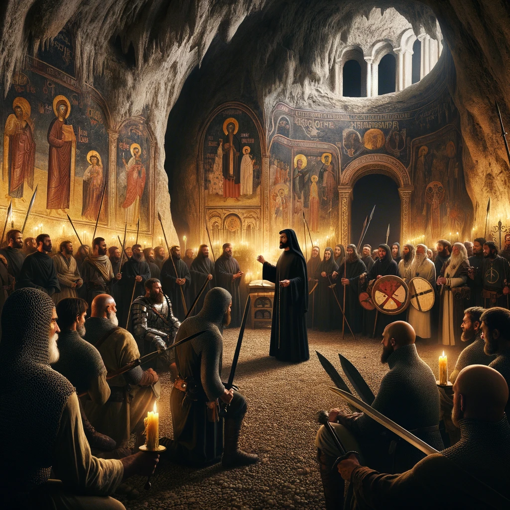
In this strained situation the abbot of Faneromeni near Ierapetra summoned the leaders – tradition names Melissinos, Kavasilas and Chamoleos alongside Kallergis – to the monastery church on Palm Sunday 1293. After communion he locked them inside and turned the house of God into something like a parliament, presiding over its debates himself. The quarrel was fierce, and when an excited crowd burst into the church carrying the banner of the Byzantine emperor Andronikos II Palaiologos, the leaders dispersed. Only seven men from the country districts stayed to the end. When they emerged from the church to shouts of victory, they swore allegiance to Andronikos. The abbot blessed the banner and set it beside the cross.
Even though the insurgents ended by splitting into five factions, the episode underlines the importance of the monastery, which is held to be one of the oldest in eastern Crete, and its unifying role at decisive moments in the history of the Cretan people. The revolt itself was closed only by the peace of 28 April 1299, in which Venice conceded Kallergis a remarkable amount: wider feudal powers, recognition of his courts, marriages between Cretans and Latins and a say in the appointment of Orthodox bishops.
Fortress and refuge under the Ottomans
During Turkish rule the monastery’s strategic position – on a slope that could scarcely be crossed and at a height from which it commanded the surrounding country – made it an impregnable fortress and a rallying point for the Christian fighters whose struggle against Ottoman domination went on for many years. It played a key part in the fight for liberation: as a refuge and strategic base for the leaders, as a mustering place, and as the scene of decisions of great moment.
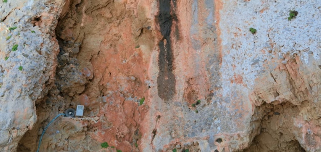
The monastery’s martial character is attested by the so-called zematistra, the “scalding hole” – an opening above the main entrance through which boiling oil or molten lead was poured on attackers trying to force their way in. During sieges a small cave to the south-west of the cave church of the Transfiguration of the Saviour, which also served as the monastery’s cemetery, was used to supply the defenders in secret and to open unseen ways out.
Like many other Cretan monasteries, Faneromeni also backed the successive risings against Ottoman rule with money. Prominent men who believed in the aims of the Greek Revolution and sought the protection of the Mother of God – Fragios Tsantirakis of Kato Chorio near Ierapetra, for instance, or the rebel Papadakis – often fled to Faneromeni and even bequeathed their land to the monastery in order to strengthen the cause financially. A letter of 1878 from Abbot Neophytos to the chieftain Emmanouil Lakerdas, asking him to protect the monastery from Turkish bandits, bears witness to the concealed but deep collaboration between monks and insurgents. At the same time the monastery spent considerable sums on charitable ends, among them education and the support of various institutions.
A new chapter in the monastery’s history opened in 1839, when Gerasimos Chatzis became abbot: the buildings were repaired, the complex was given an orderly form and its fame spread far and wide. Gerasimos renewed the cave church, gave it its present appearance and furnished it with icons and church plate; the two- and three-storey ranges around the long lower courtyard, entered from the west, owe their shape to this 19th-century campaign. His efforts drew large numbers of pilgrims, who endowed the monastery with valuables and land. Purchases of land and energetic farming laid the foundations of its prosperity and reinforced its role as a spiritual centre and, at the same time, as a stronghold in the struggle against the Turkish yoke.
The secret school
Under the Turkish occupation Faneromeni did much for education in the district: it taught reading and writing not only to the young people who had found shelter behind its walls but also to the children of the villages round about. In defiance of the Ottoman authorities, who hoped by suppressing schooling to stifle every thought of rebellion, the monastery housed one of the first secret schools in Crete, one of those “kryfa scholeia” that hold a fixed place in Greek memory.
The lessons did more than impart knowledge. They strengthened the children’s faith and their sense of belonging to a nation, fed the longing for freedom and stiffened the spirit of resistance to the Ottoman yoke. The pupils were taught the history of Greece, the fundamentals of the faith and love of their country. Classes were held in a room to the south-west of the monastery, fitted out to meet the needs of the time and lit, for the sake of concealment, only by small windows like loopholes.
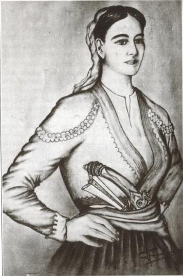
Among the pupils of this school was a girl, Rodanthi Kritsotopoula, one of the outstanding figures of her day.
Rodanthi, the Kritsotopoula
Rodanthi was the daughter of the protopapas, the senior priest of the parish of Kritsa; the name by which she is remembered, Kritsotopoula, means simply “the girl of Kritsa”. Tradition says that she was sent to the secret school at Faneromeni at the age of five and returned to Kritsa at eight to learn weaving and the work of the household. While her father was away at a funeral, an Ottoman dignitary named Hursit Pasha heard her singing and desired her. In 1817 he had her abducted by his henchman Omer Aga, meaning to take her into his harem by force; her mother, who resisted loudly, was killed before her daughter’s eyes. On the wedding night, however, Rodanthi escaped her tormentor by killing him in the bridal bed with a knife – his own, the story adds.
The rest of her life took her far from home. She cut off her hair, got hold of men’s clothes and made for the Dikti Mountains, where she joined the irregulars on the Lasithi plateau led by Manolis Kazanis. Under the name “Spanomanolis” she fought with unbending courage for some six years without her sex being discovered – “spanos” is the Cretan word for beardless, and Manolis is one of the commonest Christian names on the island. She gave her enemies no quarter, and among them was her mother’s murderer. In one of the decisive engagements of the period, the two-day battle fought in January 1823 against Turkish and Egyptian troops at Koutaranto, between Kritsa and the ruins of ancient Lato, Rodanthi received a mortal wound in the chest, having first struck Omer Aga a grave blow.
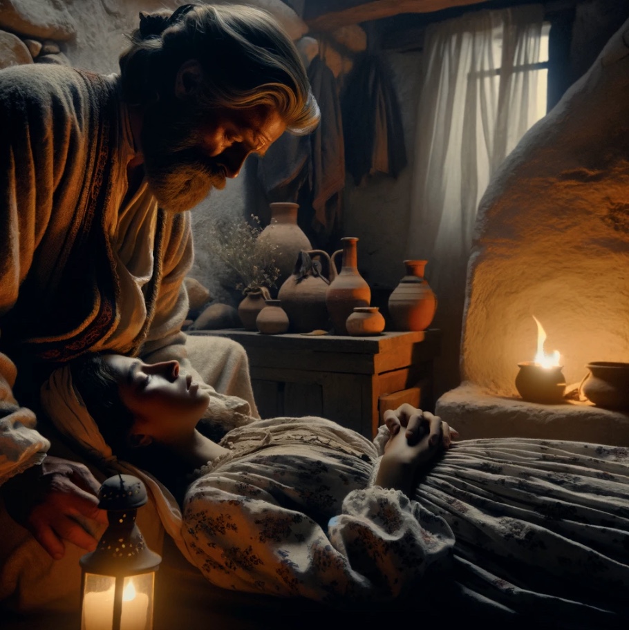
With this wound she came back to her native Kritsa and was carried to her father’s house to be nursed. There, at the point of death, her true identity came to light: the father recognised his daughter, and in the end the two died in each other’s arms. So ended her earthly course, a heroic and tragic chapter in the story of the Cretan fight for freedom. Father and daughter were laid in the same grave in the cemetery of Prodromos at Kritsa, where the mother already lay. Much of the tale has come down by word of mouth and was given literary form by the Cretan dramatist Michalis Diallinas. Kritsa keeps her memory in several ways: a street bears her name, a bust stands in the village square, and the house said to have been her own is now a Historical and Folklore Museum, with looms, handwoven textiles, Cretan costumes and a traditional coffee house. Below Lato, on the battlefield, a stone relief by the British sculptor Nigel Ratcliffe shows the wounded Rodanthi cradled in the arms of a fellow fighter.
Property, decline and a new beginning
Thanks to numerous endowments the monastery acquired extensive farmland during Turkish rule and absorbed the smaller monasteries of Armos, Exakoustis and Karydiani near Ierapetra into its estate. This brought it into conflict with the Turkish aga Tsagkalidis, who tried to appropriate the lands bordering on the monastery, so that the monks had to go to court to recover their property. By the survey of 1893 the monastic estate stretched north as far as the sea and south to the upland of Asari and the monastery of Vriomenou; it comprised four dependent farms (Pivorvolous, Asari, Achlada and Vriomenou) together with holdings scattered across the provinces of Ierapetra, Mirabello and Sitia – in 239 separate places in all.
In 1925 the Cretan Reservists’ Fund was assigned by law a substantial share of the monastery’s property – three fifths – to support the families of reservists and the refugees from Asia Minor; further land was sold through the Lasithi office for the administration of monastic property (the O.D.M.P.).
In 1881 seven monks lived in the monastery; by 1901 their number had risen to nineteen, after the monasteries of Exakoustis and Karydiani near Ierapetra and of Agios Ioannis Theologos near Kritsa had been dissolved and attached to Faneromeni. Although the house was itself declared dissolved for a time in 1900 and again in 1930, it was later recognised once more as a working monastery – in 1903, 1935 and finally 1961 – and so was able to continue its long history. Today only a handful of monks live here.
During the German and Italian occupation in the Second World War the monastery became a refuge for the persecuted and for patriots who opposed the occupiers. The monks of Faneromeni hid Allied soldiers in the caves of the neighbourhood and helped them to get away to Egypt.
The feast of the Dormition on 15 August
Pilgrims come throughout the year from every part of the island to venerate the wonder-working icon in the secluded cave church, a place held to be rich in grace; but in the days of the Dormition, around 15 August, the faithful of every age arrive in a steady stream. Following an old tradition, many of them spend the first two weeks of August – the Dekapentavgoustos, the fast that leads up to the feast – in the monastery’s renovated pilgrims’ hostel, giving themselves to fasting and prayer and attending the daily services. Of the miracles that are said to happen here there are countless testimonies from people who, in their own words, have experienced the grace of God healing ailments of body and soul alike.
At Faneromeni the feast of the Dormition of the Mother of God has an atmosphere entirely its own. True to a tradition centuries old, the faithful climb to the Panagia Faneromeni in reverence and humility and seek communion with God here, in the church in the rock some 540 metres above the bay. They ask the Mother of God for her blessing, for comfort of soul and for the peace that fills their hearts with strength and hope for the road ahead. Their prayers and hopes they lay in the hands of the All-Holy one, and they plead for her powerful protection in the words of the ancient hymn: “All my hope I place in thee, Mother of God; keep me under thy protection.”
Miracles associated with the icon of the Mother of God
In the monastery and among the pilgrims a great many accounts of answered prayer are handed on. A few of them are set down here as they are told.
The healing of a girl after her family’s pilgrimage
At the beginning of August 1997 a party of pilgrims from Heraklion arrived at the monastery. For more than ten years this family had kept the devout custom of walking up to the monastery for the feast days of the Panagia. They all set out from Heraklion together – parents, children, uncles and aunts, cousins of both sexes – and walked the whole way to Faneromeni in company. The journey took them about two days.
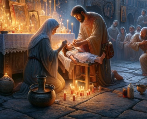
Asked which miracle of the Panagia Faneromeni had prompted the custom, they told the following story. They had a ten-year-old daughter who had fallen ill with leukaemia. The child had been examined and treated, but the results everyone hoped for did not come. In their despair and grief someone told them about Faneromeni Monastery and the wonder-working grace of the Panagia. They came to the monastery with their daughter, bowed before the icon, took a little oil from the lamp and anointed the child with it. As they left, both parents, without having spoken of it to each other, made a vow: if the grace of the Panagia helped their daughter to recover, they would walk from their house to the monastery for as many years as the child was old – ten, that is. The treatment that followed produced very encouraging results, and within a short time the girl had recovered completely.
The prayer for a child
Fifteen years ago a woman from Heraklion who longed for a child turned to the late nun Philothea, of blessed memory, who was then serving at the monastery, and asked her to go up to the church with her at night and pray to the Panagia together. They did indeed go into the church shortly after midnight and held a service of supplication. At the end the nun handed the woman a scrap of the wick from the Panagia’s lamp. “Eat it on an empty stomach, after fasting,” she said.
Some time passed, and the woman gave birth to a healthy boy. When the doctor came out of the delivery room he asked her: “Did you have this child by a miracle?” – “Yes, by a miracle. Why do you ask?” the mother replied. “Because I noticed this mark on the baby’s leg.” Astonished, the mother saw on her child’s ankle a small mark resembling a little eye. It had exactly the shape and size of the piece of wick she had eaten from the Panagia’s lamp. The mark remained visible on the child’s leg for many years.
A rescue after a road accident
Shortly before Easter 2006 a soldier serving at the military base near Ziros in eastern Crete visited the monastery to pray before the Panagia. On the way back he lost control of his car and plunged into a ravine, falling about 150 metres. When the rescue crews had freed him and taken him to hospital, it was found that he had suffered nothing worse than a few superficial grazes. The faithful hold that the young man came through unharmed, as if by a miracle, through the intercession of the Mother of God, while his car was reduced to a heap of twisted metal.
The healing of a child before an operation
Some years ago a mother and her son came to the monastery from the village of Anatoli, above Ierapetra. The child had had a birthmark under one eye since infancy. In time it had grown, begun to bleed and turned into a large open wound. An operation was urgently needed. Before matters reached that point, however, mother and son came to the monastery, took some oil from the lamp of the All-Holy Mother of God and dabbed it on the wound every day. Within a few days, so the account goes, it had disappeared completely – and the birthmark with it.
Healing after a grave illness
In the lean years between the Asia Minor Catastrophe of 1922 and Greece’s entry into the war in 1940 – a time when two great wars had shaken the country and left it impoverished – a woman from Ierapetra who already had three children gave birth to a fourth. The boy was born healthy, but when he was about four years old he suffered severe exposure out of doors in the district of Asari, where the family was then living. Afterwards he was completely paralysed. The mother, herself in bitter want, saw no way of bringing up the sick child and came to a desperate decision: she would entrust him to Faneromeni Monastery.
One night she climbed the steep mountain on foot and laid the child before the monastery gate. “May the Panagia take him into her care – or take him to herself,” she said to herself, and went back into the darkness.
The next morning the monks found the child at the gate. They decided to hand him over to the local authority, which was responsible for such cases. But the following night the Mother of God appeared to the abbot in a dream and said: “In the morning take the child you found at the gate, go down to the sea and bury him in the sand.” At daybreak the abbot told the brethren of this strange dream. The monks were dismayed; they sensed that it might carry a message from the Panagia, and yet they shrank from carrying out so incomprehensible an order.
On the second night the abbot saw the Mother of God again, and she repeated the same words with emphasis. After the morning service the old man once more told the fathers of the apparition and of the command to bury the child in the sand – and once more the brethren refused. On the third night the Panagia came before the abbot a third time and now ordered him with great severity to do her will; otherwise a heavy misfortune would fall upon them all.
Now the monks doubted no longer. In the morning they wrapped the child in a linen sheet, went down to the beach and did as they had been bidden: among the sand dunes they bedded the little body in the sand, leaving only the head free. Then they returned to the monastery. That evening all the fathers together sang the Paraklisis, the service of supplication to the All-Holy one, and on the following day they celebrated the Divine Liturgy, imploring the Mother of God to reveal her providence to them.
On the third day a farmer came up the path to the monastery carrying a child in his arms. It was the very boy the monks had buried on the shore. The man said that he had heard cries on the beach, found the child and picked him up; the little one himself had made him understand that he wanted to be taken to the monastery. The Panagia had healed him completely. The story is told in the district to this day – as one of the many miracles ascribed to the icon of Faneromeni.
A child for a childless couple
A married couple from Chania had been childless for twelve years. They had tried a great deal, but not even modern medicine had been able to give them the pregnancy they longed for. They meant to try their luck one last time, with artificial insemination.
A few days before the procedure the wife saw in a dream a young woman dressed in black, standing high up on a rock and holding a small child in her arms. “This child will be yours if you come and venerate me,” she said. “Who are you?” the woman asked. “I am the All-Holy Mother of God,” came the answer, and the apparition vanished.
In the morning the wife told her husband about the dream and begged him to find out where there was a church or monastery of the Panagia Faneromeni, so that they could make a pilgrimage there and bow before the Mother of God. The husband calmed her and promised to enquire where such a monastery might be – inwardly, however, he gave no credence to what she said, and after a few days the apparition was forgotten.
A few evenings later the Mother of God in black appeared to the woman a second time: “Come and venerate me, and the child I am carrying will be yours.” In tears the wife asked her husband again the next day to look for the shrine of the Panagia Faneromeni. Again he attached little importance to the matter and merely tried to console her.
On the night before the procedure the Panagia entered the woman’s dream a third time, now in an unmistakably stern tone: “Come and venerate me, and the child I am holding will be yours – otherwise I shall let it go from my arms, and you will never bear a child.” Shaken, the woman got up and, weeping, implored her husband to drive with her to the Panagia Faneromeni. “Let us go to the doctor first and have the procedure,” he replied, “and I promise you that the very next day we shall find out where this church is and go there.”
So it went at first. They drove to the clinic, but the woman would not let herself be prepared for the treatment. The doctor saw how tense and oppressed she was, and hesitated. “Let her make her pilgrimage to the Mother of God first, so that she can settle; then come back and we shall carry on with the treatment. In her present state there is nothing to be done in any case,” he advised the husband.
The very next day they made enquiries and learned of the monastery of Panagia Faneromeni near Ierapetra. Full of awe, they set off. The year was 2000. They climbed the steep steps and stood before the cave church of the Mother of God. Then tears of amazement ran down the woman’s cheeks: the rugged rock faces and the whole landscape around the shrine were exactly those she had seen three times in her dream – with the Panagia holding the child in her motherly arms. She knelt before the holy icon, bowed and left the monastery full of hope.
A few days later the couple came to the clinic again to be examined. After a short while the gynaecologist informed them that medical treatment was no longer necessary: the woman was pregnant.
The Pompeii of Minoan Crete: Gournia
On a low hill a few hundred metres from the sea, barely two kilometres west of Pachia Ammos and some 19 kilometres east of Agios Nikolaos, lies Gournia (Γουρνιά). It is often called the “Pompeii of Crete”, and hardly any other place on the island gives so direct a picture of everyday life in a small Bronze Age town. The ruins visible today date for the most part from the Late Minoan I period (c. 1550–1450 BC); Gournia is regarded as the most characteristic excavated example of a medium-sized settlement of that time. At its greatest extent the town covered rather more than a hectare and a half, with over sixty houses and more than half a kilometre of cobbled streets.
The town was uncovered between 1901 and 1904 by the American archaeologist Harriet Boyd (later Boyd Hawes) and her team, who in three seasons exposed almost the whole of it – houses, street system, central building and cemetery. Boyd is considered one of the very first women to direct a major excavation in the Mediterranean, and Gournia was the first Minoan town to come to light on such a scale. Work has resumed more than once since: Jeffrey Soles and Costis Davaras dug here on a modest scale from 1971 to 1976, a field notebook of Boyd’s that had been lost was recovered in 1973, and Vance Watrous surveyed the surroundings in 1992–94 and went on to excavate until 2014. The ancient name is still unknown. The name Gournia goes back to the farmers of the neighbourhood, who long before the archaeologists arrived kept coming across stone troughs and basins here – “gournes” in Cretan.
The first traces of human activity on the isthmus of Ierapetra, the narrowest part of Crete, reach back to the Early Minoan III period (c. 2300 BC). Further remains that tell of the life of the Minoans date from Middle Minoan times (2000–1600 BC), when the place saw a phase of large-scale building, a destruction and a rebuilding. The development culminated in a palace erected towards the end of that era, which perished about 1450 BC together with the town around it; tablets in the still undeciphered Linear A script were found in the destruction layer. Some fifty years later the site was reoccupied on a modest scale – a hall of the mainland megaron type belongs to this Mycenaean-period phase – and around 1200 BC it was abandoned for good.
The town had no wall and spread freely over the slopes of the hill. Two paved ring roads ran round the summit, linked by lanes that branched off at right angles and were often stepped, and beneath them ran a network of drains. Seven blocks of houses have been excavated so far. The houses, small and tightly packed, mostly had two storeys and shared their outer walls with their neighbours. On the ground floor were storerooms and workrooms that had no doors and could be reached only from above by wooden ladders; the living quarters proper were on the upper floor, entered by steps straight from the lane, and the big threshold stones of these doorways still lie in place along the streets. The lower walls were of rubble masonry, the upper ones of sun-dried mud brick, stiffened by a timber frame against earthquakes.
One can stroll along the ancient paved ways and look into the workshops of the metalworkers, carpenters and potters. Chisels, hammers and fish hooks were found here, ingots of copper and lead, and evidence of farming, stock-raising, fishing, pottery and weaving. Many tools seem to have been left behind in great haste – mute witnesses to a sudden calamity. The end of the town, which burned, is often linked with the tremendous volcanic eruption of Santorini and a tsunami in its wake; since the dating of that eruption is disputed among scholars, some archaeologists also consider earthquakes, fires or unrest as the cause.
On the west side of the hilltop rose the palace, the seat of a local ruler – a modest affair beside Knossos, Phaistos or Malia, measuring about 50 by 37 metres and stepped up the slope on three terraces. Its monumental west façade was articulated by recesses, a central portal and windows. It was entered from a rectangular open space, a public court of roughly 40 by 15 metres lying outside the building rather than enclosed by it, on the south side of which was an L-shaped flight of steps – a kind of theatre for ceremonies and religious celebrations. Inside were reception rooms and storerooms, with further apartments above; the main hall was separated from the court by a portico in which round wooden columns alternated with square stone piers.
At the top of the hill, north of the palace, was a small public shrine with an offering table, dedicated to a Minoan snake goddess to whom the inhabitants of this nameless town paid homage. In the roughly square room, only about three metres by four, with a bench along its south side, the excavators found clay figures of the goddess with upraised arms, a three-legged altar and so-called snake tubes – cylindrical cult vessels decorated with snake motifs, with handles in the form of snakes and horns of consecration in relief. The dead were buried outside the town: in built “house tombs” to the north and in the rock shelters of Sphoungaras towards the shore, where from about 1900–1800 BC bodies were laid in large storage jars. The very numerous finds from Gournia now adorn several museums in Crete, above all the Archaeological Museum of Heraklion, while a selection went to the Penn Museum in Philadelphia.
Beach
Pachia Ammos (“thick sand”)
Pachia Ammos (Παχειά Άμμος) takes its name from the pale, coarse-grained sand – literally “thick sand” – that covers its long beach. The village lies in the innermost corner of Mirabello Bay, at the fork where the roads to Agios Nikolaos, Sitia and Ierapetra meet: Agios Nikolaos is some 21 kilometres to the west, Ierapetra 15 kilometres to the south, and the Libyan Sea is thus barely a quarter of an hour’s drive away across the narrowest part of the island. The locality is mentioned as early as 1630, but Pachia Ammos only became a settlement in its own right at the beginning of the 20th century, after which it grew quickly: 162 inhabitants were counted in 1928, and 574 by the census of 2011. Today the community also takes in the two small villages of Vasiliki and Monastiraki inland. The place is known above all for its fish tavernas, which stand in a row almost at the water’s edge, and it has a small harbour and a regular bus service along the north-coast road.
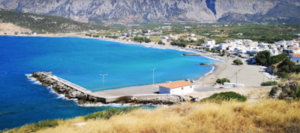
The beach is the longest on the north coast of the Ierapetra district. Its western part is sandy; to the east it turns to large pebbles over a rocky sea bed, with little more than the shade of the tamarisks by way of amenities. Unfortunately it lies at the southernmost point of Mirabello Bay, so that wind and waves carry flotsam here from all over the Aegean – a constant annoyance for the local authorities. A north wind also tends to raise a heavy swell, particularly when the meltemi blows between June and September. Bathing is nevertheless good in the western section below the church of St Nicholas, reached by the lane signposted to Limani, the harbour, where a mole calms the water. Here the beach is well organised, with sunshades and loungers, and the sea is very clean.
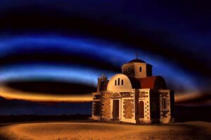
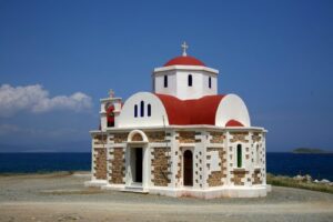
The church of the Holy Great Martyr Photini (Fotini), Equal to the Apostles – the Samaritan woman. Tradition identifies her with the woman of Samaria with whom Christ spoke at Jacob’s Well; the Orthodox Church commemorates her on 26 February and again on the Sunday of the Samaritan Woman in the weeks after Easter.
This is a modern church. It stands beside the hill of Chalepa, on which the scant remains of an old tower and of the artillery emplacement of Pachia Ammos can still be made out. The fortification was built in 1868 on the orders of the Ottoman governor Hüseyin Avni Pasha, to cut the Cretan insurgents’ lines of communication and to keep watch over the coast – this was the time of the great Cretan revolt of 1866–69, when the Ottomans covered the island with a network of watchtowers and blockhouses.
The cross-in-square church was begun in 1965 by a survivor
of the Greek army’s Asia Minor campaign
He was Emmanouil Tsikalakis, and his work was completed by his heirs, Georgios Peronikolis and Emmanouil Tsikalakis. They regarded it as their duty to fulfil his vow and build a church to St Photini in thanksgiving: during the destruction of Smyrna in 1922, fleeing from the Turkish troops, Emmanouil Tsikalakis had found refuge and deliverance in the venerable and magnificent church of the same name in Smyrna – the city’s former metropolitan church, which perished in the flames of those days. In 2004 the heirs made the plot over to the parish of Pachia Ammos; the building was finished in 2008, and on 27 September of that year the church was solemnly consecrated.
Church of St Photini
The church of St Photini
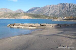
The beach at Pachia Ammos
Anyone with a taste for Minoan civilisation and for wild, barely accessible gorges should allow for a short detour south from Pachia Ammos: turn off at the fork for Ierapetra and visit the villages of Vasiliki and Monastiraki and the Ha Gorge. The road runs through the fertile plain of the isthmus, which was already drawing settlers more than four thousand years ago. Walkers can link the three on foot as well, for the E4 European long-distance path climbs from Vasiliki by way of Monastiraki to the Thripti plateau, a distance of about nine kilometres.
The Minoan site at the village of Vasiliki
On the low hill of Kefali beside the out-of-the-way village of Vasiliki (Βασιλική), about two and a half kilometres from Pachia Ammos and some eleven from Ierapetra, American archaeologists uncovered one of the great secrets of Minoan civilisation at the beginning of the 20th century. After preliminary soundings by Harriet Boyd, the principal excavator was Richard Seager, who worked here between 1903 and 1906. The ruins he exposed belong to Early Minoan II (c. 2600–2300 BC): the settlement was founded in the first half of that period, destroyed, and rebuilt in the second. On the hill stood a building in miniature that is regarded as a forerunner of the great palatial centres of Knossos, Phaistos and Zakros – which arose only six or seven centuries later – and the site is counted among the earliest Minoan settlements to show signs of deliberate planning, with houses grouped beside a paved court. Nikolaos Platon returned to the hill in 1953, and from 1970 to 1982, and again in 1990, the Greek archaeologist Antonis Zois cleaned the old trenches and re-examined their stratigraphy on behalf of the Archaeological Society at Athens.
The so-called “House on the Hilltop” consisted of rectangular rooms linked by long corridors; the south wing was the largest part of the complex. Some of the long, narrow rooms served as storerooms, others as living quarters. The inner walls were coated with red lime plaster – hence the name Red House given to one part of the complex – and timber beams tied the masonry together. The ground floor was built of small stones bound with clay and straw, the upper storey of mud brick. Finds show that the hill was inhabited again and again: the Minoan settlement itself remained in use into the early Late Minoan period, around 1500 BC, and occupation of one kind or another continued down to Roman times.
Particular attention was aroused by some curious vessels whose surfaces are covered with enigmatic black and red blotches and rings. This pattern is not painted decoration but was produced in the firing itself: by deliberately uneven exposure to heat and air, the thick lustrous slip turned red in some places and black in others. Exactly how the potters controlled the effect has still not been fully explained. Scholars have named this unmistakable style after the place where it was found: “Vasiliki ware”. It is generally described as the Minoans’ first truly distinctive pottery style; it makes its appearance early in Early Minoan II and by the later part of the period had become the dominant fine ware across eastern and southern Crete. Typical are bold shapes such as beaked jugs, vessels with long, teapot-like spouts, and hemispherical cups.
A visit to Vasiliki is a singular encounter with the beginnings of Minoan architecture, and shows what a high level of development this culture had already reached some 4,600 years ago. The hill is low and the walls stand no more than knee-high. The site is fenced, and the best way to find out whether and when it can be entered is to ask the custodians of the archaeological site of Gournia.
After about two kilometres you cross the main road to Ierapetra, and only two kilometres further on the village of Monastiraki appears on the right, at a height of about 180 metres on the lowest slope of the mountain.
The village of Monastiraki and the Ha Gorge
The name Monastiraki (Μοναστηράκι, “little monastery”) probably recalls a modest religious house said to have existed here as early as Early Christian times. Under Ottoman rule it was converted into a mosque. According to local tradition the first houses of the village belonged to monks. Monastiraki had its heyday in the 19th century; thereafter it gradually emptied – the census of 1981 recorded just eighteen people – until for a long time only a single inhabitant remained. In recent decades, however, the houses, lanes and water channels have been carefully restored, and Monastiraki is now reckoned one of the most attractive villages in the Ierapetra district.
The village is set in delightful country of clear water and green fields, in the shadow of the enormous rock walls of the Ha Gorge and with a wide view over Mirabello Bay. The old watermills are characteristic of the place, and simple Cretan dishes can be tried in its small traditional kafenia; one of the tavernas has a reconstructed olive press, a fabrica, of the kind that once served the village.
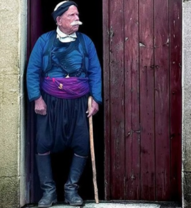
Stone houses of the typical Cretan kind, a stillness in which the hum of bees can be heard, old women knitting on their doorsteps, grave-faced men in black shirts, in the peculiarly cut baggy Cretan breeches and, it goes without saying, in tall leather boots – such is the life of the villages in these parts.
On their heads the men wear black fringed kerchiefs, the tassels falling over the forehead. The scene gives the impression that one has stepped back several centuries in time. Behind the village stand numerous half-ruined windmills. Most worth seeing is the impressive church of St Stephen (tou Agiou Stefanou) beside the spring, near the point where the gorge opens on to the plain. Some two kilometres from the village is another small church, that of the Holy Spirit (tou Agiou Pnevmatos), and behind it rises the wild, majestic gorge – in Greek, farangi – with the brief name of Ha (Χα) and its almost vertical walls. On a spur about 280 metres south-west of the mouth of the gorge, at a height of 230 metres, lie the remains of Chalasmenos, a settlement of the 12th century BC with cobbled lanes and a communal shrine, whose inhabitants could keep an eye on both seas.
The Ha Gorge
The Ha Gorge (Φαράγγι του Χα) impresses by its sheer scale. Its depth is put at up to 700 metres, the width between the upper rims at around 100 metres and its length at about 1,800 metres; the vertical cliffs that flank the cleft itself rise between 200 and 400 metres. It begins in the uplands of Thripti and opens on to the plain of Ierapetra at Monastiraki. The entrance lies at about 370 metres, the exit at roughly 140. At the top it is only three metres wide, and in places the walls close in to within a few centimetres – some thirty, at the narrowest. The name probably derives from the verb “chasko”, meaning to gape or open wide – the gorge is quite literally a crack in the mountain. It cuts at right angles through the escarpment of the active Ierapetra fault, the great fault scarp that divides eastern Crete, and the rock strata and folds match exactly on either side of the cleft: it was tectonic force that shaped this extraordinary landscape.
Precisely because it is to all intents and purposes impassable, the gorge is a unique refuge for rare plants and animals that have been little studied to this day. Here live the Cretan hare, the Cretan weasel, the badger, the Cretan wild goat (kri-kri) and the spiny mouse, a species of African origin found nowhere else in Europe. Small rock pools serve as resting places for migrant and resident birds, and the crags of the Thripti range are nesting ground for griffon vultures, golden eagles and peregrine falcons. On the slopes grow Calabrian pines, aromatic herbs and numerous rare and in some cases endangered plants – more than sixty species endemic to Crete have been recorded, among them the Ierapetra bellflower.
The untamed wildness of this natural monument leaves an indelible impression. The Ha Gorge is regarded as one of the wildest in Greece and one of the hardest to traverse in Europe – and at the same time as one of the ten most beautiful gorges on the continent. It was first descended in its entirety from 17 to 23 June 1987 by three mountaineers from Thessaloniki, Stavros Lazaridis, Vlasis Hatzipanagiotou and Chronis Amatzidis, who needed seven days to do it. Today the descent involves some thirty abseils, the longest of 30 to 35 metres, together with stretches of climbing and swimming, and takes a competent party about five hours; since 2012 the belay stations have been equipped to modern safety standards. The sheer walls allow no escape to either side once a party is committed, and the route is strictly for experienced canyoning groups with full equipment and a guide. Water runs through the gorge from about November to May, after rain and snowmelt; in summer the upper part is usually dry. For everyone else the view from the church of the Holy Spirit will suffice, or the short path beside the church of St Anne that leads into the mouth of the chasm. After heavy rain, moreover, the Mastoras waterfall comes down over the rocks nearby, where a side ravine meets the Ha at right angles in its last third – at 215 metres one of the highest in Greece, though it only rarely carries water.
Kato Chorio (“lower village”) and Thripti
After the visit to the Ha Gorge the route returns to the crossroads and continues towards Ierapetra as far as the turning for Kato Chorio (Κάτω Χωριό). The principal village of the area, about seven kilometres from Ierapetra, occupies a strategically important position at the narrowest waist of Crete. It is known for its many springs and streams, which give it luxuriant vegetation. The place has been inhabited for at least 7,000 years: a clay figurine of the Neolithic period found here is considered an important piece of Neolithic small-scale sculpture. Besides Kato Chorio itself, the community includes Episkopi, Pano Chorio, Papadiana and Thripti. Until a few decades ago the village was among the most prosperous in the district; its centre is still the large square with plane trees, eucalyptus, pines and tavernas.
Kato Chorio has several notable churches. Chief among them is the church of the Transfiguration of Christ (Metamorfosis tou Sotiros) of 1831, with its splendid carved wooden iconostases in differing styles. The church of the Holy Trinity (Agia Triada), a single-aisled basilica of the late 17th century, has a masterfully carved icon screen and furnishings of the 19th century. The church of the Dormition of the Virgin (Koimisis tis Theotokou) is a large three-aisled domed basilica in which old icons, liturgical books and other ecclesiastical treasures are kept. On a hill above the village, finally, stands the chapel of the Prophet Elijah, from which both seas can be seen – the Sea of Crete to the north and the Libyan Sea to the south.
The way goes on along a stretch of asphalt, which climbs from the neighbouring village of Pano Chorio, and then over farm tracks: after about eight kilometres you reach the village of Thripti (Θρυπτή), often referred to as the “upper village”, which lies at around 860 metres on the mountain range of the same name, known locally as “Aori”. Thripti was long a summer settlement: families from Kato Chorio and Ierapetra moved up in the hot months to tend their vineyards, for which the altitude offers ideal conditions; the census of 1940 recorded all of three permanent residents, and today there are none – the owners come up at weekends and in summer to see to their vines and their apple, pear, walnut and almond trees, and shepherds bring their flocks for the season. The traditional stone houses and the hospitality of the people have remained. Around the plateau stands the last surviving pine forest of the Sitia mountains, badly damaged by fire in 1987. The real reason for a visit, however, is the views.
Those who venture the ascent of Afendis Stavromenos, the summit of the Thripti range at 1,476 metres, are rewarded with a landscape that is hard to put into words. The way up is strenuous, and the upper slopes are bare and exposed to sun and wind. In clear weather the eye ranges over the Libyan Sea and the districts of Ierapetra and Sitia as far as the island of Kasos and out across the waters of the Dodecanese. On the summit stands the little church of Afendis Christos (“Christ the Lord”). The fauna and flora of these mountains are included in the European network of protected areas, Natura 2000, and are designated a special area of conservation.
Kato Chorio
Thripti
View from the summit of Afendis Christos
The church of Christ the Lord
The village of Kavousi
From Pachia Ammos we drive on eastwards, following the coast road round Mirabello Bay, to the village of Kavousi (Καβούσι). It lies about 26 kilometres east of Agios Nikolaos, 19 north-east of Ierapetra and 42 west of Sitia, at a height of some 140 metres at the foot of two mighty mountains in the northern foothills of the Thripti range, and is buried in the green of plane and olive trees. Numerous springs and streams, fed by the water that comes down from the Mesonas and Chavgas gorges, make it a true oasis; the path up the Mesonas is among the most rewarding walks in eastern Crete, though it calls for a good level of fitness. The origin of the name is uncertain; in the Cretan dialect the word seems to denote a small hollow or trough in which water collects. Kavousi is first recorded in 1577. At the census of 1881 it had 955 inhabitants; in 2011 there were still 559. The village beach is at Tholos, a sandy, shallow bay fringed with tamarisks about three and a half kilometres to the north, where the remains of Roman storehouses can be seen.
The area has been settled for thousands of years. In the surrounding hills are the Minoan and Early Iron Age sites of Vronda and Kastro, first explored by Harriet Boyd in 1900 and re-excavated by American teams from the late 20th century; about a kilometre south-east of the village, on a twin-peaked hill some 365 metres above the bay, is the settlement of Azoria, which flourished in the Archaic period (7th–5th century BC), had a communal dining hall and a monumental civic building, and was destroyed by fire early in the 5th century BC; and at Chrysokamino is one of the oldest known copper-smelting sites in the Aegean. Kavousi is famous above all for its ancient olive tree near Azoria, a kilometre south of the village on the road to the hamlet of Avgos. Its trunk measures 4.9 metres across at its widest and 14.2 metres round, and its age is estimated at 3,500 years at least – counts of its annual rings suggest that it was planted between 1350 and 1100 BC; it is a cultivated olive grafted on to a wild stock, and is protected as a natural monument. A branch of this tree was ceremonially cut for the Olympic Games of 2004 in Athens and made into the victor’s wreath for the marathon – the women’s race, the first to be run.
Kavousi has the Byzantine church of St George (tou Agiou Georgiou) of the 14th century, which is remarkable for its superb wall paintings. Nor should the church of the Twelve Apostles be overlooked, decorated with frescoes of the 16th century. Both stand close to the village square. Equally worth seeing is the 19th-century church of the Dormition of the Virgin, with an exceptionally fine iconostasis. In a cave to the west of the village, moreover, are the remains of a church of St John, built according to tradition by a hermit in Early Byzantine times.
Church of St George
14th century
The church of St George
Church of the Twelve Apostles
16th century
The Holy Apostles
Frescoes of the 16th century
Church of the Dormition of the Virgin, 19th century
The iconostasis
The Dormition of the Virgin, 19th century
Tholos beach
Only a few kilometres north of Kavousi – between three and six, depending on the road taken, and a little over three and a half as the crow flies – lies Tholos (Θόλος), a broad and picturesque beach that might have been made for a restful day by the sea. Fine sand, gently shelving water and shady tamarisks make it agreeable for families with children too, and the facilities provide everything needed for a comfortable day’s bathing. The lane down from the village runs through olive groves and is surfaced throughout. On the shore stands a chapel of the Panagia, which keeps its feast at the Ascension. In antiquity the bay was a place of trans-shipment: the remains of large Roman storehouses, which swimmers can make out at the water’s edge, are a reminder that goods were loaded here long before there were roads; part of the buildings was destroyed by the German occupying forces in the Second World War.
Close by is another remarkable place: the small, uninhabited rocky island of Pseira (Ψείρα), which rises as much as 204 metres out of the sea off the coast. Between about 1750 and 1450 BC it was the site of a Minoan settlement of fishermen and seafarers who traded with ports all over the eastern Mediterranean; the first people had come much earlier, at the end of the Neolithic. The American Richard Seager discovered and dug the town in 1906–07; from the mid-1980s the island was investigated systematically by Philip Betancourt, for Temple University in Philadelphia, and the Greek archaeologist Kostas Davaras. Some sixty buildings were laid out round an open square, with flights of steps cut down the cliff to the harbour on which the community depended, and the two-storeyed stone houses are well preserved. Among the best-known finds are a pithos decorated with bulls’ heads and olive sprays, a series of ritual pouring vessels, one of them in the form of a bull, and a relief fresco of two sumptuously dressed Minoan women from a building interpreted as the town shrine. In 2006, moreover, the wreck of a Minoan ship was discovered off Pseira. The town was violently destroyed around 1450 BC, though a remnant of the population lived on among the ruins. Besides the Minoan remains, walls of later periods can be seen on the island – terraces and enclosures for farming, some of them Byzantine.
Not far from the mainland shore, too, the remains of a Minoan settlement have been discovered, notable for their good state of preservation and affording a still closer insight into the early history of this district. Pseira itself can be reached only by boat, for instance from Tholos or from nearby Mochlos; a permit from the antiquities service is required to visit the excavation. There is no water, shade or landing stage worth the name on the island, so a calm day is essential.
Sfaka
Sfaka (Σφάκα) is a hill village where old customs have survived to the present day. It lies some 240 metres above Mirabello Bay, a good twenty kilometres west of Sitia on the road to Agios Nikolaos, and is the mother village of the harbour of Mochlos: even today by far the greater part of the hundred or so people who live down there come from Sfaka families. Like many villages of eastern Crete it has lost inhabitants through emigration – 488 were counted in 1981, and only 385 ten years later – but those who have left keep close ties with home. Two explanations are offered for the name: it is said to come from the shrub so called, in whose shade travellers once rested, or – according to a local tradition – to go back to a Venetian woman named Sophia.
The inhabitants venerate the Cross of the Lord as their patron, and two impressive churches stand in its honour. One is the parish church of the village, the church of the Holy Cross (Timios Stavros); the other is a notable twin-aisled church whose second aisle is dedicated to St Charalambos. Sfaka holds its great patronal festival on 14 September, the feast of the Exaltation of the Cross; St Charalambos is honoured in addition on 10 February. Among the other places of worship is the church of the Holy Trinity and the Panagia, with an inscription of 1643. In the War of Independence of 1821 men from Sfaka joined the rising, and the first road down to Mochlos was built in 1948 by the villagers themselves, laboriously and by hand.
Not far from the village, and easily reached on foot, stands a Venetian tower. It is celebrated not only for its historical value but also for the remarkable views that open from its height over the coast and the sea. A second chapel with a panorama of the whole of Mirabello Bay, that of the Holy Spirit, stands on the hillside to the south of Mochlos.
Mochlos – a small paradise
Mochlos (Μόχλος) lies at the end of a seven-kilometre asphalt road that winds down in hairpin bends from Sfaka, with wide views on the way over the bay far below. It is 48 kilometres from Agios Nikolaos and 35 from Sitia.
The quiet, picturesque fishing village has an unhurried atmosphere. Its crystal-clear inshore water, the little harbour and the beaches are ideal for those who love unspoilt nature; along the waterfront, which is free of traffic, tavernas serve fresh fish with a view of the sea. There is a small sandy beach directly below the tavernas, and rocky coves on either side that are good for snorkelling. Small boats cross to the offshore island of Agios Nikolaos, which lies only some 150 metres from the shore and is named after its chapel; strong swimmers manage the crossing in five to ten minutes, though shoes are needed for the sharp rocks on the far side. Archaeological excavations have brought to light a Minoan harbour town here whose beginnings go back to about 3000 BC. The American Richard Seager dug on the island from 1908; since 1989 the American archaeologist Jeffrey Soles and the Greek Kostas Davaras have continued the work in a joint Greek-American project.
In antiquity the present island was joined to the shore by a narrow strip of land. This isthmus created a natural harbour on either side – a great advantage for mariners, who could choose the more sheltered one according to the direction of the wind. It was inhabited until an earthquake in Byzantine times caused it to subside. Today the ruins of the old residential quarters can be made out on the sea bed from a boat, and divers can explore them at close quarters.
In the Early Minoan period Mochlos was an important harbour with far-reaching trading connections that extended to the Near East. On the western slope of the island is a cemetery of some thirty rectangular built tombs, divided into several chambers, in which families buried their dead over generations and honoured their ancestors; most belong to Early Minoan II, and simpler burials in storage jars and pits lay among them. From them come precious pieces of goldsmith’s work: diadems, pins, necklaces, ornaments in the form of leaves and flowers, and a famous signet ring. A large building was also discovered on the island which, to judge by the elaborate jewellery, weapons, fine vessels and tools found inside it, probably belonged to a person of high rank. From the Late Minoan period (c. 1500–1425 BC) paved streets and orderly residential quarters survive, and ten hoards of metalwork of that date, among them copper ingots of oxhide shape brought from Cyprus, show that the trade continued; on the mainland opposite, the excavators found an artisans’ quarter where bronze, ivory, stone and pottery were worked, and a Minoan farmhouse at Chalinomouri at the eastern end of the little plain. A Mycenaean phase followed, with its cemetery on the hill above the workshops; later came a Hellenistic settlement, whose fort crowns the summit, and between the 8th and 14th centuries a Byzantine establishment with the church of St Nicholas, an enclosure wall and fortifications. The finds are now in the museums of Heraklion, Agios Nikolaos and Sitia, and the excavations on the island continue.
About 400 metres west of the little harbour is the beach of Limenaria, with fine shingle and well sheltered – a good spot for those who want seclusion by the sea.
The strait
The island of Agios Nikolaos
Mochlos
View of the island of Agios Nikolaos
Mochlos
Mesa and Exo Mouliana
From Mochlos we drive on to Mesa Mouliana (Μέσα Μουλιανά, “Inner Mouliana”), passing on the way through the villages of Tourloti and Myrsini, which are buried in greenery and have handsome churches and old houses in the traditional manner. Near Myrsini stands a Venetian tower associated with the Kornaros family, with a chapel of St Anthony.
Mesa Mouliana lies at a height of about 400 metres, some 19 kilometres from Sitia, and has about 200 inhabitants. Several derivations are proposed for the name – from the Greek verb “moulono” (to stoop or bow), from the Venetian “mulo” (mule), or from a word meaning tall and slender. Surrounded by vineyards, the village has made its name through its wine and its vines. A wine quite of its own is pressed here from the Liatiko grape, the “Liatiko mavro krasi”, a “black wine” of deep, almost black colour that is known throughout the district.
Near the village, at a spot called Sellades, the celebrated Cretan archaeologist Stefanos Xanthoudidis uncovered two tholos tombs in 1903 – the same year in which he dug the oval house at Chamezi further along this road. They date from the Late Minoan period and remained in use into Early Geometric times. Among the finds are a gold mask and a famous krater, a mixing bowl of the Protogeometric period, on which a mounted horseman is shown – the earliest known representation of a rider in Crete.
The patron of Mesa Mouliana is St John the Theologian (Agios Ioannis o Theologos). The principal church of the village, which is dedicated to him, is particularly worth seeing, and beside it a spring has been enclosed in a very handsome fountain.
Only three kilometres away is Exo Mouliana (Έξω Μουλιανά, “Outer Mouliana”), likewise surrounded by luxuriant greenery. Here the Byzantine church of St George, of the 15th century, deserves a visit for its exceptional wall paintings.
A little to the west of the village stands the Byzantine church of Christos Afendis (“Christ the Lord”), dedicated to the Transfiguration and dating from the 14th century. Its idiosyncratic architecture makes it especially attractive to those with an interest in history and art.
Mesa Mouliana (“Inner Mouliana”)
The church of St John the Theologian at Mouliana
Exo Mouliana
The church of Christos Afendis
Chamezi
Chamezi (Χαμέζι) lies at about 430 metres on the road from Agios Nikolaos to Sitia, some ten kilometres short of Sitia, and today has around 250 inhabitants. In Venetian and Ottoman registers it appears under changing names – Camesi (1583), Glamesi (1630), Hamizi (1671) – and as early as 1583 it had 371 inhabitants. The village is known for its skilled stonemasons, the “petrites”, whose craftsmanship can be admired on many houses and fountains of the district.
The village has a Folklore Museum (Laografiko Mousio). It was founded in 1978 on the initiative of a local schoolteacher, Irene Papadaki, with the help of the villagers, and is housed in an old, typically Cretan dwelling that has its own mill for producing olive oil, the “elaiourgio”, a treading floor for making wine, the “patitiri”, and finally the “kazanario” – an ingenious still in which the famous Cretan raki was distilled from the pressed grape skins. These three installations were once an inseparable part of every Cretan farmhouse. In addition the museum shows a traditional kitchen and bedroom with their furniture, a weaver’s workshop with its textiles, folk art and agricultural implements.
Also at Chamezi is an outstanding monument of Minoan civilisation: the “oval house” (ooeides oikia), which the Cretan archaeologist Stefanos Xanthoudidis excavated in 1903. This elliptical building, dated to the Middle Minoan period, is the only one of its shape known from Minoan Crete and yields valuable evidence for prehistoric architecture; remains of an earlier structure lie beneath it. It stands on the hill of Souvloto Mouri – the name means something like “sharp-faced” – at the end of a dirt track about a kilometre long from the village. Whether it was a peak sanctuary, as Nikolaos Platon proposed, or a dwelling was long debated; since the site was re-examined and consolidated by Kostas Davaras in 1971 it has generally been interpreted as a large farmstead with a domestic shrine, its curving outline, as Duncan Mackenzie had argued as early as 1907, simply following the shape of the hilltop. The rooms are grouped round a small court containing a cistern or well for rainwater, and there were two entrances. The finds included bronze objects, tools, clay figurines, fragments of an altar and household pottery. At Fatsi, north of the village, five tholos tombs of Sub-Minoan and Protogeometric date also came to light in 1971.
Chamezi also has the Venetian fortress of Liopetro (Φρούριο Λιόπετρο), whose name is traced to the Italian “Leon di Pietra”, “lion of stone”. It was built on a steep crag on the site of an ancient acropolis at the beginning of Venetian rule, and in the late 16th century was intended to give the people of Sitia a refuge from Ottoman attack. Parts of the walls and towers survive to this day, together with a circular water tank, vaulted cisterns and a small church of St John on the summit. The hill commands a splendid view of the surrounding country; the climb is rough and unshaded.
Chamezi
The oval house
The Folklore Museum
Traditional architecture
Sitia
Sitia (Σητεία) is a little coastal town rising like an amphitheatre above the deep bay of Didymos. Its long sandy beach, which runs east from the port for about two kilometres and is set with loungers and sunshades, an abundance of cafés, tavernas, restaurants and bars, and hotels for every taste give travellers a memorable stay, and the friendliness of the townspeople does the rest. Unlike the large resorts of the north coast, Sitia has kept the easy pace of a Cretan provincial town; it has a small airport of its own, opened in 1984.
Sitia is also famed as the home of two great figures: Myson, who was numbered in antiquity among the Seven Sages, and Vitsentzos Kornaros, the poet of the “Erotokritos”, that verse romance of the 17th century which every Cretan knows and whose lines are sung to the lyra to this day. The modern town was built on the site of the ancient harbour town of Itia (Eteia), which even struck its own coins; the district had been settled since the end of the Neolithic, and on the eastern edge of the town are the remains of the Minoan palace of Petras.
A few traces of the Venetian period survive in the town, among them two Catholic churches. One of them, Santa Maria, was destroyed by the Turks and replaced by the Orthodox church of the Ascension of Christ, which now serves as the cemetery church.
The town’s history has been turbulent. In 1508 an earthquake destroyed Sitia, which was then rebuilt; in 1538 the corsair Hayreddin Barbarossa sacked it in a devastating raid. In 1651, after three years’ resistance, Sitia fell to the Turks – but they found a town empty and in ruins: the Venetian commander Mocenigo had declared the fortress untenable and had the troops and war material withdrawn to Candia, the present Heraklion. For some two hundred years thereafter Sitia ceased to exist as a town. The present one dates from 1870, when it was laid out afresh under the reforming Ottoman governor Hüseyin Avni Pasha – the same man who had the tower at Pachia Ammos built – and for a short time it even bore his name, Avniye.
Above the town sits the fortress known as the “Kazarma”, a name that goes back to the Venetian “Casa di Arma”, “house of arms”, for it served as the garrison’s barracks. Its origins reach back to the late Byzantine period and the early 13th century, when the Genoese freebooter Enrico Pescatore controlled parts of Crete; the Venetians enlarged it, and the earthquakes of 1303 and 1508 and Barbarossa’s attack did it grievous damage. The Turks left their mark as well, in the little domed turrets, or “koubedes”, on the battlements. It has been under restoration since 1966. Today the Kazarma is a protected monument in which the “Kornaria” festival in honour of the poet is held each summer, with theatre, concerts, dance, lectures and exhibitions. The walls look out over the town and the bay of Sitia.
The Archaeological Museum of Sitia, opened in 1984 by Melina Mercouri, displays a rich collection of finds from the whole province, covering some 4,000 years of Cretan history, from about 3500 BC to AD 500. Among its most famous pieces is the statuette of a youth from Palaikastro, about half a metre tall, made of hippopotamus ivory, serpentine, rock crystal and wood and overlaid with gold – one of the masterpieces of Minoan art. It dates from about 1450 BC and was recovered at Roussolakkos, the Minoan town at Palaikastro, in stages between 1987 and 1990: the torso first, the head a year later, then fragments of the legs and hundreds of splinters sieved from the soil, for the figure had been burnt and deliberately smashed. The face is lost, but the elaborately carved stone hair survives, and the parts were pegged together with dowels of olive wood; it is thought to represent a youthful god. Equally important are the clay tablets in the still undeciphered Linear A script from the palace of Zakros, which were baked hard, and so preserved, by the fire that destroyed the palace; many of them are inscribed on both sides.
The more recent history of the town and its culture is the subject of the Folklore Museum, established in 1975 and arranged as a Sitian house of the 19th and early 20th centuries. It shows collections of costumes, embroidery, woven textiles and objects of everyday life made by the hands of local craftsmen and women.
The Gorge of All Saints and the Monastery of the Mother of God
Not far from Sitia, in the gentle hill country of eastern Crete, lies the Gorge of All Saints (Farangi ton Agion Panton), which asks nothing more strenuous of the walker than an unhurried stroll. It takes its name from the small church of Agii Pantes that stands near its mouth. Those who set out from Platani, the pebbly cove some seven kilometres west of Sitia and two kilometres beyond the village of Skopi, enter a place where history and legend lie close to the path. The gorge is about three kilometres long, with barely fifty metres of difference in height between its two ends, and an hour and a half is ample for it; among the gorges of Crete it counts as one of the very easiest. It is also one of the greenest walks in the east of the island: myrtles, carob trees and plane trees in their hundreds line and shade the route, and in spring anemones flower beneath them. The rock is largely marl, a soft sediment halfway between limestone and clay, which water has worn into strange shapes – mushrooms, columns and forms that look like cream running down the side of a bowl; the pale, mushroom-like formations are most striking towards the seaward end. Two springs, Koutsounari and Chosti Vrysi – the “hidden spring”, which rises inside a cave – give water all year round, and in winter the Skafidaris stream runs along the bed that the path follows, turning the valley floor for a few months into a small wetland. For the rest of the year the bed is generally dry. Heavy winter rains can damage the path.
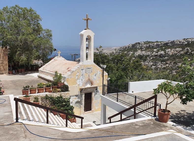
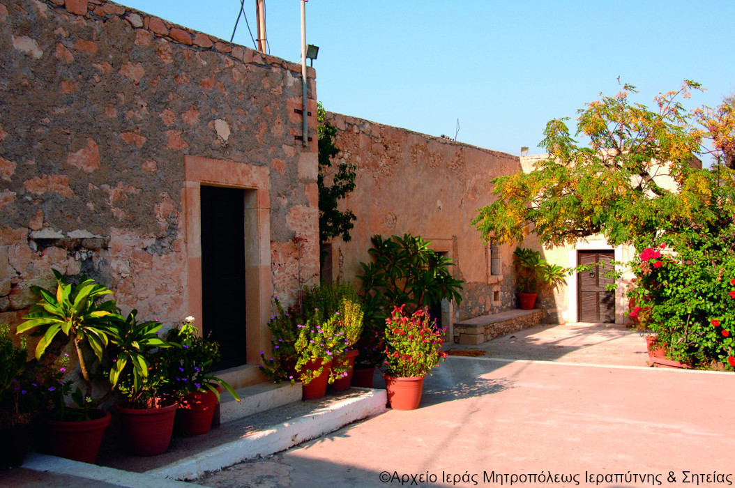
This route brings us to the second Faneromeni monastery of our journey. As with its namesake near Ierapetra, the foundation here is bound up with the miraculous discovery of an icon of the Mother of God, which gives the place its particular spiritual standing. The monastery lies about eight kilometres west of Sitia on the edge of a steep slope between Cape Trachilas and Bambakia, roughly a kilometre and a half from the sea and only a few hundred metres from the gorge. It belongs to the territory of Skopi, one of the largest villages in the municipality of Sitia, and an asphalt road runs out to it from the village by way of Platani, so that it can be reached by car as easily as on foot.
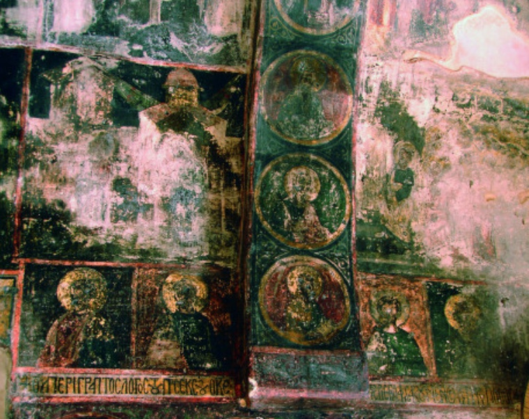
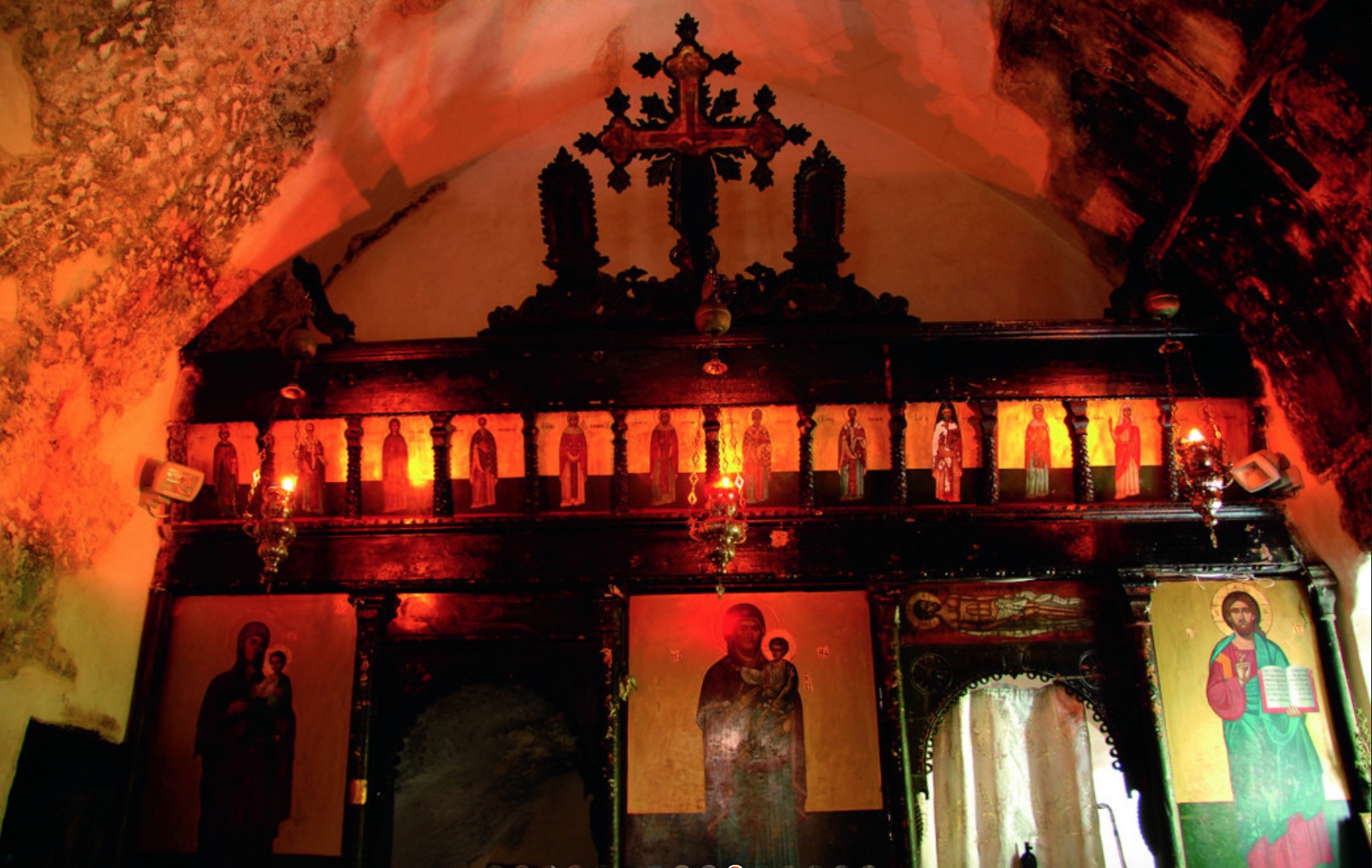
The monastery, rising with some dignity out of the green landscape around it, is not only a place of prayer but also a keeper of Orthodox history. Within its walls are old icons and wall paintings more than five centuries old – the frescoes of the church carry the date 1455. They are of particular spiritual value, and they bear witness to the deep faith and the long history of the place.
The monastery was destroyed in the 19th century, under Ottoman rule; its rebuilding became a testimony to the unshakeable faith of the Cretans. Today it is a place where any Orthodox Christian can feel the connection with the past and sense the peace and blessing that proceed from its holy things.
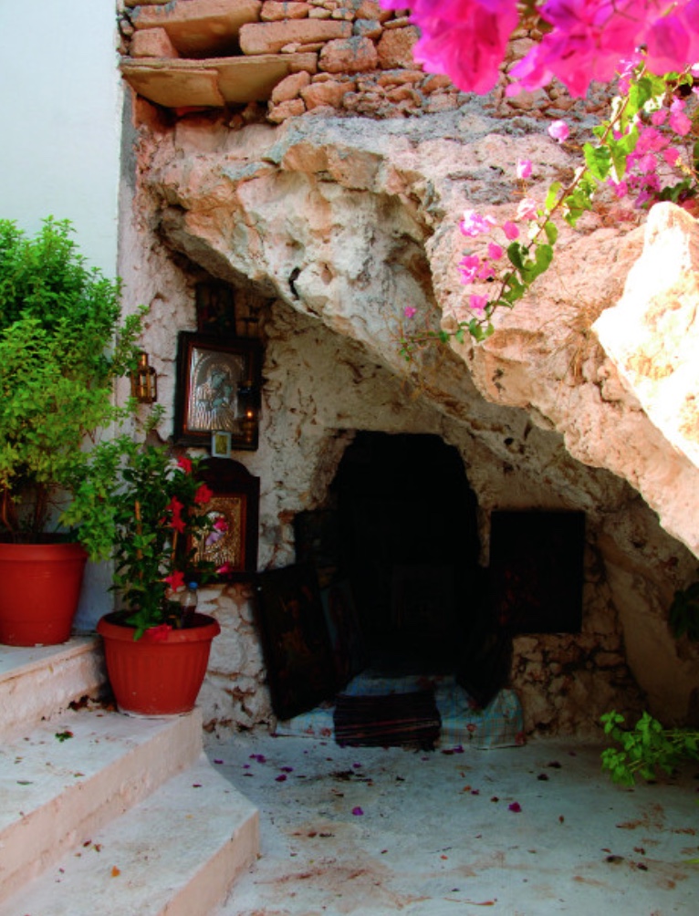
According to tradition a shepherd found the icon of the Mother of God in a small cave beside the present church, the hollow still known as the Hermit’s Cave. He took it home with him, but when his wife opened his bag she found nothing in it but his provisions. The next day the icon was back in its place in the cave. Three times the same thing happened, and so the Mother of God received the epithet Faneromeni, “she who has been revealed”, while on the spot two monks built the monastery. The icon is venerated there to this day, and a small icon is still kept in the recess of the rock where the first was found.
General historical notes
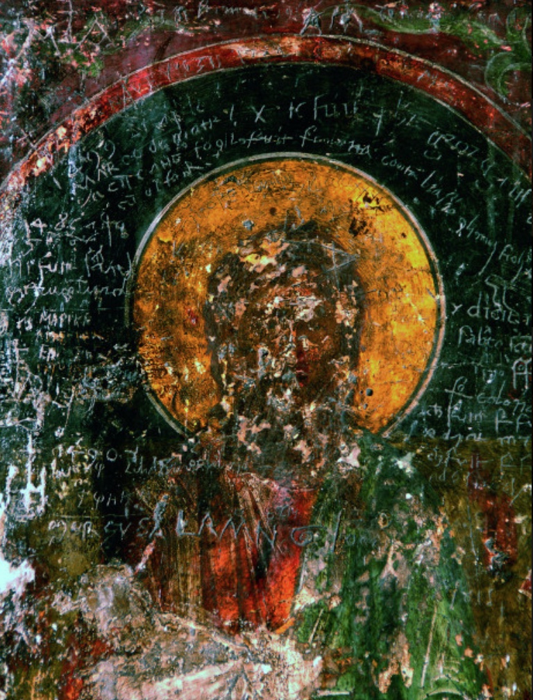
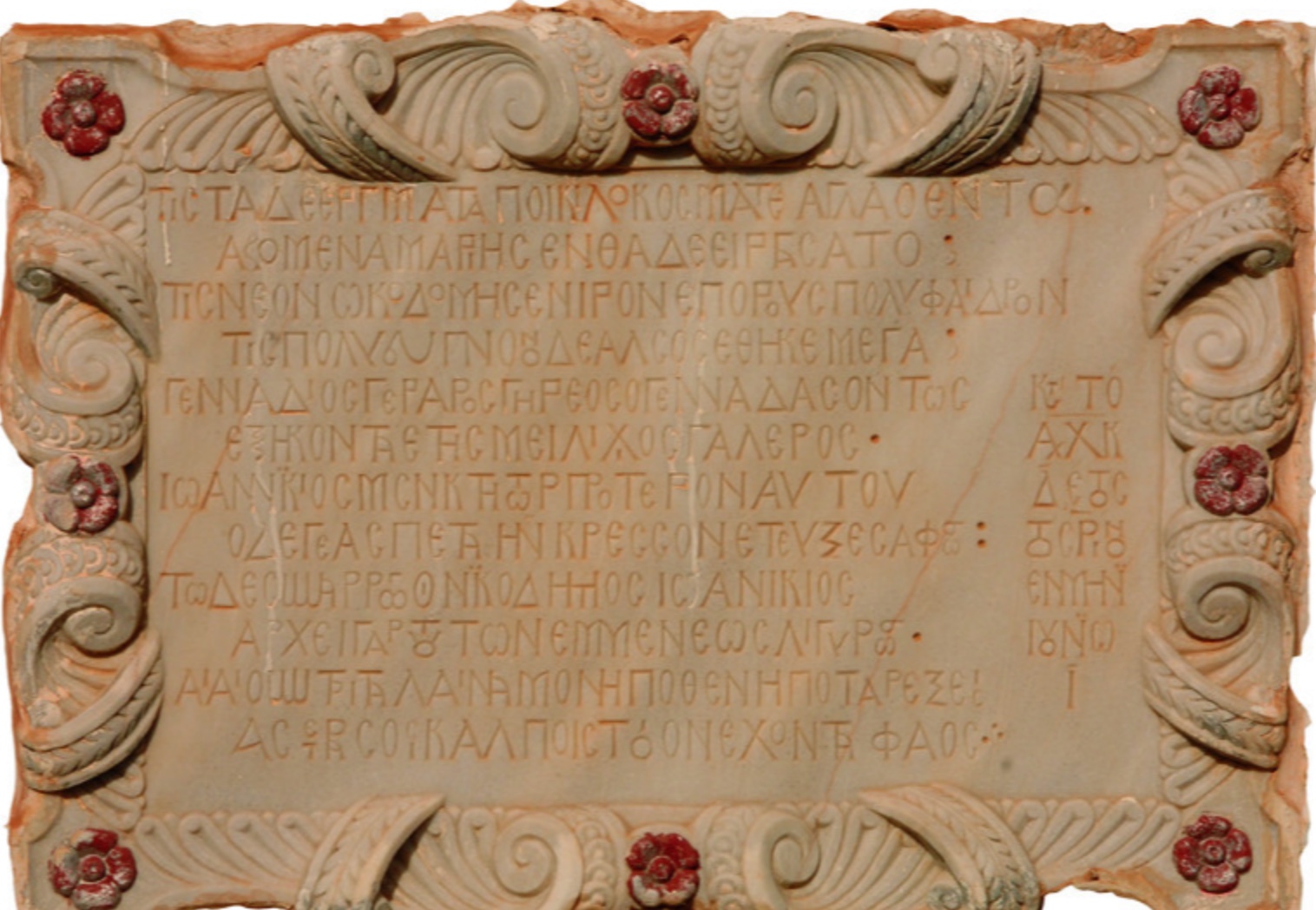
The monastery is old, as is shown by the graffiti surviving on the south-west side of the katholikon, the inscriptions of the brothers and priest-monks Gavriil and Meletios Pantogalos, and the names of the great Kornaros family; but an exact date of foundation cannot be established. In the view of N. I. Papadakis the monastery already existed and was destroyed by pirates towards the end of the 16th century. He concludes from the earliest date scratched on the walls that the monastery was founded before 1455, and from the last, which marks the end of the visits, that it ceased to exist after 1536 and was probably destroyed in Barbarossa’s raid (1537–1538) (N. I. Papadakis, “The Church of Crete”, p. 112). The coast of Sitia was notorious in the 15th and 16th centuries for the number of pirate raids it suffered. Since the building of the monastery cannot be dated precisely, while the inscriptions and dates scratched in the church run from 1455 to 1598, it can be said with certainty that all the evidence points to construction by 1624 at the latest. Other accounts carry the foundation back as far as the 13th century, attributing it to a hermit named Ioannikios who settled among the caves of the gorge.
The heart of the monastery is a two-aisled church dedicated to the Dormition of the Mother of God (15 August) and to St George (patronal feast on 3 November). The katholikon is surrounded by more recent buildings, some of them of the 18th century, which serve as cells for the “Dekapentistes” – those of the faithful who spend the first fifteen days of August, the fast before the feast of the Dormition, at the monastery. Inside the church is a small cave in which, according to legend, the icon of the All-Holy Mother of God was found, the event that prompted the building of the church. Besides this cave there are others round about, in the celebrated Gorge of All Saints, which was regarded as a place of withdrawal and prayer for ascetics. The cave to the west of the church is today thought to have been the dwelling of a hermit before church and monastery were founded.
The building of the church called for considerable technical skill, no easy task given the cramped site and the rules of Orthodox church architecture at the time. Nor did the builders manage to leave the cave of the Faneromeni outside the body of the church. For that reason the customary east–west orientation was abandoned, and the master builder chose to set the church on a north–south axis. The sanctuary is fitted into a low cave in the roughly hewn rock. The church has two doors because it houses two holy altars (it is a two-aisled church), arranged side by side in a symmetrical recess in the rock. Six very old cells in the medieval manner survive in the monastery, with iron-bound doors and small windows; there is also a room used as a dormitory.
In addition to the monastic cells there are numerous private cells, built by local people with parish funds, above all by the inhabitants of the village of Skopi, to lodge pilgrims, especially in August. For the “Dekapentistes” come to seek the grace of the Panagia from every village of the Sitia region, chiefly from the neighbouring villages of Skopi, Piskokefalo, Achladia, Chamezi, Exo Mouliana, Myrsini, Mesa Mouliana and others, and from the town of Sitia itself, and at the time of the holy services of supplication to the Mother of God the crush is tremendous. The inner courtyard of the monastery is fairly spacious; during the Dekapentavgoustos, the fortnight leading up to the feast, many people gather here and rest on the stone benches of the church. Above the sanctuary the shape of the cave has been preserved.
The “Great Cell”, a roomy chamber spanned by a medieval arch, speaks of the work once done here: this is where the monastery’s olives were milled. The “Tholos” is a cell in the upper part of the complex with a vaulted stone roof. The “Bakehouse”, a large cell at the start of the upper range, has a very big oven in which the bread of the monastery was baked, and bread for many of the people living on the metochia, the monastic estates, as well. Many remember, besides the bakehouse, an olive press within the monastery buildings, which was used by the “metocharides” and by the tenants of the monastery’s lands.
The church, the fresco decoration and the inscriptions of the katholikon are remarkable both for their state of preservation and for their artistic worth. Particularly well preserved is the entrance door of the church in the south wall. Its surround, elaborately carved all the way round, rests on inverted capitals decorated with floral ornament. Above it rises a splayed lintel with a pointed, fluted arch in relief, crowned at the apex with a pine-cone finial and decorated at the springing with a flower motif. In the reveal of the door is a graffito of 1469.
Set in above the lintel is a building inscription that tells something of the monastery’s history. From it we learn that in 1624 Gennadios restored the monastery after it had been destroyed by Barbarossa’s pirate raid of 1538. Before him Ioannikios had been its founder. This work was carried out in the last decades of Venetian rule on Crete, a period in which monasticism was flourishing.
The Greek inscription, in the rendering of Stylianos Alexiou and given here in substance, reads: “Who, out of reverence for Mary, raised these works in their manifold adornment and splendour? On the mountain that spread wide the fragrant grove a new and lovely sanctuary was built. The mighty Gennadios, full of years, truly great-hearted, gentle and noble, at the age of sixty. Ioannikios was the founder before him; the great labours of Ioannikios he has visibly completed and improved. His helpers are Nikodimos and Ioannikios, whom he directs with energy and skill. Alas, poor monastery, when and whence will you ever again find so radiant a star in your bosom? In the year of our salvation 1624, on the 10th of June.”
The inscription consists of six elegiac couplets and is composed in an archaising language that is not free of mistakes. It gives the names of the abbot Gennadios and of the venerable Ioannikios, together with those of the monks who helped in the work – Ioannikios and Nikodimos. In the opinion of St. Alexiou the original founder Ioannikios is the same person as the helper named in the inscription, which underlines the important part he played in the history of the monastery.
The aisle that carries the inscription is divided from the sanctuary by a wall pierced by two arched openings. That frescoes once covered its entire surface is betrayed by the surviving traces of colour. With funds from the parish of Skopi the walls were cleaned and conserved by restorers of the 13th Ephorate of Byzantine Antiquities. According to the Ephorate’s investigations the surviving frescoes are hard to make out, hidden as they are by layers of soot, damaged paint surfaces and modern coats of mortar; fires during the Ottoman period did damage as well.
Among the frescoes that have been identified are scenes of the punishments of hell on the south wall, depictions of the Bride in Paradise and of the Apostle Peter on the west wall, and full-length saints on the side walls. An inscription on the south side of the dome speaks of the “ineffable Word of the Father, from thee, O Mother of God”.
On the inner walls of the church numerous inscriptions and dates have been discovered, which testify to the long history of the monastery and the high regard in which it was held. Graffiti on the south and west walls record the names of distinguished visitors, among them members of the great Kornaros family.
During the Turkish occupation the monastery, on the testimony of Emmanouil Angelakis, who was living on Crete at the time, continued in being until 1829 and kept “at least a minimum of personnel” (Emmanouil Angelakis, “Siteia”, p. 221). Written evidence for each individual year of this period has not survived. But the condition of the monastery’s property at the beginning of the 20th century shows that it was not left uncared for: the life of the community went on, and buildings and land were maintained as far as was necessary.
In 1829, during yet another Cretan uprising, the Faneromeni monastery was destroyed. The Ottomans, who were leaving Sitia, plundered it and wrecked everything they found, including the icons, whose eyes they scratched out as a mark of “terrible fanaticism” (Emmanouil Angelakis, “Siteia”, p. 221). The monks themselves managed to get away.
After fifty years of oblivion the monastery was restored in 1879, as a date carved in the lintel of one of the cells records, and a handful of monks settled there again. N. Psilakis notes in the second volume of his work “Monasteries and Hermitages of Crete” that the Faneromeni monastery did not attract the attention of those 19th-century monks who were striving to restore old monasteries wherever it could be done.
After 1870 the monastery passed into the possession of Toplou Monastery, whose monks tried to rescue and restore whatever they could. The work concerned the cells and the communal rooms; the olive press was put back in order, and work was done on the surrounding land too. The years from 1870 to 1900 were a brief but significant chapter in the life of the monastery, in which the monks of the monastery of the Panagia Akrotiriani, known as Toplou, looked after the upkeep of the buildings without respite.
From 1900 the monk Grigorios Papadakis took on the office of steward of the monastery. The monk Gerasimos and the nun Salome lived here too. After a pilgrimage to the Near East Grigorios returned to his home monastery to do penance and declined to go back to Faneromeni. The buildings fell into decay once more, and services were no longer held in the church.
According to the documents in the archive of the Metropolis of Lasithi the monastery was leased to private individuals after 1900, though by then it owned very little land. In 1900, under the ecclesiastical statutes of Crete, the Faneromeni monastery was declared dissolved and attached to the monastery of the Panagia Akrotiriani and St John the Theologian at Toplou. Later the local people succeeded in having the church and buildings made over to the parish, which led to lawsuits between Sitia, Piskokefalo and Skopi over the ownership of the monastery. In the end it was awarded to the parish of Skopi, but its property was expropriated, so that it was left with only the cells, a few gardens and the offerings of pilgrims.
In 1937, when the parish of Skopi was without a priest, a priest from Chamezi took it on. The parish committee, whose members were Rousos Fragoulis, Agapitos Kotsifakis and Konstantinos Vasilakis, built and renovated the cells and laid out the first cistern for rainwater. The courtyard had been redesigned as early as 1917 and planted with acacias and other trees, which still give shade to pilgrims. Today the monastery is silent and almost deserted for most of the year; but for the feast on 15 August the icon is brought in solemn procession from the church of St George in Skopi, and then the courtyard fills with pilgrims once more.
Miracles and legends of the monastery
Scarcely any place in the east of Crete is so rich in stories as the monastery of the Panagia Faneromeni above Sitia. It stands on Cape Trachila, south of the headland that bears its name, on the edge of the gorge of Agii Pantes (All Saints), and looks far out over the sea. Tradition has it that it was founded in the 13th or early 14th century; the frescoes of the church are dated to 1455. In 1538 the corsair Hayreddin Barbarossa laid the place waste, and it was afterwards rebuilt; around 1620 there followed a further renewal. In Ottoman times fires did grave harm to the building, and the smoke has left the wall paintings blackened to this day. From 1870 to 1901 the monastery was subject to the great monastery of Toplou. Today it is uninhabited but cared for – and the stories that the old people of the district tell about the place have stayed alive.
The hermits in the rock caves
Many have heard of the two caves that open in the slope opposite the church. There, it is said, hermits once lived – for centuries the gorge and its grottoes served monks as a place of retreat and prayer. Older villagers used to relate that, passing by, they had more than once caught the sound of psalms being chanted and the scent of incense. Yet when they went closer they found in the cave neither monks nor any other living soul – only monastic habits and liturgical vestments lying there, as though their wearers had only just laid them aside.
The oil of the Mother of God
A man of the district was once passing the Faneromeni monastery and decided to go in and pray before the icon. As he did so his eye fell on a vessel full of olive oil, and he was tempted to take some of it home for his own household. “What does the Mother of God want with so much oil?” he asked himself. “She does not cook, she does not eat.” So he took another vessel and filled it. As he set off for home and was passing the olive tree of the Panagia Faneromeni, he heard a mighty voice, though he could see no one: “Take the oil back at once to the place you took it from, for it belongs to her who is full of grace – it is needed to light her lamps and candles.” The man carried the vessel back and never again ventured on anything of the kind.
The icon that kept coming back
The monastery owes its name to the most important of the legends: Faneromeni means “she who has appeared” or “she who has been revealed”. A shepherd noticed, in a narrow cleft in the rock four or five metres above the ground, a small icon of the Mother of God. He managed to climb up to it; he took the image and tucked it into his shepherd’s bag beside his bread. At home he called his wife and said: “Fetch out of my bag what I have brought back in it.” The woman looked, but found only the bread. The shepherd crossed himself. The next day he saw the icon in the cleft again. Once more he brought it down, put it in the bag, went to his wife and repeated his request – and once more there was nothing there. So it went on the third day too. Then at last the shepherd understood that it was the will of the Mother of God to remain up there. He sent word to two monks and directed them to the place where the icon had stayed, made over to them all his modest possessions, and with God’s help the monastery came into being. Other versions of the tradition say that the icon was found in a small cave beside the present church – the hollow that is shown inside the building today, where a small icon is still kept.
A place for ascetics, not for families
On another occasion a farmer happened to pass the monastery. He saw that the olive trees in the fields were heavy with fruit while the cells stood empty, and he said to himself: “I shall bring my family here. This is a good spot; with my wife and my daughters I shall do well here. We will till the fields and gather the olives – there is nobody here, after all.” Before he had even finished the sentence he heard a voice: “Go away at once, for this place is meant for the ascetic life and not for families.” Put to shame by the voice of the Mother of God, he got up and left there and then.
The uninhabited islands of the god Dionysus
From Sitia a small, privately chartered boat will take you out to a chain of islands that go by the collective name of the Dionysades (Διονυσάδες). The group lies off the north-east coast of Crete, north of the Bay of Sitia – some seventeen or eighteen kilometres from the town and about twelve and a half from the lighthouse on Cape Sidero – and consists of several bare, rocky islets: Gianysada, Dragonada and Paximada, together with little Paximadaki and their smaller satellite rocks. None of them is permanently inhabited, though finds of the ancient and early Christian periods show that people once lived out here.
Legend has it that the god Dionysus himself created these islands, and it is from him that they take their name. The name is an ancient one: Diodorus Siculus, in his Library of History, tells how Dionysus – in the Cretan version a son of Zeus and Persephone – made two islands near Crete in the so-called Twin Gulfs and called them after himself. Today they are under strict protection and form part of the European Natura 2000 network of protected areas (site GR4320011); they are also recognised as an Important Bird Area. Rare species of animals and plants find undisturbed habitats here, among them breeding colonies of Scopoli’s and Yelkouan shearwaters, while lesser kestrels pass through on migration. On the island of Paximada some 300 pairs of Eleonora’s falcon (Falco eleonorae) breed – one of the rarest and most elegant birds of prey in the Mediterranean, which spends the winter on Madagascar.
Eleonora’s falcon
According to the Hellenic Ornithological Society, Greece is home to more than 85 per cent of the world’s breeding population of this falcon, some 14,700 to 15,400 pairs; on Crete and its offshore islets about a third of the world population nests – and the Dionysades are among the important colonies. The bird is named after Eleanor of Arborea, the Sardinian ruler who in 1392 became the first sovereign known to have given legal protection to the nests of hawks and falcons. It is a slender, long-winged falcon, 36 to 42 centimetres long with a wingspan of 87 to 104 centimetres, something between a large hobby and a small peregrine, and it occurs in two forms, one sooty brown all over, the other pale buff beneath. Its way of life is remarkable. Eleonora’s falcon breeds unusually late, not until July, laying up to four eggs on the sea cliffs. Until the end of July it hunts mainly large insects on the wing; from August to October it then feeds itself and its young almost exclusively on the small songbirds that cross the sea to Africa in autumn, patrolling the cliffs to intercept tired migrants as they come in over the water. In mid-October the young fledge, and at the end of October or the beginning of November the falcons themselves set off on their flight to East Africa and Madagascar, where they again live chiefly on insects. Satellite tracking has shown that they do not follow the coasts, as was long assumed, but strike inland across the Sahara, a single one-way journey of up to 9,000 kilometres. Anyone visiting the islands should therefore keep well away from the nesting cliffs and take care not to disturb the birds.
From Piskokefalo to the village of Zou
The village of Piskokefalo (Πισκοκέφαλο) lies only about four kilometres from Sitia, on the road that leads south towards Ierapetra, and is reckoned one of the largest and most prosperous villages of the municipality; it has some 700 inhabitants, and until 1871 it was the seat of the Ottoman administration of the district. It first became famous in Venetian times, when it formed part of the fief of the Kornaros (Cornaro) family, a Venetian-Cretan house held in high esteem on the island, which had lived at first in nearby Trapezounta before settling here. Two members of the family have gone down in history, the brothers Andreas and Vitsentzos. Andreas Kornaros was a notable scholar and historian, who wrote in Italian on the history of Crete and around 1590–91 founded in Candia, today’s Heraklion, the Accademia degli Stravaganti, one of the literary societies on the Italian model. His brother Vitsentzos Kornaros (1553–1613/14), who moved to Candia around 1590, married Marietta Zeno there and served as a health commissioner during the plague of 1591–93, wrote the “Erotokritos”, a verse romance of more than 10,000 rhymed fifteen-syllable lines – 10,012, to be exact – on the love of Erotokritos for the king’s daughter Aretousa. It is set in an imagined ancient Athens complete with jousting knights, takes its plot from the French medieval romance “Paris et Vienne”, and was first printed in Venice only in 1713, a century after its author had been buried in the church of San Francesco in Candia. The poem is taught in schools and is familiar to every Greek pupil; on Crete its verses are sung to the lyra to this day. At the end of the epic the poet himself names Sitia as his home.
Still standing in the village are the family’s manor house, which goes back to about 1550, and its watermill, both of which have been restored and are intended to house a museum devoted to the poet, together with the family church of St George, which once belonged to the Kornaros and still bears their coat of arms above the doorway. In the time of the struggle against Ottoman rule Captain Giannis Papadakis, a son of this village, made a name for himself.
A detour leads to the archaeological site on the hill of Katrinia at the entrance to the village, reached by a dirt track. Here in 1952 the archaeologist Nikolaos Platon, working for the Archaeological Society at Athens, uncovered a Minoan open-air sanctuary of the Middle Minoan period. Illicit diggers had been there before him and had already carried off many figurines. The finds include figurines of people and animals – among them representations of pregnant women, and men and women with elaborately dressed hair – finely painted vessels, delicately worked jewellery and cult objects. Most curious are the clay models of beetles, found here in unusual numbers, and the miniature shrines whose cornices are crowned with the Minoan horns of consecration. They throw light on the forms of invocation, the symbolism of the votive offerings and the social background of the donors. The finds are kept in the Archaeological Museums of Sitia and Heraklion; a comprehensive scholarly publication appeared in 2023. Between Sitia and Piskokefalo, moreover, a two-storey Minoan country house has been excavated, whose rooms and staircases can still be clearly made out.
There are Byzantine monuments too: the church of St Anne and the chapel of the Panagia Trapezountiani. Close by, only a kilometre away, lies the village of Kato Episkopi, whose name recalls the bishop’s seat that once stood here; Minoan tombs and the Byzantine church of the Holy Apostles can be seen in it. Two kilometres from Piskokefalo there is also the village with the one-syllable name of Zou – the word is said by tradition to come from Arabic and to mean “spring”. It is known for its abundant spring, whose water has been piped to Sitia since 1991; beside the spring stands an old mill. In the country round Zou a Minoan farmstead has been excavated as well.
Church of St George in Piskokefalo
Piskokefalo
Church of St Anne in Piskokefalo
Panagia Trapezountiani in Piskokefalo
Church of the Holy Apostles in Kato Episkopi
The little village of Zou
From Piskokefalo you return to the main road and drive either to Sitia or to Agios Nikolaos. Sitia is the better choice, for that is where our next route begins.