Sitia to Ierapetra: across the south-east of Crete
The most complete guide to Crete: 221 places on the map, 23 routes and 49 articles — with photos, videos and the story behind every place. No sign-up, no trackers.
Routes drawn along real roads
Weather at every stop
Full-text search
“Near me” by geolocation
Create your own printable itinerary
Satellite, terrain, dark mode
Works offline
⌕
Searches 1.7 million characters of descriptions, not just names
—places
4regions
—routes
—with video
Search results
—
Interactive map
Find what is near you
Filters narrow the map and the list at once. Zoom out and pins group together.
Region
Category
Фильтры карты
Landmarks
Featured places
RegionCategory
Routes
Ready-made day trips
Individual places
Articles about landmarks
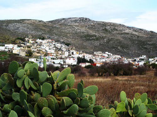
The road from Sitia to Ierapetra crosses the eastern end of Crete from the north coast to the Libyan Sea. Its appeal lies in the constant change of scenery and of period: Venetian and Byzantine churches and traditional villages give way to Minoan settlements, the Hellenistic town of Ampelos and the sandy coves of Xerokampos. Fertile upland plateaux of vineyards and windmills alternate with bare hills scented with thyme and sage, and at the end the sunny south coast opens out with its long beaches. Ziros, the largest village of the plateau, lies some 30 kilometres south of Sitia by the road through Piskokefalo, Epano Episkopi and Chandras, so the first half of the route can be covered comfortably in a morning – though the detours will easily fill a day.
Ziros and Xerokampos stand out in particular. At Ziros the church of Agia Paraskevi is held to be one of the oldest places of worship in the village and still has its wall paintings; at Xerokampos a fortified Hellenistic settlement is being investigated on the hill of Farmakokefalo, generally identified with ancient Ampelos. It was first uncovered in 1984, when excavation revealed a prosperous town with massive walls, houses and clearly laid-out streets. The finds point to links with other Cretan cities and with the islands of the Dodecanese.
What follows describes every stop along the route – villages, churches, caves, manor houses, archaeological sites and beaches. Greek names are added wherever they help in finding one’s way on the ground.
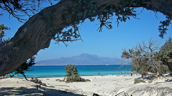
On this drive we explore the attractive countryside of the Cretan south-east. We visit the great monastery of Kapsa, pass through a succession of picturesque villages and finally reach the almost tropical island of Chrysi off Ierapetra, where splendid sandy beaches are backed by groves of large-fruited juniper, which the Greeks call “kedri”.
We leave Sitia heading south, drive through the village of Piskokefalo, already described in the previous tour, and after six kilometres reach Maronia.
Maronia
The homely village of Maronia (Μαρωνιά) lies on the west bank of the river Panteli, among olive groves that have provided its people with a living for centuries. Two churches are worth a visit: the church of the Holy Trinity (Agia Triada) and the church of the Dormition of the Virgin (Kimisis tis Theotokou) on the central square.
A handsome old fountain survives from the period of Ottoman rule. Another sight is the old olive mill, which the villagers simply call “the factory” (i fabrika). An olive museum is due to open here in the near future, telling the story of the olive growing that still shapes the Sitia region today – the olive oil of Sitia is among Greece’s protected designations of origin.
No less interesting is the locality of Kefala, where tombs cut directly into the rock have been found. A Minoan settlement was discovered close by.
Two notable caves also belong to the village: Spiliaria and Agionero, the “Holy Water”. The spring in the Agionero cave is known for its water, which is regarded as sacred and credited with healing powers.
Epano Episkopi (the Upper Bishopric)
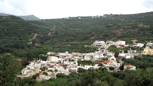
Only three kilometres from Maronia lies the attractive village of Epano Episkopi (Επάνω Επισκοπή). Its houses climb the slope like the tiers of an amphitheatre and command a wonderful view across the country as far as the Libyan Sea. The villagers receive visitors warmly in their tavernas and small restaurants.
Pride of place among the sights goes to the building of the bishop’s seat, to which the village owes its name. In Venetian times it was the residence of the Latin bishop Gaspare Viviani, who was appointed Bishop of Sitia on 17 July 1556 and from 1571 held the united see of Ierapetra and Sitia, until he was translated in 1579 to Anagni in Italy, where he died in 1605. The splendid courtyard paved in mosaic and the walls with frescoes that in part survive to this day make the building one of the historic treasures of eastern Crete.
On the village square, shaded by plane trees, stands an imposing three-aisled church dedicated to the Nativity of the Virgin, St George and St John. The natural stone masonry and the façade bearing the initials of Bishop Viviani, who had it built – which places it in the third quarter of the 16th century – give it particular importance. The church is regarded as an emblem of reconciliation, for in Viviani’s time one half was Catholic and the other Orthodox – a rare testimony to the coexistence of the two confessions in Venetian Crete.
North of the village tombs have been discovered whose sarcophagi are now kept in the Archaeological Museum of Ierapetra. At the locality of Trypitos, about a kilometre east of the village, a guard fort of the Classical and Hellenistic periods came to light. The archaeologist Nikolaos Platon examined the spot as early as 1960; since 1980 it has been a designated archaeological site. What survives is a wall some two metres high and 17 to 18 metres long, built of large dressed blocks in pseudo-isodomic masonry, the joints filled with smaller stones. The post probably watched over the valley of the Panteli and the routes along the north-western border of the territory of Praisos.
Not far from Epano Episkopi one can visit the Byzantine church of St Basil (Agios Vasilios), which was installed in a building originally put up as a bathhouse.
Leaving Epano Episkopi and following the road through the fertile plain, one reaches Nea Praisos after only three kilometres.
Praisos
The little village of Nea Praisos (Νέα Πραισός), formerly called Vavelos and today home to only about 40 people, bears the ancient name of Praisos. That was also the name of the ancient city, to whose ruins a narrow, overgrown path leads some two kilometres to the north. A walk round the site takes in Minoan sanctuaries, the remains of the acropoleis, dwelling houses, tholos tombs and late Hellenistic buildings, and a stretch of the city wall can still be made out. It is a journey some 4,000 years back, to the time when Praisos was among the most powerful cities of ancient Crete. The hills are open and there is little shade.
Praisos was the centre of the Eteocretans, the “true Cretans”, whom Homer already mentions in the Odyssey – in Book 19 they are the “great-hearted Eteocretans”, listed among the peoples of the island. Strabo calls them probably indigenous, says that they held the south and names Praisos as their town, where the temple of Dictaean Zeus stood; he places the city 60 stadia from the sea. Herodotus adds that the Praisians were one of only two Cretan communities that did not sail on the expedition to Camicus in Sicily to avenge the death of Minos. For centuries this people preserved its pre-Greek language and religion; its inscriptions are written in Greek letters – the earliest, of the late 7th or early 6th century BC, in the archaic Cretan alphabet, the later ones, down to the 3rd century BC, in the standard Ionic script – but the language has not been deciphered to this day. Most of the stones are kept in the Archaeological Museum of Heraklion. The city spread over three hills, known as the First, Second and Third Acropolis. On the so-called Altar Hill a place of sacrifice of the 8th and 7th centuries BC was found, with two Eteocretan inscriptions and votive offerings such as shields, helmets and greaves. The first excavations were carried out at the end of the 19th century by the Italians Federico Halbherr and Lucio Mariani; from 1901 the British School at Athens dug systematically under Robert Carr Bosanquet. From a tomb of the 6th century BC come two black-figure Panathenaic prize amphorae – the trophies of Athenian games. Surviving inscriptions and some fifty coin types with the legend ΠΡΑΙΣΙΩΝ attest an independent polis with kosmoi, a council of elders and a popular assembly. One custom of the place was recorded in antiquity: the Praisians used to sacrifice a pig before a wedding.
The position of Praisos favoured trade, for the city controlled the middle of the Sitia peninsula from coast to coast – its territory, as the ancient writers note, reached to either sea – and had two harbours: Heteia (Itia) in the north and Stilai (Stiles) in the south. Praisos existed for almost two millennia, the site having been occupied since Neolithic times, and flourished until, around 145/144 BC, it was conquered and destroyed by the Dorian city of Hierapytna, the present Ierapetra, which could count on the backing of Rome.
Near the modern Nea Praisos is the cave of Spileo Skala. Its exploration has thrown light on the long history of human presence in this area – from the Neolithic through the Minoan to the Geometric period.
Chandras
At a height of 570 metres, among green vineyards, lies the traditional village of Chandras (Χανδράς). In the Venetian census of 1583 it appears as “Candra” with 399 inhabitants – roughly as many as lived here into modern times. The upland on which it stands is known locally as the plateau of Armenochandrades, after its two principal villages. Substantial manor houses survive from the Venetian period, once the property of noble families; an old stone fountain (krini) dates from the same era, and a hammam, a Turkish bath, from the Turkish period.
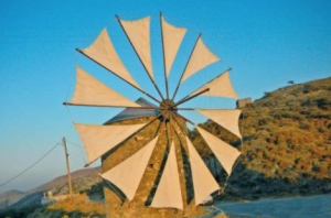
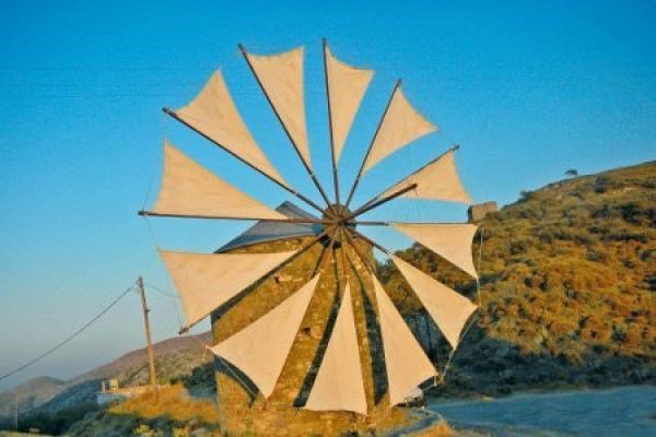
The Folklore Museum (Laografiko Mousio), small but instructive, opens a window on the world of Cretan everyday life and folk art. Around the village stand numerous old windmills (anemomyli), some of which still turn – the plateau on which Chandras lies has always, on account of its winds, been a landscape of mills.
On the hill of Xykefalo archaeologists discovered a Minoan settlement with a peak sanctuary (iero koryfis). One kilometre from Chandras, on a lonely hill reached by a paved road or a short walk, lies the mysterious abandoned village of Voila (Βόιλα). The name may go back to the Byzantine word for landed lords; in 1583 some 301 people lived here. The settlement flourished from the 15th to the 19th century and had been deserted by the end of the latter. Voila was a fief of the Salamon family, famous in Crete, with whom the ancestors of the great poet Dionysios Solomos – author of the words of the Greek national anthem – are associated. At the highest point of the hill stands the church of St George and St John the Theologian, in origin two separate churches that were later joined, the southern one, St George, being the older. It has frescoes of the 16th century and, in its south-western corner, the founder’s tomb of a “Georgius Salamon, Venetian patrician”, dated 1516; the faded painting above it shows the Virgin and Child with two noble couples. Today the village is gradually being restored and is intended to become a lively attraction reflecting Venetian Crete.
Here too stands the tower of Tzen Ali (Τζεν Αλή), built in the late Venetian period but altered and embellished by the Turks; a Turkish inscription on the outer wall carries the year 1742. Its owner is thought to have been a Venetian nobleman of the Zeni family who had converted to Islam, and he is remembered as one of the harshest janissaries of the Sitia province; Voila became a janissary stronghold. When some 500 rebels attacked it during the rising of 1828, they found that the Turks had already left. The tower is in comparatively good condition. Two fountains with Turkish reliefs, built to water the fields, likewise date from the Ottoman era. Close by are the ruins of the two-aisled church of St Panteleimon, of the 16th century. Driving north-west from Chandras, one can visit, at the locality of Panteli, the old chapel of Christ the Lord (Afendis Christos), an important building of the 15th century with a rich painted programme, including a cycle of the Creation. A Latin inscription is scratched into the wall: “Petro Abramo came here in the year 1486”. Every year on 6 August the feast of the Transfiguration of the Lord is celebrated here.
Armeni (the Armenian village)
Only two kilometres south of Chandras, surrounded by luxuriant gardens and vineyards, lies Armeni (Αρμένοι). The village owes its name to an Armenian contingent that came to the island in AD 961 with the army of the Byzantine general and later emperor Nikephoros Phokas, when he won Crete back from the Arabs. The place preserves two Byzantine churches, dedicated to St George and to the Dormition of the Virgin. Set among Venetian architecture, they give the village a particular charm.
The church of the Dormition of the Virgin was burnt down by the Turks in 1829 and rebuilt later in the 19th century. The church of St George, with its surviving Byzantine frescoes, is a witness to earlier ages. Also worth seeing is the manor house of the Kornaros family, a fine legacy of that celebrated Cretan line.
Numerous windmills and abundant springs lend the place its special character. A few minutes’ walk from the village is the Venetian monastery of St Sophia (Agia Sofia). Once flourishing, it is now abandoned, but it keeps its monastery church with a magnificently carved iconostasis and impressive icons. Some of the cells survive; in one of them a finely worked stone fireplace comes as a surprise.
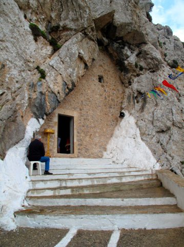
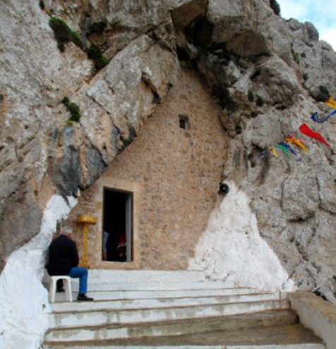
South-west of the monastery a farm track leads to a flight of 40 steps by which one reaches a cave into which the church of the Holy Spirit (Agio Pnevma) has been built. The unusual little church and the glorious view over the green valley of Chandras to the Libyan Sea leave a lasting impression. Climbing the steps further, one comes to another church, just as curious.
Armeni adjoins the village of Etia (Ετιά), whose name means “willow” and which was once the property of the Venetian De Mezzo family, feudal lords of the surrounding country. The medieval village had more than 500 inhabitants at its height and is now deserted. The family’s mansion is regarded as one of the most important architectural monuments of the Venetian period in Crete, and has been called the most splendid private Venetian building of the Cretan countryside. Originally a compact tower house with loopholes, it was enlarged in Renaissance style around 1620 to 1635; in its final form it was a rectangular block of three storeys with vaulted, richly carved rooms, set within a walled enclosure with a large court on the east side. Over the main portal, consoles borne by chimeras support the De Mezzo arms, which adorn the stone-ornamented façade; an Italian inscription on the lintel of the hall, “Intra vostra signoria senza rispetto”, invites the visitor to enter without diffidence. A fountain in the courtyard was fed by an aqueduct from a spring a kilometre and a half away, and smaller fountains outside the walls served passing travellers; a Turkish fountain was added in 1701. In Ottoman times Turkish dignitaries resided here, the last of them a janissary, Mehmet Aga, put to death in 1821. In the rising of 1828 Turks barricaded themselves in the building – some 600 armed men with 3,000 women and children are said to have taken refuge – and it was badly damaged, the upper floor collapsing; ten years later the roof and timbers were carried off, the house was fought over again in 1897, and its stone is said to have gone into the village church. The earthquake of 1856 had meanwhile brought down large parts of the walls. Admiral T. A. B. Spratt mentions the mansion in his account of his Cretan travels. The villa has been a protected monument since 1959 and has by now been largely restored; it is not normally open, but the exterior can be seen at leisure.
Etia also has two small Byzantine churches: a single-aisled one dedicated to St John, and a two-aisled one in honour of the Panagia and St Catherine. Both are in excellent condition despite their great age.
Ziros
At 590 metres above sea level lies the large village of Ziros (Ζήρος), whose inhabitants – 399 at the census of 2021 – live mainly by farming, vine growing and wine making. Until 2010 Ziros was the seat of the municipality of Lefki, named after the ancient island off the south coast; it now belongs to the municipality of Sitia. Crete’s first centre for organic viticulture was founded here; it dispenses entirely with chemicals and uses natural fertilisers only.
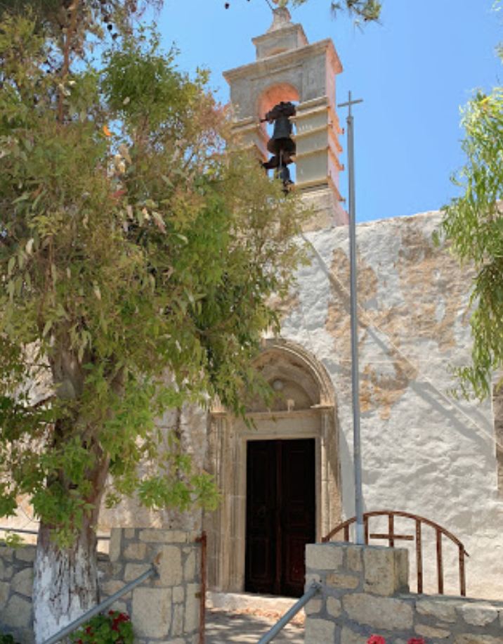
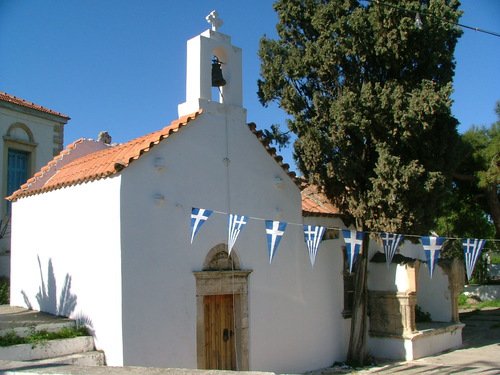
Among the cultural treasures of the village is the church of Agia Paraskevi with its splendid frescoes. In it, moreover, rest the bones of the inhabitants of the village of Skalia, who were cruelly murdered by the Turks – which gives the church a particular dignity. No less worth seeing is the church of St Nicholas, whose walls are adorned with frescoes of the 14th and 15th centuries.
Near Ziros are two spacious caves, Spilio Agrilia and Spilio Ligias. Both preserve traces of human presence from the earliest times.
The country round Ziros is rich in archaeological finds. Minoan settlements have been discovered here, and the excavations continue to this day.
Xerokampos beach
Driving south from Ziros and passing through the village of Chametoulo, one reaches after eight kilometres the coastal hamlet of Xerokampos (Ξερόκαμπος), whose name means “dry plain”. Here one can cool off on the sandy beaches of small, sheltered coves with clear water. The longest of them, Mazida Ammos, lies 500 metres west of the settlement: white sand, shallow turquoise water that is usually calm, and shelter on the east from Cape Trachilos, in which the sea cave of Fokiospilio opens. Further coves – Argilos, Amatos and Alatsolimni among them – follow within a couple of kilometres, all reached by road. The place has remained quiet; instead of large hotels, small guesthouses and tavernas set the tone. Archaeologists believe that a town of Hellenistic and Roman date lay here in antiquity, probably the ancient Ampelos, whose remains are being investigated on the hill of Farmakokefalo, about a kilometre from Mazida Ammos and approached by a dirt track. The town is thought to have been founded in the 5th century BC; in the middle of the site stands the chapel of Agios Nikolaos, built in 1895. The little islands off the coast, the Kavali islets opposite Mazida Ammos, also bear traces of ancient settlement; today their most important inhabitants are rare species of migratory birds that rest here on their way between Africa and Europe.
The patronal festival (panigiri) is held in Ziros on 29 August in honour of John the Baptist, on the day that commemorates his beheading. It is a genuine Cretan feast with music, dancing and generously laden tables.
Back in Ziros, a round trip through the surrounding villages can be made. By way of Mesa Apidi (4 km) and Exo Apidi (5 km) the road returns to Armeni (9 km); on the way one sees dozens of stone windmills, which give this landscape its character. Then, through the village of Papagiannades (14 km), one reaches the main road that leads to Lithines.
Lithines
Lithines (Λιθίνες) lies some 26 kilometres south-west of Sitia, at about 276 metres above sea level, on the old road that drops from the Sitia uplands towards the Libyan Sea. In Byzantine times the village was the estate of the influential Lithinos (Litinos) family, from whom it takes its name. According to tradition the nobleman Loukas Litinos was one of the twelve Byzantine archons whom the emperor sent to Crete in the 12th century to bind the island more firmly to Constantinople; other accounts connect the settlement with the reconquest of Crete by Nikephoros Phokas in 961. Under the Venetians the village kept its standing: a three-storey tower stood in its centre, the seat of the feudal Vlachos family, built to hold the surrounding countryside in check. The tower met a violent end in 1828, during the War of Independence, when insurgents under G. Tsouderos besieged some 140 armed Turks and 250 women who had barricaded themselves inside. After two days the attackers breached the wall and set off gunpowder within; in the panic, so the story goes, a barrel of raki was thrown onto the flames, and the ensuing blaze finished the building off. It was never rebuilt and nothing of it survives. Two splendid churches from the Venetian and Byzantine centuries do survive, however, and bear witness to the rich history of the place.
The church of Agios Athanasios stands on the village square, a few steps from the old schoolhouse that now serves as a cultural centre. It began in the 15th century as a simple single-naved chapel; a transverse aisle was added later, and inscriptions give dates between 1591 and 1603 for the work. The church has no frescoes, but it does hold a family vault: according to the inscription it served as the burial place of the noble house of Vlachos, and the tomb of the local lord Georgios Vlachos, in excellent condition, carries the family arms. A second, more weathered tomb of the arcosolium type stands against the outer wall. No less remarkable is the church of the Panagia of Lithines, built into the rock of a cave. Originally dedicated to the Dormition, it is, unusually, celebrated at the feast of the Virgin’s Birth. Its frescoes – among them a Last Judgement on the west wall and scenes from the lives of Christ and the Virgin – are generally placed in the 14th to 15th centuries, and the paintings of Christ and the Mother of God beside the iconostasis are themselves venerated as pilgrimage icons. Two further aisles were added in the mid-20th century, and the whole building has been restored by the Byzantine antiquities service. The icons are of extraordinary quality: the iconostasis carries a 15th-century St George and a Crucifixion of the same period, while the icon of the Panagia Vrefokratousa, the Virgin holding the Child, painted in the second half of the 14th century, was rediscovered in 1995 beneath a layer of overpainting dated 1714. Revered as miracle-working, it draws many pilgrims. The traditional feast in honour of the Panagia on 7 and 8 September, the Nativity of the Mother of God, is the high point of the village year.
Continuing eastwards along the coastal strip, one senses how the modern world gives way to the simplicity of rural life. Stop at Makry Gialos to absorb that distinctive atmosphere.
Makry Gialos
Makry Gialos (Μακρύς Γιαλός), the “Long Shore”, is made for a seaside holiday. The eastern part of the beach is covered with snow-white, powder-fine sand. The pirate raids of earlier centuries drove the coastal population into mountain villages such as Agios Stefanos, and for a long time the place was all but deserted, with only a few fishermen’s huts on the shore; it was resettled only after 1950, when the first local roads were built. Today the village lives on farming, greenhouses and tourism. To the north-west of the beach, in the locality called Plakakia, the archaeologist Kostas Davaras excavated a Late Minoan country house in 1973 and 1977. The building, which dates almost entirely from the Late Minoan IB period and was destroyed around 1450 BC, is laid out around a rectangular central court of about 6 by 12.5 metres with colonnades on its north and east sides; a large altar stood at the northern end of the court, with a bench facing it, and Davaras regarded the whole as a “cult villa” comparable with the houses at Nirou and Amnisos. The site has since suffered badly from farming, but it yielded a particularly precious find: a seal-stone showing a ship, an altar with a mast-like tree, and a cult figure in the bow with raised hand. This unique discovery is regarded as the first evidence of a sacred ship in the enigmatic religion of the Minoans; a female figurine, Marine Style sherds and a stone anchor, perhaps a votive offering to a goddess of the sea, came from the same house.
No less interesting is the find in the locality of Katovigli near the harbour. There, between 1976 and 1980, archaeologists under Nikos Papadakis uncovered a Roman villa inhabited from the 1st century BC into the 3rd century AD. The single-storey, tile-roofed building comprised 37 rooms around a long courtyard; in the south wing lay a luxurious bath suite with a petal- or horseshoe-shaped pool whose floor and steps were faced with marble, and an underfloor heating system (hypocaust) whose floor rested on 56 small pillars. Water was brought in from cisterns through built and pipe conduits. Mosaic floors with geometric patterns and ivy leaves, a mosaic at the entrance with floral motifs, a large reception hall and marble slabs on floors and walls speak of the prosperity of the owners, who probably lived on agriculture and seaborne trade. A funerary chamber with a complete human skeleton was found in the complex, but hardly any portable objects: the house seems to have been stripped by pirates and later plundered for its building materials in Byzantine times, and the few finds are kept in the Archaeological Museum of Sitia. Restoration work is in progress, and further discoveries may be hoped for.
If you have time, a short detour of three kilometres to the excellently equipped beach at Analipsi is worth making before you go on to Pefki; the drive then combines bathing with antiquity.
The island of Lefki, Koufonisi or “Little Delos”
From the harbour of Makry Gialos a delightful boat trip can be made to Koufonisi
The island is called Little Delos because, besides a landscape of almost divine beauty, it has yielded the exceptionally well preserved ruins of an ancient sanctuary and settlement. Its ancient name Lefki, “the White One”, comes from the pale limestone and marl that glitter in the sun. The island covers roughly 5 square kilometres and lies some 5.6 kilometres south of Cape Goudouras, separated from Crete by a narrow and often turbulent strait; its coastline runs to about 14 kilometres and counts dozens of beaches large and small, among them Anemertia, Kamarelles and Papaloukas, with dunes and sea caves between them. Excursion boats cross in calm weather from Makry Gialos, about ten nautical miles away, as well as from Xerokampos and Atherinolakkos, setting out early in the morning and returning in the late afternoon; in rough seas the trips are cancelled. There is no shade, no water and no facility of any kind on the island, so take a hat, sun cream and plenty of drinking water. A full circuit on foot takes two to three hours.
The island has had no permanent population for a very long time; in the 20th century a few families still sowed corn here in summer, and livestock grazed on it until 1975. In the writings of Aristotle and Pliny it is named as the principal export centre of the famous purple dye, obtained from a particular kind of sea snail, the murex, in its coastal waters. The live shells were gathered in season and broken open, and the milky gland removed; each snail yielded only a single drop, whose colour changed in the air from yellow to purple-red, and the finished dye was sold for its weight in silver. Sponge fishing added to the island’s wealth. In antiquity the cities of Itanos and Hierapytna quarrelled over possession of the island: after the Ptolemaic garrison left eastern Crete around 145 BC the dispute turned into open war, and the Roman Senate twice, in 140 and 112 BC, had it referred to arbitrators from Magnesia on the Maeander, who finally awarded Lefki to Itanos. The text of their judgement, carved in stone, is built into the façade of the church of Toplou Monastery. In April 1823 Cretan insurgents defeated a force of janissaries on the island. Since 1976, following a visit by the celebrated oceanographer Jacques-Yves Cousteau and the archaeologist Nikos Papadakis, excavations have been carried out here. They brought to light, at Anemertia, an excellently preserved stone theatre for about 1,000 spectators with twelve tiers of seats, some 34 metres across, with an orchestra floored with clay tiles and a stage of roughly 20 by 9 metres; it was violently destroyed and burnt down in the late 4th century AD. Near it a settlement was excavated, dominated by a large house of eight rooms with workshops for processing the purple, fishing gear and reception rooms floored with black-and-white geometric mosaics; sixteen smaller buildings, probably fishermen’s dwellings, and a public bath-house in use from the 1st to the 4th century AD, with hypocausts, hot and cold rooms, marble revetment and walls standing 4 metres high, belong to the same town, which was supplied with spring water through an extensive system of vaulted channels.
Also found were a Minoan cemetery with stone tholos tombs, remains of a town wall, and the ruins of an ancient temple, some 18 by 15.7 metres on a stepped platform, on the summit of a hill. Beside the temple two fragments of an enthroned goddess were discovered; the statue, of Hellenistic date, must once have stood about 2.5 metres high, and other pieces of it were unfortunately built into the lighthouse erected on the temple site in 1920, which was bombed by the Germans in 1944 and today works automatically. Remarkably, those who later defaced the monument scratched their names into it and recorded what was evidently for them a momentous event with the year 1630; sailors of several centuries left similar marks, and caves on the island contain Byzantine inscriptions invoking the saints.
Quite apart from its historical interest, this little island has glorious beaches of fine sand, dunes and sea grottoes. Its scrub of tamarisk, lentisk and thyme, with a few bleached tree trunks, gives it an almost African look, and it is listed as an Important Bird Area for its colony of Eleonora’s falcons.
The village and pine gorge of Pefki
In this Cretan mountain village, whose name Pefki (Πεύκοι) means “pines”, everything breathes the past and tradition. Set on the hillside at about 420 metres, some 7 kilometres north of Makry Gialos, it is a place in which to see Cretan village life as it really is. The caves of Apaloustres and Latsida impress with their stalactites, which form astonishing natural sculptures, and coins bearing the name of the emperor Marcus Aurelius have been picked up in Apaloustres; both caves show traces of human presence going back to Neolithic times. Nearby is the cave of Vreiko, about 2 kilometres north-east of the village and five minutes on foot from the car park, into which one climbs down an old metal ladder: the entrance drops 7 metres into a three-level system with a northern chamber 60 metres long and up to 12 metres high, a damper southern chamber of some 1,500 square metres richly hung with formations, and a third gallery 31 metres long. Handrails have been fixed at the steepest points, and a small colony of protected horseshoe bats lives in the southern chamber.
A walk through the pine gorge is a real discovery for lovers of nature. The gorge proper is about a kilometre long, on average some 90 metres wide and between 10 and 120 metres deep, its white rock walls rising in places to over 100 metres; it carries the stream that drains from the peak of Romanati (937 metres) down to the beach at Analipsi. Pines, plane trees and carobs line the way, with holm oaks among them; numerous springs and shady resting places invite a pause, and drinkable spring water bubbles up at the southern exit. On the way one sees the remains of the old watermill called Ilias, which worked until 1915, when the flow of water was no longer sufficient to drive it, and a path continues on to Analipsi and Makry Gialos by way of Megali Lagada and Pisokamino, with repeated views of the Libyan Sea. The whole descent from the village to the coast, about 5 kilometres with a drop of some 300 metres, forms part of the E4 European long-distance path, is marked and easy, and takes about two hours; wear closed shoes, since the bed is stony, and avoid the hours after heavy rain, which in recent years has damaged the paths of several gorges in the district. Below the gorge one finds two unusual kinds of lodging: farmhouses converted into guest rooms, and, at the hamlet of Aspros Potamos about 2 kilometres from the village, 13 little houses hewn into the rock that blend harmoniously into the green of the olive trees.
On the hill above the village stands the church of the Crucified Lord (Afendis Stavromenos), near which one may come upon Minoan remains; in the locality of Kastelopoulo a Late Minoan building has been identified that is thought to have been a beacon post or watchtower. The Folklore Museum, housed in the village primary school, introduces the life and daily round of the villagers in former times.
On the way from Analipsi to Koutsouras it is worth stopping at the cave of Staousa, where clear water gushes straight from the rock. The following video shows Staousa.
Kapsa Monastery
3 videos
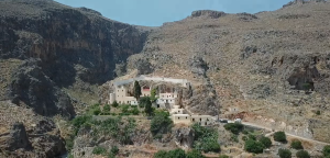
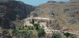
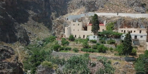
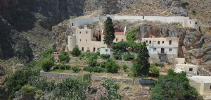
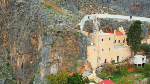
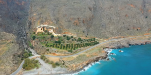
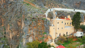
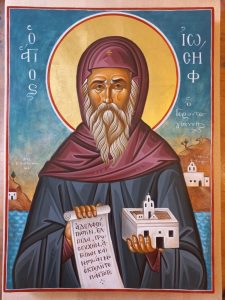
At the extreme south-eastern edge of Crete, where the Pervolakia Gorge (Φαράγγι Περβολακίων) opens towards the Libyan Sea, the Monastery of Kapsa – in full Ιερά Μονή Τιμίου Προδρόμου Καψά, the Monastery of the Venerable Forerunner John – clings to the cliff like a swallow’s nest. It lies about 9 kilometres east of Makry Gialos, 32 kilometres east of Ierapetra and 37 kilometres south-west of Sitia, some five kilometres short of Cape Goudouras; a small beach of large round pebbles with a few tamarisks lies directly below it, and from its terraces the eye travels across the bay to the flat islands of Koufonisi. Ecclesiastically it belongs to the Metropolis of Ierapytna and Sitia, and it is a dependency of Toplou Monastery. The beginnings of the monastery are obscure. They probably go back to the 13th or 14th century, for that is the date assigned to the oldest wall paintings of the cave church, of which a few Byzantine fragments survive. In 1471 pirates sacked it and the district was emptied of people; when settlers returned in the 15th century, a certain Giovanni Capsas is said to have given the place its name. Kapsa is thus not only a shrine of the faith but a living witness to the tenacity with which spiritual life on Crete has held out across the centuries against foreign rule, piracy and decay. It owes its real rebirth to a man of the 19th century: Ioannis Vitsentzos, whom the Cretans still reverently call Gerontogiannis – “Old John” – and venerate as St Joseph (Όσιος Ιωσήφ ο Γεροντογιάννης). Hardly any other name is spoken in the east of the island with such affection as that of this wonder-worker.
His path was marked by humility and renunciation. Before he brought the abandoned monastery back to life, he lived for many years as a hermit in a remote cave not far from the cave church, perhaps a hundred metres from it. There he passed his days in prayer and contemplation, plumbing the depths of a spiritual life that came to him, a man who could neither read nor write, not from books but from the services of the Church, which he knew only by ear, and from his own experience. His asceticism and unwavering devotion left a lasting impression in the hearts of countless believers, and his life is an inexhaustible source of encouragement for the pilgrims who come to Kapsa today. The cave in which he prayed can still be visited.
Today Kapsa is not only a much-visited place of pilgrimage but also a precious piece of Cretan heritage. Because the slope is so steep, the buildings are staggered on several levels, one above the other; from the quiet courtyards, where the scent of the sea breeze mingles with that of flowering plants, wide views open over the bay. The walls tell of times of flowering and of decline, yet the monastery always remained a bulwark of the faith and a refuge for all who sought spiritual clarity. That held true in the recent past too: during the German occupation in the Second World War, Greek patriots and stranded British and other Allied soldiers found shelter in this remote coastal landscape between 1941 and 1943, before escaping by submarine and small craft to Egypt. The abbot of the day, Ilarion Syntychakis, is said to have hidden fugitives and even to have operated a wireless set; the occupiers thereupon declared the district a prohibited zone, and in November 1943 the monastery had to be abandoned for a time. The monks returned in 1945, after the Germans had gone.
Kapsa attracts not only believers but equally those who seek seclusion, peace and beauty. The katholikon is a two-aisled church: the old cave chapel of St John, and beside it a second aisle dedicated to the Holy Trinity, added in 1861; the main church was completed in 1869 by the master builder Minas Hatzis, and its carved wooden iconostasis, made in 1869, was painted in 1874. Important icons of the Cretan School are kept in the church, among them a Mother of God with the Child of the 15th century and an image of John the Baptist of the 16th. Kapsa is counted among the most picturesque and impressive monasteries of Crete.
The finest day for a visit is 29 August, the patronal feast of the monastery. On that day the Orthodox Church commemorates the Beheading of John the Baptist; in popular speech the feast is called Ai-Giannis o Rigologos (Αη-Γιάννης ο Ριγολόγος). From the eve of the feast thousands of the faithful arrive from every part of Crete, many of them after a long pilgrimage on foot, to take part in the vigil, the festal Divine Liturgy and the panigyri that follows – that popular festival in which faith and the Cretan way of life fuse into an inseparable whole. The monastery keeps other feast days besides: on 7 August the memory of St Joseph Gerontogiannis is celebrated, the day after the anniversary of his death in 1874, and on the Wednesday of Easter Week (Τετάρτη της Διακαινησίμου) the finding and translation of his relics, which took place on 7 May 1982 and are now kept in a silver reliquary, is commemorated. A vigil is also held on the night of 6 to 7 January, for the feast of the Synaxis of John the Baptist.
The life of the Blessed Joseph
Ioannis Vitsentzos, later called Gerontogiannis, was born in 1799 in the half-ruined Monastery of the Forerunner (Prodromos) at Kapsa. His devout parents, Emmanouil and Zambia, had fled from the depredations of the Turks into these bleak and isolated ruins. Only later, when the persecutions had eased a little, did they move to the neighbouring village of Lithines. The boy never attended a school; he learned the prayers and chants of the Church simply by listening, and he remained unable to read or write to the end of his life.
When he was grown he took as his wife Kalliopi, who came from the Gerontakis or Gerontis family. She too was one of the persecuted: she was hiding on the south-eastern coast for fear of suffering the same fate as her only sister, who had taken her own life rather than be dishonoured by the Turks.
For that very reason her parents had sent Kalliopi to the lonely shores near Kapsa Monastery. There she met Ioannis and married him; four children were born of the marriage, three daughters and a son.
Towards his Turkish masters Ioannis was unbending, yet at the same time he was a markedly devout Christian. Again and again he drew the attention of the Ottoman authorities, and the Turkish police pursued him. For that reason he often took refuge with his family in the Pervolakia Gorge, where no one could track him down. For most of the year, however, the family lived on the metochi – a monastic farm – called Katsaroli, not far from Lithines.
According to tradition, one Sunday Ioannis gathered firewood and loaded it on his beast of burden in order to sell it, as he usually did, in the villages of Armeni and Chandras and barter it for wine. He took his wife Kalliopi with him and left her at Lithines with her relatives, while the children stayed behind alone on the farm. On the way home Kalliopi was seized by a dark foreboding that something terrible had happened at home during their absence.
When they arrived they found their youngest daughter Irini lying burnt in the yard. Her little dress had caught fire, and her brothers and sisters had carried her outside in the childish belief that the wind would put out the flames. Ioannis saw in this misfortune, which cost his daughter her life, a divine punishment for his sins – not least for having worked and traded on the Lord’s Day. The event became the turning point of his life and the occasion of a profound conversion.
He left the deserted monastery and settled for good at Lithines. Villagers, relatives and all who knew him became witnesses, day by day, of his transformation. The hard, hot-tempered and quarrelsome Ioannis became a patient, merciful, gentle man who bore no one a grudge. Regular participation in the sacraments of the Church, fasting, prayer, almsgiving and unceasing repentance purified his heart and enlightened his mind, so that he became ready to receive a divine revelation that was to prove decisive for the rest of his life.
In 1841, at the age of 42, Gerontogiannis fell into a deathlike sleep which those around him took for his end. Like the Apostle Paul before him, so tradition relates, he was carried up into heaven by an angel of the Lord; he beheld the hosts of the righteous in heavenly glory and joy, but also the manifold torments of those condemned to eternal pain. After 43 hours he awoke serene and calm, and found himself surrounded by a crowd of relatives, neighbours and villagers. Among them was a paralysed old woman. He stretched out his hand to her, whispered a prayer and healed her before the astonished eyes of the many present. From then on, it is said, spiritual teachings poured from the mouth of the unlettered man and left his hearers amazed.
Immediately afterwards he began to preach and to work miracles. From the whole district of Sitia people made the daily pilgrimage to his house to meet him, to ask his blessing and advice, and to be freed from their sufferings. Such goings-on naturally did not escape the Turkish authorities.
These were troubled years: the Greek Revolution had shaken Crete too, and the situation on the island was tense. The Turks declared Gerontogiannis a danger to public order, for they suspected that the gatherings in his house served revolutionary ends under a religious pretext.
In truth, however, those who surrounded the saint were above all the sick and the infirm, who sought relief, comfort and healing from him.
Three times he was summoned to Heraklion before the court of the governor of Crete, Mustafa Pasha – Mustafa Naili Pasha, an Albanian who had risen in the service of Mehmed Ali of Egypt, governed the island from 1832 to 1851 and was later twice Grand Vizier at Constantinople. But the continued persecutions and arrests produced exactly the opposite of what the authorities intended: in every village through which the righteous man was led, people flocked together to greet him and receive his blessing. At the third arrest, too, a great crowd of the faithful gathered. This angered the governor – called Igemonas in Greek – and he ordered his guard to disperse the crowd and throw Gerontogiannis into prison at once. At the intercession of one of his advisers, Ioannis Kapetanakis of Sitia, however, the latter was allowed to take the prisoner into his own house; Gerontogiannis was nevertheless forbidden to leave it until sentence was passed. Rumour had it that he faced either banishment from Crete or the dungeon.
In those very days the governor’s child fell down a staircase. It suffered severe injuries and lay unconscious; no physician could bring it back to life. A father’s love proved stronger than any pride: the Turkish governor sent for the wonder-working healer of the Romii – as the Greeks had called themselves since Byzantine times. Scarcely had Gerontogiannis touched the child with his hand and spoken a prayer than it awoke and came to itself.
Something similar befell the governor’s mother-in-law, whom he freed from a long illness that had been thought incurable. Thereupon the Pasha released Gerontogiannis and allowed him to return to his village and continue his beneficent work. Out of gratitude he even sent rich presents after him, but the saint accepted of them only seventeen kantaria – an old Ottoman unit of weight – for the church of the Panagia at Lithines.
Later Ilarion Katsoulis, Bishop of Ierositeia, that is of Sitia (1846–1869), advised him to withdraw to some remote place so that the protests and complaints of the Turks might at last fall silent. According to one tradition the bishop too had at first distrusted him and taken him for a charlatan; only when Gerontogiannis healed his sick mare, which had become unmanageable after foaling, did he change his mind. For the hermit no other hallowed place could come into question than the half-ruined Monastery of Kapsa, where he had been born, baptised and married. It was the same bishop who, in 1863, when the rebuilt church was consecrated, tonsured him a monk of the Great Schema and gave him the name Joseph.
So the modern history of the monastery begins with the decision of the enlightened man to settle in the wilderness of Kapsa in 1841. The refoundation is also dated to 1844 or, counting from the consecration of the church, to 1861 or 1863.
After 1840 the Ottoman administration of Crete under Mustafa Naili Pasha, who had married a priest’s daughter and allowed her to remain a Christian, showed itself comparatively tolerant towards the restoration of monasteries and the repair of numerous churches that had been left to decay for centuries. That naturally benefited the monastery into which Joseph Gerontogiannis withdrew. In 1841 the last owner of the ground on which stood the half-ruined monydri – the little monastery – of the Prophet and Forerunner made over the cave church and the surrounding land to St Joseph Gerontogiannis, the founder and restorer of the monastery. This owner was Chatzi-Nikolaos Zafiridis from the village of Agia Triada near Sitia, who had earlier bought the land from the Turk Dervish Aga Chatzarifakis.
Since the blessed elder was wholly unlettered and left no written record, it cannot be said with certainty what he found at Kapsa at that time. What is certain is that there was a church of St John, which evidently drew many believers from the surrounding villages, together with two buildings beside the church whose cells lay in ruins. There was also a well of brackish water – a further indication that a monastery had once stood here, on whose ruins the new one was now raised. The deserted monastery awoke to new life: pilgrims and the sick came once more, wishing to meet the hermit and find healing through his blessing. The blessed Gerontogiannis himself lived for seventeen years in one of the remote caves north-west of the cave church, while the old cells were given over to the many pilgrims and the numerous novices who wished to take the monastic habit. In this way the nucleus of the first monastic community was formed, and by the time the church was consecrated in 1863 the buildings had grown on four levels to include cells, a guest house, a refectory, kitchen, ovens and cisterns.
A growing community needed somewhere to live, and so the monastery had to be restored: the old buildings were repaired and new ones raised beside them. The work went on for several years and stopped only in 1858, when a fresh rising in the Turkish-held parts of Crete drove Gerontogiannis to the island of Kasos for five months. In 1861 the main church in the rock was given a second aisle, dedicated to the Holy Trinity. The monastic buildings were laid out on four levels, stepped up the cliff, and comprised cells, a guest house, the refectory, a kitchen, a bakehouse, storerooms and a large cistern for collecting rainwater – the only dependable supply on this dry coast. By 1863 the monastery was complete, and Bishop Ilarion Katsoulis consecrated the katholikon, the main church. In the same year Ioannis received the Great Schema, the highest degree of Orthodox monasticism, and with it the monastic name Joseph. The carved wooden iconostasis was finished in 1869; it is the work of the woodcarver Hatziminas (Minas Hatzis), and its painted panels are attributed to Antonis Alexandridis.
The blessed Gerontogiannis remained at Kapsa until the great Cretan revolt, proclaimed on 21 August 1866. Fearing that the occupiers would destroy the monastery, he decided to move with his community to the old, long-forgotten and abandoned monastery of Agia Sofia (Hagia Sophia), which lies some twenty kilometres away on the Armeni plateau in the heart of the Sitia district, a little over a kilometre from the Venetian villa at Etia. It was a house of some antiquity, thought to have been founded between 1450 and 1500, probably by the Venetian Cornaro family, and renovated in 1634. At Kapsa he left a single monk in charge until 1870. According to some accounts it was his grandson, Joseph Gerontakis, who took over the direction during these years and carried on enlarging the monastery.
At Agia Sofia the blessed Joseph set about the complete renewal of the monastery, which had suffered at Turkish hands in 1866, and the cultivation of its lands; he also installed a number of monks there. Within a short time he had quite literally transformed the whole neighbourhood, and won general admiration for it.
Because pilgrims from the surrounding villages sought him out there too, he became a target for slander. On the instructions of the then Bishop of Ierositeia, Neofytos Kalogeridis (1869–1878), he therefore returned in 1870 to his original monastery, where he spent the last years of his life; Agia Sofia fell empty behind him and for a time housed a school. The elder lived in strict abstinence, in prayer and in fasting. He ate only dry food – chiefly olives, wild greens and rusks. Most of the day he spent praying in his cell; he followed the services through a window that gave on to the church, and only on Sundays, when he received Holy Communion, did he go down into the church itself. The Lord had granted him the gift of healing, and day after day he worked many miracles for those who approached him in faith. The heart of his teaching has come down in one plain sentence: “Without love, everything is in vain.”
His reputation spread quickly across the whole of Crete and as far as the islands of Chalki, Kasos and Symi. Every day crowds of the faithful arrived, looking for wise counsel and direction in their ordinary lives. Others begged him to cure their illnesses or to free them from unclean spirits. Through it all Gerontogiannis kept his inner peace; moved by boundless love for suffering humanity, after the example of the Lord Jesus Christ, he advised, strengthened and healed all the sick and brought them the grace of God for the health of body and soul. It was widely told that the elder could turn seawater fresh merely by touching it. People also say that he would cast his habit on the waves and use it as a raft to cross from time to time to Koufonisi, the island that lies a few nautical miles off the monastery and is plainly visible from its terraces. The blessed Joseph had, besides, the gift of second sight: he recognised stolen goods, which pilgrims frequently brought him as offerings, and told the bearers to return them to their rightful owners.
Decades of asceticism wore out his ailing body; his voice grew so thin that it was hard to make out what he said. For the last months of his life he was bedridden and no longer left his cell. He foresaw his death and summoned the whole brotherhood to his cell, to ask their forgiveness and give them his last counsels. He named the monk Anastasios as his successor, and foretold the exact day and hour of his death. He asked his grandson Joseph, then a deacon, and the monk Gennadios to celebrate the liturgy together and bring him the Holy Mysteries.
On 6 August 1874, the feast of the Transfiguration of Christ, having received Communion, he called the fathers to his cell once more, again asked their forgiveness, made the sign of the cross, lay down on his right side, folded his hands across his breast in the monastic manner and gave up his soul to the Lord. He was seventy-five.
His body at once became an object of popular veneration. Crowds came to the monastery every day to bow before it and pay their last respects, so that it lay unburied for three days. On 9 August 1874 he was laid to rest in the church of the Forerunner, in the south-west corner, in a grave cut into the rock. It had been prepared by his grandson, later abbot of the monastery, Archimandrite Joseph Gerontakis, who went on enlarging the complex over the following decades and provided it with a water supply. An inscription of 1882 above the entrance to the katholikon commemorates both founders, grandfather and grandson.
People went on coming to the elder’s tomb after his death. Visitors to the monastery took away earth from his grave as a blessing, and many, it is said, were healed by it. The bones of the blessed Joseph were ceremonially raised on 7 May 1982, 108 years after his death.
The holy relics, from which an indescribable fragrance is said to rise, now rest in a silver reliquary in the central part of the monastery church; the saint’s skull is displayed for veneration in a place of honour. To this day they draw thousands of pilgrims who come seeking help in their troubles and, as the faithful attest, find healing. In the early 2000s the Ecumenical Patriarchate of Constantinople formally entered Joseph Gerontogiannis in the calendar of saints. His feast is kept on 7 August, the day after the anniversary of his death, so that it does not coincide with the Transfiguration. Having been a husband and father before he became a hermit, he is honoured in Crete as a model of both the married and the monastic life.
The history of the monastery before the blessed Joseph
The holy monastery of the Prophet and Forerunner at Kapsa rises on a steep mountainside, 57 metres above the sea, around the two-aisled cave church dedicated to St John the Baptist and the Holy Trinity. From outside the church appears as a twin-aisled, vaulted building whose rear wall passes straight into the living rock; the whole complex, piled up against the cliff, has something of the look of a fortress.
In this inaccessible, stony slope of grey-red rock open a number of caves, large and small; immediately to the west is the mouth of the picturesque Pervolakia Gorge, whose high walls part here to meet the sea. A pebble beach lies below, and the surfaced coast road from Makry Gialos, nine kilometres to the west, passes the foot of the monastery on its way to Goudouras.
When exactly the old monastery was founded, on whose footings the present one arose thanks to the devout Joseph Gerontogiannis, cannot be established. There are no written sources to tell us – with one exception: the codex of the monastery, compiled in 1890 by a descendant of the blessed Joseph, Archimandrite Joseph Gerontakis, and confirmed by the late Bishop Amvrosios of Ierositeia (1890–1929).
It reads: “… from ancient times there stood on this rock a cave monastery, a very old one – perhaps Venetian or even Byzantine – whose walls were formed by the rock itself; it was adorned with four wooden images, one of the Mother of God and three of the Prophet and Forerunner, fixed to the rock on the east side …”
The layout, moreover, is markedly different from that of other monasteries founded around the middle of the 19th century. The existence of an older house is also borne out by the dates scratched into the walls, which run from 1552 to 1809 – mostly left by priests who served or prayed in the ruined monastery – and by the inscriptions on the frescoes of the north wall and on the ambo of the church of St John the Baptist, the only part of the old complex to survive, where a few fragments of Byzantine-period painting can still be made out. Local tradition holds that a predecessor monastery was laid waste in 1471 in a raid by Turkish corsairs, after which the district was for a time deserted – a fate shared by many of the coastal monasteries of Crete in that age. The name Kapsa is said to go back to one Giovanni Capsas, who settled here when people returned to the coast in the 15th century, by which time only the little rock church was standing. So when Ioannis Vitsentzos brought the ruins back to life in the 19th century, he was taking up a tradition of prayer that had already existed for many generations on this remote rock above the Libyan Sea.
The history of the monastery after the blessed Joseph
A few years after the passing of the blessed Joseph Gerontogiannis, his grandson, Archimandrite Joseph Gerontakis, took over the direction of the monastery and continued his grandfather’s work. He showed a rare gift for administration and organisation, and remarkable energy.
He had new cells built, bought additional land and piped the water of the spring of the Holy Forty (Άγιοι Σαράντα) into the monastery – for a community in this parched, rocky country an achievement whose importance can hardly be overstated, since until then it had depended on its rainwater cistern and a brackish well. Under his leadership new monks joined; in 1881 five monks and five laymen were living at Kapsa.
In 1900, however, when the Statute of the Church of Crete (Law 276/1900 of the then autonomous Cretan State) came into force, Kapsa was dissolved as an independent house and attached to Toplou Monastery – the stauropegial monastery of Panagia Akrotiriani and St John the Theologian in the north-east of the Sitia district, a fortified foundation with walls ten metres high that had enjoyed patriarchal protection since 1704. The deserted monastery of Agia Sofia at Armeni was made over to Toplou in the same year.
The abbot of the day, Archimandrite Joseph Gerontakis, could not reconcile himself to this decision. He went to the Dodecanese island of Symi, where he was entrusted with a parish, and remained there for the rest of his life. He died in 1933, leaving behind the reputation of a devout and much sought-after confessor.
For a long time the monastery remained dependent on Toplou
The part the monastery played in the struggle for national liberation during the Italian and German occupation also deserves mention. For Crete this began in the spring of 1941; the east of the island was under Italian administration until the autumn of 1943.
Many Greek resistance fighters, together with officers and men of the Allied forces, found refuge in this isolated district, to be taken off from here by submarine and by boat to safety in Egypt. The concealed coves of the south-east coast, hard to keep under watch and far from the garrison towns, lent themselves particularly well to the purpose.
The abbot at the time, Ilarion Syntychakis, and his monks hid and looked after those hunted by the occupying troops – although they knew perfectly well that under the standing order anyone who helped foreign soldiers or assisted their escape faced the death penalty. The danger was real enough: at the mother house of Toplou, which sheltered resistance men and their wireless set, the abbot and two monks were tortured and executed when the transmitter was discovered.
In spite of brutal arrests, interrogation and torture, the monks of Kapsa admitted neither to having protected resistance fighters nor to having used a wireless set. They had joined the fight against the invaders not for reward, laurels or fame, but solely out of love of God and country. This only embittered the Germans further, for they suspected Kapsa of being a nest of Greek espionage. In November 1943, having taken over the east of the island from the Italians, they accordingly declared the area a dead zone and ordered the abbot and all the inhabitants to clear the monastery at once.
After the war had ended, in 1945, Hieromonk Ilarion came back and devoted himself to rebuilding the monastery. Since then Kapsa has continued on its way with a small number of monks. A notable contribution was made by the late Gerontissa Agathangeli Karidi (died 2007), who served at the monastery for more than fifty years. As she liked to tell pilgrims, she never left the holy place, even in the hardest times.
In 1975 the present abbot, Archimandrite Methodios Perakis, settled at the monastery. With characteristic zeal he has given himself ever since to restoring and embellishing its buildings.
Following a detailed structural and historical survey by specialist engineers, the west wing and the inner courtyard of the complex were restored and consolidated in 2005 and 2006 under the supervision of the 13th Ephorate of Byzantine Antiquities. At the same time the frescoes in the katholikon were conserved and cleaned (see the photograph album).
The visitor can enjoy a quiet and captivating landscape here, in which the eye loses itself in the endless blue of the Libyan Sea, with Koufonisi low on the horizon, and which calls to mind St Catherine’s Monastery on Sinai or the hermitages of Karoulia on the Holy Mountain of Athos. He can equally enjoy the hospitality of the monks, who by old custom offer a traditional welcome beneath the vines that roof the courtyard – usually a glass of cool water, a coffee and a piece of loukoumi, or a raki.
The elaborate floor of the katholikon merits particular attention: it is laid with pebbles from the sea, arranged to form ornamental patterns and religious symbols. Equally worth seeing is the splendid wooden iconostasis of 1869, with Hatziminas’s exquisite carving and its painted panels.
The pilgrim can also venerate the miracle-working icon of the Forerunner, the tomb and the holy relics of the monastery’s founder, the blessed Joseph. The monastery keeps, in addition, relics of numerous other saints, among them John the Baptist, Basil the Great, Saints Panteleimon, Eleftherios, Modestos and Charalambos, Bishop Michael of Synnada, St John “from the Hagarenes” and others, as well as a fragment of the True Cross of our Lord.
Inseparable from the monastery is the cave in which the blessed Joseph Gerontogiannis lived as an ascetic for seventeen years. It lies about 100 metres west of the monastic buildings. A specially made path leads through the monastery and then up behind it to the cave, which opens in the sheer, iron-hard wall of the Pervolakia Gorge. Stalactites hang inside, and water seeps constantly from the rock; the faithful regard it as holy and like to take it home in small bottles. The short climb is steep, and stout shoes are advisable.
The community keeps its patronal feast on 29 August, in commemoration of the Beheading of the venerable Forerunner. Hundreds, and in some years thousands, of the faithful from the dioceses of Ierapetra and Sitia take part, many of them arriving on foot.
With particular devotion, and with an all-night vigil, the memory of the blessed Joseph Gerontogiannis is also observed on 7 August. The translation of his relics is celebrated on the Wednesday of Easter Week.
Finally, on the night of 6 to 7 January, for the feast of the Synaxis of the venerable Forerunner and Baptist John, a vigil with vespers is held.
Koutsouras
A few kilometres west of Makry Gialos and some 20 to 22 kilometres east of Ierapetra, on the main coast road between the two, lies Koutsouras (Κουτσουράς), today a well-equipped resort with a police station, a pharmacy, a clinic, hotels, tavernas and supermarkets, yet still a quiet place. The village is built in a shallow valley of pines, olive groves and greenhouses at the foot of the southern slopes of Mount Thripti. Besides tourism its inhabitants – just over 770 at the 2011 census – live on market gardening and above all from the plastic-covered greenhouses that stamp the whole coastal plain around Ierapetra. The place was once widely known for its pistachios, which only a handful of farmers still grow. The name is usually traced to the pine trunks (κούτσουρα) that were once felled here; a small pine grove at the entrance to the village, beside the beach of Apigania, recalls that trade and serves in summer as an open-air stage for cultural events. The dense pine forest that once clothed the slopes of Thripti above the village was badly damaged by a great fire in 1993, though the green has since returned.
The parish church is dedicated to St Catherine, but the villagers venerate St Anthony as their patron. A popular tradition tells how, in the time of Turkish rule, the inhabitants fled into the church to escape a massacre. The building was surrounded and no help could be expected from any quarter – whereupon the altar split into two halves and everyone was able to escape.
In July and August the local cultural associations stage evenings of folk song and dance, so that visitors have plenty to see and hear. On 15 August, the feast of the Dormition of the Virgin, a great panigyri is celebrated in honour of the Panagia, with a procession, performances by dance groups and a communal meal to which everyone is welcome.
The beach at Koutsouras flies the Blue Flag, awarded by the Foundation for Environmental Education (FEE) for clean bathing water and exemplary environmental management. The main beach lies west of the village: its shore is of fine, dark grey shingle and coarse sand, shaded in places by tamarisks, and the crystal-clear water and gently shelving seabed draw thousands of holidaymakers every year. Among the loveliest stretches is the beach of Kalamokania; there is also a small pebble beach by the little harbour, about a kilometre and a half to the west beside the Apigania pine wood, and the sandy beach of Koutsourelis a kilometre to the east, which is particularly suitable for children. Near the village, too, the Gorge of the Red Butterflies (Φαράγγι των Κόκκινων Πεταλούδων) comes down to the coast: a well-watered, densely vegetated ravine, also known as the Orino or Koutsouras Gorge, about five kilometres long, with small streams and waterfalls, in which countless red butterflies fly in spring. The fire of 1993 reduced their numbers, but the vegetation has recovered completely, and the walk – signposted, though not always clearly, and taking under four hours in summer, longer in winter when the streams run high – is a rewarding excursion for walkers.
We drive on towards Ierapetra. Five kilometres beyond the coastal village of Agios Panteleimonas – a small place of some 120 inhabitants with its own beaches and tourist facilities – we turn right at the church of the same name and climb into the mountain village of Orino, roughly eleven kilometres inland from the main road.
Orino – the mountain village
Orino (Ορεινό, literally “the mountainous one”) lies at about 620 metres on the slopes of the Thripti range and counts as the highest inhabited village in the municipality of Ierapetra; from here the view opens wide across the Libyan Sea. The village is sunk in the green of plane trees and great walnuts, with vines, flowers and fruit trees around the old houses and streams chattering between them, and a torrent that still runs through the village in summer. A good part of the housing has been restored and paved lanes laid out, though stretches of the old earthen streets survive. Today it has only about a hundred inhabitants (101 at the 2011 census); the Venetian census of 1583 recorded 217. Two neighbouring hamlets, Andrianos and Kalyvitis, have been abandoned altogether. Arthur Evans, passing through on his early travels, noted ancient remains at the sites of Lenika and Skafi nearby.
The tower of the Solomos family gives the place historical depth. It most probably bears the name of a notable Cretan family: scholars suspect that the roots of Greece’s national poet Dionysios Solomos, author of the Hymn to Liberty, lie here. The field name Solomika and the ruins of the tower in which the family is said to have lived point that way; they are thought to have left Crete for Zakynthos after the Ottoman conquest of the island.
In the gorge below the village stands the Byzantine church of the Transfiguration of the Saviour (Μεταμόρφωση του Σωτήρος). It dates from the second Byzantine period of Crete, that is from the years between 961 and 1204, and preserves well-kept frescoes. An inscription on the lintel records the visit of a Byzantine general – “a general of Byzantium came here”. The village church itself is dedicated to Christ the Lord (Αφέντης Χριστός).
To the south of the village stands the church of St Demetrios, of the 12th century. Its astonishingly well-preserved frescoes are priceless testimony to the faith and the painterly skill of their age.
The great excursion from here is the ascent of the summit of Thripti (Θρυπτή). A dirt track leads from Orino almost to the top, and the European long-distance path E4 also touches the range – it runs from Vasiliki by way of Monastiraki to the hamlet of Thripti at 855 metres on its little plateau – which the locals call Aori, “the unfenced”. On the highest point, Afentis Stavromenos, at 1,476 metres, stands the chapel of the Holy Cross (Τίμιος Σταυρός), also known as Afentis Christos. From here one surveys the whole coast of eastern Crete, in clear weather as far as the island of Kasos, the Libyan Sea and the districts of Ierapetra and Sitia. On the northern side of the massif the mountain holds the only surviving pine forest of the Sitia mountains, with the hamlet of Thripti among its vineyards, and it is from there that the famous Ha Gorge plunges down towards Kavousi. The climbers’ hut beside the chapel offers seclusion and quiet, and the panigyri for the Exaltation of the Cross on 14 September gathers the people of the surrounding villages in shared faith and cheerful company.
Afterwards the journey takes us back down to the coast, through the seaside villages of Mavros Kolymbos, Achlia and Galini with their fine beaches, well frequented in summer. Koutsounari too, known for its excellent beaches, lies on the way to Ierapetra and rounds off this special stage of the route.
This detour into a Cretan mountain village and its surroundings shows the history, culture and nature of the region at close quarters.
Ierapetra – the southernmost town in Europe and the “sacred stone”
Ierapetra (Ιεράπετρα), fondly described as the southernmost town in Europe and the only real town on the whole south coast of Crete – its people call it “the bride of the Libyan Sea” – is among the oldest continuously inhabited places in the Mediterranean, and it surprises the visitor with a rich historical inheritance as much as with the charm of a lively present. Traces of settlement reach back into Minoan times. Ancient Hierapytna rose in the Classical and Hellenistic periods to become the most powerful Dorian city-state of eastern Crete, the Dorians being the warlike people who shaped much of the island in the 1st millennium BC; tradition, however, ascribes the foundation to the Korybantes from Rhodes and knows older names such as Kyrba, Pytna and Kamiros. The name Ierapetra is generally understood as “sacred stone”, a hint of the cultic and religious significance the place held for its earliest inhabitants. In the 3rd century BC the city won an unsavoury reputation for piracy, and in the Cretan War of 205–200 BC it sided with Philip V of Macedon against Knossos and Rhodes. In the 2nd century BC the city reached its zenith, subduing among others its neighbour and rival Praisos, the last stronghold of the Eteocretans.
Over the centuries the town lived through countless upheavals. In 67 BC, after a hard siege, it fell as one of the last free cities of Crete to the Roman general Quintus Caecilius Metellus. Under the Romans Hierapytna became an important administrative and cultural centre and a naval base; they built splendid temples, theatres, baths and aqueducts, and the city flourished. Remains of the Roman harbour can still be made out in the shallow bay. In early Byzantine times it was the seat of a bishop. A severe earthquake around 796 and the Arab conquest of Crete from 824 brought decline and destruction, though the Arabs made use of the site as a base for their corsairs. Only in 961 did the Byzantine general and later emperor Nikephoros Phokas win the island back and have Ierapetra rebuilt as well, which underlined the strategic value of the place.
Under the Genoese and the Venetians Ierapetra flowered again. It was then that the well-known harbour fortress of Kales (Καλές) arose, the only surviving fort on the south coast of Crete to stand in the middle of a town: according to tradition it goes back to the Genoese count Enrico Pescatore at the beginning of the 13th century, in 1212, before passing to Venice, and the Venetians enlarged it and strengthened it again in 1626 under Francesco Morosini. On 29 May 1508 a devastating earthquake had all but razed the town. In 1647 Ierapetra fell to the Ottomans, who incorporated the fort into their own defensive network – its present name derives from the Turkish koules, a fortress – and despite the Turkish conquest the town kept its importance for the region, remaining the chief place of eastern Crete until 1870. From Ottoman times survive the mosque of 1891–92, a rectangular building with its minaret at the north-west corner and a Koranic inscription above the marble doorway, and close by the fountain of Kutsuk Hassan in the old town – together one of the most complete groups of Ottoman architecture on Crete. In 1898 the Greek flag was raised on the Kales. The fort, restored, now serves as a venue for cultural events.
A special chapter in the town’s history is the visit of Napoleon Bonaparte. According to local tradition he spent a few hours in Ierapetra on the night of 26 June 1798, on his way to Egypt. The two-storey house of the Peroulios family in the oldest quarter, Kato Mera, in which he is said to have slept, is today a listed monument owned by the municipality and draws many visitors – even though the story cannot be documented. The town takes the tradition seriously enough to have joined the European Federation of Napoleonic Cities in 2024 as its 47th member.
Present-day Ierapetra – the municipality counts more than 26,000 inhabitants (27,338 at the 2021 census, of whom some 17,700 live in the town itself) – happily combines its ancient heritage with modern comfort. There are ample shops, with Koundouriotou Street as the main shopping thoroughfare, banks, hotels and a lively nightlife. The region is reckoned the warmest and sunniest in Greece, with a mean annual temperature of around 20 °C, under 500 millimetres of rain and more than 3,000 hours of sunshine a year; to this climate it owes the vast greenhouse plantations – some 15 square kilometres of them – that supply the whole of Europe with vegetables, an industry that began in the mid-1960s. The town beaches are well equipped for water sports and attract visitors with clean water and good infrastructure; it was on the beach at Ierapetra that Anthony Quinn danced the sirtaki in the film Zorba the Greek in 1964. Since 1983 the Kyrvia cultural festival, named after the city’s ancient name Kyrba, has been held every summer with music and theatre.
Among the principal sights is the Archaeological Collection of Ierapetra. It is housed in the former Ottoman school building, the Mektepi of 1899, a listed monument; the collection itself began to be assembled at the end of the 19th century through the efforts of the town’s Educational Association. The display covers finds from the 3rd millennium BC to the 5th century AD, from the Minoan to the Graeco-Roman period, drawn from ancient Hierapytna and its hinterland. On show are painted Minoan clay coffins (larnakes), gravestones, inscriptions, jewellery, amphorae, coins and sculpture that testify to the high development of Minoan culture; the showpiece is a statue of a draped goddess wearing the peplos – Persephone or Kore – of the 2nd century AD, and it is remarkably well preserved.
A stroll through the old town (Palea Poli, the quarter of Kato Mera below the fort) with its low houses, flowering courtyards, old chapels and narrow lanes conveys the particular atmosphere of the place; the modern town, Pano Mera, spreads out beyond it. Churches of Venetian date such as the church of Christ the Lord (Afentis Christos), held to be the oldest in the town and dating from the 14th century, with fine icons and a carved wooden iconostasis, the Panagia Kaleiotissa and the church of St Nicholas lend the quarter its historical colour. The cathedral of St George in the town centre, built in 1856 by the master craftsman Hatzimanolis, is a three-aisled church with Ottoman architectural touches and unusual domes of cedar wood.
In Ierapetra old traditions and modern life interlock, and travellers come as much for the past as for the present.
The Golden Island (Chrysi)
3 videos
A day trip from Ierapetra to the Golden Island (Chrysi)
The island of Chrysi (Χρυσή), popularly known as Gaidouronisi, “Donkey Island”, lies eight nautical miles – roughly 12 to 15 kilometres – south of Ierapetra in the Libyan Sea. It is only about five kilometres long and at most two kilometres wide, averaging barely one, and so low that its mean height above the sea is a mere ten metres. About 700 metres off its eastern tip lies the islet of Mikronisi. From May to October several excursion boats leave Ierapetra daily – some also sail from Myrtos – and the crossing takes 40 to 60 minutes; one normally stays about six hours on the island, since the boats go out in the morning and return in the afternoon. Officially the island is uninhabited; the census of 2017 found three residents.
It owes its name to the golden colour of its sand (first video), which is made up to a great extent of finely broken shells and in places takes on a pink tinge. The island also carries one of the largest natural stands in Europe of the large-fruited juniper (Juniperus macrocarpa), which the locals call kedros, cedar – hence the frequent but mistaken talk of a forest of Lebanon cedars. The second video shows this forest.
Most of the trees are about 200 years old and on average seven metres high; some have more than 300 years behind them and reach ten metres. The wood has a density of some 28 trees to the hectare. The island is protected as a Natura 2000 site and designated an area of outstanding natural beauty. More than a hundred plant species grow on it, among them several Cretan endemics and an autumn crocus (Colchicum cousturieri) found nowhere else. There is no fresh water on the island.
A walk through the juniper wood and a swim in the crystal-clear sea, accompanied by the delicate resinous scent of the trees, make the day a memorable one. Traces of history are to be found as well: the remains of a Minoan settlement of about 1800 to 1500 BC, where workshops for the extraction of purple dye from murex shells have been identified, Roman rock-cut tombs – at least three of them – and harbour works, the small Byzantine church of St Nicholas on the north-west coast, which probably dates from the 13th century, old salt pans beside a dried-up lagoon, a small solar-powered lighthouse near the chapel and, on the highest point, the 31-metre Kefala, a station of the forestry service. In antiquity fishing, the export of salt and the purple dye brought the islanders a modest prosperity. The beach of Belegrina, the “golden beach” on the north coast and the one most visitors head for, is strewn with shells, as are the bays of Chatzivolakas and Kataprosopo; on the eastern side of the island the accumulated shells have cemented into a fossil bed which geologists call a thanatocoenosis. Other beaches are Vougiou Mati, Vlychadia and Avlaki.
The waters around the island are shallow: for a kilometre to the north and 500 metres to the south the sea is nowhere deeper than ten metres, and the sandy shallows off Mikronisi are especially rewarding. Anyone who enjoys swimming with mask and snorkel will be in their element here (third video).
A photograph album is of little help here, for the reality is more fantastic than any picture – I have nevertheless added one photograph.
Kalamafka
Kalamafka (Καλάμαυκα) is among the loveliest villages of Crete, and one of the largest and most prosperous in the district of Ierapetra. It lies at about 500 metres in a fertile valley enclosed by hills, through which flows the stream Kalamafkianos; some 500 people live here, chiefly by farming, and the tavernas of the village are famous for their local cooking. In antiquity the city of Larisa is thought to have stood here, flourishing from Minoan to Classical times – though its exact position is still disputed among scholars. The road up from the coast, incidentally, offers some splendid views back over the Libyan Sea.
Your visit begins with a tour of the remains. Opposite the village rises a crag some 200 metres high called “the Kastello”, interpreted as the acropolis of ancient Larisa. Up 225 steps you climb from a paved little square with a café at the foot to the church of the Holy Cross (Timios Stavros), built into a mysterious cave and adorned with notable frescoes; the cave is believed to have been a sacred place for thousands of years, since Minoan times. In this cave a bronze statuette of the healing god Asklepios was found, which is now kept in the Ashmolean Museum in Oxford, and it was largely on the strength of such finds that the hilltop was identified as the acropolis of Larisa. On 14 September, the feast of the Exaltation of the Cross, the village celebrates its panigyri up here. The climb takes a quarter of an hour or so and is rewarded with a panorama over the village in its bowl of mountains and out to the Libyan Sea.
West of the acropolis nature has carved a rock formation recalling a human figure; the locals call it Petrinos Theos, the “stone god”. The surrounding cliffs, jokingly dubbed the “Chinese landscape”, hold fossilised shells and corals – witnesses to an age when the sea covered this ground. Also rewarding is a walk through the nearby Chavga Gorge, just outside the village, with its curious rock pinnacles, nicknamed the “little Meteora of Lasithi”, and more fossil shells and corals scattered along the way.
Many springs rise around the village, above all in the area of Kefalovrysi, where the Kalamafkianos has its source and the springs have been landscaped; beside them grow plane trees centuries old, in whose shade you can rest. The village church is dedicated to St Anthony, the patron of Kalamafka; there is also a church of St George.
From Kalamafka we return to the coast and drive west to the last destination of our journey, the village of Myrtos.
Myrtos
Myrtos (Μύρτος), about 15 kilometres west of Ierapetra and 50 from Agios Nikolaos, takes its name from the myrtle that grows wild here. The village lies at the mouth of a river known as the Kryos Potamos, the “cold river”, which the municipality of Ierapetra calls the Sarantapichos, beneath the striking mountain of Kolektos. It has glorious beaches of sand and fine pebbles, awarded the Blue Flag, and spotlessly clean water, and it is sunk in the green of deciduous trees, olive groves and orange orchards; here too the greenhouses that now surround it were introduced by the Dutchman Paul Kuijpers in 1966, allowing harvests the whole year round. A seafront promenade with tavernas, cafés and small shops makes it today a popular yet pleasantly quiet resort, with a population of just over 500.
On the hill of Pyrgos archaeologists led by the Briton Gerald Cadogan, digging for the British School at Athens in 1969–70 and again in 1981–82, uncovered one of the oldest early Minoan settlements, which goes back to about 2400 to 2200 BC. Around 2200 BC it burnt down, but it was rebuilt and spread over the slopes of the hill. In the age of the later Minoan palaces, around 1600 BC, a handsome house of several storeys stood on the summit, laid out on the model of the palaces with a central court, light-wells, a cistern, a paved staircase to the upper floors and traces of wall painting; a monumental tomb at the edge of the settlement held the remains of men alone, buried with clay vases and cups, knives, daggers and triton shells. The ground floor of the house is well preserved and gives an idea of how far the ancient Cretans had advanced.
On another hill, Fournou Korifi, Peter Warren discovered in 1967 and 1968 an even older Minoan settlement of about 2500 to 2200 BC, roughly 1,250 square metres in extent, with some 90 small rooms enclosed by a wall with two entrances, and published it in 1972 as the first early Bronze Age settlement on Crete to be fully excavated. It is one of the few completely excavated settlements of the Prepalatial period; the uniform construction, with storerooms, a textile workshop, a potter’s workshop with potter’s wheels and a small shrine, points to a community without any marked social hierarchy. Here too was found the famous “Goddess of Myrtos”, a jug-shaped female idol with a long thin neck and rounded body, holding a small jug for pouring libations, which is now on view in the Archaeological Museum of Agios Nikolaos. In the village itself remains of Roman baths and mosaics survive, along with a Roman villa much damaged by the sea, and a small museum displays finds from the surroundings, including a scale model of Fournou Korifi made by the British potter John Atkinson, its curator.
The darkest chapter in the village’s history came in 1943. In September, during the reprisals that went down in history as the Holocaust of Viannos, the German occupiers ordered the inhabitants of Myrtos to leave the village within two hours. Anyone found there afterwards was arrested and shot – 18 people lost their lives – and the village was burnt down. The punitive action, ordered by General Friedrich-Wilhelm Müller, “the butcher of Crete”, in retaliation for an attack by the partisans of Manolis Bandouvas on a German post at Kato Symi on 10 September, was aimed at the support given to the resistance; between 14 and 16 September it claimed well over 400 lives in some twenty villages of Viannos and the west of Ierapetra, and about a thousand buildings were destroyed. Müller was executed by firing squad in 1947. This sorrowful event is known to every Greek, and the memory of the innocent dead is honoured all over Crete; a memorial in the centre of the village, later moved to stand beside the main road from Heraklion to Ierapetra, recalls them.