The most complete guide to Crete: 221 places on the map, 23 routes and 49 articles — with photos, videos and the story behind every place. Everything is open and free: no sign-up, no paid sections and no advertising, open or hidden. You can install the guide on your smartphone as an app.
Routes drawn along real roads
Weather at every stop
Full-text search
“Near me” by geolocation
Create your own printable itinerary
Satellite, terrain, dark mode
Works offline
⌕
Searches 1.7 million characters of descriptions, not just names
—places
4regions
—routes
—with video
Search results
—
Interactive map
Find what is near you
Filters narrow the map and the list at once. Zoom out and pins group together.
Region
Category
Фильтры карты
Landmarks
Featured places
RegionCategory
Routes
Ready-made day trips
Individual places
Articles about landmarks
Orino: a mountain village on Thrypti
Orino (“the mountainous one”) has earned its name: set at about 620 metres on the southern slopes of Thrypti, it is counted the highest inhabited settlement in the Ierapetra district. Plane trees, walnuts and the water that runs down from the mountain springs make for a fresh microclimate that has almost nothing in common with the heat of the coastal plain. Pine and stone set the tone. The road up from Koutsouras winds through green side valleys and, on the hairpins, gives views out over the Libyan Sea; from Ierapetra the drive takes a good half hour. It is a small place even by Cretan standards – the census of 2011 found 101 inhabitants, fewer than half the 217 recorded by the Venetians in 1583 – and the nearby hamlets of Andrianos and Kalyvitis have been abandoned altogether.
Stone houses, old churches and a reservoir
Orino is known not only for its setting but for its old houses of rubble stone. Carefully restored dwellings stand beside abandoned cottages, and between the paved paths narrow earth lanes still run. The place is first mentioned in 1368, in Venetian sources, as “Orno”; local tradition has it that the original settlement lay on the height of Kastri opposite and was moved to the present site only later. Another tradition, supported by a place-name and the ruins of a tower, holds that the family of the national poet Dionysios Solomos lived here before the Ottoman conquest drove it from Crete. The two most important churches go back to Byzantine times: Afentis Christos, dedicated to the Transfiguration and dated to the second Byzantine period, between 961 and 1204, which keeps part of its wall-paintings, and to the south the old frescoed church of St Demetrius (Agios Dimitrios). Both lie on the way into the gorge and are usually locked; ask in the village for the key. About three kilometres above the village, reached by a dirt track, a concrete dam holds back the Goula stream to form the little lake of Skafi – so called because from above it resembles the hull of a boat. Its clear water stays cold even at the height of summer, and the lake is at its clearest in spring.
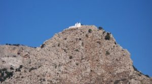
Above the village rises the summit of Thrypti, Afentis Stavromenos, at 1,476 metres the highest point of the massif. A variant of the E4 European long-distance path leads to it; on the top stands a small church dedicated to the Transfiguration of Christ, known to local people simply as Afentis Christos, with a mountain refuge beside it that is kept locked. In clear weather the view takes in both seas, the districts of Ierapetra and Sitia and, far off, the island of Kasos. The descent from Orino to the coast at Koutsounari and Koutsouras runs through the Gorge of the Red Butterflies.
Tourism has scarcely touched Orino: there is nowhere to stay, only a kafenion and a taverna, where snails, cheese pies filled with mizithra, staka with eggs and kid from the wood oven come to the table. That is precisely the charm of a day’s excursion – best in spring, when the streams are running, or on a hot August day, when one wants to escape the coast for a few hours.