The most complete guide to Crete: 221 places on the map, 23 routes and 49 articles — with photos, videos and the story behind every place. Everything is open and free: no sign-up, no paid sections and no advertising, open or hidden. You can install the guide on your smartphone as an app.
Routes drawn along real roads
Weather at every stop
Full-text search
“Near me” by geolocation
Create your own printable itinerary
Satellite, terrain, dark mode
Works offline
⌕
Searches 1.7 million characters of descriptions, not just names
—places
4regions
—routes
—with video
Search results
—
Interactive map
Find what is near you
Filters narrow the map and the list at once. Zoom out and pins group together.
Region
Category
Фильтры карты
Landmarks
Featured places
RegionCategory
Routes
Ready-made day trips
Individual places
Articles about landmarks
Aptera (Άπτερα) was a polis, an independent city-state with its own territory, its own laws and its own coinage. Two harbours linked the city on its high plateau to the sea lanes: Minoa, near modern Marathi on the Akrotiri peninsula, and Kissamos near Kalyves, at the mouth of the Apokoronas plain. Anyone looking down on Souda Bay from above had the whole coast and every movement of shipping in view – an advantage already noted by Strabo, who names Kissamos as Aptera’s port, and by Pliny.
The excavation site, about 13 kilometres east of Chania above the village of Megala Chorafia and roughly a kilometre inland from the southern shore of the bay, is well enough preserved for the history of a city to be read in it – a city that lived by maritime trade and played its part in the defence of Crete. From Paleokastro on the edge of the slope the view opens over Souda Bay – a landscape that explains both the strategic importance of the place and the power of the myths attached to it.
Find on the map
The way leads first into the myth, then out on to the bay and its islands and finally through the ruins themselves – as far as the two Ottoman forts, which extend the tour into more recent history.
The myth of the Sirens
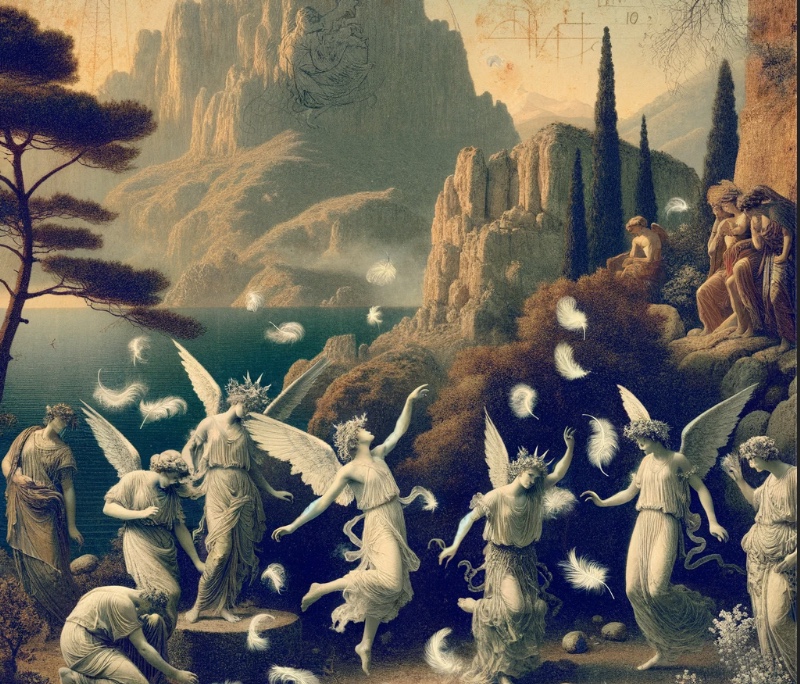
According to legend it was here that the Sirens entered a musical contest against the Muses, lost their plumage in the process and fell naked to the ground; the place where they came down has been called Aptera, “the wingless”, ever since. So the late antique lexicographer Stephanus of Byzantium records, placing the scene, a “Museion”, close to the city. How the Sirens came by their wings in the first place antiquity tells in many versions that contradict one another. In one they were companions of Persephone. After her abduction they wandered about and came to the land of Apollo, where Demeter made wings grow on them – as a punishment for not having stood by Persephone. In another the gods turned them into birds precisely so that they could search for the stolen girl. Others again report that Aphrodite made them half-birds because they scorned marriage; or else that they wept for the rape of Persephone, fled to the rock of Apollo and there became birds.
On Hera’s advice they challenged the Muses to a singing contest. The Muses won, plucked out the Sirens’ feathers and wove them into wreaths, which they wore from then on as a headdress. The defeated, tradition adds, turned pale with grief and threw themselves into the sea.
In ancient art the Sirens combine a woman’s face with a bird’s body – the fishtails of the mermaids are an addition of the Middle Ages. Their song stood for dangerous knowledge and ruinous temptation: the traveller heard the promise of omniscience and thereby lost any chance of ever returning home.
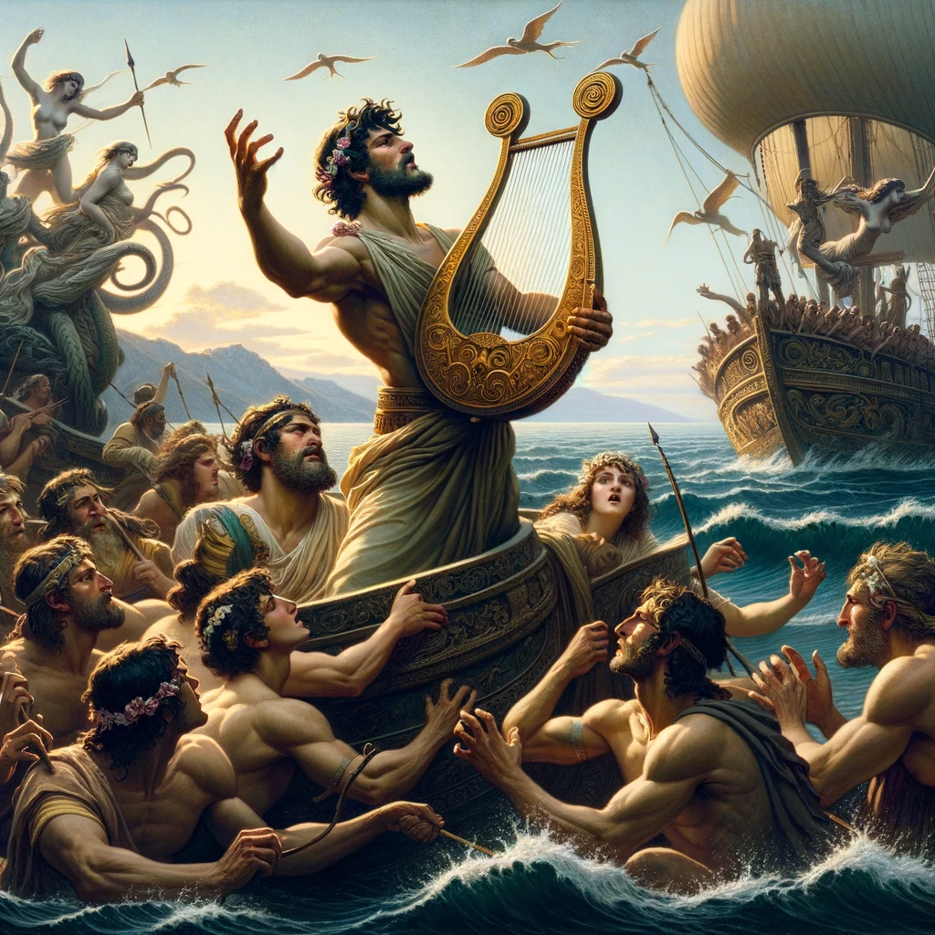
The Argonauts escaped destruction only because Orpheus was with them: with his own singing and the playing of his lyre he drowned out the voices of the Sirens.
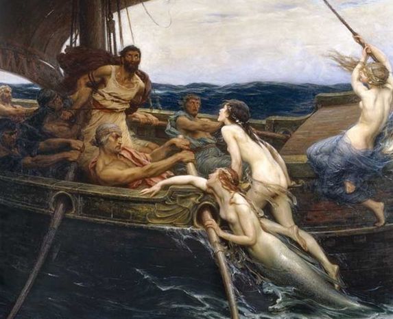
In Homer’s “Odyssey” they try to bewitch Odysseus and his companions with their song; they promise omniscience and yet lead to death. Odysseus, forewarned by Circe, has his men’s ears stopped with wax and himself bound to the mast – and so he alone hears the song without succumbing to it.
The island of Minoa, Souda Bay and its military history
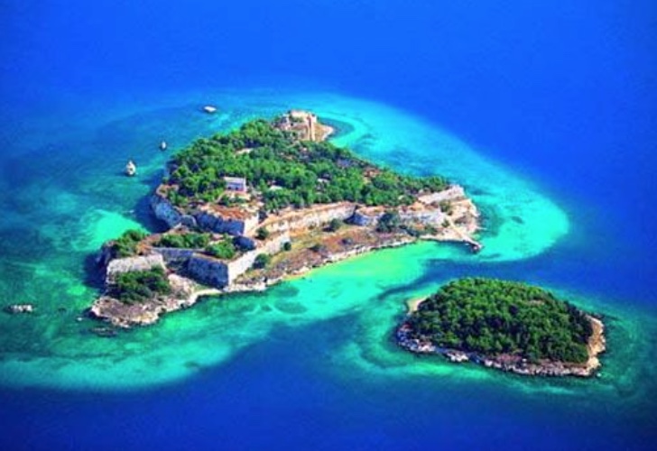
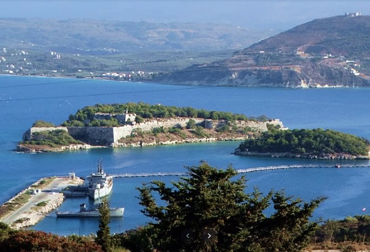
Souda Bay is regarded as one of the safest natural harbours in the Mediterranean: a long, deep arm of the sea sheltered on the north by the Akrotiri peninsula. At its entrance, opposite Aptera, lie two small islands – Souda and, as tradition calls it, Minoa, a smaller and almost circular islet known today as Nisi or Leon, which medieval Venetian charts marked as “Rabbit Island”.
Mythical geography linked the islet of Minoa off Aptera with the Sirens; in antiquity the islets also bore the name Leukai, “the white ones” – after the Sirens who turned pale and are said to have leapt into the sea here. Such names belong to the world of legend and take nothing away from the solid historical importance of the islands as the natural gateway to the bay.
On the island of Souda the Venetians began building a fortress in 1573, to command the entrance and confront the Ottoman fleet. Only after a long defence did the stronghold pass to the Ottomans in 1715, in the same year as the other two Venetian sea forts of Crete, Gramvousa and Spinalonga.
In the 20th and 21st centuries Souda Bay became an important naval port: a base of the Hellenic Navy and NATO installations are situated here. Access to the military zone is restricted, and the fortress island too, which has no inhabitants, can be reached only on a few specially arranged occasions.
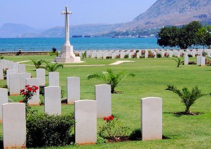
Beside the bay also rest the Allied soldiers who fell in the Second World War. The Commonwealth war cemetery lies on the innermost shore, in the locality of Vlites near the town of Souda: a good 1,500 graves – 862 British, 446 New Zealanders, 197 Australians, together with South Africans, Canadians and one Indian – most of them casualties of the Battle of Crete in May 1941. More than seven hundred of the wartime dead could never be identified, and nineteen graves date from the First World War. Among those buried here is the archaeologist John Pendlebury, who had worked at Knossos and was shot by German troops in May 1941. The cemetery was designed by the architect Louis de Soissons and is cared for by the Commonwealth War Graves Commission; an inscription records that the land is a gift of the Greek people. Most impressive is the great Cross of Sacrifice with its bronze sword, standing above the rows of white headstones in front of the water.
The fortress of Souda in detail
Work on the Venetian fortification on the island of Souda began in 1573. The design is attributed to the military engineer Latino Orsini, who also directed the works; only a year later the first cannon stood on the ramparts. Within the walls arose powder magazines, barracks, dwellings, churches and cisterns, together with a mole at which ships could be supplied.
In 1646, when the Turks attacked, the fortress was still unfinished and its weak points came to light. The attackers destroyed magazines and barracks, but the defenders under the command of Gerolamo Donà showed unbending courage and held out.
Although the Ottomans took final possession of Crete in 1669, at the end of a war that had lasted since 1645, the fortress remained Venetian for a further five decades. It became the unofficial capital of the “Kingdom of Crete”, was called the “eye of the kingdom” and offered refuge to Cretan insurgents. In 1715, during the last Venetian–Turkish war, it surrendered after a siege of 72 days because no help came from Venice – on 27 September. With that, Venetian rule in Crete came to an end.
Under the Ottomans the fortress served as a naval base and supply station. In 1898 the Turkish garrison withdrew; in the time of the Cretan State the island stood under the eyes of the Great Powers, whose flags flew beside the Ottoman one. Since 1913, the year of Crete’s union with Greece, the Greek flag has flown here – in February of that year the last Turkish flag was hauled down.
The fortress has preserved some remarkable elements: the bastions, among them the one named after Martinengo on the north, and the church at which Augustinian friars once held services.
The archaeological site of Aptera
Where the name Aptera comes from is disputed among scholars. It is connected with the myth of the wingless Sirens and equally with the cult of Artemis, who was worshipped here as “Aptera”, the wingless one; the images and legends on the coins – Artemis on the obverse, an armed hero on the reverse, and besides these Apollo, Hera, torch, bee and bow – admit of various interpretations. The district was already settled in Minoan times, with a Bronze Age settlement about a kilometre and a half away at modern Stylos; the place name appears on Linear B tablets of the 14th century BC. The city on the plateau itself came into being, on present knowledge, in the 8th century BC. Its archers were sought after as mercenaries and fought among others on the side of Sparta; the pay they brought home made possible the striking of the city’s own silver coins. Relations with its neighbours were less happy: Aptera was at war with Kydonia in the 3rd century BC, and in the Lyttian War of 220 BC it began as an ally of Knossos before being forced over to the side of the Polyrrhenians. Aptera enjoyed its heyday in the Hellenistic and Roman periods: in 67 BC it submitted to Rome without being destroyed, and in the 1st and 2nd centuries AD baths, cisterns, houses and sanctuaries were newly built. The great earthquake of AD 365 ushered in the decline; a further earthquake in the 7th century and the raids of the Arabs, who conquered Crete in the 9th century, gradually left the city deserted.
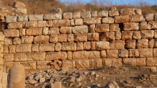
Long stretches of the city wall survive, among them sections of the Hellenistic period, of the 3rd century BC. The circuit, whose layout the excavators trace back to the middle of the 4th century BC, measured 3,480 metres, was reinforced with towers at vulnerable points and was already designed with siege engines in mind. Most impressive is the west side with its mighty, carefully fitted ashlar blocks. The fortifications were consolidated between 2003 and 2006, and the main gate in a separate campaign from 2010 to 2012.
A tour of the ruins: sanctuary, cisterns and theatre
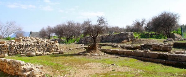
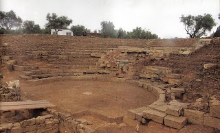
On the site one can see a temple of the classical period dedicated to Demeter and Persephone – a small, two-roomed building of the 5th to 4th century BC, cleared in 1942 by the German occupying forces – as well as an administrative building with an apse, interpreted as a council house, large cisterns and the remains of the ancient theatre. The theatre, cut into the slope and facing south towards the White Mountains, was built of the local fossil-bearing limestone in the first half of the 3rd century BC and remodelled in several phases, from the Hellenistic period into the early and late Roman Empire; the second half of the 1st century AD brought a new stage building and a lowered orchestra. Its auditorium is nearly 55 metres across and had at least 26 rows of seats, divided by five flights of steps into four wedges. In modern times it served as a quarry – a lime kiln set up in the middle of the auditorium burnt seats and architectural members to quicklime well into the 20th century – until it was put in order again in years of work that began with excavation in 2008 and were completed in 2015; today concerts are occasionally held here.
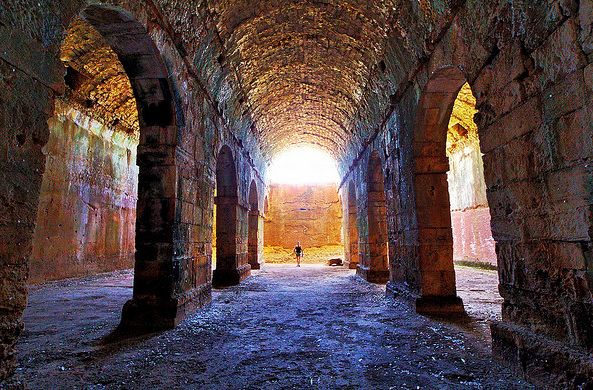
The most impressive structures, however, remain the Roman cisterns: a three-aisled hall carried on rows of piers and vaulted over, and a second basin laid out at an angle. The first, partly hewn from the rock, measures 17 by 25 metres inside and held some 2,900 cubic metres; the L-shaped one, with arms of about 56 and 34 metres, held slightly more. Both are built of Roman concrete lined with waterproof mortar and braced outside by buttresses against the pressure of the water, though the sturdy piers of the vaulted hall seem to go back to a Hellenistic predecessor. They supplied the city and its baths with water and show how highly developed its technical infrastructure was. Anyone who goes down into the half-dark vaults will grasp that these spaces were meant not only to be useful but also to impress.
In the middle of the site stands the abandoned but well-kept monastery of Agios Ioannis Theologos (St John the Theologian), a dependent estate (metochi) of the Monastery of St John on Patmos. Tradition takes it back to Byzantine times, to the 12th century; the surviving buildings – a chapel and a two-storey range of cells around a courtyard – date mainly from the 16th and 17th centuries, and the house remained in use until 1964. Around the courtyard begin the paths to the cisterns, the baths and the houses of the Roman period, among them a villa with a colonnaded court. Not far away, concrete German machine-gun emplacements are a reminder that the vantage point above the bay was also put to military use in the Second World War.
It was the English traveller Robert Pashley who in 1834 first correctly recognised the ruins as those of Aptera. The first excavations were undertaken by French archaeologists in 1862 and 1864, who uncovered the so-called “wall of inscriptions”, a large structure bearing honorary and proxeny decrees of the 3rd and 2nd centuries BC; the Greek Archaeological Service has dug here since 1958, systematic research has been under way since the 1980s, and the work continues. According to the Greek Ministry of Culture, Aptera is today the most visited excavation site in the Chania region. The tour takes a good two hours, and there is hardly any shade.
The fortress of Paleokastro
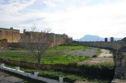
On the north-eastern edge of Aptera stands the fortress of Paleokastro, also called Koules or the Subashi fort. The Ottoman authorities had it built after the Cretan uprising of 1866, under Hüseyin Avni Pasha, to keep watch over the Apokoronas plain and the road to Chania. The ancient city supplied the building material: blocks from its fortifications are embedded in the walls.
The plan is almost square: two massive towers stand on the south and south-west sides, a large bastion on the north-east, and two further semicircular towers at the remaining corners. Inside were barracks, magazines and storerooms. After the departure of the Turks the building served for a time as the school of the village of Megala Chorafia. It is well preserved, and from its walls the eye ranges far over Souda Bay and across to the White Mountains.
The fortress of Itzedin
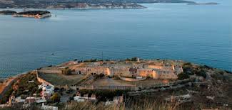
To the south one descends to the village of Kalami, which lies on the hillside directly at the entrance to Souda Bay. The chief sight of Kalami is the guard fortress of Itzedin (Izzeddin), built between 1866 and 1872 on the orders of the Turkish governor Reuf Pasha. By common tradition it is named in honour of a son: either of the pasha himself, as is said locally, or – according to most Greek accounts – of Izzeddin, the eldest son of Sultan Abdülaziz; the name itself means “glory of the faith”. Before that a watchtower had stood on the same spot since 1646. Twelve cannon on the north side covered the entrance; in 1884 a richly ornamented fountain was added at the gate.
From the early 20th century until 1971 Itzedin served as a prison for especially dangerous criminals and men condemned to death; later political prisoners were held here – communists under the special law of 1929, the Idionymon, opponents of the Metaxas dictatorship and, in 1948, more than a hundred men sentenced to death in the Civil War. Eleftherios Venizelos too spent some days in the fortress after coming out against Prince George – fifteen, it is said, in 1903; the dictator Theodoros Pangalos, who had first had his opponents locked up here, was himself detained in Itzedin after his fall, from 1926 to 1928. The prisoners organised lessons and theatrical performances, formed their own association to press for better medical care and an end to harsh punishments, and built a small chapel of St Eleftherios. Today Itzedin, protected as a monument since 1986, is regarded as one of the most striking witnesses to the Ottoman period in Crete; feature films have been shot in the grounds, among them “Days of ’36” by Theo Angelopoulos (1972) and “Stone Years” by Pantelis Voulgaris (1985). The interior is as a rule not accessible.