The most complete guide to Crete: 221 places on the map, 23 routes and 49 articles — with photos, videos and the story behind every place. No sign-up, no trackers.
Routes drawn along real roads
Weather at every stop
Full-text search
“Near me” by geolocation
Create your own printable itinerary
Satellite, terrain, dark mode
Works offline
⌕
Searches 1.7 million characters of descriptions, not just names
—places
4regions
—routes
—with video
Search results
—
Interactive map
Find what is near you
Filters narrow the map and the list at once. Zoom out and pins group together.
Region
Category
Фильтры карты
Landmarks
Featured places
RegionCategory
Routes
Ready-made day trips
Individual places
Articles about landmarks
The Askifou plateau
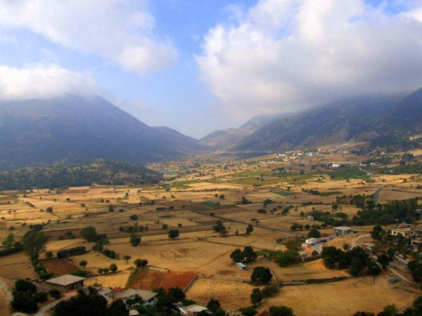
The next stop is the group of villages in the mountain valley of Askifou (Ασκύφου). The plateau lies at an altitude of about 730 metres and resembles a broad bowl: its green floor is shut in on every side by the austere summits of the White Mountains – Kastro, at 2,218 metres, to the west, Tripali (1,493 metres) to the east and Agathes (1,511 metres) to the south. In winter it is often under snow, in spring it is in flower – and that is when one best understands why Askifou is counted among the most expressive high-mountain landscapes of Sfakia; in summer it is noticeably cooler than the coast. Coming from the north coast, you leave the main highway at Vryses and climb in wide bends through holm oak and cypress; it is some fifty kilometres from Chania, and after the last rise the plain with its fields and hamlets lies suddenly at your feet. The same road is served by the buses that run between Chania and Chora Sfakion.
Find on the map
Introduction
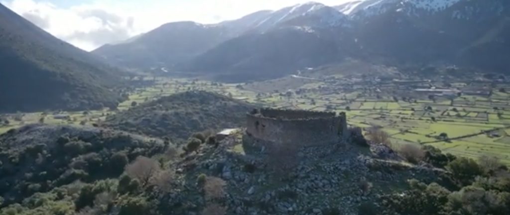
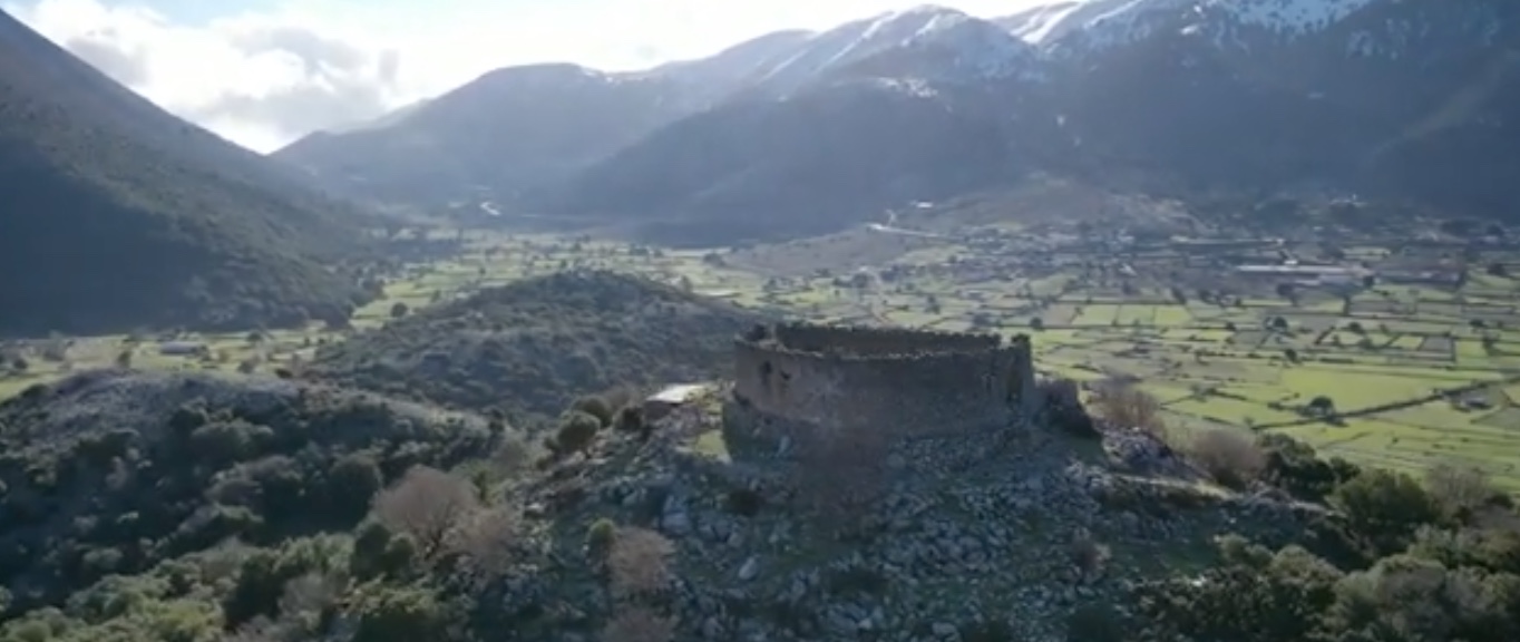
Askifou, built on a small upland between the mountains Kastro and Fanari to the west and the ridge of Choreftes, is an enchanting sight. The picture becomes almost unreal in winter, when snow covers the plain, and at the time of the spring blossom. Administratively Askifou is not a single village but a community of several small settlements at the northern entrance to the historical region of Sfakia. Once across the plateau you stand at the head of the Imbros Gorge, through which for centuries the only route to the south coast ran – a mule track that was the sole link between Chania and Chora Sfakion until the motor road was built. A side road also leaves the plateau eastwards, towards the springs of Argyroupoli and on to Rethymno.
The villages of the plateau
The community of Askifou consists of the small villages of Kares, Ammoudari, Goni – divided into Inner and Outer Goni – and Petres; Stravorachi is also reckoned among the historical settlements of the group. None of them is large, and the people are for the most part shepherds or make their living from those passing through. For travellers the one that matters is Ammoudari, the main village on the through road, with its eating places, petrol station and rooms to let. In a courtyard in Ammoudari grows a fir tree – a rarity in Crete. The inhabitants have always lived from sheep and goats, grow vines and potatoes and make cheese; the visitor can buy anthotyros and mizithra, as well as thyme honey and mountain herbs. In November the celebrated raki is distilled in the houses, a pomace spirit made from grapes which is not a liqueur but a clear, strong schnapps – and anyone who passes one of the stills in those weeks will seldom be allowed to go on without a glass and a bite to eat.
In the valley there are a post office, a bureau de change, guest rooms, bakeries, cheese dairies, a petrol station and several tavernas. What comes to the table is the cooking of Sfakia: the Sfakian cheese pita with honey, and syglina, pork prepared with aromatic herbs and preserved in its own lard. The plateau is visited by travellers on their way to Chora Sfakion and by walkers and mountaineers – the European long-distance path E4 crosses the valley, the ascent of Kastro starts from here, and some farms offer riding and mountain-bike tours. A few kilometres to the west, higher up, lie the smaller upland plains of Tavri and Niatos. In the first week of June, at the feast of the Holy Trinity, whose date depends on that of Easter, the inhabitants gather at the chapel on the Tavri plateau, at over 1,000 metres west of the valley, where there is also a refuge belonging to the mountaineering club; after the service the guests are entertained with wine and local dishes.
Through the Imbros Gorge to the sea
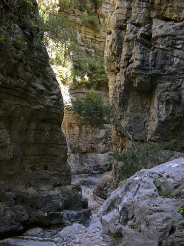
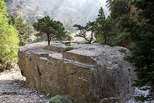
On the southern edge of the plateau, beyond the village of Imbros at 780 metres, the Imbros Gorge begins. Local legend has it that the village was founded by two brothers who came from the island of Imbros off the Turkish coast. The gorge is about eleven kilometres long in all, of which walkers cover some eight, losing 650 metres in height on the way. The old mule track, the lifeline of Sfakia until the road was built, leads in two and a half to three hours at a gentle gradient down to Komitades near the Libyan Sea. At the narrowest point the walls close in to just 1.60 metres, so that one can almost touch them both with outstretched arms. The walk is far less strenuous than that through the Samaria Gorge and is possible all year round, provided it is not raining or snowing hard; the bed is dry, loose scree, so shoes that support the ankle are advisable. From Komitades a taxi will take you back up to your car. At the end of May 1941 thousands of Allied soldiers trudged south by this route and across the plateau to embark at Chora Sfakion for Egypt.
The “Thermopylae of Sfakia”
Anyone interested in more recent history should seek out the small private war museum of the Chatzidakis family at Kares. Georgios Chatzidakis, born in 1931, lived through the fighting of 1941 as a child and began collecting at the age of fourteen; over the decades he gathered up what the war had left behind in the mountains: weapons, helmets, wireless sets, pieces of uniform and everyday objects, the oldest items dating from the time of the rising of 1770, most of them from the Second World War, when the retreating British and Dominion army and its German pursuers both passed through this valley. His son Andreas keeps the collection going and is glad to tell visitors its story. Afterwards the short climb to the koules above Goni is worth the effort: from the walls you look out over the whole bowl of Askifou, the hamlets among vineyards and potato fields and, behind them, the grey front of the White Mountains.